Tag: North Taiwan

  • Cycling Route: Xiong Kong Tea Plantation – Climb Training

    Cycling Route: Xiong Kong Tea Plantation – Climb Training

    I went for a cycling trip from Xindian 新店 to Xiong Kong Tea Plantation 熊空茶園 with a group of local cyclists on a weekend in May. It was a 60km route with two climbs (338m, 728m), planned by one of our fellow cyclists Martin. The tea plantation is operated by Taiwan Tea Corporation 台灣農林 (TPE: 2913), formerly known as Mitsui & Co., Ltd., which was founded in 1899 during the Japanese rule. The downloadable GPX file of this cycling route is at the end of this post. 

    We met at 7:20 am in the convenience store near Xindian MRT station. It had been transformed, by different cycling groups meeting up there, into an outdoor showroom of advanced bikes, cycling outfits, and various cycling accessories. With two convenience stores located conveniently near the MRT station, and a well-maintained toilet inside the MRT station, this spot serves as the default starting point for a number of popular cycling routes, including the section of Provincial Highway No. 9 connecting Taipei and Yilan (Beiyi Road 北宜公路), and the No. 9A (9甲) which brings you to the Wulai District 烏來區 (Xinwu Road 新屋路). 

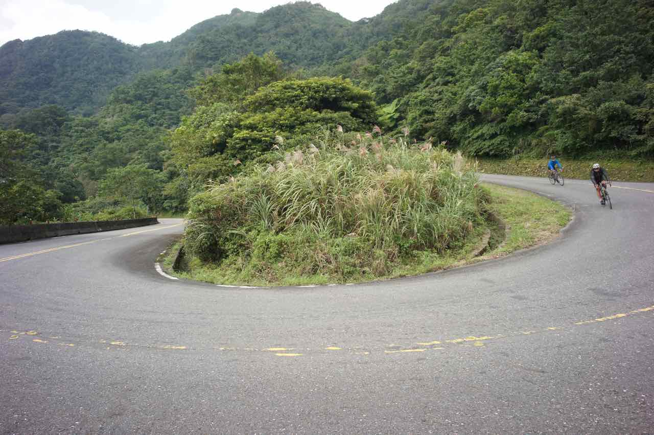
    After socialising with others and filling up my bottles, I set off with the group to cycle along County Highway No. 110. The first climb soon appeared on our left-hand side on Chezi Road 車子路, leading to Daguan Road 達觀路. Motor traffic was practically zero as it is a cul-de-sac at the top with only a handful of residential buildings sitting along the road. We took a long break at a small pavilion just before we reached the top of the climb. It was a good warm-up to climb 305m.

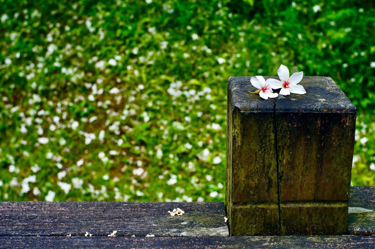
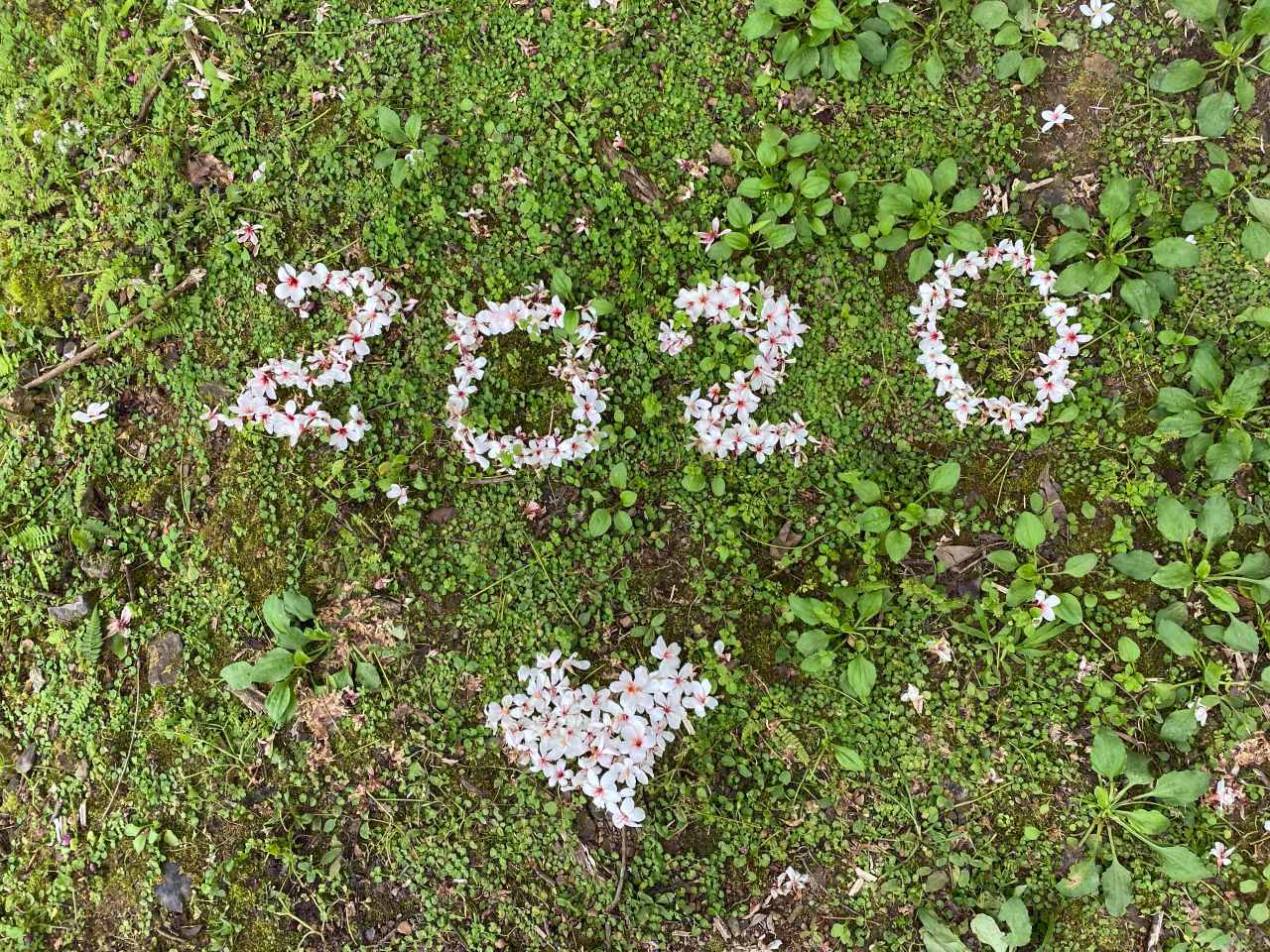
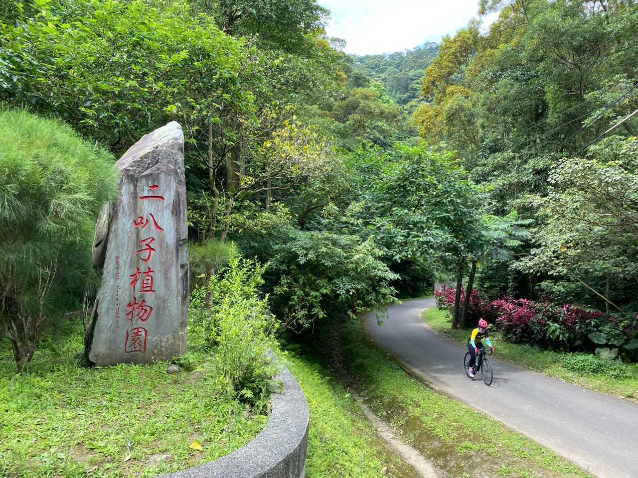
    Then, Martin showed us a shortcut right next to the pavilion, which leads to the Erbazi Botanical Garden (二叭子植物園) via a series of short stairways. You will have to carry your bikes if you want to take this shortcut, but we all found it worth the effort as it was a beautiful garden. Also, by taking this shortcut, you can avoid descending on the same route.

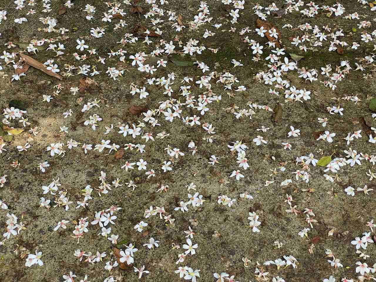
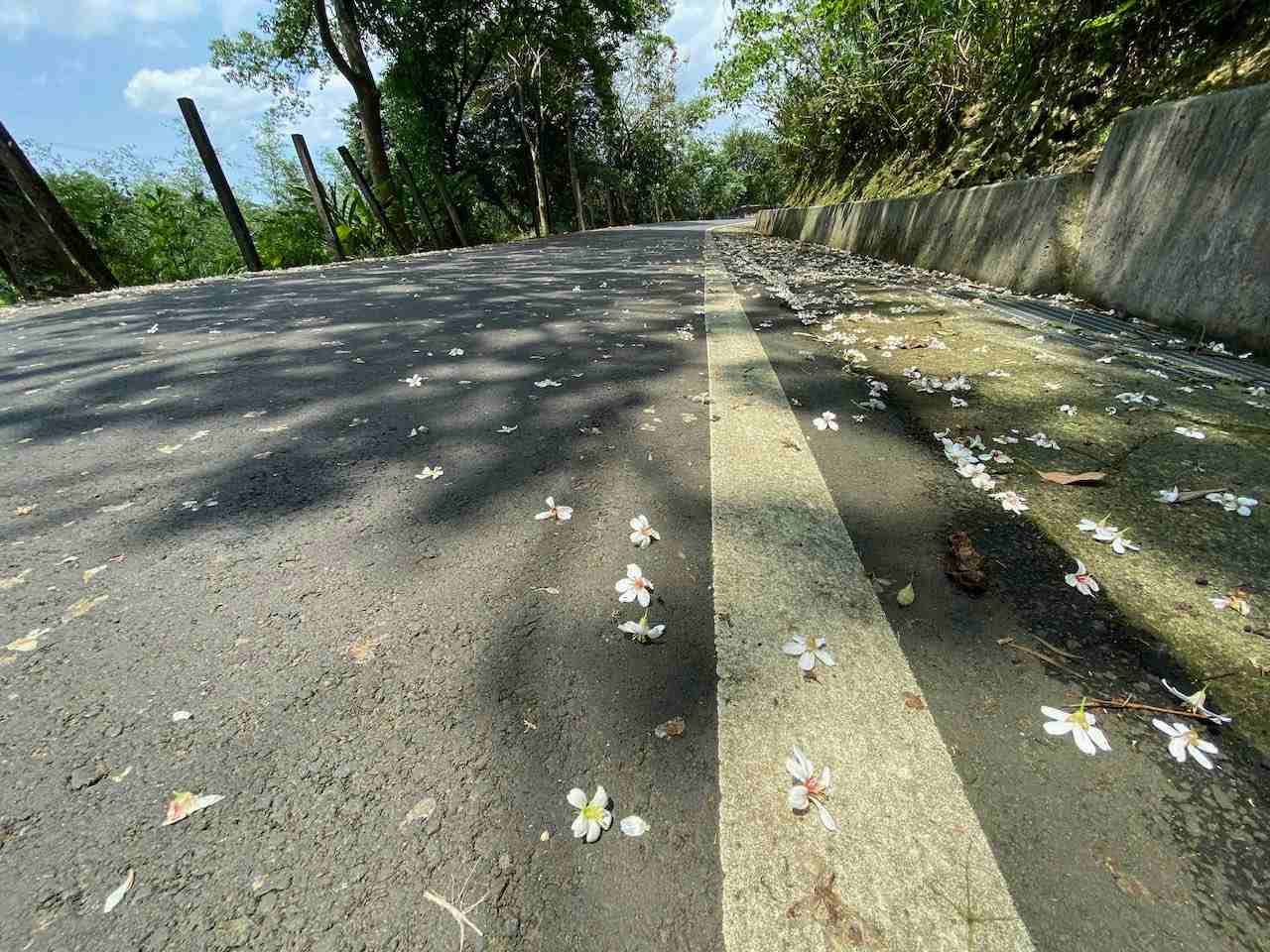
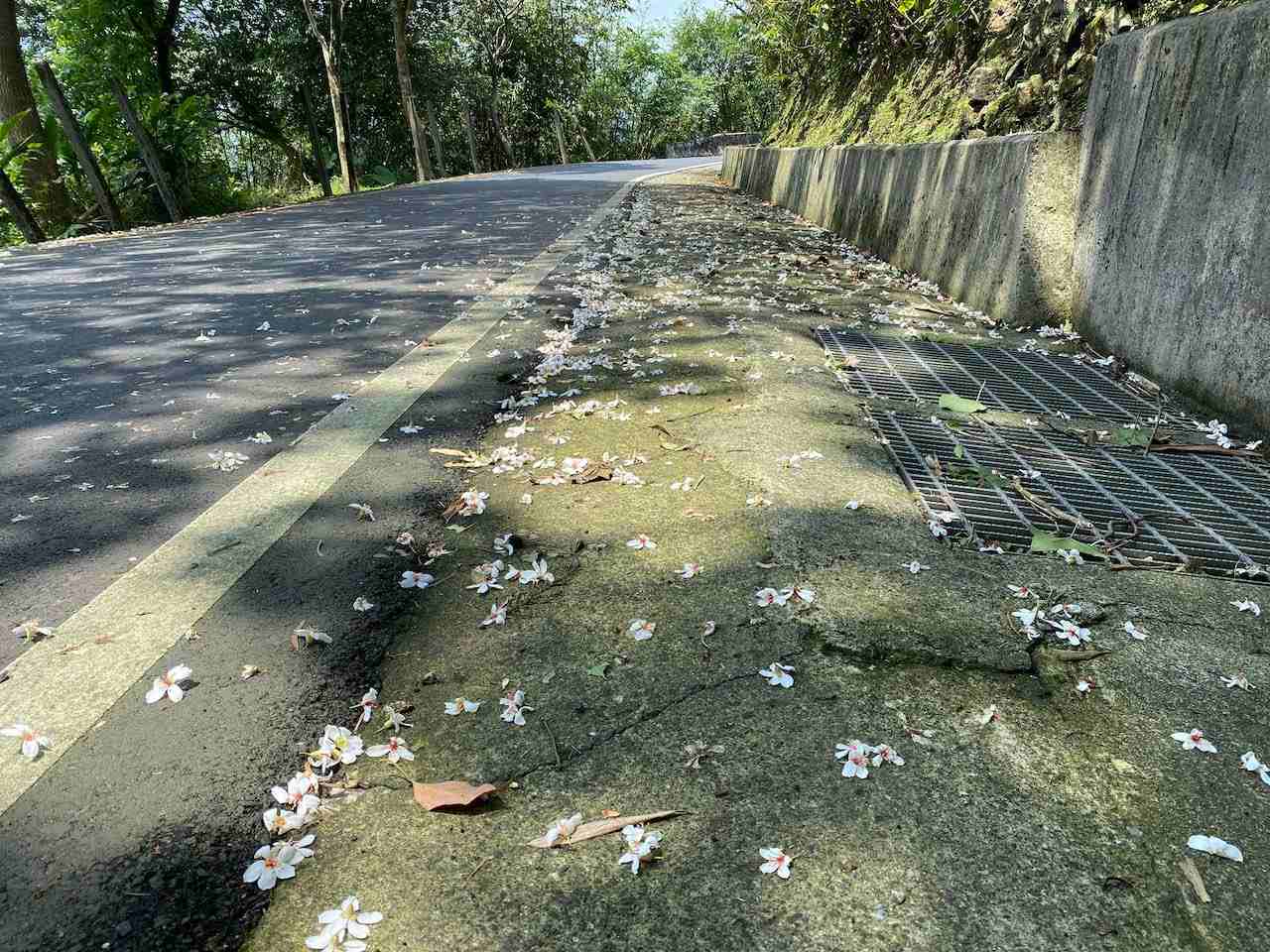
    Where the botanical garden is located is a humid valley. Plants love humidity. Mosses are growing on the cement surface of the paths in this area, which make them slippery all the time except for a bright sunny day. It’s especially dangerous on the steeper parts, so walking with your bike is mandatory in this case. Go with your walkable pedal shoes if you plan to take this route. We were lucky to have the sun high up and dry the mosses, so that we could ride on our bikes slowly back to the main road.

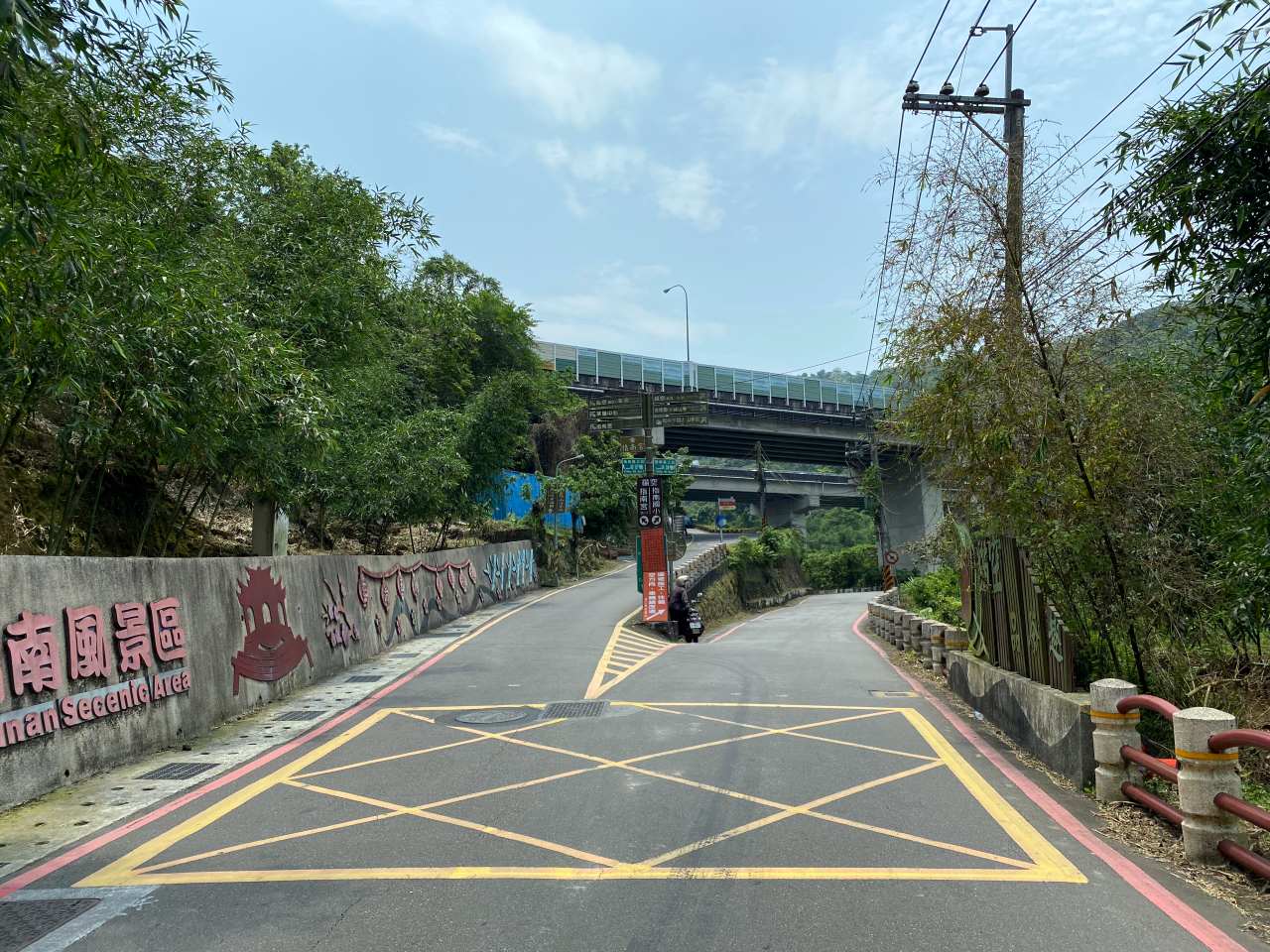
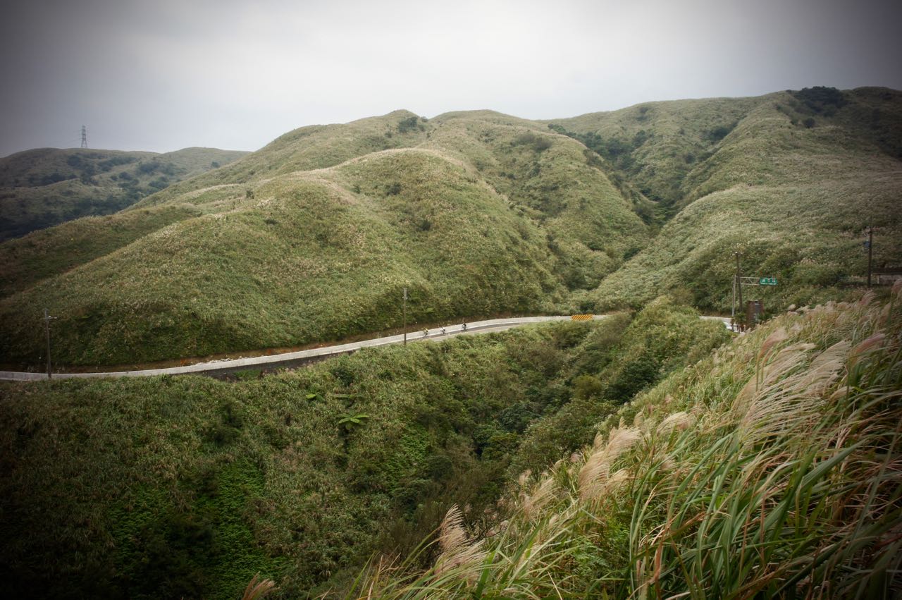
    When we were back on County Highway No. 110, we started heading to the Sanxia District 三峽. Traffic was not busy and we could set our own pace without pressure. We reached a small town called Jiou Jiou 九鬮 with several stalls selling very juicy roasted pork sausages. Make sure you have more of those before the real climb to Xiong Kong because, at the top, there is only one small restaurant with very limited capacity. On that day it took them 45 minutes to prepare some very standard meal sets for us. 

    After the feast of pork sausages, we went to the 7-Eleven (address: No. 241, Chengfu Road, Sanxia District, New Taipei City, 237) around 300m ahead along County Highway No. 110 for water supply. It’s also good for some more snacks. I would have done that if I had known I would need to wait that long for my meal. The 7-Eleven also comes with a toilet. If you miss this chance, there is another toilet stop 2.3km away at the Daliao Tea House. The tea house is an old Japanese building built in 1944 as the residence of the chairman of the Taiwan Tea Plantation Corporation. We visited it only on the return leg because we did not want to start our climbing late. It’s better time management, I think.

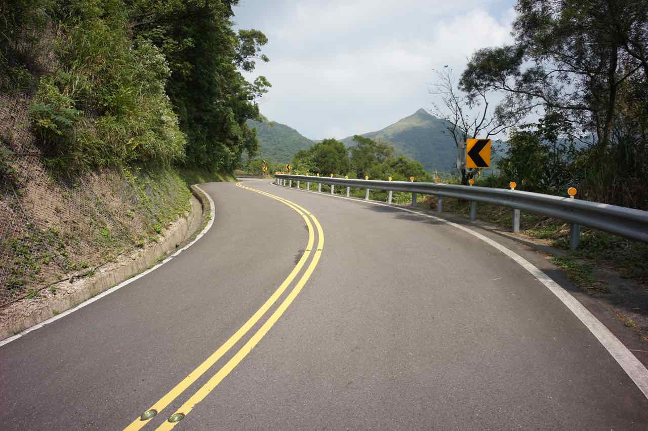
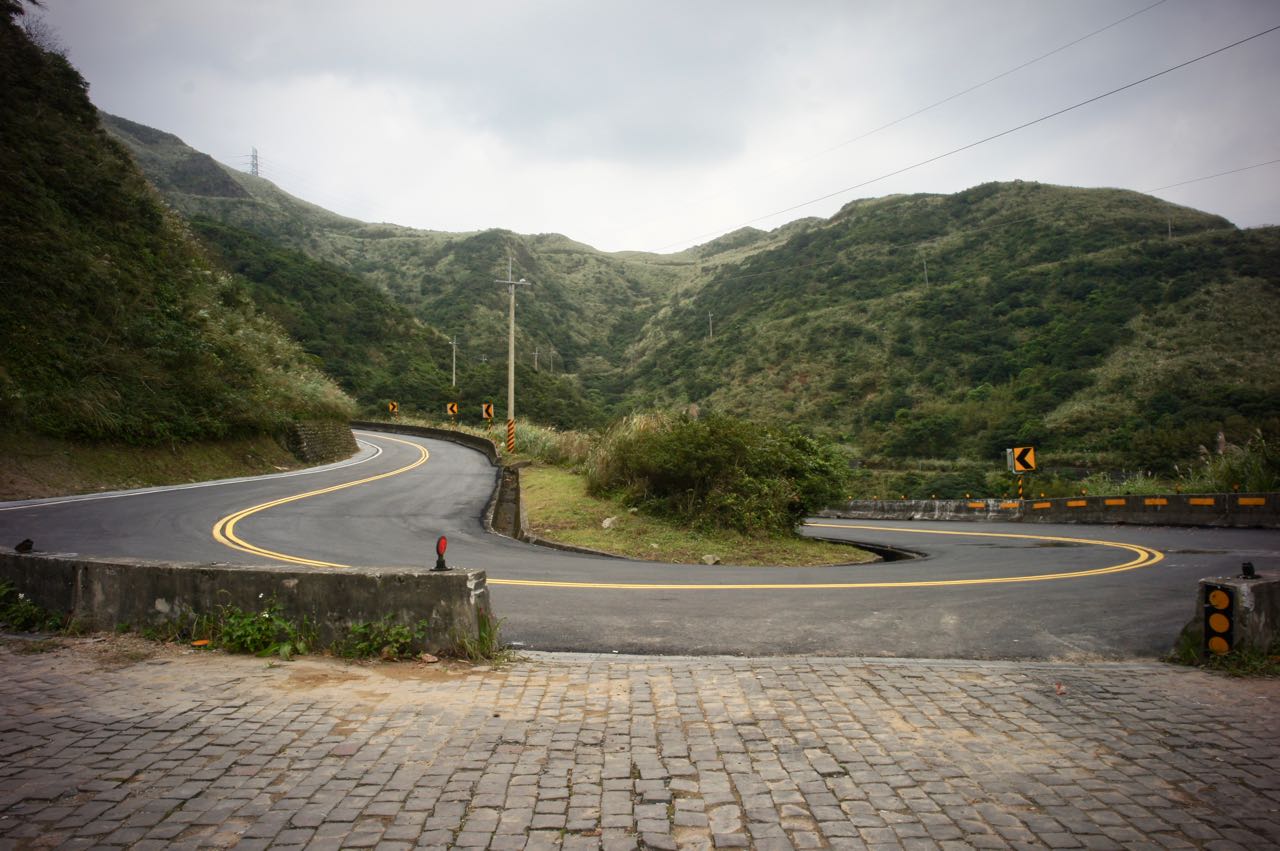
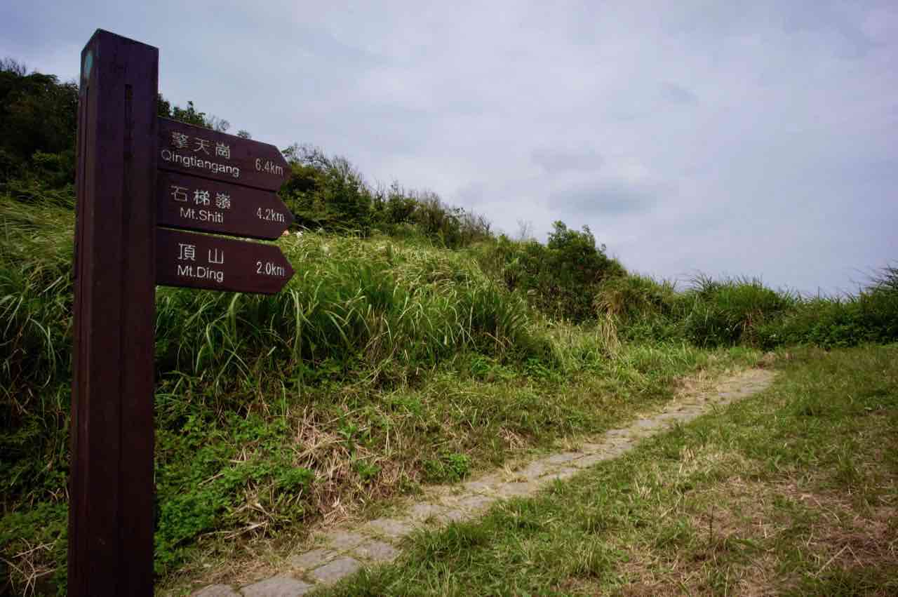
    The climbing starts on the quiet Zhulun Road 竹崙路 (Township Road 北109). Road signs for the tea plantation were clearly displayed along the road. First half of the path was wide. Road surface was well maintained and smooth. The slope was moderate. There were cars and motorbikes passing by sporadically. We all shared the same destination as this road is also a dead end. After the first half, cracked surfaces and small pieces of broken concrete appeared. Roads got narrower, cracks deeper, slopes steeper, and turns sharper as we were approaching the top. I was told that a cyclist friend once had a minor accident on the descending leg when a trailing car imposed pressure on her. Her wheels slipped sideways on the edge of the cracks. She lost balance and fell. Fortunately, her bike was fine and she had minor injuries only. Anyway, this must be an enjoyable route for her, or she wouldn’t have joined us this time. 

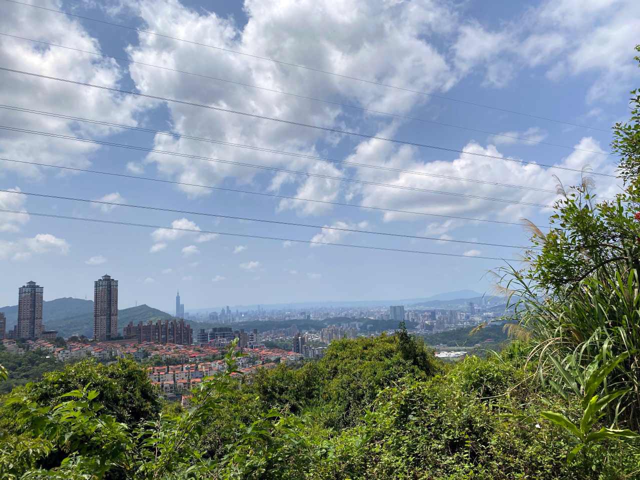
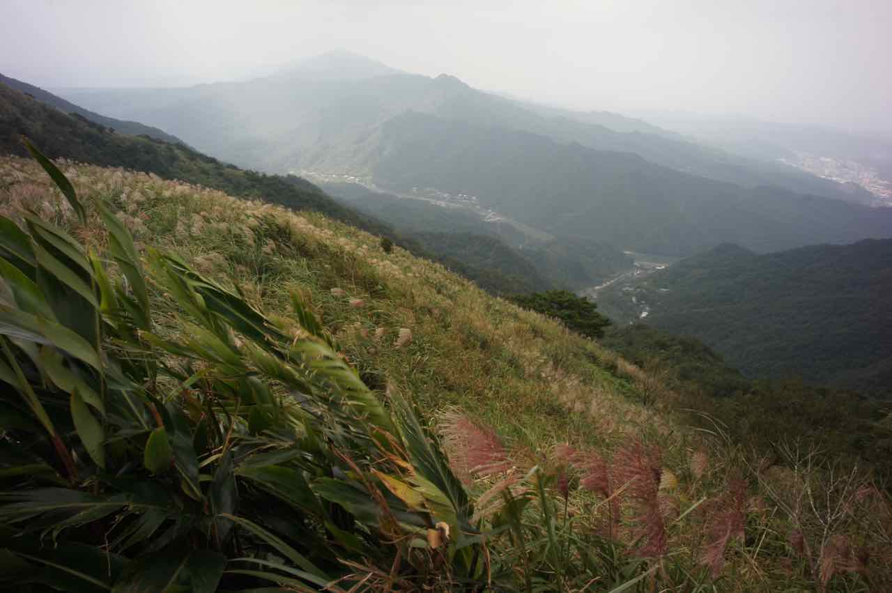
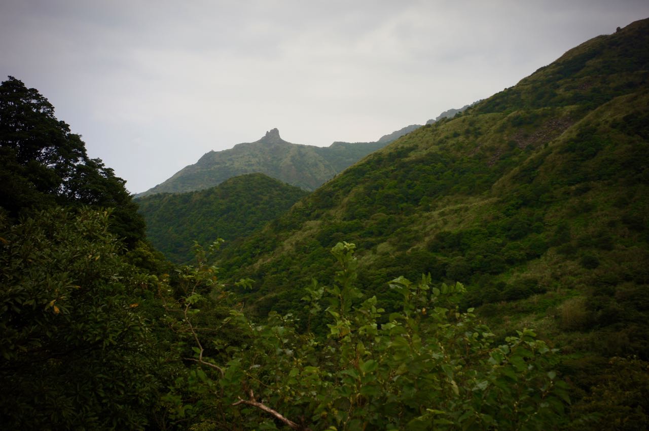
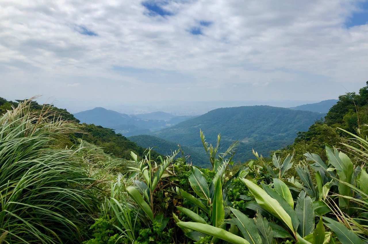
    I made it to the top sooner than I had expected. A short, mild downward slope brought me to the entrance of the tea plantation. A wide planform with tables for people to enjoy the vast view of the hills caught my eyes. On my right-hand side, there was a trail leading into a small forest of tall straight pine trees (Japanese Cedar). A billboard showing the elevation of 700 metre was set up right next to the gate of the tea plantation on the other side. They charge NTD100 per head for each visit, which will be rebated when you shop in the souvenir shop. Fair deal. But for us, it’s enough just to stay outside for the views and some food. 

    The descent from the top was tricky because of the condition of the road. When my bike rolled over the cracked surface, my hands were almost shaked off the handlebar. I was lucky to do the ride with a Rikulau Audax Hercules, a flat-bar road bike. I could hold the grip and the brakes securely without making my hands numb. If I had been on a drop-bar, I might have had to stop and let my hands take a break. 

    The return trip to Xindian was very straight forward. That was enough for the day. It was a weekend and I took MRT home with my bike.

    For those who want more, the New Taipei City Yingge Ceramics Museum is 10km away from Jiou Jiou 九鬮. The building itself is nice and worth a visit even if you are not interested in ceramics. There is an outdoor water plaza for some water fun in the summer. Kids love it. Then you may either take a train back to Taipei or cycling back along the Dahan River Bikeway. 

    Routes

    NOTE: To use the routes, please install the App on your smartphone. The App will launch and load the route automatically after you tap the above links on your smartphone’s browser. For Garmin Connect, you can then use the APP to send the route to your garmin device. If your Garmin device is not purchased in Taiwan, you will also need make sure you have the Taiwan map on your device. Here is our blog post on this topic.

  • Cycling Route: Maokong Loop – Climb Training

    Cycling Route: Maokong Loop – Climb Training

    Maokong Loop is a 13km long, single-peak (326m) cycling route in Wenshan District, South East of Taipei City. We went there on a public holiday in May, me on a Rikulau Audax Hercules and Lois on a Klever Q Comfort. The downloadable GPX file of this cycling route is at the end of this post. 

    Maokong is a popular tourist area where people can take the Maokong Gondola at the Taipei Zoo Station (next to the Taipei Zoo MRT Station of the Brown Line) to the top of the hill, take a leisure walk along the route on the peak, and enjoy the panoramic view of Taipei City with a cup of tea grown locally in one of the many tea cafes scattered around. This area used to be the biggest tea plantation in Taipei. As for kids, there is of course the amazing Taipei Zoo at the foot of the hill that never fails to offer joy and wonder. 

    To get to the starting point of this route, simply set your GPS navigation to this address: “No. 12, Section 1, Xinguang Road, Wenshan District”. It’s a 7-Eleven with a spacious area outside where you can park your bikes. If you start your ride early enough in the morning, say around 6:00, road traffic should be quite sparse and you will take less than an hour to get there from the centre of Taipei. 

    Strava (anti-clockwise): https://www.strava.com/routes/26747667

    If you start late and want to avoid the traffic, you may take the MRT Green Line to Jingmei Station, as the Brown Line does not take bicycles, and then use the following route to get to the starting point:

    Strava: https://www.strava.com/routes/26748715

    Taipei MRT takes bikes during weekends and between 10:00-16:00 on weekdays, except the Brown Line and a few busy stations. 

    If you are in the west side of the city like Datong District, Zhongzheng District, or Wanhua District, you may take a pleasant detour along the Riverside Bikeways to get to Maokong. We have compiled a list of the access points to the Riverside Bikeways in this post.

    As to us, we live on the east end of Taipei. There is a popular and well shaded cycling route linking up that part of the city and the area around Taipei Zoo, by going along Section 1, 2, 3, and 4 of the Academia Road (also known as Yanjiuyuan Road), followed by Lane 43, Section 5 of Muzha Road. It’s a 15.5km ride with 177m of elevation gain and very sparse motorized traffic:

    Strava: https://www.strava.com/routes/26403740

    We took a brief break and fueled up at the 7-Eleven before heading for the real climb. Traffic was busier than usual because it’s a holiday but still not too bad for cycling. I had done the loop anti-clockwise before, so this time we opted for a clockwise ride by taking the left branch at the Y junction on Section 3 of Zhinan Road.

    It was a straight, continuous climb all the way up to the top without much shade at noon time. The climbing ended shortly after we took a right turn and cross a short bridge called Caonan Bridge 草湳橋. There was then a mild downward road winding around the peak, lined with tea houses and cafes. Once you reach the busy Gondola Terminal, the descent back to the ground level starts. It may be a good idea to bring along a book if you have the whole day. It is said that the sunset and night views there are really great, so night rides along this route are popular among local cyclists. If you googled 夜騎貓空, which means night rides in Maokong, you will find lots of blog posts in Chinese. But for first-timers, it may be better to do it during daytime for safety consideration.

    Now I have done it both clockwise and anti-clockwise. Which way is better? My vote goes to the anti-clockwise one. It’s because the climbing is less steep and there seems to be more shading. The Gondola Terminal will again greet you at the end of the climb. 

    Strava (clockwise): https://www.strava.com/routes/21611174

    We had a late lunch after the ride, which wasn’t worth mentioning, and then headed back home following the same route.

    There is another route to climb Maokong, via the Hengguang Bridge. It is said that the traffic is sparser. I will have a try later.

    Routes

    NOTE: To use the routes, please install the App on your smartphone. The App will launch and load the route automatically after you tap the above links on your smartphone’s browser. For Garmin Connect, you can then use the APP to send the route to your garmin device. If your Garmin device is not purchased in Taiwan, you will also need make sure you have the Taiwan map on your device. Here is our blog post on this topic.

  • Cycling Route: Xizhi Pigeon – Climb Training

    Cycling Route: Xizhi Pigeon – Climb Training

    I had been seeing fellow local cyclists posting accounts and photos of their rides along the route named Xizhi Pigeon 汐鴿展翅, which seems to be lots of fun. I wanted to do it, too. I found the route’s gpx on xplova and invited Lois to join me. The downloadable GPX file of this cycling route is at the end of this post. 

    Xizhi Pigeon 汐鴿展翅 is a 28km cycling route with its starting point at the Nangang Exhibition Center 南港展覽中心 on the east fringe of Taipei City. The maximum elevation of 394.29m at the top makes it a good route for climb training. The route mainly consists of Section 1 and Section 2 of Jiuzhuang Street 舊莊街, Xiding Road 汐碇路 and Xizhi Keelung Riverside Bikeway 汐止基隆自行車道. Upon completion of the route, you will draw a pigeon with spreading wings on the map of your GPS tracking app. 

    To get to the starting point with your bike, you can either take MRT to the Nangang Exhibition Center Station on the blue line (ref: Taking Bicycles on the Metro) or simply cycle there via the Riverside Bikeways along the Keelung river, setting your destination as the Nanhu bridge. It is along the route, so you may as well just start there. If you live outside Taipei, you can also get there by taking a train / HSR to the Nangang Station, followed by a short ride.

    I took the trip on a Friday morning in April, with me on a Rikulau Audax Hercules and Lois on a Klever Q-Comfort. The traffic soon got much quieter after about 5 minutes’ ride from the busy MRT station (Nangang Exhibition Center Station). We could enjoy our ride at our own pace with almost no cars and scooters on Jiuzhuang Street. Some of the slopes were rather steep for me that my heart rate raced up to over 170 bpm. There were tea shops and a tea workshop along the way but I had no mood to stop to explore. It took me about 1.5 hour to reach the top, where a shiny silver sculpture sits. This is the Luku Incident Memorial park and you can find out more about the incident in this blog post.

    With Velodash turned on to share our locations real time, I left Lois behind briefly to enjoy my speedy descent on Xiding Road. It was less steep and I could enjoy it without having to hit the brake much. I saw carpets of little white flowers spreading along the way. It was so beautiful that I had to stop to take a good look and take some pictures. It occurred to me later that those are the flowers of Tung Trees, which were introduced to the island during the Japanese rule (1895 -1945) for their economical values. The oil from their seeds makes good waterproofing material and paints. The trunks were used for furniture, clogs, toothpicks and matches. They were popular and planted extensively by poor families to supplement their income. Nowadays, local people love the trees for their dense blossoms during April and May. It’s dubbed as the May Snow. As beautiful as they are, you’d better not touch them as the whole plant is poisonous.

    At the bottom end of Xiding Road, we passed a busy juncture and entered the quiet Riverside Bikeways of Xizhi. It’s easy to miss the entrance, which is shown on the picture below. Then you will complete the route after riding for around 15 more minutes.

    I love this route because its elevation gives me enough training and it offers the reward of a mild downward slope which is perfect for speedy yet unthreatening descent. Traffic on the route is really low and therefore makes it very bike friendly. No wonder we ran into several groups of cyclists even on a weekday. 

    If you want more climbing after doing Xizhi Pigeon, Fengguizui lookout is just about 13km away via Dahu Street, which offers a 636m climb. GPS route available at the end of this post.

    If you want a low-carb meal, an authentic American smokehouse serving juicy brisket, Bogart’s Smokehouse, is about 1km away. 

    For me and Lois, our pick is this local hotpot restaurant that offers all-you-can-eat duck-blood curds 鴨血,  braised pork rice 魯肉飯, and free drinks and ice cream along with a very generous portion of meat and veggies in a standard lunch set. That’s a very satisfying conclusion for a great ride.

    Routes

    Xizhi Pigeon

    Fengguizui Lookout from Nanhu Bridge

    NOTE: To use the routes, please install the App on your smartphone. The App will launch and load the route automatically after you tap the above links on your smartphone’s browser. For Garmin Connect, you can then use the APP to send the route to your garmin device. If your Garmin device is not purchased in Taiwan, you will also need make sure you have the Taiwan map on your device. Here is our blog post on this topic.

  • Cycling in Taiwan: A 7-day Ride on the East Coast by Alaric Lester

    Cycling in Taiwan: A 7-day Ride on the East Coast by Alaric Lester

    Guest Contribution from Alaric Lester

    “Fancy riding the east coast of Taiwan in November?” asked my mate Jon last August. Before then, Taiwan had meant little more to me than Giant cycles – the world’s biggest cycle manufacturer – and the infamous Taiwan KOM challenge, but my interest was piqued. 

    A little research and my mind was made up. Encouraged by Giant, Taiwan has developed excellent cycling infrastructure in recent years. Cycle tourism is increasingly popular. The best routes are on the less developed eastern side of the island, where one can choose between flatter coastal routes and any number of dramatic mountain passes. Jon rides sporadically and I was recovering from a couple of months’ illness, so we sketched out a relatively unambitious clockwise route from the capital Taipei to its second city, Khaosiung. 

    Arrival 

    I landed mid-morning at Taoyuan International Airport and took the train to Taipei Central station and the metro to our BnB. All was civilised, calm and welcoming. The train was fast, clean and efficient. Most signs are in English as well as Chinese, which helps no end with navigation. Some metro stations play ambient music as trains approach, as if to say, “Your train is approaching. Queue calmly, relax and enjoy the ride.” 

    The city was busy, but not hectic like some Asian metropolises. People keep to themselves, often separated from their wider surroundings by a face mask and a mobile phone screen. This is a highly connected country and the younger generation is permanently plugged in. The weather was a comfortable 26 degrees, a little humid, but by no means oppressive. I liked this place already. 

    Jon arrived separately and we soon set about exploring the neighbourhood. We were staying in Datong district, one of the older parts of Taipei. Untidy, older low-rise buildings nestle next to taller modern ones. Temples are everywhere, some on imposing large plots, others in small gaps between shop fronts. Taiwanese are superstitious people and even non-believers feel compelled to make regular prayers and offerings. Our favourite temple was the magnificent Dalongdong Baoan Temple, where we marvelled at the architecture and paid homage to the gods.

    The next morning, we headed to the nearest Giant store to hire bikes. The network of official Giant stores has a good-value cycle hire scheme, where you can even drop the bikes off at a different location. The shop assistant was friendly enough, but explained that they needed two weeks’ notice for bookings. The remaining stock bikes were too small, unsurprising in a country where the average male height is just 171 cm. A quick, panicked web search found the excellent Bike Express Taiwan, who arranged to deliver bikes and accessories to our door the next day. 


    Day 1 – Taipei to Jiufen, 46 km 

    Our bikes arrived just as promised. We loaded up the panniers, fuelled ourselves with street food and headed off into the city streets. A little intimidated at first by the chaotic traffic, we soon got to grips with the flow of things. There are shared cycle and scooter lanes on most major roads, with large advance-stop boxes at junctions. After around 3 km we reached the Keelung River cycle path, where we enjoyed traffic-free riding for the next 15 km – easier on the lungs, as well as the nerves. From Hengke onwards, though, we were back on busy roads as we weaved our way through the urban sprawl of the river basin. Only in the last 4km, as we climbed towards Jiufen, we were in anything remotely resembling countryside. 

    Jiufen itself is a stunning mountain town, with narrow alleyways scattered on the hillside of the old town. It is rumoured to have influenced Studio Ghibli anime films such as Spirited Away and Howl’s Moving Castle. 

    We stayed at Rita’s House homestay, just below the old town. Our hosts were most welcoming and helpful, a benefit that was to become a theme of our Taiwan tour. Rita advised us to go into town before 7pm, so we just had time for a quick shower before dragging ourselves up the many, many steps to the old town. The alleys were full of street food, trinket shops and lanterns, not to mention hundreds of Japanese and Korean tourists. We grabbed a bite to eat and I bought souvenirs for my children – and just in time, because, sure enough, everything but the 7-Eleven and Family Mart closed dead on 7pm and busloads of tourists were spirited off into the night. 

    Continue to read Alaric’s article on Strava

  • A Bike-Day Trip in Taipei City by Pirawadee

    A Bike-Day Trip in Taipei City by Pirawadee

    Guest Contribution from Pirawadee of Radtour

    เรามีทริปไทเปสี่วัน โดยวันสุดท้ายเป็นฟรีโปรแกรม เมื่อรู้ดังนั้น แผนการของสายปั่นจึงเกิดขึ้น

    ฉันติดต่อที่เช่าจักรยานในไทเป ซึ่งเสิร์ชพบว่ามีหลายที่ หลังจากศึกษาข้อมูลต่างๆแล้วก็ตกลงปลงใจกับ Bike Express Taiwan เลือกรุ่นและขนาดของจักรยาน จ่ายเงินออนไลน์ แล้วก็บอกให้มาส่งที่โรงแรมตอน 8:30 น.ของวันจันทร์ที่ 11 มีนาคม หลังจากนั้นก็กำหนดเส้นทางการปั่น และเนื่องจากสมาชิกปั่นจำนวน 8 คนในครั้งนี้ มีครึ่งหนึ่งที่นอกจากปั่นรอบสวนรถไฟแล้วก็ยังไม่เคยปั่นท่องเที่ยวที่ไหน ดังนั้น route ของเราจึงต้องไม่โหดมากนัก ระยะทางรวมทั้งสิ้นตลอดวันประมาณ 15–20 กม.เท่านั้น

    ระหว่างนั้นก็เช็คสภาพอากาศ ลุ้นจนคืนสุดท้าย เพราะตลอดทริปฝนตกทุกวันมาหยุดเอาคืนก่อนวันที่ปั่นนี่เอง มากับดวงจริงๆ

    Since we would have a free day on the last day of the company outing, we decided to take a short bike trip in Taipei city. Have been searching for some info, I ended up using the bike rental service with Bike Express Taiwan. The appointment is on March 11th, 8:30 am at the hotel and they would pickup the bikes at 6 pm. There were 8 of us and half have never been in the bike trip before. So what I have planned would be quite easy with total distance of around 15–20 km. for the entire route.

    Our fate then relied on the weather. There had been raining everyday since the beginning of the trip. Luckily, there was no rain on our day.

    The bikes we used were Rikulau Audax Hecules with variety of sizing. After signing the contract and paid the deposit, we then started our trip.

    8 นาฬิกาตรง ร้านจักรยานทยอยขนรถมาเรียงไว้หน้าโรงแรม จักรยานที่เราใช้วันนี้เป็นยี่ห้อ Rikulau รุ่น Audax Hercules แบบแฮนด์ตรง มีตั้งแต่ขนาด XXS, XS, S, และ M ตามมาตรฐานความสูงชายหญิงไทย พอ 8:30 ปุ๊บ Lois เจ้าของรถเช่าก็มาถึงพร้อม accessories ต่างๆ ฉันเซ็นสัญญา จ่ายมัดจำข้าวของ หลังจากสมาชิกทดลองขยับกันเรียบร้อยเราก็พร้อมลุย

    การปั่นจักรยานในนครไทเปง่ายมากๆ เพราะทำเหมือนคนเดินถนน แค่เปลี่ยนจากสองขาเป็นสองล้อ ปั่นไปบนฟุตปาธ ซึ่งจะมีเลนจักรยาน หากถนนไหนไม่มีเลนจักรยานเฉพาะก็ใช้ร่วมกับคนเดิน โดยกฎหมายจะให้สิทธิคนเดินก่อน “Pedestrian has right of way” เวลาจะข้ามถนนก็ข้ามตรงทางม้าลายตามจังหวะสัญญาณไฟ และอย่าลืมว่า ไทเปขับรถชิดขวา ดังนั้นเวลาเราปั่นในเลนก็ต้องปั่นชิดขวาเช่นกัน เพราะอาจมีจักรยานปั่นสวนทางมาได้

    Cycling in Taipei is very easy. We cycle on the footpath which normally have a bike lane. If there is no specific bike lane on the footpath then bicycles will share the path with the pedestrian. Wait for the green signal when crossing the road and remember that in Taipei, drive rule is on right hand side.

    จุดแรกของเราคือไป Taipei Expo Park ซึ่งเคยใช้เป็นที่จัดงาน Taipei International Flora Exposition ในปี 2010–2011 มาก่อน แม้ว่าจะนานมากแล้วแต่สภาพพื้นที่ยังสวยและดูดีอยู่มาก ไฮไลท์ของสวนนี้อยู่ที่ Expo Dome ที่เป็นเวทีแสดงงาน สถาปนิกวิศวกรอย่างเราจึงกิ๊วก๊าวกับรูปลักษณ์ของโดมกันพอสมควร

    ในสวนแห่งนี้ มีพื้นที่ที่น่าสนใจและสวยงามอยู่หลายจุด เช่น อุโมงค์ต้นไม้ (แม้ว่าวันนี้ จะแห้งแล้งไปบ้าง) และพาวิลเลี่ยนต่างๆ รวมไปถึงสะพานพลังงานแสงอาทิตย์ (Solar Bridge) ซึ่งขนาดว่าวันนี้ไม่มีแดดเลยยังสามารถผลิตพลังงานไฟฟ้าได้จำนวนไม่น้อย

    Street Furniture และ ป้ายสัญญลักษณ์ต่างๆ เป็นศิลปะที่สวยงามน่าสนใจ

    There are several interesting areas in the park. Floral tunnel and the solar bridge are ones among them. All street furniture, graphic and signage are of interested items too.

    There are 40 solar panel on the bridge roof.
    เราปั่นผ่าน Fine Art Park มาออกมุมบนสุดของสวนส่วนที่ติดกับ Minzu Park เพื่อไปจุดหมายที่สองคือบ้านโบราณที่ชื่อว่า Lin An Tai Ancestral House เสียดายที่ลืมเช็คมาก่อนว่าเขาปิดวันจันทร์ เราเลยได้แต่ถ่ายรูปด้านหน้ากับส่องๆดูเท่านั้น

    Second destination was the Lin An Tai Ancestral House. But unfortunately, is is closed on Monday so we could only look from outside.

    Lin An Tai Ancestral House
    ใกล้เที่ยงแล้ว เราตั้งใจไปกินกลางวันกันที่ตลาดปลา Addiction Aquatic Development (บางคนในทีมถูกหลอกล่อให้มาปั่นเพียงเพราะบอกว่าจะพาไปกินอาหารทะเลที่นี่ อิอิ) ใครไม่เคยมาไทเป ขอแนะนำให้มากินอาหารทะเลที่นี่สักครั้งหนึ่ง ราคาถูกและสดมาก รับเงินสดเท่านั้นนะคะ นอกจากอาหารทะเลแล้วก็มีอาหารอื่นๆด้วย มีทั้งแบบเลือกมาสดๆแล้วให้นำไปปรุง หรือจะเลือกที่ปรุงสำเร็จแล้วก็ได้

    ด้านหลังของพื้นที่กินนี้ เป็นตลาดปลาจริงๆคือ Taipei Fish Market แต่เรายังไม่เคยเข้าไปดู

    Addiction Aquatic Development is a place where we had lunch. If you spend time in Taipei, this is a place of recommendation. The food is really good, fresh and reasonable price, especially all seafood. Behind the development is the Taipei Fish Market.

    อิ่มแล้วก็ปั่นต่อ ไปหาที่กินกาแฟกับขนมกัน ย่านถนน Fujin Street แหล่งฮิปสเตอร์คือเป้าหมายถัดไป อาจเป็นเพราะวันจันทร์ คนก็เลยค่อนข้างน้อย หลายๆร้านก็หยุดวันนี้ด้วย

    หาร้านกาแฟอยู่เป็นนาน ไม่มีเปิดเลย ฉันไปเก้ๆกังๆอยู่หน้าร้าน “หมูน้อย” ที่ดูเมนูเป็นร้านขายอาหาร จนเจ้าของร้านออกมายิ้มพร้อมกับเชิญชวนให้เข้าไปกิน ฉันถามว่ามีกาแฟขายมั้ย เขาตอบว่า มีสิ ดีด้วยนะ นอกจากกาแฟยังมีขนมอร่อยด้วย เขายิ้มกว้างพร้อมถามว่า กี่คน

    เรานั่งกินกาแฟที่ดีจริงอย่างที่เขาว่ากับขนม ก่อนจะจากลาไปปั่นต่อ

    After lunch we went to “Fujin Street”; the famous area for hipster. It might be because of Monday so there was very few people around thus less shops openned.

    We spent an hour enjoying our coffee and dessert at Au Petit Cochon: The Little Pig cafe. They serve good coffee though.

    ช่วงบ่ายเราวางแผนไปปั่นริมน้ำกัน

    จาก Fujin Street ปั่นตรงไปเรื่อยๆมุ่งหน้าริมแม่น้ำ ปั่นบนฟุตปาธเลาะกำแพงไปจนถึงทางเข้าสวนใต้ Minquan Bridge พอปั่นเข้าไปด้านหลังกำแพงเท่านั้น ทุกคนถึงกับร้องว้าว รีบจอดรถลงไปถ่ายรูปกันใหญ่

    ทุ่งหญ้าเขียวขจีมีดอกหญ้าสีขาวเล็กๆแซมกระจายไปทั่ว บนเนินขนาดใหญ่มองลงไปเห็นแม่น้ำ Keelung และสะพาน สองสามแห่งขนานกันไปสวยงามเกินบรรยาย

    พื้นที่สวนริมน้ำนี้ มีทางเดินและทางปั่นจักรยานเลียบไปโดยตลอด สภาพสวนสวยงามมาก ดอกไม้บานสลับสีสดใส ส่วนด้านกำแพงก็มีเรื่องราว กระทั่งงานกราฟฟิติ้ก็ยังดูน่าสนใจ

    เราปั่นจนไปถึงทางออกใต้สะพานสายรุ้ง

    From Fujin Street, we rode in the direction toward the river. Enter the riverside park via the entrance under the Minquan Bridge just to see the large lush mound with white tiny flower scattered around, down below is the Keelung river.

    The area along the river side is mixed with pavement, colorful flower garden and street art. We rode along this area until the exit under the Rainbow Bridge.

    จุดสุดท้ายเราไปแวะที่อนุสรณ์สถานของดร. ซุนยัดเซ็น Sun Yat Sen Memorial Hall ซึ่งใกล้กับช่วงเวลาที่เขามีการเปลี่ยนทหารรักษาการณ์กันพอดี ก็เลยได้ดูอีกรอบ ที่นี่ไม่ต้องเบียดคนมาก แต่ที่น่าสนใจคือนิทรรศการภาพวาดที่กำลังจัดแสดงอยู่ ชื่องาน Female Elegant Demeanor — Woman Figure Watercolor Painting Exhibition เป็นภาพวาดสีน้ำภาพเหมือนคน ที่เหมือนมากๆ ขนาดถ่ายรูปแบบซูมยังเหมือนคนจริงๆเลย

    เราออกมาจาก Memorial Hall กันตอน 17:30 แล้วปั่นกลับโรงแรมทันเวลานัดหมายส่งรถพอดี

    เป็นทริปปั่นที่สนุกและน่าจดจำอีกทริปหนึ่งทีเดียว

    The last stop was Dr. Sun Yat Sen Memorail Hall. We went there by the time they changed the guard so we had an opportunity to see the event with less crowd. One exhibition in the Bo-ai Gallery is “Female Elegant Demeanor — Woman Figure Watercolor Painting Exhibition” which is really impressed for realiness of the painting.

    We left the memorial hall around 5:30 pm and arrived on time of the pickup at 6 as scheduled.

    It was such one of a great bike trip we had so far.

    Thank you Lois from Bike Express Taiwan for your great service.

    Continue to read Pirawadee’s other articles on Medium

  • Cycling Route: Buyan Pavilion – Climb Training

    Cycling Route: Buyan Pavilion – Climb Training

    Buyan Pavilion (不厭亭), apart from Fengguizui (風櫃嘴), is another popular climb training route in the Greater Taipei Area. The pavilion can be found at the highest point (530m above sea level) of Ruifang – Shuangxi Highway, a segment of County Highway 102, which is about 11 km away from either Ruifan Station or Shuangxi Station. However, Jiufen Old Street, the busy tourist spot, lays somewhere en route Ruifan Station to Buyan Pavilion. If you don’t want to get stuck in the heavy traffic, breathing in car emissions while you are doing the climb, starting from Shuangxi Station is definitely a better idea. But if you have to approach Buyan Pavilion from the Ruifan side for some reason, you may take a detour to Ruibin Beach via the Provincial Highway 2D (shown on Google Maps as 2丁) and then start climbing from Bin’er Road (also shown on Google Maps as 北35) or Jinshui Highway (北34) to avoid the heavy traffic in Jiufen. The downloadable GPX file of this cycling route is at the end of this post. 

    Some experienced cyclists may find this route too short for a one-day workout. In that case, County Highway 106 is a great route to bring you to Ruifan (44km, elevation gain 861m) or Shuangxi (40km, elevation gain 675m) from Taipei Zoo. Note that the county highways may be swamped with roaring motorbikes during weekends. If you happen to live around Nangang area, County Highway 109 could bring you to Shenkeng, where it meets County Highway 106.

    For my trip this time, I would just take the train to Shuangxi from Nangang Station. Otherwise I would have exhausted all my strength and time before even reaching the starting point. 

    It was a Saturday in October 2018. I had planned to board the train no. 4148 at 07:44 because it would take a naked bike, but unfortunately the tickets for bikes were sold out when I got to Nangang Station. See? It’s indeed a popular cycling destination. The next train that carries naked bikes was not leaving until 12:47! My contingency plan: bag it. You just need to make sure the bagged bike is not over 150 cm on any side and the total measurement is under 220 cm.  

    I took the train no. 4152 that leaves Nangang at 08:05. Still early. Not many passengers. I could keep my bike comfortably with me in front of my seat. Then, around an hour later, I arrived at Shuangxi, a quiet, relaxing small town with enough breakfast kiosks and convenience stores for cyclists to stock up. For me, I tend to have my first meal only after cycling. 

    Navigation was straightforward. Just find County Highway 102 and go towards Ruifang and the climbing would soon begin. Vegetation is not as tall as what I saw on the route to Fengguizui. Not much shade. Anyway, it was a cloudy day. I found the weather quite comfortable and reached Buyan Pavilion without much struggles, though I’m sure most cyclists would find my speed pretty slow.

    The view from the top was much better than that of Fengguizui. There was silvergrass all over the place. There was a truck selling roasted sweet potato and water, which I think would only be there during weekends and holidays. 

    Cyclists on a hilly road
    Three Cyclists Descending from Buyan Pavilion

    Then, I enjoyed my descend to Jiufen and met the busy traffic there. Going downhill with all the cars, buses and coaches requires extra caution. I had my lunch near Ruifang Station and took a detour via Provincial Highway 2D to visit Fanzi’ao Park (番仔澳酋長岩公園), Shen’ao Elephant Trunk Rock, and then Shen’ao Fishing Harbour. I should have left County Highway 102 at Jiufen and switched to Bin’er Road (北35), which would allow me to avoid the busy traffic and bring me to the coast directly. I should have had my lunch at the seafood restaurants there. Calling it a day, I completed my trip with the last leg to Keelung station and took a train home with my bike in the bag.

    If you still have time and strength to spare, switching to Jinshui Road (北34) from Jiufen will bring you to some less popular yet also interesting spots like Golden Waterfall and Gold Museum. You can even try climbing the Teapot Mountain (無耳茶壺山). It is also a less popular route as you have to come down on the same route and people find it boring. But it also makes it a less busy and perhaps more pleasant route.

    Routes

    NOTE: To use the routes, please install the App on your smartphone. The App will launch and load the route automatically after you tap the above links on your smartphone’s browser. For Garmin Connect, you can then use the APP to send the route to your garmin device. If your Garmin device is not purchased in Taiwan, you will also need make sure you have the Taiwan map on your device. Here is our blog post on this topic.

  • Cycling Route: Fengguizui Lookout – Climb Training

    Cycling Route: Fengguizui Lookout – Climb Training

    Fengguizui Lookout (風櫃嘴) is a very popular destination for those Taipei cyclists who want to get some quick training on climbing. Today, I tested myself to see if I can make it to the Lookout at 598m above sea level. I took the 6.5km Wanxi Industry Road (萬溪產業道路) and start climbing. It is a well shaded road with lots of fellow cyclists who would give you words of encouragement generously. And most importantly, there are not much other vehicles to share the road. The downloadable GPX file of this cycling route is at the end of this post. 

    The view from the Lookout is not particularly impressive. It is a pass connecting Shilin District (士林區) and Wanli District(萬里區). If you are looking for a better view, you may join the hikers and take the trail to the Mt. Ding (頂山, 768m) and Mt. Shiti (石梯嶺, 886m) on foot. Or, let’s don’t leave our bicycles and take the “北 28” and descend to Wanli Fishing Harbour (萬里漁港) and then take the dedicated bikeway along the coast to Keelung (基隆).

    If you have enough of cycling, try your luck to find a train to take you and your bicycle back to Taipei (e.g. Nangang station (南港車站), Songshan Station (松山車站) or Wanhua Station (萬華車站). But not for Taipei Station (台北車站)) . Some particular trains accept naked bicycles for half the fare. Otherwise, keep cycling and take Provincial Highway No. 5A (Shown on Google Maps as 5甲) to get back to Taipei (around 25km)


    Route:

    • Garmin: https://connect.garmin.com/modern/course/43115208
    • Velodash: https://cx6sm.app.goo.gl/3sfZ
    • komoot: https://www.komoot.com/tour/1032787650
    • Most navigation apps will not route us to the dedicated bikeways along the costal line. Find this Bikeway Entrance right next to the Wanli Fishing Harbour (shown below) and stick to it, you would reach Dawulun Fishing Harbour (大武崙漁港) and then Waimushan Fishing Harbour (外木山漁港) and then Keelung city without much climbing. If you take the Provincial Highway No. 2, expect lots of climbing and traffics without much benefit of seaview.
    Bikeway entrance next to a fishing port
    • When you reach Dawulun Fishing Harbour, Set Google Map Navigation: Keelung Station (基隆車站).

    My Strava link here