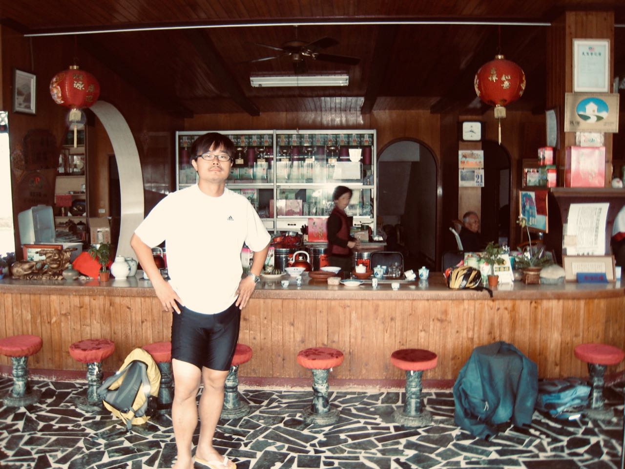
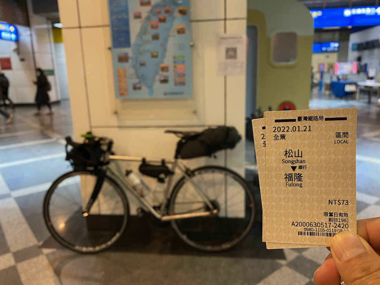
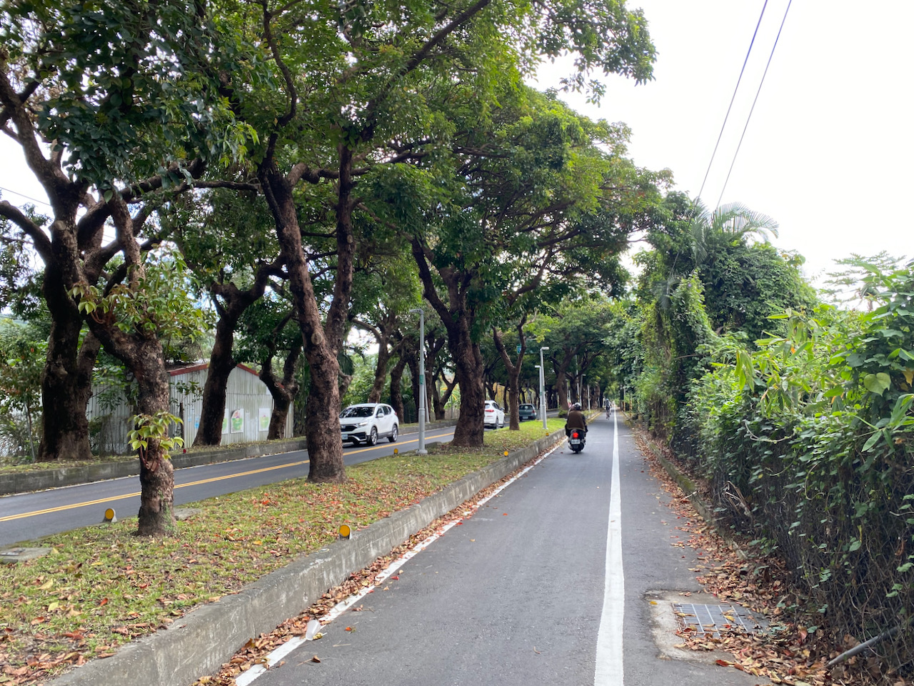
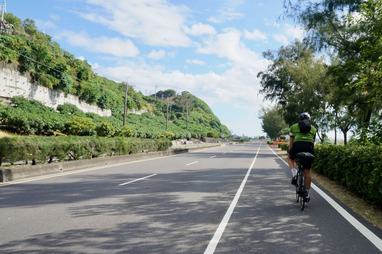
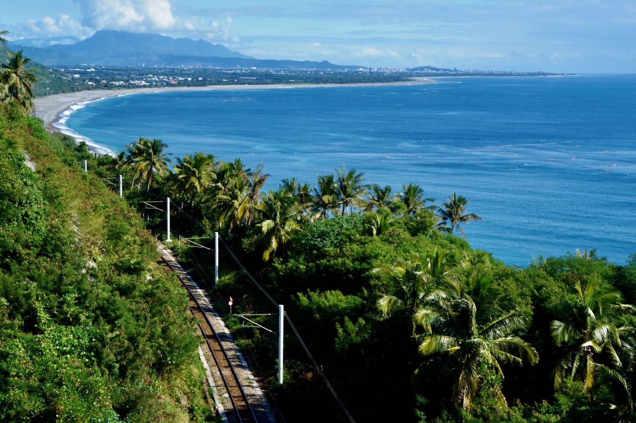
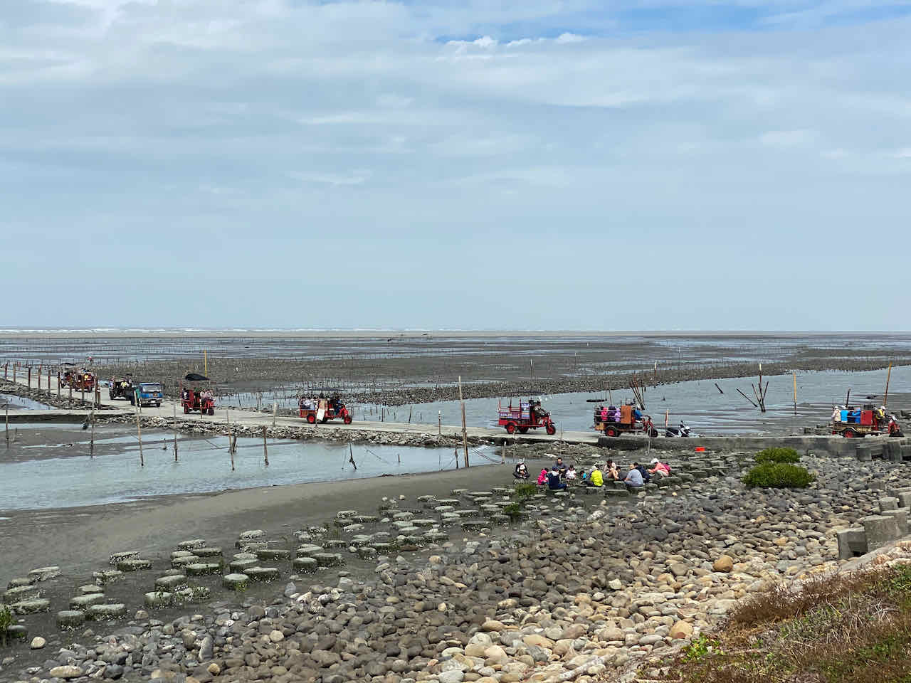
We started late this day at around 10:00. Weather turned wet and cloudy but there’s not much rain. Leaving Keelung and heading eastwards, there were quite a number of brown road signs showing the directions to some tourist spots. But we did not bother to stop and check. Cycling per se was just too enjoyable. By 1:00 pm, we had covered 25km and arrived at a cape called Bitoujiao (鼻頭角, literally meaning cape nose tip). Lunch break. John seemed to be doing an experiment of spending his money as frugally as possible. He picked the smallest food stall at the fishing harbour, which served only bowls of noodles. If you want to reward yourself with some delicious food, there are certainly some seafood restaurants.
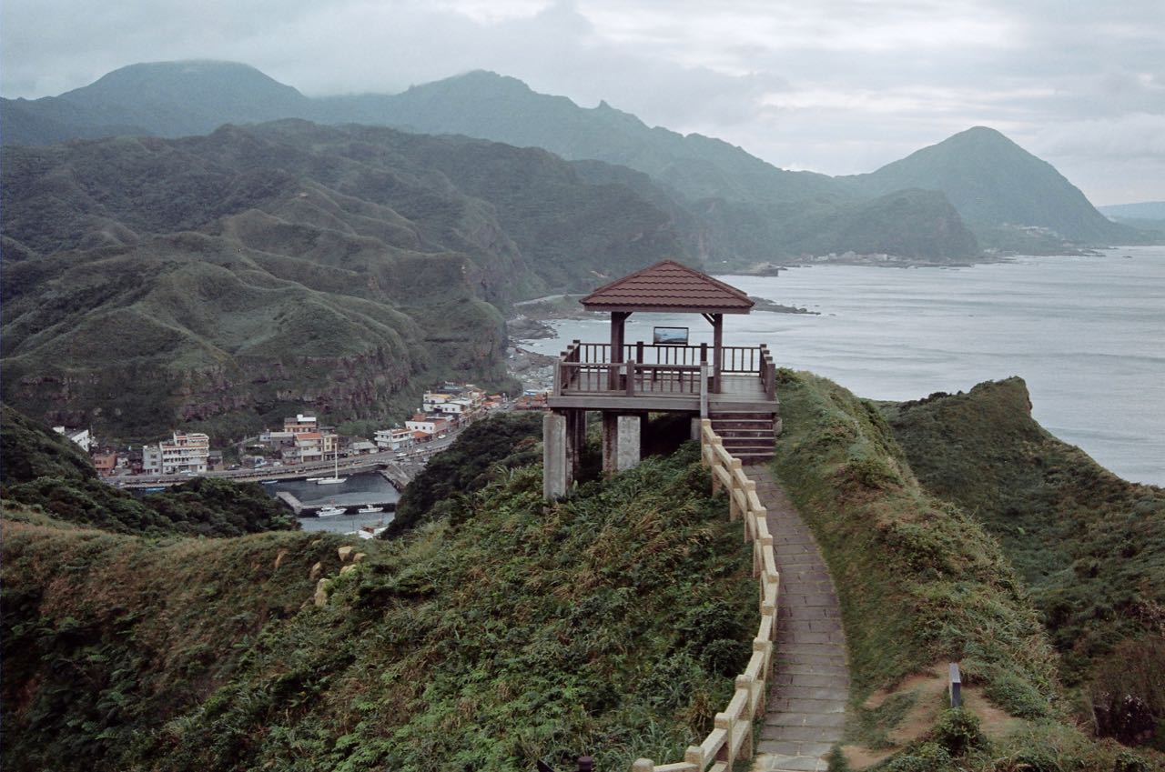
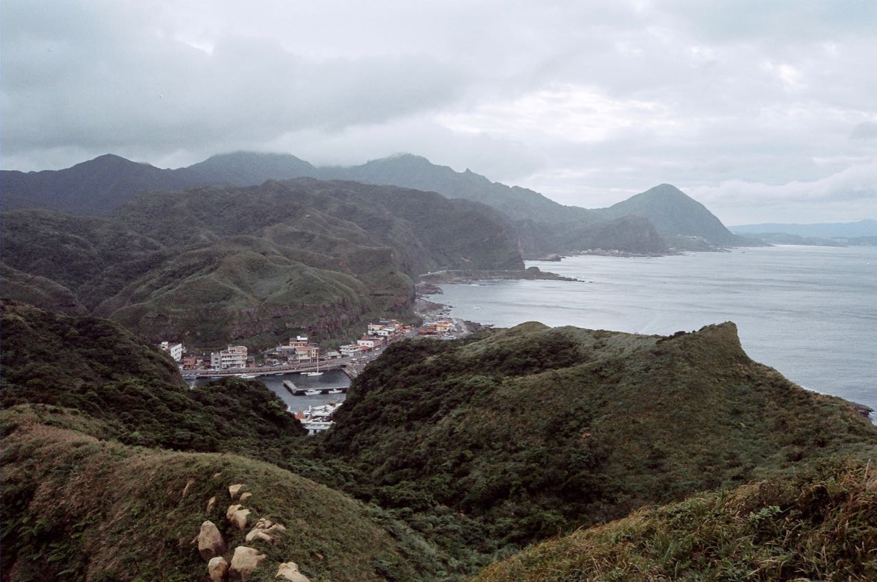
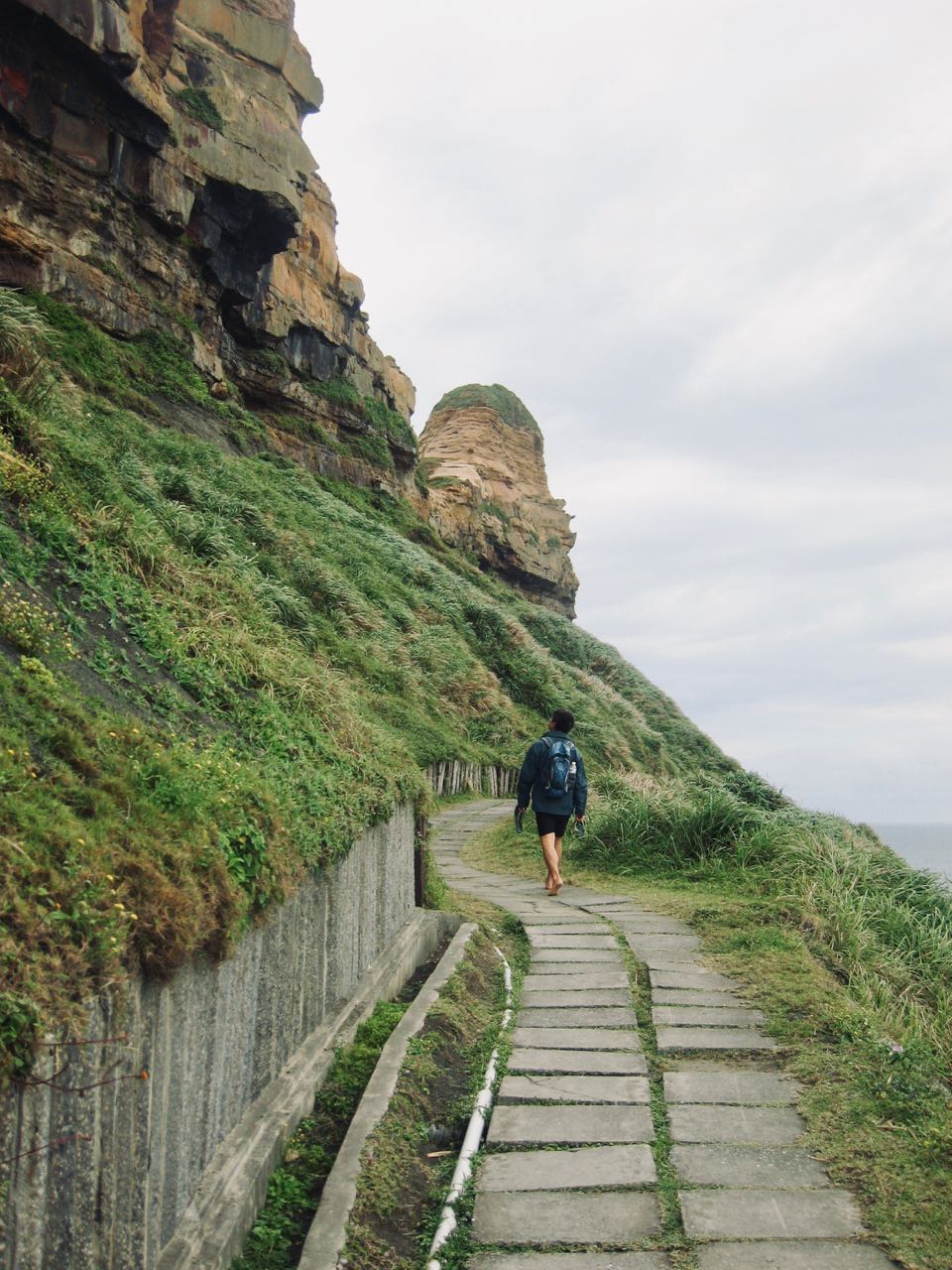
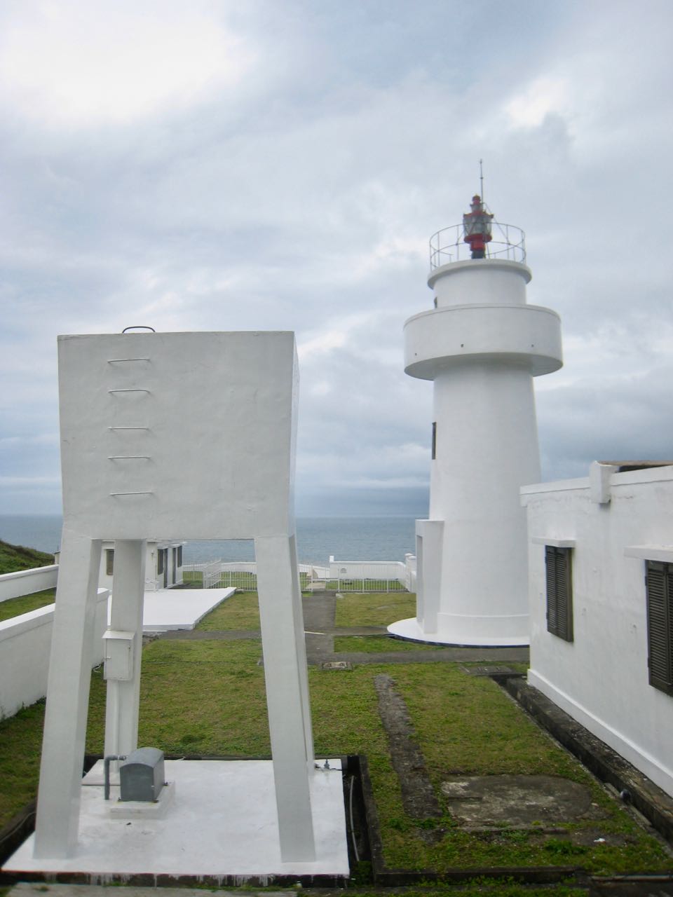
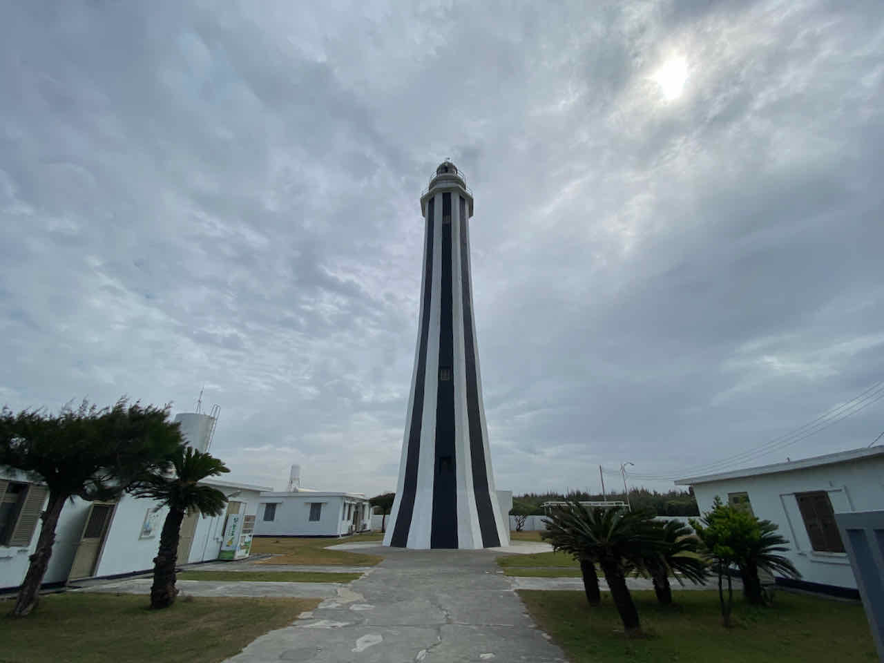
In spite of our meager lunch there, I had a great time in Bitoujiao. One of Taiwan’s most beautiful primary schools sits on the cape’s cliff with a view of the vast Pacific Ocean in different shades of blue. Like allother public schools in Taiwan, the outdoor area is open to public after school and during weekends. There are three hiking trails in Bitoujiao, all exalted by visitors. We picked the one along the ridge and found a great location where we could look back at the coastal line we had just cycled. Of course I would not miss the trail leading us to the Bitoujiao Lighthouse. (Sadly, this part is closed now because the cliff there has been cracking. Hopefully it will be fixed soon.) Then, we finished the walk with some coffee at the small hut (opens only on Saturday and Sunday) next to the entrance of the primary school.
Bitoujiao trailBitoujiao Lighthouse.
The trails actually form a circuit that links with the fishing harbour. You may leave your bikes at the restaurant and come back in a loop.
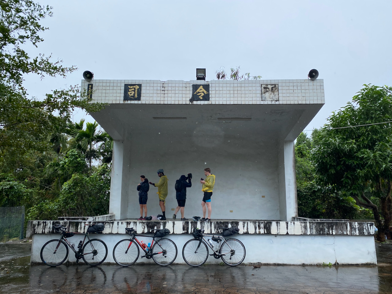
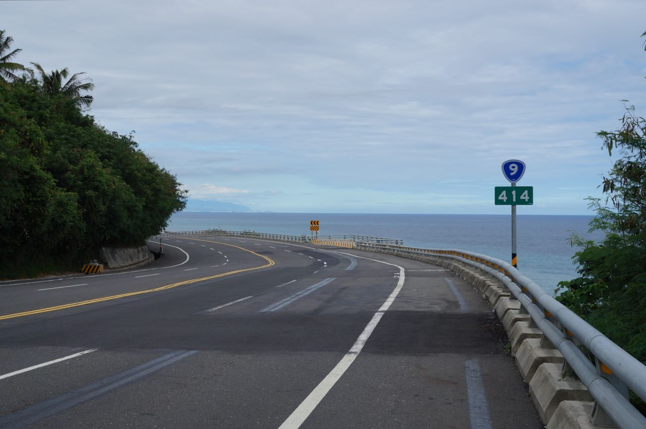
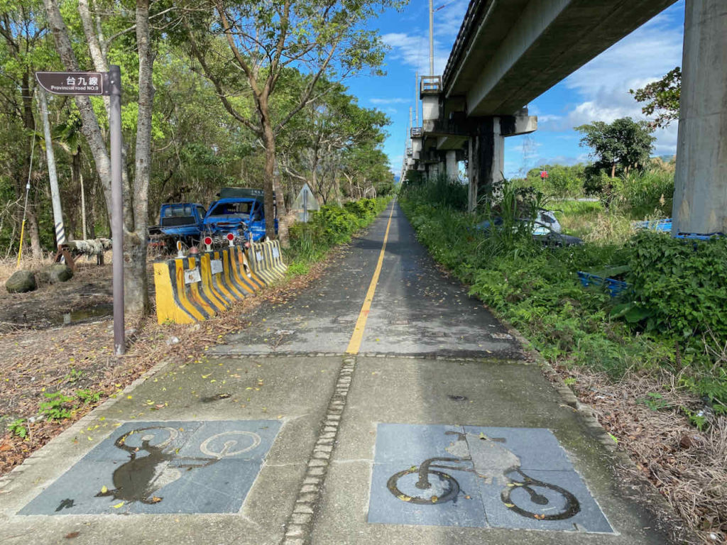
We spent more than 3 hours in Bitoujiao. It was getting dark when we started cycling again. Definitely not a problem; we have done that before. Slowly, we reached Fulong, a small resort village, before 7:00 p.m. The small area right outside the Fulong Train Station is packed with bento (lunchbox) shops. The Rustic Bento (鄉野便當) has been there since 1958. I think I had two of this for dinner. We were not ready to call it a day yet. We were about to reach the easternmost point of Taiwan main island, the Cape Santiago or Sandiaojiao (三貂角). An old train tunnel has been converted to a bikeway and forms a 20 km loop with the route around the peninsula. The Old Caoling Bikeway Loop (舊草嶺環狀線自行車道) was a dedicated bikeway separated from lanes for motor vehicles. With a big beach nearby, this small village does make a good place for families to spend a day or two. The tunnel, which became a short cut through the peninsula to the next village, was closed after 5:00 p.m. No problem at all. I always have the desire to reach the “extremes” and certainly would not miss the easternmost point of Taiwan. I would not have used the tunnel even if it were available. The Sandiaojiao lighthouse is sitting on the peak of Cape Sandiaojiao, casting light onto the sea. We did not go up there as it involved some climbing and it was already too dark. In hindsight, we should have stayed the night at Fulong and visited the lighthouse. Instead, we found a small homestay run by an old lady at the next village, inside a small building with a light-box signage outside. She collected the fees and told us that she would need to go to the temple early the next morning. We could just leave by ourselves. Read: No breakfasts.
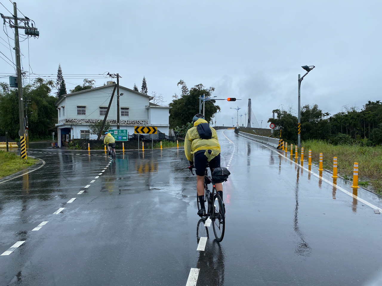
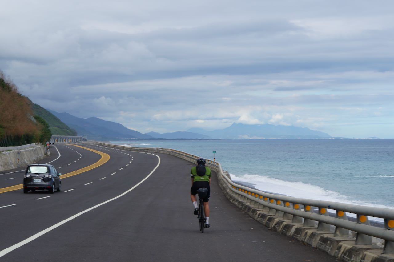
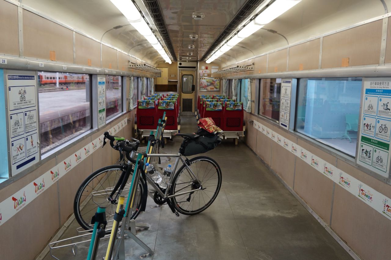
We started cycling in drizzles. Without the fenders, soon I had two big vertical stripes on my chest and back, painted by the wet dirts thrown up by the wheels. We reached Toucheng Station (頭城車站) in no time. Some fellow cyclists told us that we could try our lucks here to board certain trains (without bagging the bikes) to skip the hair-raising Suhua Highway and reach Hualien safely. The next train available was around 4:00 pm. Rain stopped. We headed South (8km) to the hot spring town Jiaoxi to munch on a whole chicken roasted in a kiln fuelled by the wood of litchi or longan. We even had enough time to take a dip in some hot spring before returning to Toucheng Station to board the train.
Lychee or Longan wood is the kiln’s fuelJohn and I ate the whole chicken
In fact, Toucheng Station is no longer an ideal station to board a train with your bikes now. At the time of writing, there are only three trains a day that would carry naked bikes. That one we took has been cancelled. Instead, Luodong station (25km southwards) or Su’aoxin Station (33km southwards) have 9 trains a day, stretching from early morning to around 11:00p.m. You would also skip the most part of Yilan if you board the train at Toucheng as it locates at the northern part of Yilan. Here’s where you can check for relevant information but it’s in Chinese only: TRA Bike Trains. Clients of Bike Express Taiwan need not worry about this; we are happy to check it for you. (Note: The Taiwan Railways Administration has launched their official website on spring of 2019 with the options of Chinese, English, Japanese and Korean)
Back to my trip. Again, we found ourselves in the dark when we arrived at Hualien and prepared our bikes outside the train station. A woman approached us and tried to persuade us to stay at her hostel. She appeared to be horrified by our idea of cycling in the dark. A man joined in to help. He claimed that he could predict the weather precisely after being a sailor for decades. He sticked one finger into the air and tasted it. “It’s sweet! it’s going to rain soon!”, he concluded and announced loudly. Sorry man! The north and north east coasts had made us experienced cyclists specializing in riding in the rain and in the dark. And please don’t be so sure. It’s very difficult to make predictions, especially about the future! I thought to myself.
We turned down the woman’s offer and headed into the 180 km longitudinal valley connecting Hualien and Taitung, the Huadong Valley. It was created after the Eurasian Plate and the Philippine Sea Plate kept pushing each other for many many thousand years. It is believed that the Philippine Sea Plate crept above the Eurasian Plate and formed the Hai’an Range or Coastal Mountain Range (海岸山脈). And they are still doing it. That’s why the frequent earthquakes in the area.
The valley was more populous than the northern coast. We had a local person cycling with us as he was heading home. He told us that the valley was so full of homestays that we needed not worry about finding a place to stay. Then, we decided to stop for the day after passing several townships at a leisure pace. And nope! Mr. Sailor, there wasn’t a single drop of rain.
John, who speaks better mandarin, asked a cashier at a convenient store if there were any homestays around. He came back with a look of disbelief on his face while I was looking for some snacks. Turned out a young lady with a baby in her arm overheard the conversation and invited us to stay in their place, which was just a couple blocks away and where she lived with her husband. For free! Wow! what could I say? I did have a split second of wary thoughts but how could we turn down such a generous offer? If she did not worry about safety issues of having two strangers staying at their place, neither should we. So we accepted her invitation and followed her home. Her husband was a young jade carver. He was appreciating (evaluating?) several pieces of raw jade stones on his desk while we chatted. We were told that Yuli Township (玉里, translated literally as Jade Township) in the valley used to produce a special kind of jade with fibre patterns.
Even though I could barely participate in the conversation with my broken Mandarin, I gained a new perspective on the Japanese rule in Taiwan (1895 – 1945). I used to think the older generations of Chinese must have all harbored a feeling of hostility towards the Japanese, who had been frequently in war with the Chinese in the past centuries. Being a former wartime foe of KMT and notoriously brutal during World War II, Japan was commonly thought to detest by the older Chinese from the other side of Taiwan strait.I was surprised to learn that some people in Taiwan had a nostalgic view of Japan’s colonial period. Like in all other colonial economies, human and natural resources were used to aid the development of Japan. But firstly, roads, railways, schools, clinics, water supplies, etc. had to be built to facilitate the extraction. After half a century of ruling, the Japanese had left behind numerous valuable infrastructures, historical buildings, sake breweries, sugar mills, logging railways and some intangible assets like agricultural technologies. Of course, the subjects weren’t treated equally. After we moved to Taipei, one of our neighbours told me that Chinese were not allowed to study law and politics during that period. The only prestigious profession left for those Chinese elites to pursue was medicine. This somehow became a convention within the Chinese community and that’s why people in Taiwan are enjoying superior medical services today. The living standard and population had grown significantly when Japan left Taiwan in 1945. Many old Taiwanese have a fondness towards the Japanese. I guess some people in Hong Kong share the same sentiment about the British rule (1841-1941, 1945-1997).
The next day we did exactly as the hostess told us the night before: leave by ourselves when we woke up. They probably had their own daily routines and did not want to put any time strain on us.
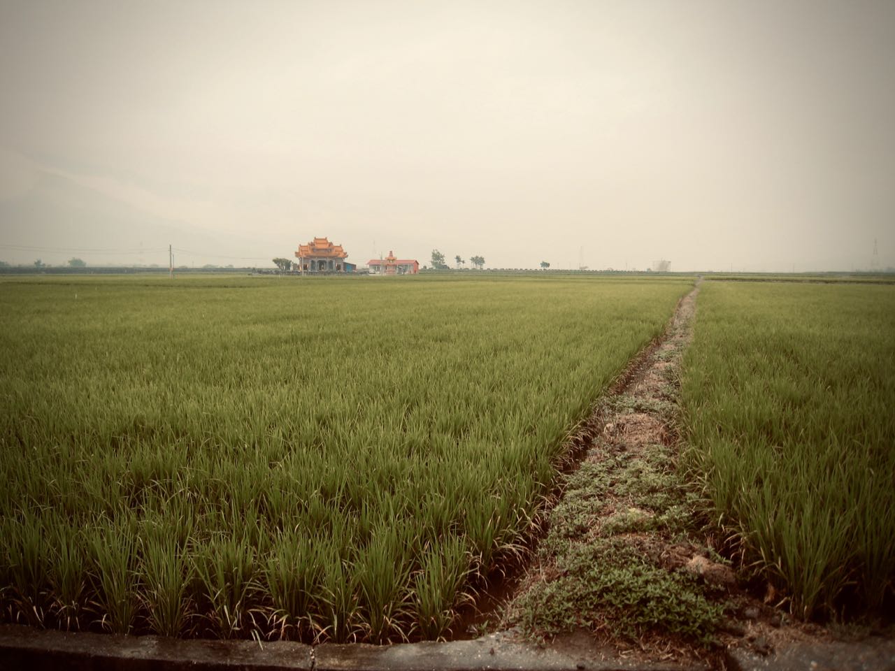
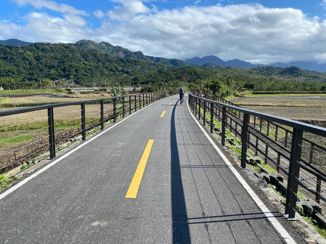
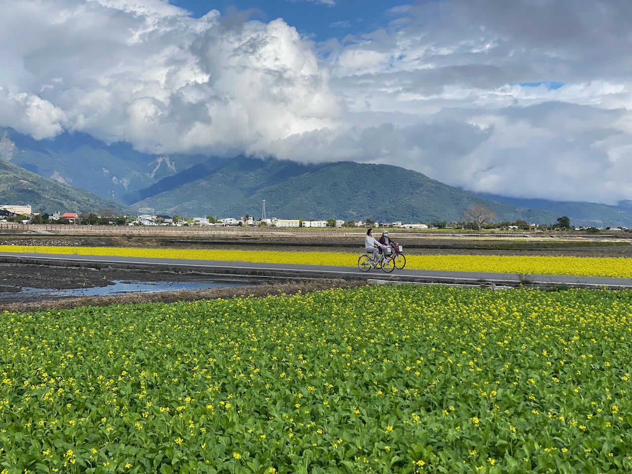
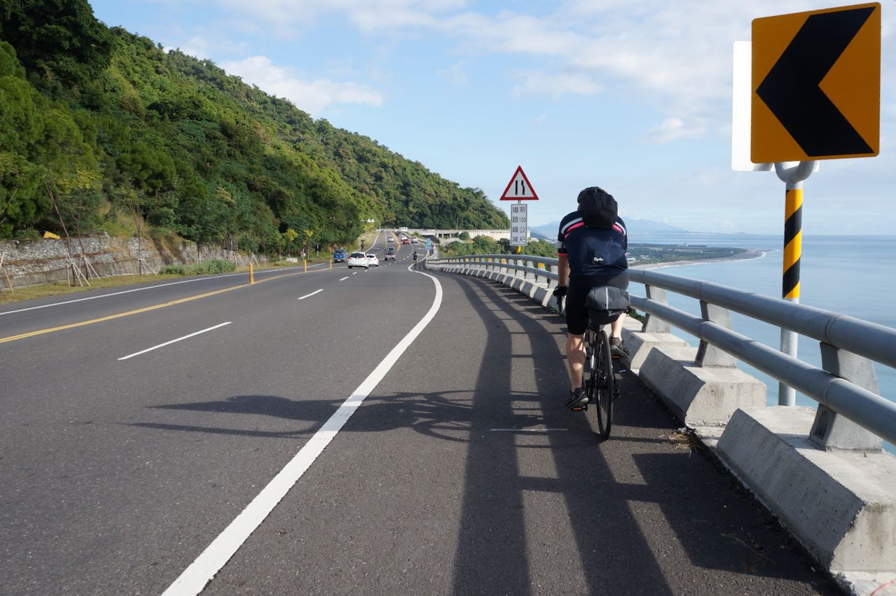
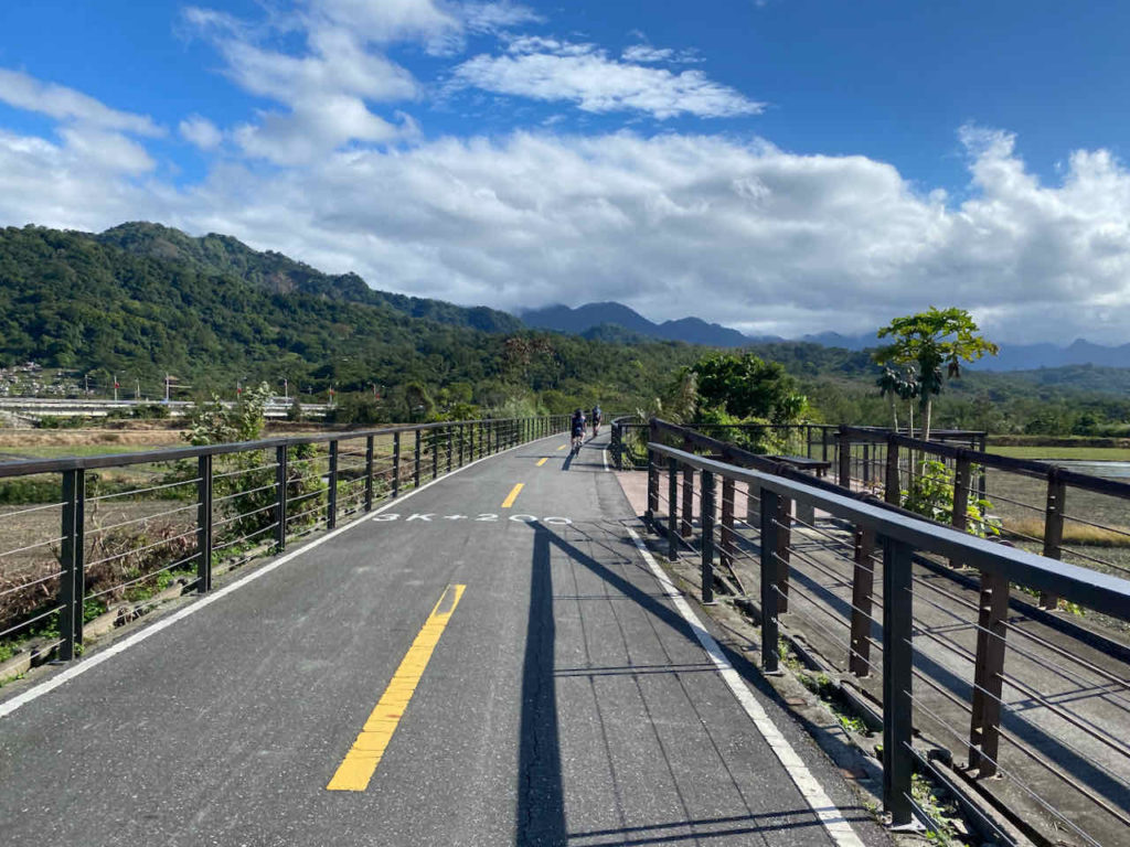
Some intermittent drizzles again. We continued our tour southwards on the Provincial Highway No. 9 and got a chance to take a good look at the valley in broad day light. Roads were flat and straight and flanked by green paddy fields. It’s a very pleasant view.
After lunch, we needed to pedal harder. After some serious climbing, I finally reached the top of a slope and stopped in front of a tea shop in the Wuhe village, 210 metres above sea level. As I was waiting for John, who lagged behind me, the tea shop owner waved me in and later offered us lots of tea for tasting. There used to be more than 100 tea farmers with 200 hectares of plantation. In the1990’s, failing to compete with the high mountain (over 1000 metres) tea from the west coast, half of the plantation has gone out of business.
Meanwhile in Taitung, inspired by the Oriental Beauty Tea, Chen Huicang (陳惠藏), a specialist of the Tea Research and Extension Station (茶葉改良場, an institute under the Council of Agriculture, Executive Yuan), has developed a special kind of tea that, among other aromas, carries a natural signature flavour of honey.
Some research findings revealed that, when bitten by tea green leafhoppers, tea plants would secrete some chemicals that, even at an extremely low level, could attract a special kind of spider, Evarcha albaria, which is a predator of the leafhoppers. It seems after hundreds or thousands years of evolution, tea plants has developed a way to call for help. And those chemicals are the sources of that signature flavour.
A tea farmer from Wuhe village, Gao Zhaoxu (高肇昫), went to consult Chen Huiceng and returned home with the tea processing technique. But he still needed the leafhoppers to bite his plants.
He adopted the eco-friendly farming practices, including suspending the use of pesticide, as promoted by the government of Hualien Township. After years of development and improvement, the tea produced in Wuhe village has regained its competitive advantage and tea farms started to stand on their own feet again. Until 2007, the total area of tea plantation has returned to 160 hectares.
Live in harmony with the nature and we will be rewarded with something precious. This is something I learned there.
One of the tea shops in Wuhe
I did like their tea but I could only buy two bags because of the limited space in my saddle bags and my reluctance to carry too much weight. Actually, if you find something you really want to buy during a cycling trip, you could send it back to Taipei using the railway system. Unfortunately I did not know that at the time.
We left the tea shop and started descending to Yuli. There were small road signs put up by homestays to advertise themselves. It started raining. We picked one homestay at random and followed the direction on the road sign to to somewhere quite far away from the town centre. It was closed. That sucked, especially after the climb we had to do to reach that homestay. But then even if it’s not closed, we might still end up with a fully booked one. So, you should always call to check before actually committing any time and strength to get there. Homestay owners might not be able to communicate well in English over the phone. Again, the Bike Express Taiwan team is happy to do the job for our clients.
John used the GPS to find the closest hostel. It must be up and running for some time to have its information stored in the GPS database. We did not have Google Maps back then. Anyway, we could finally take a good rest and wash our soaked cloths.
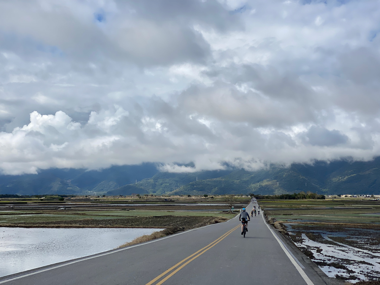
We continued our trip and headed south along the Provincial Highway No. 9 in the southern part of the rift valley. Before long, we entered Taitung County officially but still needed to ride 50km before we would reach Taitung City. Townships in Taitung County, including Chishang, Guanshan and Luyeh, have been well known for producing the finest rice in Taiwan. There were endless views of paddy fields disappearing into the horizon.
The first township to see was Chishang (池上). If you have some knowledge of Chinese, you would have recognized these two characters on many instances because several chain stores selling bento (lunchbox) bear the name, eg. , 池上便當, 池上木片便當, 池上飯包. A perfect combination of climate, water, soil and altitude, together with farmers’ meticulous caring of the plants, rice grown in Chishang has been frequent winner in rice competitions.
Given that Chishang produces around 12,000 tonnes of rice annually, which is around 1% of Taiwan’s rice production, I wonder if there is enough rice for all those bento shops. Perhaps that’s why the township office is running accreditation programs for bento shops.
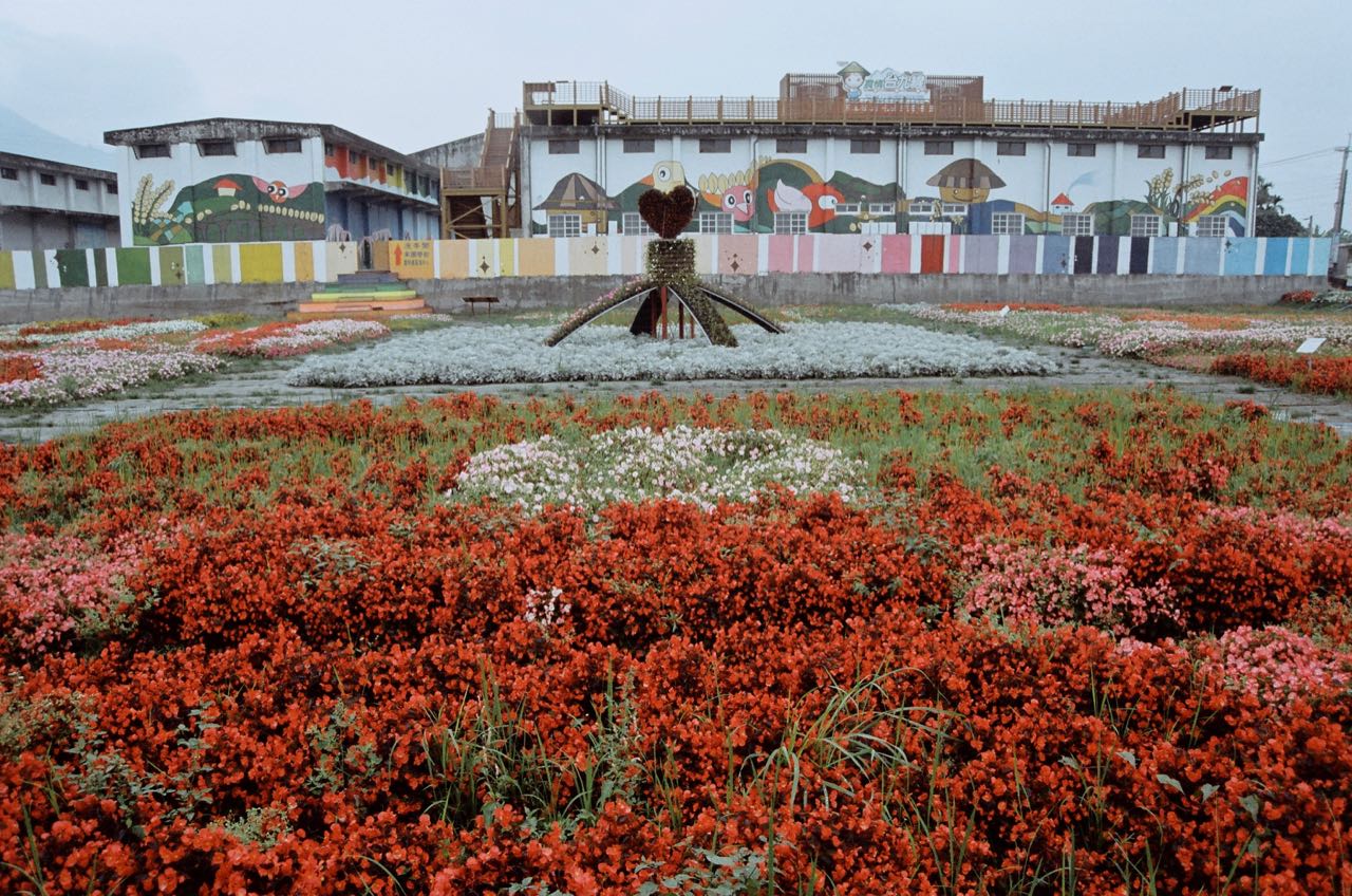
Then after further travelling for 10 km, we stopped in front of a very colourful building with rice as cartoon characters painted on it’s facade. There was an enormous display of the word Guanshan Rice in Chinese (關山米) on the field, formed by crops of different colours. A platform was set up for visitors to take a bird’s-eye view of the display. The building used to be a rice mill and storage. The Guanshan Township Farmers’ Association had turned it into a tourist service centre. Visitors could sign up for a short demonstration of the process of rice milling. Rice produced in Guanshan used to be a tribute to the Japanese emperor during the Japan rule. But this legacy alone was not enough to ensure their products thrive in the market. We could tell that the Farmers’ Association had put in lots of efforts to polish their brand.
Fuli TownVast Rice FiledsGuanshan Farmer’s Association
We missed two famous tourist spots around Chishang because we did not know of them at the time: the Dapochi and the Brown Boulevard. They are definitely worth the trouble of taking a detour. It’s pretty easy when you have Google Maps. Just set the Destination to “Dapochi” when you are approaching Chishang Station. After you have enough fun there, use Google Maps again to guide you to “Brown Boulevard”. If you are travelling northwards, set your destination to “Brown boulevard” when you are leaving Guanshan Township.
We climbed a little bit to Luyeh Highland and then started a 20 km nice long descend from 240 metres to 40 metres above sea level towards Taitung City. It was awesome. We were moving like the wind.
And that’s it. It’s about the end of our trip. We found a random hotel to stay for the night and did some common tourist thing. The next day, we cycled to Taitung Train Station and shipped the bicycles to Songshang Station in Taipei. This simply is a wonderful service for cyclists like us who prefer travelling without a rigid plan. There are more than 50 stations scattered on the island with luggage rooms that allow you to drop off your bikes. Because of this, we can plan our routes with a lot more flexibilities. We can even send some personal belongs or souvenir we bought along the way to the next stop or the final destination in order to slim our saddle bags.
Parted with our bikes, we completed the around-the-island tour by taking a train from Taitung to Kaohsiung and then the High Speed Rail to Taipei. We did some sightseeing in Kaohsiung and Taipei but it was kind of weird (cold turkey?) to switch from pedaling to bipedalism. I missed the bike, the mobility and freedom it brought me, and the encouraging smiles from strangers when I was breezing past their sides.
Since we would have a free day on the last day of the company outing, we decided to take a short bike trip in Taipei city. Have been searching for some info, I ended up using the bike rental service with Bike Express Taiwan. The appointment is on March 11th, 8:30 am at the hotel and they would pickup the bikes at 6 pm. There were 8 of us and half have never been in the bike trip before. So what I have planned would be quite easy with total distance of around 15–20 km. for the entire route.
Our fate then relied on the weather. There had been raining everyday since the beginning of the trip. Luckily, there was no rain on our day.
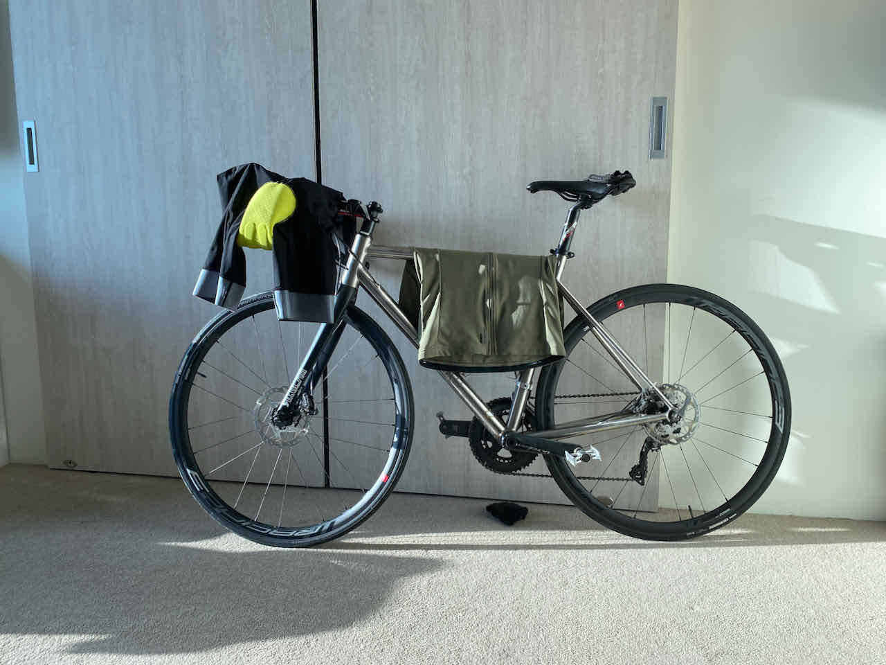
The bikes we used were Rikulau Audax Hecules with variety of sizing. After signing the contract and paid the deposit, we then started our trip.
การปั่นจักรยานในนครไทเปง่ายมากๆ เพราะทำเหมือนคนเดินถนน แค่เปลี่ยนจากสองขาเป็นสองล้อ ปั่นไปบนฟุตปาธ ซึ่งจะมีเลนจักรยาน หากถนนไหนไม่มีเลนจักรยานเฉพาะก็ใช้ร่วมกับคนเดิน โดยกฎหมายจะให้สิทธิคนเดินก่อน “Pedestrian has right of way” เวลาจะข้ามถนนก็ข้ามตรงทางม้าลายตามจังหวะสัญญาณไฟ และอย่าลืมว่า ไทเปขับรถชิดขวา ดังนั้นเวลาเราปั่นในเลนก็ต้องปั่นชิดขวาเช่นกัน เพราะอาจมีจักรยานปั่นสวนทางมาได้
Cycling in Taipei is very easy. We cycle on the footpath which normally have a bike lane. If there is no specific bike lane on the footpath then bicycles will share the path with the pedestrian. Wait for the green signal when crossing the road and remember that in Taipei, drive rule is on right hand side.
จุดแรกของเราคือไป Taipei Expo Park ซึ่งเคยใช้เป็นที่จัดงาน Taipei International Flora Exposition ในปี 2010–2011 มาก่อน แม้ว่าจะนานมากแล้วแต่สภาพพื้นที่ยังสวยและดูดีอยู่มาก ไฮไลท์ของสวนนี้อยู่ที่ Expo Dome ที่เป็นเวทีแสดงงาน สถาปนิกวิศวกรอย่างเราจึงกิ๊วก๊าวกับรูปลักษณ์ของโดมกันพอสมควร
Street Furniture และ ป้ายสัญญลักษณ์ต่างๆ เป็นศิลปะที่สวยงามน่าสนใจ
There are several interesting areas in the park. Floral tunnel and the solar bridge are ones among them. All street furniture, graphic and signage are of interested items too.
There are 40 solar panel on the bridge roof. เราปั่นผ่าน Fine Art Park มาออกมุมบนสุดของสวนส่วนที่ติดกับ Minzu Park เพื่อไปจุดหมายที่สองคือบ้านโบราณที่ชื่อว่า Lin An Tai Ancestral House เสียดายที่ลืมเช็คมาก่อนว่าเขาปิดวันจันทร์ เราเลยได้แต่ถ่ายรูปด้านหน้ากับส่องๆดูเท่านั้น
Second destination was the Lin An Tai Ancestral House. But unfortunately, is is closed on Monday so we could only look from outside.
Lin An Tai Ancestral House ใกล้เที่ยงแล้ว เราตั้งใจไปกินกลางวันกันที่ตลาดปลา Addiction Aquatic Development (บางคนในทีมถูกหลอกล่อให้มาปั่นเพียงเพราะบอกว่าจะพาไปกินอาหารทะเลที่นี่ อิอิ) ใครไม่เคยมาไทเป ขอแนะนำให้มากินอาหารทะเลที่นี่สักครั้งหนึ่ง ราคาถูกและสดมาก รับเงินสดเท่านั้นนะคะ นอกจากอาหารทะเลแล้วก็มีอาหารอื่นๆด้วย มีทั้งแบบเลือกมาสดๆแล้วให้นำไปปรุง หรือจะเลือกที่ปรุงสำเร็จแล้วก็ได้
ด้านหลังของพื้นที่กินนี้ เป็นตลาดปลาจริงๆคือ Taipei Fish Market แต่เรายังไม่เคยเข้าไปดู
Addiction Aquatic Development is a place where we had lunch. If you spend time in Taipei, this is a place of recommendation. The food is really good, fresh and reasonable price, especially all seafood. Behind the development is the Taipei Fish Market.
อิ่มแล้วก็ปั่นต่อ ไปหาที่กินกาแฟกับขนมกัน ย่านถนน Fujin Street แหล่งฮิปสเตอร์คือเป้าหมายถัดไป อาจเป็นเพราะวันจันทร์ คนก็เลยค่อนข้างน้อย หลายๆร้านก็หยุดวันนี้ด้วย
After lunch we went to “Fujin Street”; the famous area for hipster. It might be because of Monday so there was very few people around thus less shops openned.
We spent an hour enjoying our coffee and dessert at Au Petit Cochon: The Little Pig cafe. They serve good coffee though.
ช่วงบ่ายเราวางแผนไปปั่นริมน้ำกัน
จาก Fujin Street ปั่นตรงไปเรื่อยๆมุ่งหน้าริมแม่น้ำ ปั่นบนฟุตปาธเลาะกำแพงไปจนถึงทางเข้าสวนใต้ Minquan Bridge พอปั่นเข้าไปด้านหลังกำแพงเท่านั้น ทุกคนถึงกับร้องว้าว รีบจอดรถลงไปถ่ายรูปกันใหญ่
From Fujin Street, we rode in the direction toward the river. Enter the riverside park via the entrance under the Minquan Bridge just to see the large lush mound with white tiny flower scattered around, down below is the Keelung river.
The area along the river side is mixed with pavement, colorful flower garden and street art. We rode along this area until the exit under the Rainbow Bridge.
จุดสุดท้ายเราไปแวะที่อนุสรณ์สถานของดร. ซุนยัดเซ็น Sun Yat Sen Memorial Hall ซึ่งใกล้กับช่วงเวลาที่เขามีการเปลี่ยนทหารรักษาการณ์กันพอดี ก็เลยได้ดูอีกรอบ ที่นี่ไม่ต้องเบียดคนมาก แต่ที่น่าสนใจคือนิทรรศการภาพวาดที่กำลังจัดแสดงอยู่ ชื่องาน Female Elegant Demeanor — Woman Figure Watercolor Painting Exhibition เป็นภาพวาดสีน้ำภาพเหมือนคน ที่เหมือนมากๆ ขนาดถ่ายรูปแบบซูมยังเหมือนคนจริงๆเลย
เราออกมาจาก Memorial Hall กันตอน 17:30 แล้วปั่นกลับโรงแรมทันเวลานัดหมายส่งรถพอดี
เป็นทริปปั่นที่สนุกและน่าจดจำอีกทริปหนึ่งทีเดียว
The last stop was Dr. Sun Yat Sen Memorail Hall. We went there by the time they changed the guard so we had an opportunity to see the event with less crowd. One exhibition in the Bo-ai Gallery is “Female Elegant Demeanor — Woman Figure Watercolor Painting Exhibition” which is really impressed for realiness of the painting.
We left the memorial hall around 5:30 pm and arrived on time of the pickup at 6 as scheduled.
It was such one of a great bike trip we had so far.
Thank you Lois from Bike Express Taiwan for your great service.
I had been seeing fellow local cyclists posting accounts and photos of their rides along the route named Xizhi Pigeon 汐鴿展翅, which seems to be lots of fun. I wanted to do it, too. I found the route’s gpx on xplova and invited Lois to join me. The downloadable GPX file of this cycling route is at the end of this post.
Xizhi Pigeon 汐鴿展翅 is a 28km cycling route with its starting point at the Nangang Exhibition Center 南港展覽中心 on the east fringe of Taipei City. The maximum elevation of 394.29m at the top makes it a good route for climb training. The route mainly consists of Section 1 and Section 2 of Jiuzhuang Street 舊莊街, Xiding Road 汐碇路 and Xizhi Keelung Riverside Bikeway 汐止基隆自行車道. Upon completion of the route, you will draw a pigeon with spreading wings on the map of your GPS tracking app.
To get to the starting point with your bike, you can either take MRT to the Nangang Exhibition Center Station on the blue line (ref: Taking Bicycles on the Metro) or simply cycle there via the Riverside Bikeways along the Keelung river, setting your destination as the Nanhu bridge. It is along the route, so you may as well just start there. If you live outside Taipei, you can also get there by taking a train / HSR to the Nangang Station, followed by a short ride.
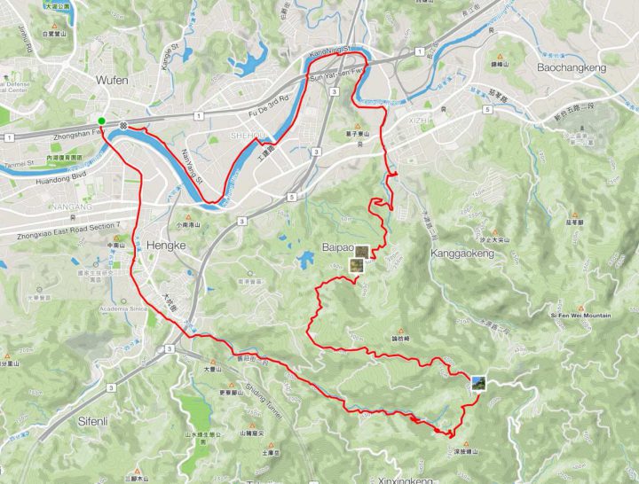
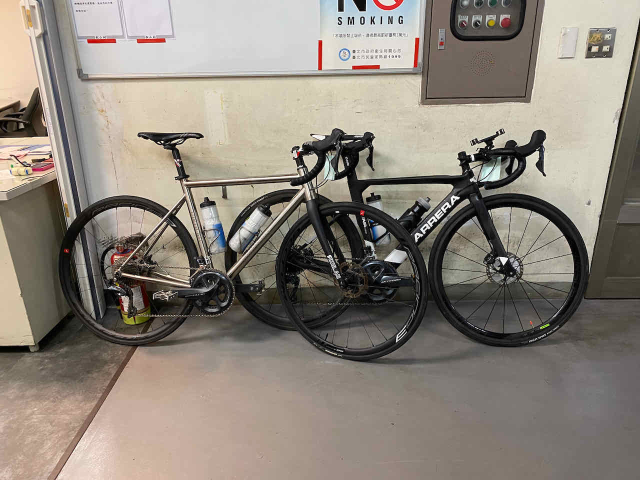
I took the trip on a Friday morning in April, with me on a Rikulau Audax Hercules and Lois on a Klever Q-Comfort. The traffic soon got much quieter after about 5 minutes’ ride from the busy MRT station (Nangang Exhibition Center Station). We could enjoy our ride at our own pace with almost no cars and scooters on Jiuzhuang Street. Some of the slopes were rather steep for me that my heart rate raced up to over 170 bpm. There were tea shops and a tea workshop along the way but I had no mood to stop to explore. It took me about 1.5 hour to reach the top, where a shiny silver sculpture sits. This is the Luku Incident Memorial park and you can find out more about the incident in this blog post.
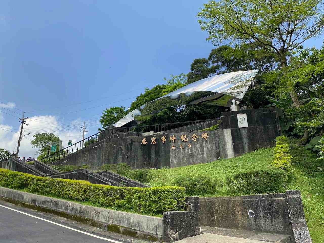
Luku Incident Memorial parkView at the top
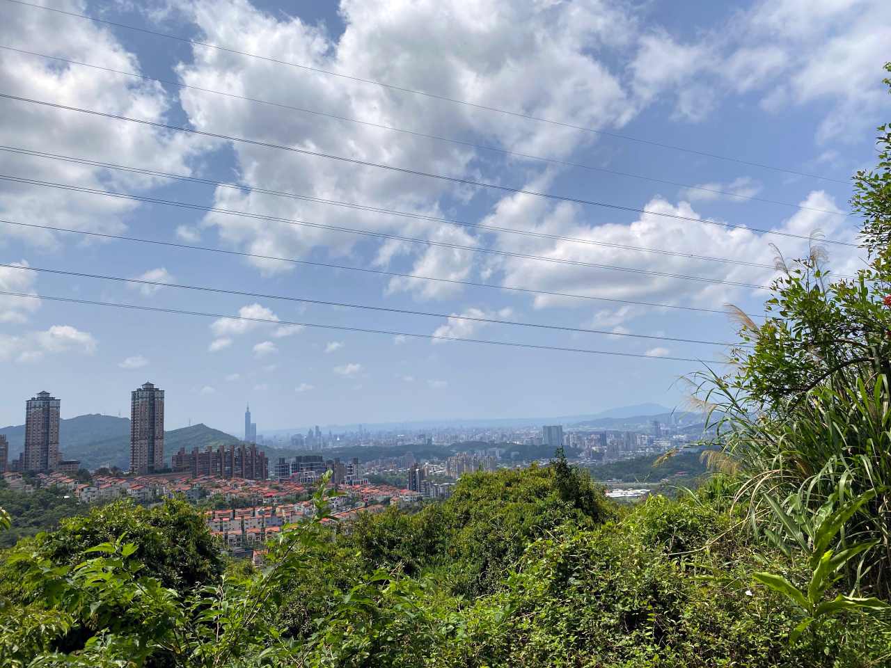
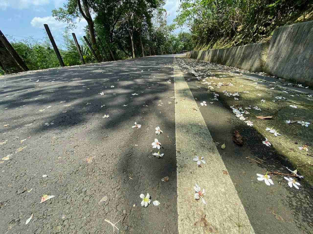
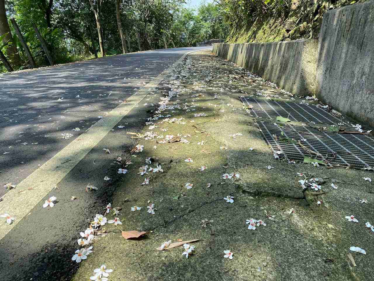
With Velodash turned on to share our locations real time, I left Lois behind briefly to enjoy my speedy descent on Xiding Road. It was less steep and I could enjoy it without having to hit the brake much. I saw carpets of little white flowers spreading along the way. It was so beautiful that I had to stop to take a good look and take some pictures. It occurred to me later that those are the flowers of Tung Trees, which were introduced to the island during the Japanese rule (1895 -1945) for their economical values. The oil from their seeds makes good waterproofing material and paints. The trunks were used for furniture, clogs, toothpicks and matches. They were popular and planted extensively by poor families to supplement their income. Nowadays, local people love the trees for their dense blossoms during April and May. It’s dubbed as the May Snow. As beautiful as they are, you’d better not touch them as the whole plant is poisonous.
Tung flowers on the road
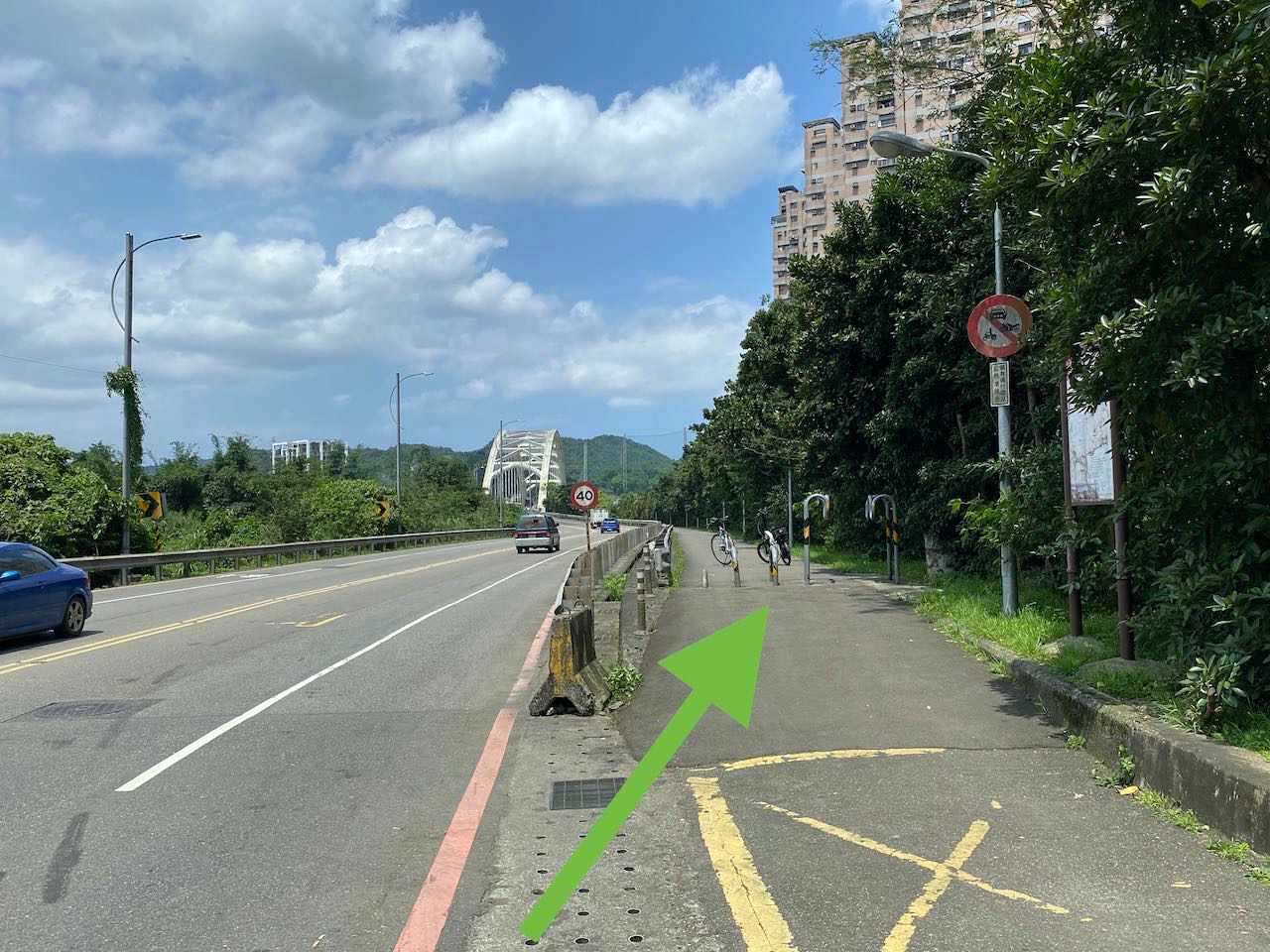
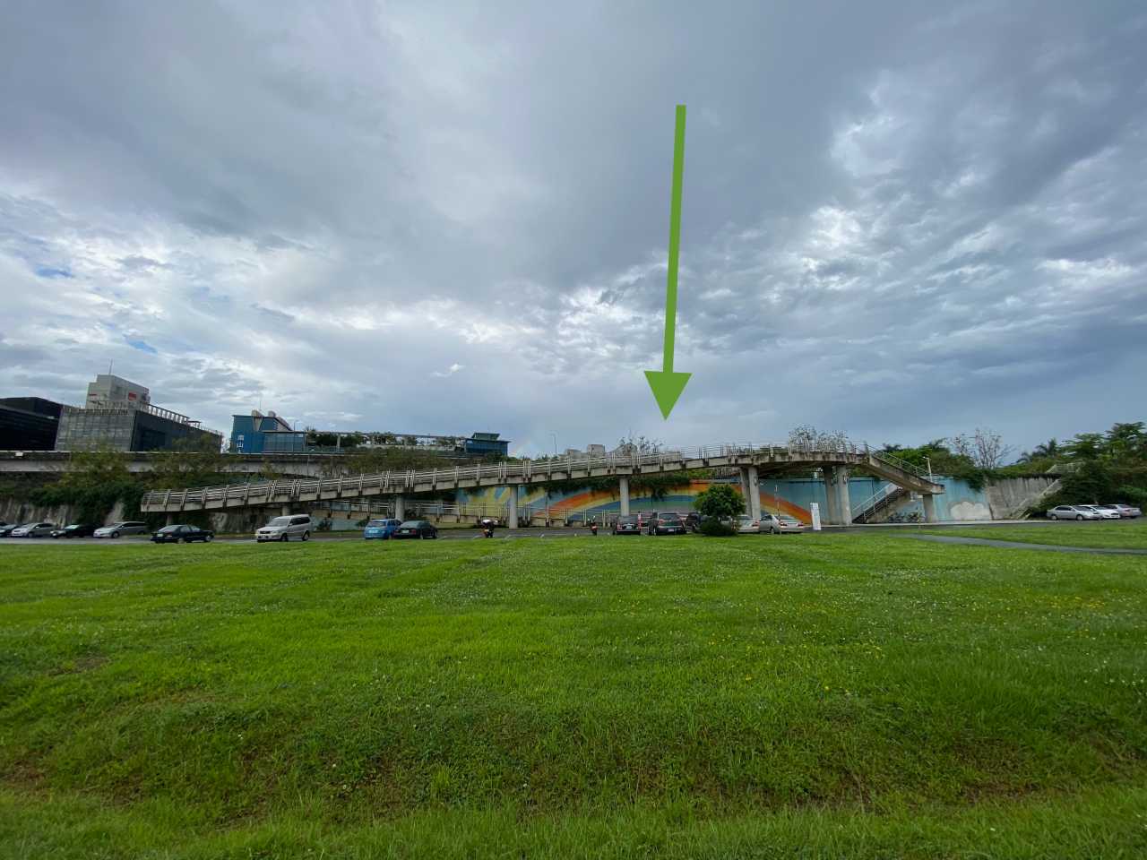
At the bottom end of Xiding Road, we passed a busy juncture and entered the quiet Riverside Bikeways of Xizhi. It’s easy to miss the entrance, which is shown on the picture below. Then you will complete the route after riding for around 15 more minutes.
Entrance of the Xizhi Riverside Bikeway
I love this route because its elevation gives me enough training and it offers the reward of a mild downward slope which is perfect for speedy yet unthreatening descent. Traffic on the route is really low and therefore makes it very bike friendly. No wonder we ran into several groups of cyclists even on a weekday.
If you want more climbing after doing Xizhi Pigeon, Fengguizui lookout is just about 13km away via Dahu Street, which offers a 636m climb. GPS route available at the end of this post.
If you want a low-carb meal, an authentic American smokehouse serving juicy brisket, Bogart’s Smokehouse, is about 1km away.
For me and Lois, our pick is this local hotpot restaurant that offers all-you-can-eat duck-blood curds 鴨血, braised pork rice 魯肉飯, and free drinks and ice cream along with a very generous portion of meat and veggies in a standard lunch set. That’s a very satisfying conclusion for a great ride.
NOTE: To use the routes, please install the App on your smartphone. The App will launch and load the route automatically after you tap the above links on your smartphone’s browser. For Garmin Connect, you can then use the APP to send the route to your garmin device. If your Garmin device is not purchased in Taiwan, you will also need make sure you have the Taiwan map on your device. Here is our blog post on this topic.
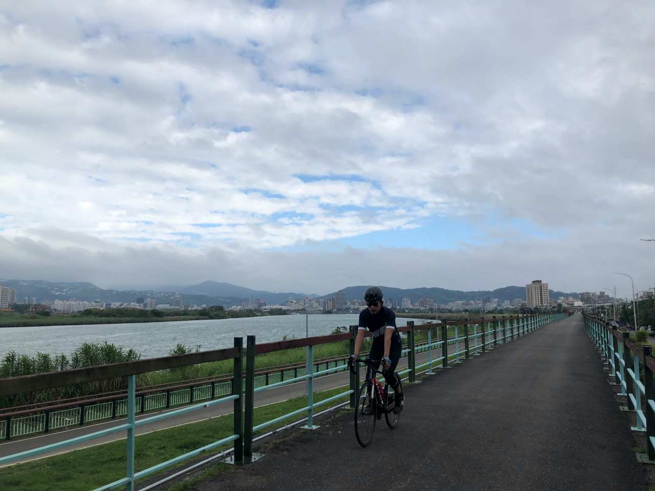
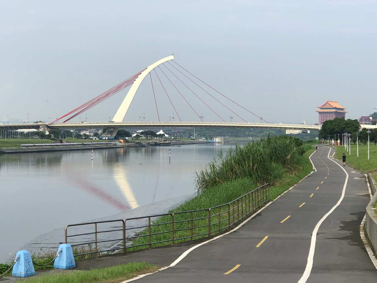
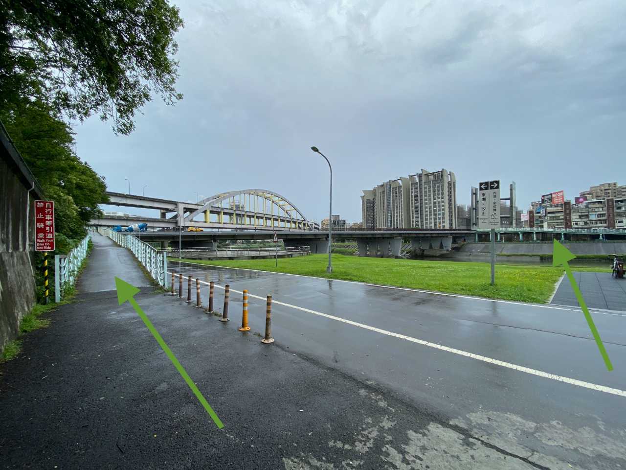
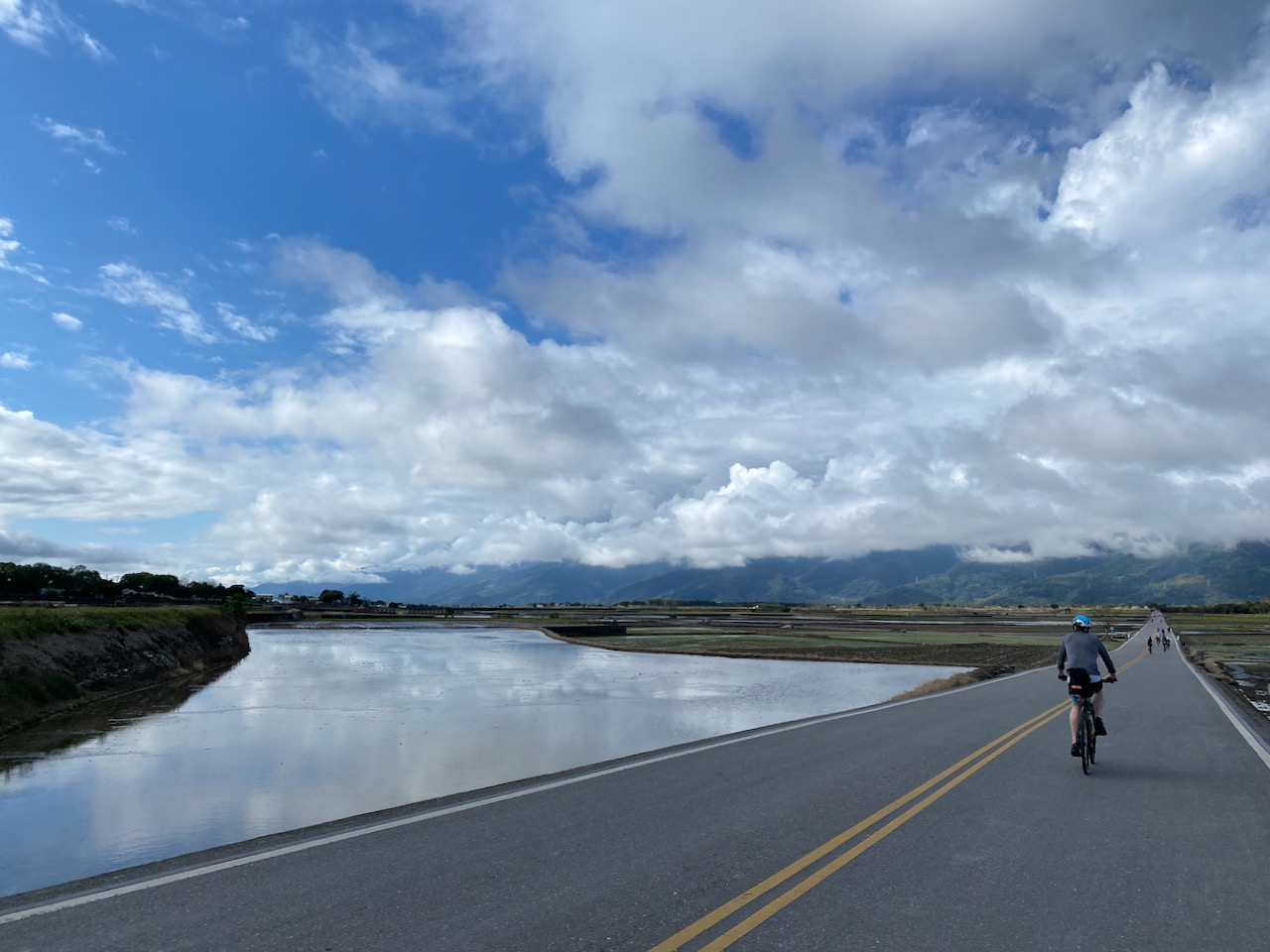
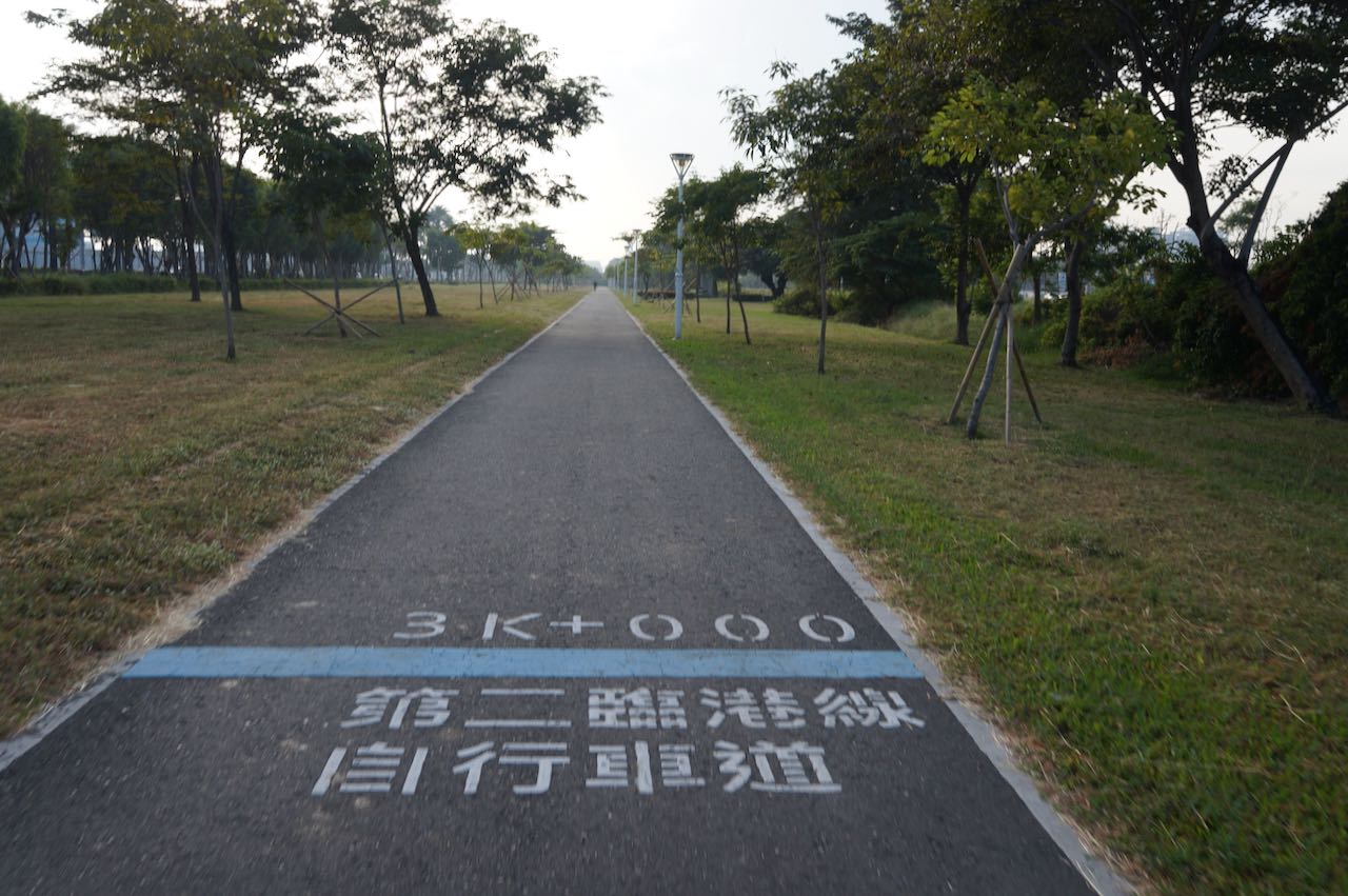
The riverside bikeways 河濱單車徑, built along the rivers winding through Taipei City and New Taipei City, form a vast network of bike paths. A significant part of it embraces Taipei City in the shape of a distorted “C”, with its flourishes extending towards Xizhi 汐止, Xindian 新店, Sanxia 三峽, Taoyuan 桃園, and Tamsui 淡水. Since only bicycles, e-bikes, and pedestrians are allowed on these designated bike paths (except one or two occasional service vehicles with special permit), cyclists don’t need to negotiate road rights with other motorized vehicles or inhale the polluted air coming from their exhaust pipes. With the absence of traffic lights, these well-paved and seemingly endless bikeways make a cyclists’ paradise whether you are a seasoned athlete in training, a newbie trying to get familiar with your bike, or a parent cycling with an over-excited new rider. Meanwhile, because of its vast coverage, commuting cyclists can also make use of it like the freeways for bikes to get to the closest exit points, so as to stay away from the busy city traffic as much as possible.
Riverside bikeways in Taipei City and New Taipei CityRiverside bikeways in Taipei City and New Taipei City
Regrettably, these amazing cycling infrastructures are mostly hidden behind the two-storey-high flood walls erected between the rivers and the city area to protect the cities from flooding during monsoon seasons, which causes the riverside bikeways remain unknown, or at least neglected, for many of the cities’ residents, let alone tourists and visitors. Cyclists who come for a cycling trip in Taiwan for the first time, including myself back in 2009, are most likely inclined to leave Taipei City in a rush for the much craved countryside. Back then I was led by my GPS navigation device onto the busy roads within the city towards the next town. That wasn’t bad at all, but the beautiful, tranquil riverside bikeways were totally ignored because those devices and apps were all programmed to come up with the shortest route to your destination. They still are.
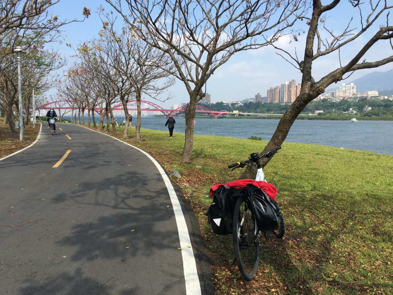
It’s not until my second cycling trip years later that I discovered the riverside bikeways, a more desirable offer by the city to cyclists. Once we got to the riverbank, we found ourselves cycling blissfully on the dedicated bike paths for more than 20km until we reached Tamsui, where the coastal road unrolled before us. It was like getting through a magic tunnel devoid of all the unpleasant aspects of city traffic.
Riverside bikeway near Bali.
The riverside bikeways in Taipei and New Taipei city are too good to be missed as a part of your cycling trip in Taiwan. I have consolidated a list of those access points in this map. You can tap on the square at the top right corner of the following map to launch GoogleMaps with the access points. And then tap on the access point closest to you to have GoogleMaps guide you there. You can then cycle on the riverside bikeway to get out of the city.
These access points can be in the form of:
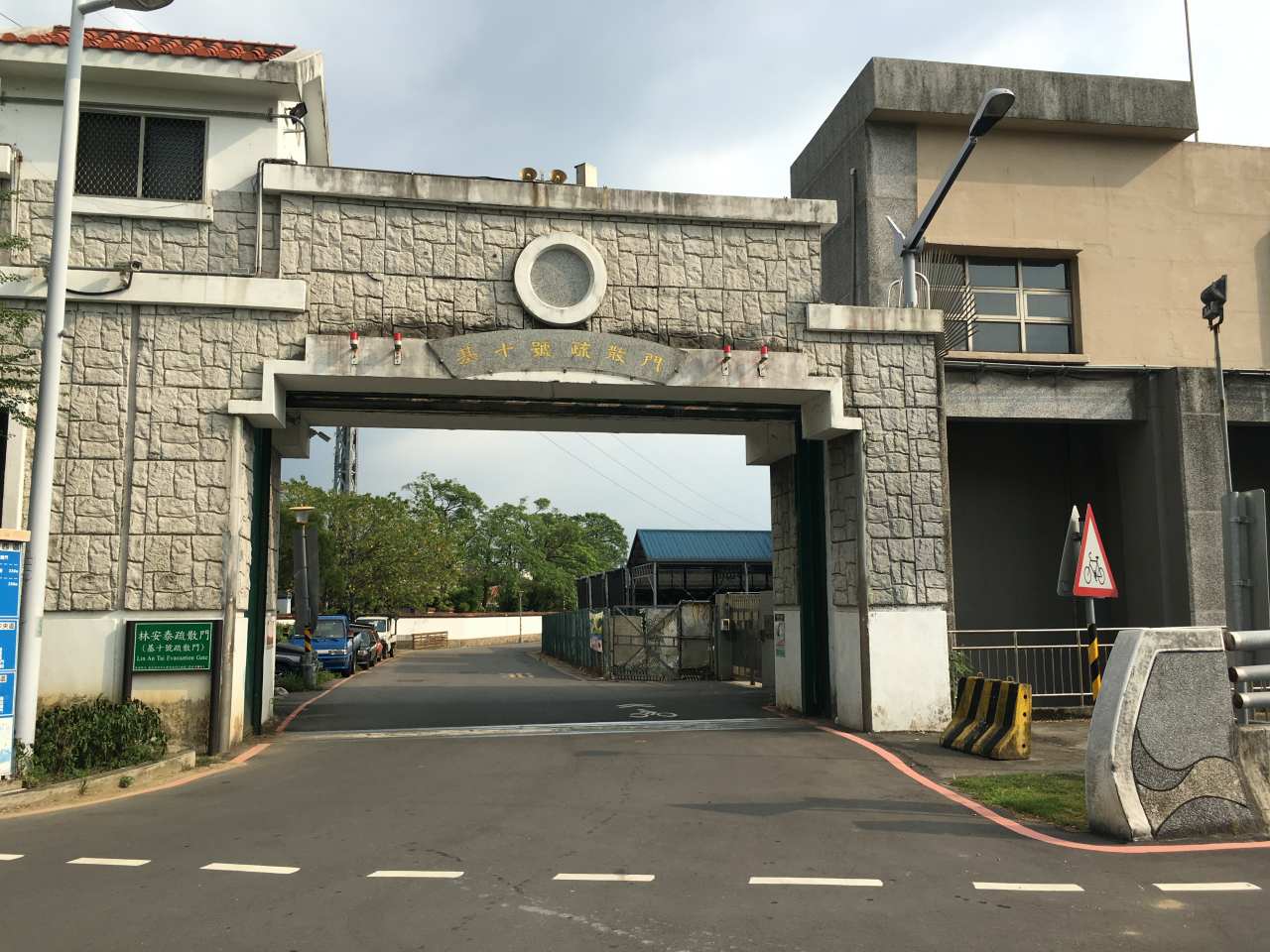
Evacuation gates
A typical evacuation gate
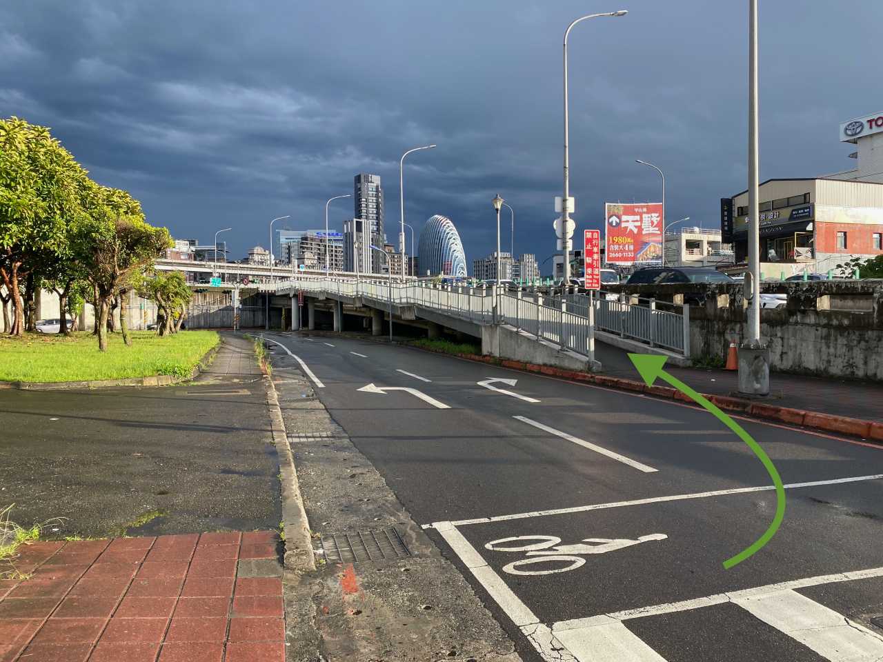
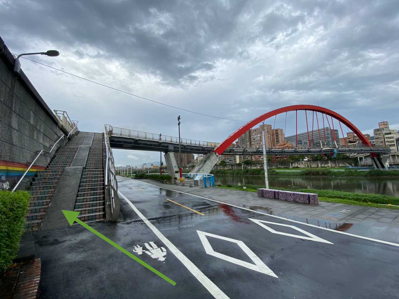
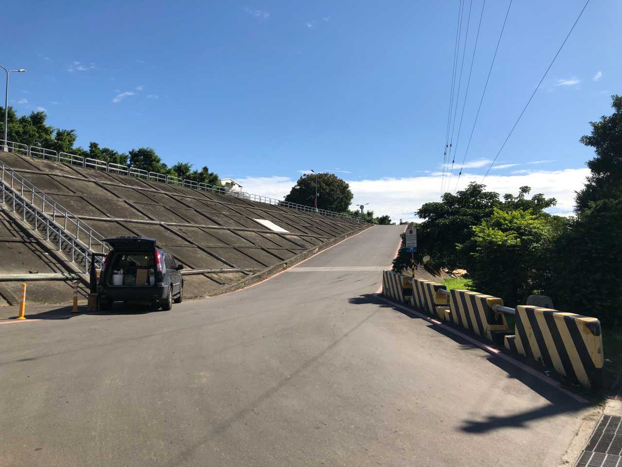
Flyovers to cross over the flood walls
A flyover to cross over the flood wallA Zig-zag ramp/flyover to surpass the flood wallA pair of gentle ramps within the bikeways network connecting the bridge to cross the riverAnother style of ramp for bikes to pass the wall and access the riverside bikewaysA ramp on the middle of a stairway
Ramps for cars
A ramp meant for cars to enter the carpak on riverbanks, another type of access point for bikes
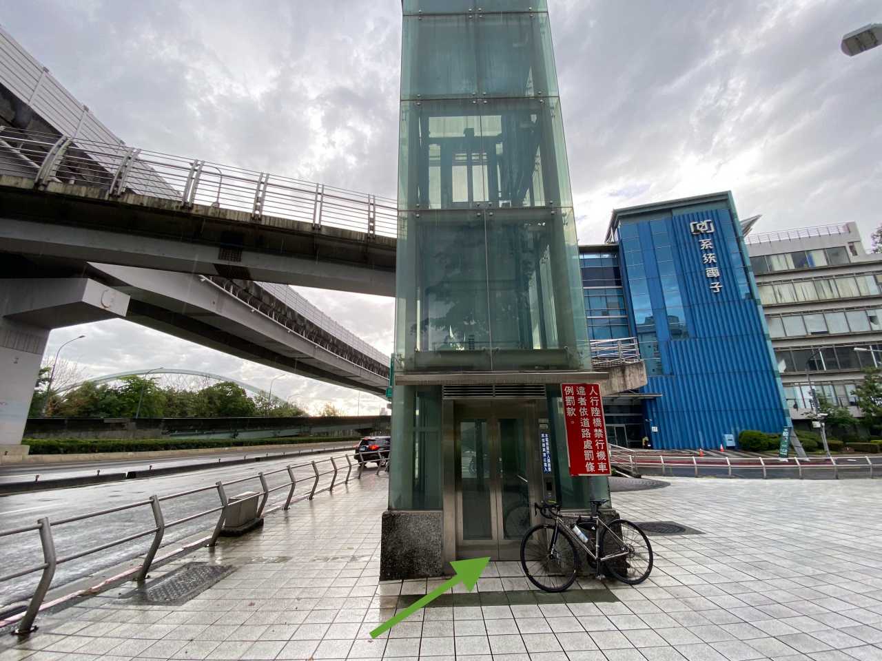
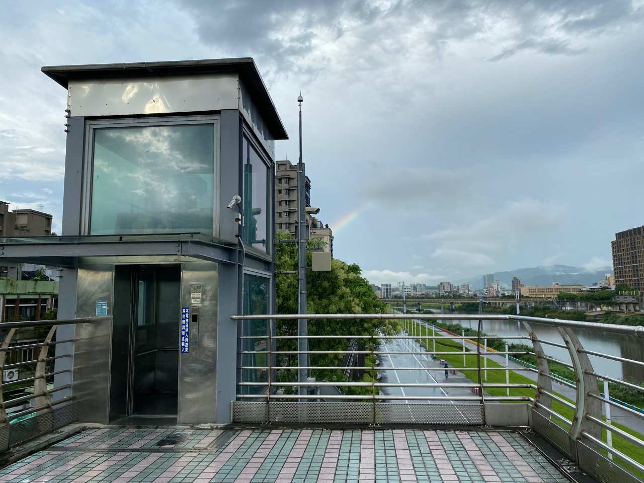
Elevators that operate at specific hours
An elevator to bring you to the footbridge found on the end of Xingshan Road, operating from 05:00 to 22:00Two elevators like this are found at the two ends of the Rainbow Bridge in Songshan District.
There are many other access points for pedestrians, but these are the points where cyclists have no need to carry their bikes on their shoulders and climb the stairways.
A small number of these access points are unmarked on Google Maps so I have marked somewhere nearby like I did with the Yanping Evacuation Gate. Once you reach the marked places, you should be able to spot the access points easily. I have also submitted the unmarked access points as missing places to Google. Hopefully they will show up on the Maps soon.
I have also included in the list those bridges that connect the bikeways to the other side of the rivers and offer designated bike paths to cyclists. Although bikes are allowed on most of the bridges in Taipei, I don’t regard them all as part of the bikeway network. Like Mingquan Bridge, you need to leave the bikeway and join the other vehicles on Minquan East Road to use the bridge. Bridges like this are not on my list.
I have also found some GPX files of the bikeways from the two government websites. I have imported to this map for you easy reference.
https://taiwanbike.taiwan.net.tw (site removed/down as in 2024-01-24)
The list and the routes are not yet completed and I will keep updating it whenever I come across a new access point or a new gpx file. If you happen to know one that is not yet listed here, or you spot any error in our list, please send us an email. We, and I believe all our fellow cyclists, will appreciate your help. Thank you.