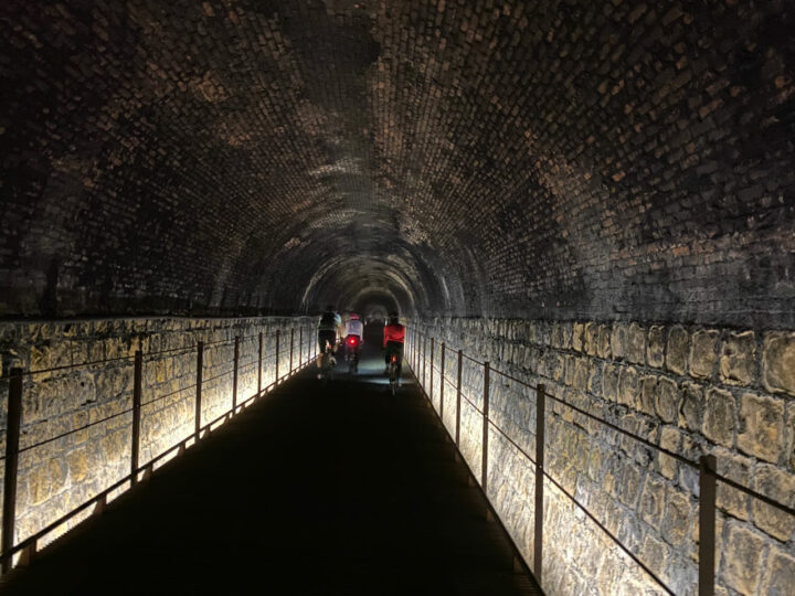
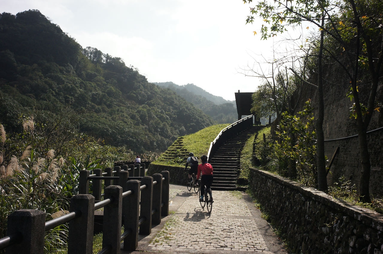
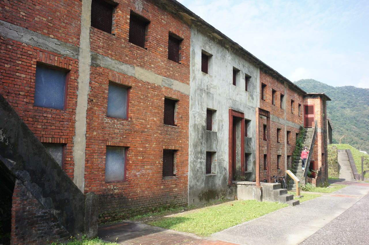
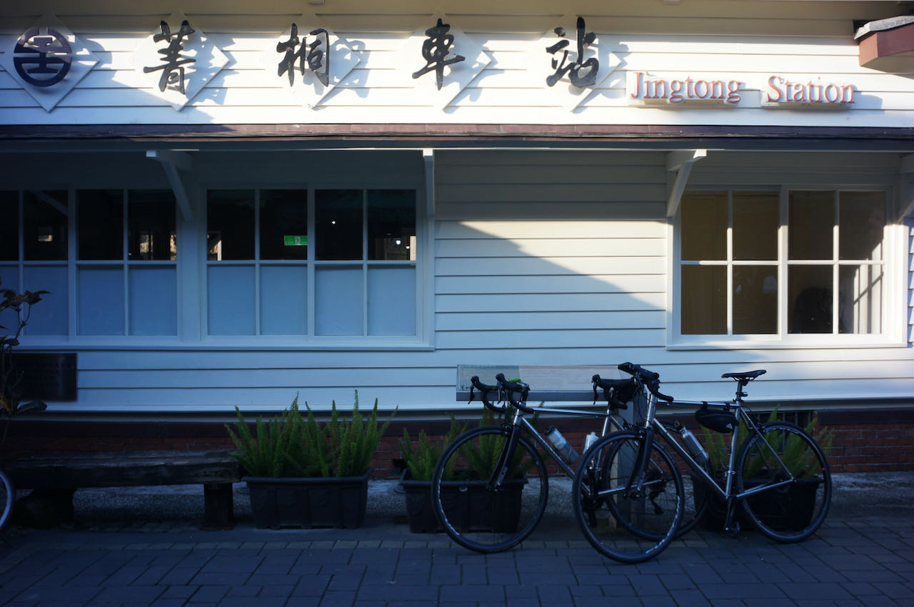
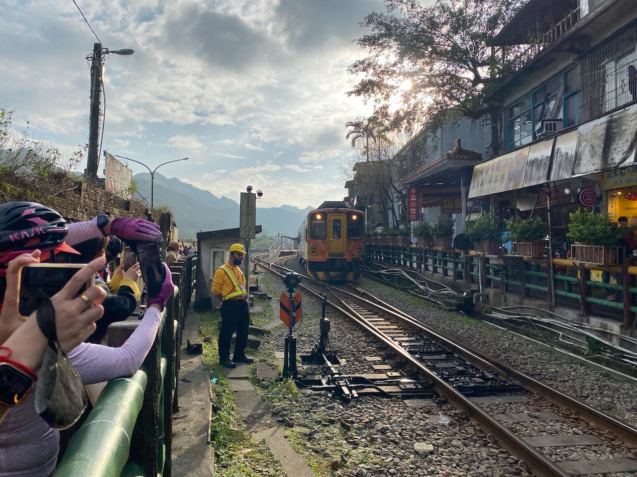
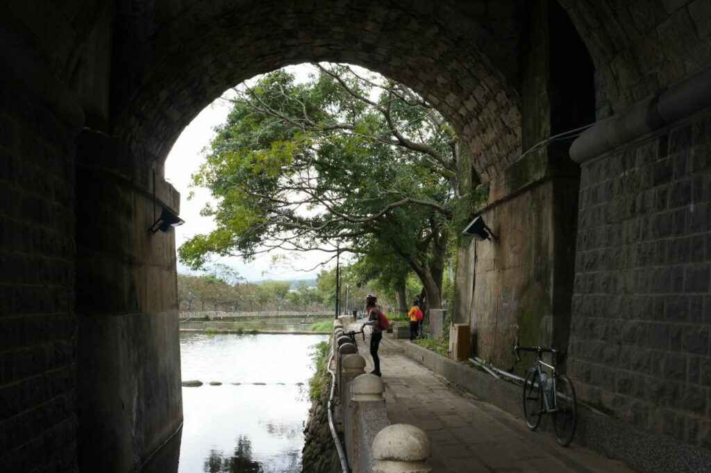
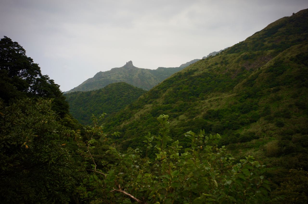
I went cycling with my friends on a Sunday in January to explore a route plotted by Sandy. We took a train from Taipei (you can board the train at Wanhua Station 萬華站, Songshan Station 松山站 or Nangang Station 南港站) to Ruifang Station 瑞芳站 and started our ride right away. We have visited the Houtong Cat Village 猴銅貓村, the Houtong Miner’s Culture & History Museum 猴銅礦工文史館 and the Sandiaoling Tunnel 三貂嶺隧道 – an old railroad tunnel that had been closed for 37 years and then was reopened in 2022 as a bike trail. On our way back to Taipei, we went to watch people flying their sky lanterns in Shifen Old Street 十分老街. This is a route with lots of interesting historical and cultural sites.
Opening hours: 8:30 ~ 16:30 everyday except Monday. If the Monday falls in a long consecutive holiday, it’ll still open. And in this case, the next working day is closed. Visitors need to to make a booking on the link above to secure a place.
Safety Precautions: The entrance of the tunnel is flooded. It’s a feature (not a bug) for people to take pictures of their reflection. But it could be slippery. The whole tunnel’s floor is laid with rows of steels with wide gaps. It can be a trap for those who wear SPD-SL or Look Keo cleats. Be careful not to stick the cleats into the gaps when you need to stop to walk. It’s dark inside and there are lots of pedestrians. Please limit your speed.
The most direct route to cycle back to Taipei is via Provincial Highway 2C (or 2丙) and County Highway 106. But it can be busy with traffic especially during weekends. Sandy had instead routed through some small roads to avoid the traffic. I have provided my GPS record below in Garmin, Velodash, and komoot. The GPX route on the entrance of Sandiaoling Tunnel is difficult to edit because the new bike path and the entrance are not yet recognised by the map. Please follow the sign on the road when you are in that area.
This is a perfect route for a 1 day cycling trip close to Taipei. If you find the route too long, you can hop on a train on Shuangxi Train Station 雙溪站 with your bike to get back to Taipei. You can also extend the route a little to make it part of your around the island trip.
NOTE: To use the routes, please install the App on your smartphone. The App will launch and load the route automatically after you tap the above links on your smartphone’s browser. For Garmin Connect, you can then use the APP to send the route to your garmin device. If your Garmin device is not purchased in Taiwan, you will also need make sure you have the Taiwan map on your device. Here is our blog post on this topic.
Where: Kaohsiung (高雄) to Kenting (墾丁), Taitung (台東) to Hualien (花蓮)
When: 18 Dec – 27 Dec 2012
Who: Peter and Lois (our first cycling trip)
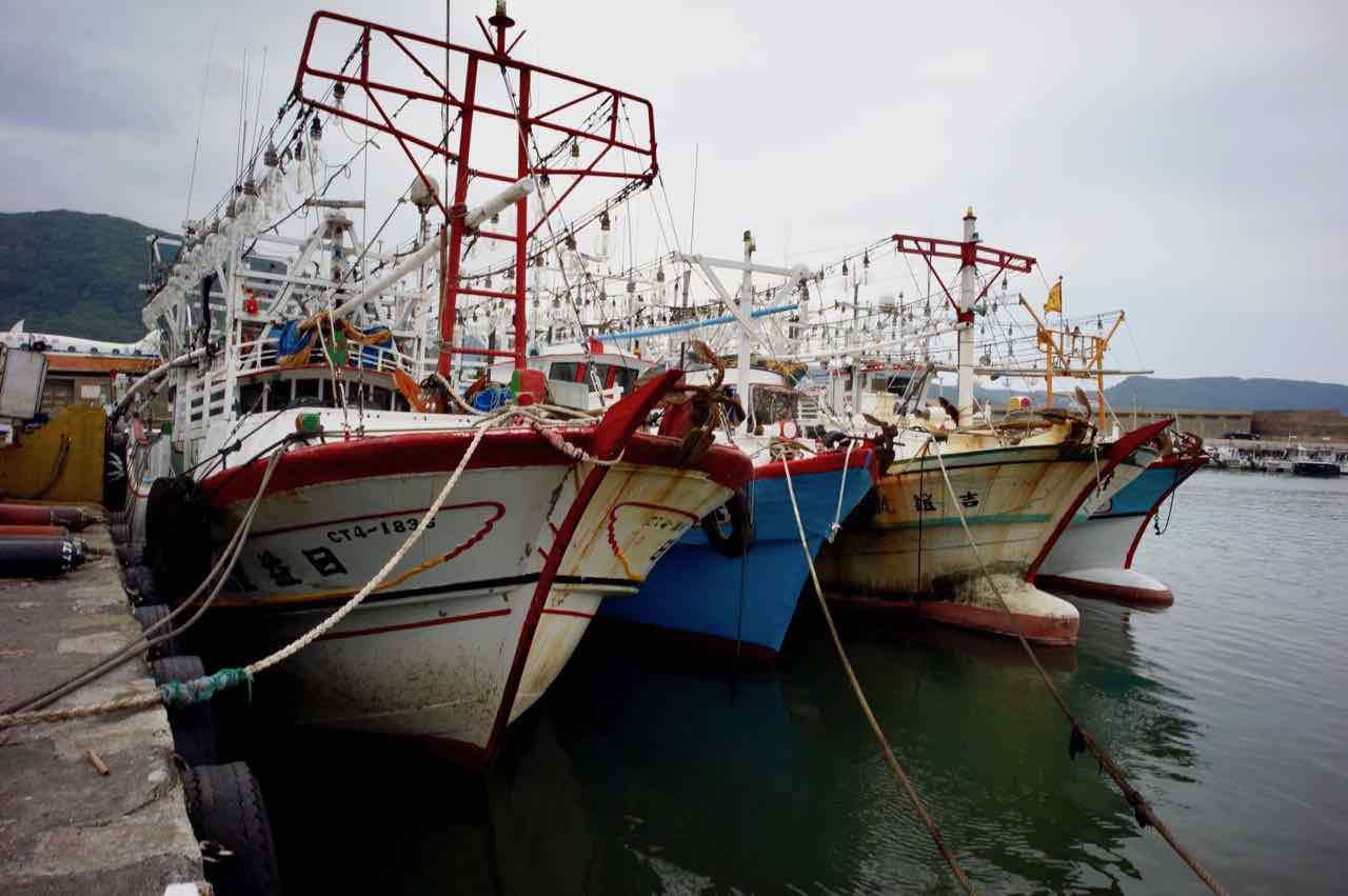
We left Dapeng Bay (大鵬灣) and cycled for another hour and decided to find a place to stay for the night. We found a small homestay in Fangliao (枋寮) on Google Maps.
This little town was formed by loggers from Fujian during the Qing dynasty (1683-1895). Its train station was built, as the terminus of the Pingtung Line (屏東線), when Taiwan was under Japanese rule (1895-1945). The South-link Line (南迴線) was then opened on 1991, connecting the east side of the island to the west. And that was how we would travel to Taitung after we had cycled to Kenting and then returned here by coach in 3 days. It became a small hub connecting Taitung, Kenting and Kaohsiung.
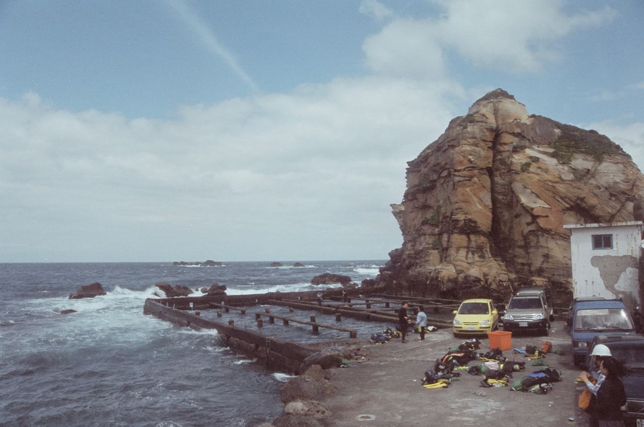
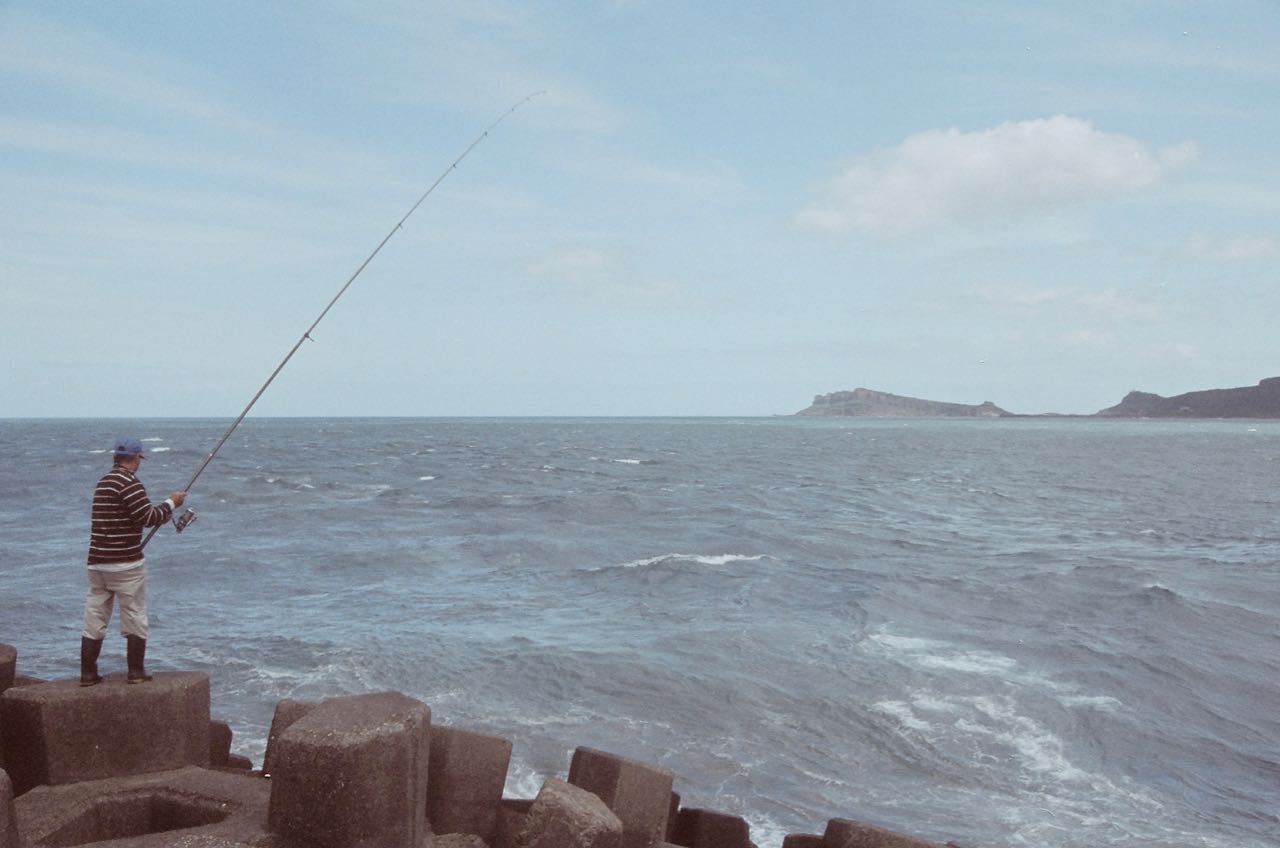
We took a 15-minutes stroll from the train station and found this fishing port. It was peaceful and quiet.
The homestay is part of a bicycle shop, with the guest rooms located on the second floor. It is actually quite convenient for getting maintenance, bike parts and supplies. We bid farewell to Fangliao the next day and headed to Kenting. The road is wider and flatter with less traffic. There were mobile cafes along the way on the sea side. We couldn’t help taking longer breaks and detouring a lot. But this left us little time and strength for the remaining trip, and there were quite some slopes in the last 10km. That was really exhausting.
We finally made it to the hotel we had booked, the Seawall Inn in Kenting, after riding 120km from Kaohsiung in two days. We were so proud of ourselves and were not at all embarrassed by the fact that many cyclists could do this within one day. Actually, in one day, some can even make it to Kenting from Fuguijiao Lighthouse (富貴角燈塔), the northernmost tip of the Taiwan island, in a cycling challenge called One-Day Twin Tower (一日雙塔). The total distance is 520km. Mr. Ko Wen-je, the mayor of Taipei, completed the challenge in 2016 at the age of 57. Although we were exhausted, we ran out to take pictures of the sunset after dropping our luggages in the hotel. We would be staying here for two days to let our muscles recover and do some tourist things.
This is Eluanbi Lighthouse (鵝鑾鼻燈塔), the other ‘tower’ besides Fuguijiao Lighthouse in the One-Day Twin Tower challenge. First constructed in 1882 during the Qing Dynasty to guide the ships away from the hidden reef nearby, it was the only armed lighthouse in the world to fend off frequent raids by local aboriginal tribes at that time. It had been damaged and rebuilt twice during the First Sino-Japanese War and World War II, respectively. What you see in the picture now was re-built in 1962. We took a break from the bicycle pedals and hired electric scooters to explore the peninsula and visit the southernmost tip of the Taiwan island.
We have been to a lot of fishing ports and beaches in Taiwan, including the Houbihu Fishing Port (後壁湖漁港) in Kenting. The clam soup never fails to impress us with its sweet freshness. After moving to Taipei in 2017, we were astonished to find that those vacuum-packed clams on the chilled shelves of the supermarkets are actually alive and will wake up from their long sleep when put in water. Sashimi can be found in many restaurants, big or small, which is probably the legacy of 50 years of Japanese rule. One of the tourist spots in Kenting is called Chuhuo Special Scenic Area (出火景觀). Fire fueled by natural gas has been burning for more than 40 years . We borrowed some heat from it and made ourselves some popcorns. There are tombs scattered around in the area and may horrified some unprepared eyes. One lady who shared a car with us was so scared that she had returned to the hotel immediately. Well, it wasn’t that bad. Don’t worry.
Where: Kaohsiung (高雄) to Kenting (墾丁), Taitung (台東) to Hualien (花蓮)
When: 18 Dec – 27 Dec 2012
Who: Peter and Lois (our first cycling trip)
So, we were back to Fangliao from Kenting by coach and then hopped on to a train towards Taitung via the South-link Line (南迴線). We had bought train tickets when we were there 2 days ago. Smart! Many cyclists could just cycle to Taitung directly from Kenting. It’s a 160km journey with accumulated elevation gain of 2,250m. The peak is at Shouka (壽卡), 460 metres above sea level. But no, not for us! We were lazy novice cyclists who just wanted to use bicycles to burn the calories we took in. This route looked barren with no prospect of delicious food. Besides, it was my first cycling trip with Lois, and I would not want it to be the last one.
On the east side of the island facing the Pacific Ocean, the sunny fine weather was gone. Clouds were gathering like a gigantic thick curtain to hide the blue sky. “The sky is flipping (變天)”, said the locals. We hit the road as soon as we left the platform of Taitung train station. Wind was blowing strong against us. We used the rest of the day to cover 25km and reach a small village, Dulan (都蘭). The village was called by the aboriginal Amis people as A’tolan / E’tolan, meaning a place with lots of rocks and hit by earthquake frequently. The school bags with the name of the local primary school (都蘭國小) printed on it is very popular among Taiwan people. It’s a long and interesting story I won’t share here but may do some day.
We had a simple meal and found a homestay operated by a retired couple. We saw their advertising note on a lamp post. The mister came riding his motorbike to lead the way. They used to live in Taipei with cramped spaces. Therefore when they were building the house for their retirement, they got too excited and made the rooms so so big.
Bleak weather with some showers the next day. We got our reward for our ordeal by having the famous, delicious Donghe bums (東河包子) with hot bitter melon ribs soup to warm our body. There were some great sea views along our route but otherwise the sea was blocked by trees. The wind kept on challenging our endurance. We were soaked and tired. I had to fend off the idea of quitting in my mind and avoid mentioning it to Lois. We made it to Chenggong Township (成功鎮, literal meaning “Success Township”), hoping to find a place to stay. But there were few shops open, let alone a homestay. We had lunch there to gather our strength. We did not bother to take a detour to the scenic spot Sanxiantai (三仙台). After riding for 19 km more in the rain, we finally reached a small village called Ningbu (寧埔), where we found some place to stay for the night. The problem was that there was no restaurant nearby. “Even a bird won’t lay eggs here (鳥不生蛋)”, said the homestay owner. He kindly drove us to a restaurant in another village that we had just passed by so that we could have dinner, and made sure the restaurant owner would drive us back after that. We learnt later from the TV news that a cold wave had just hit Taiwan that day.
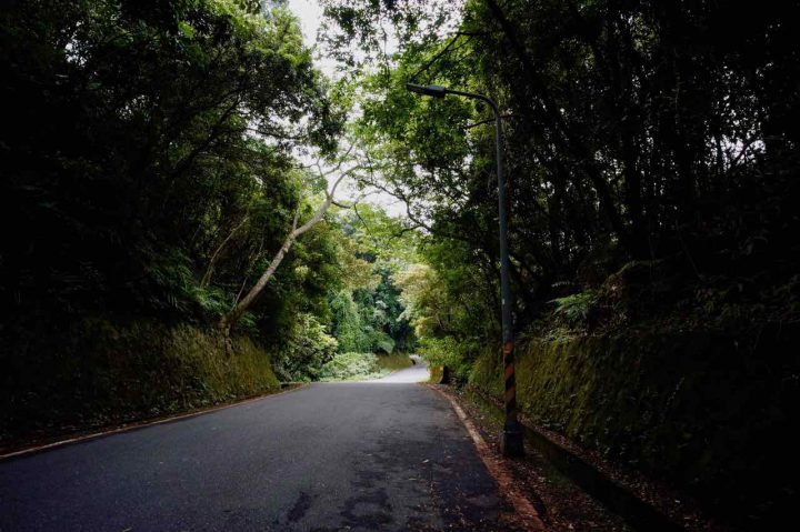
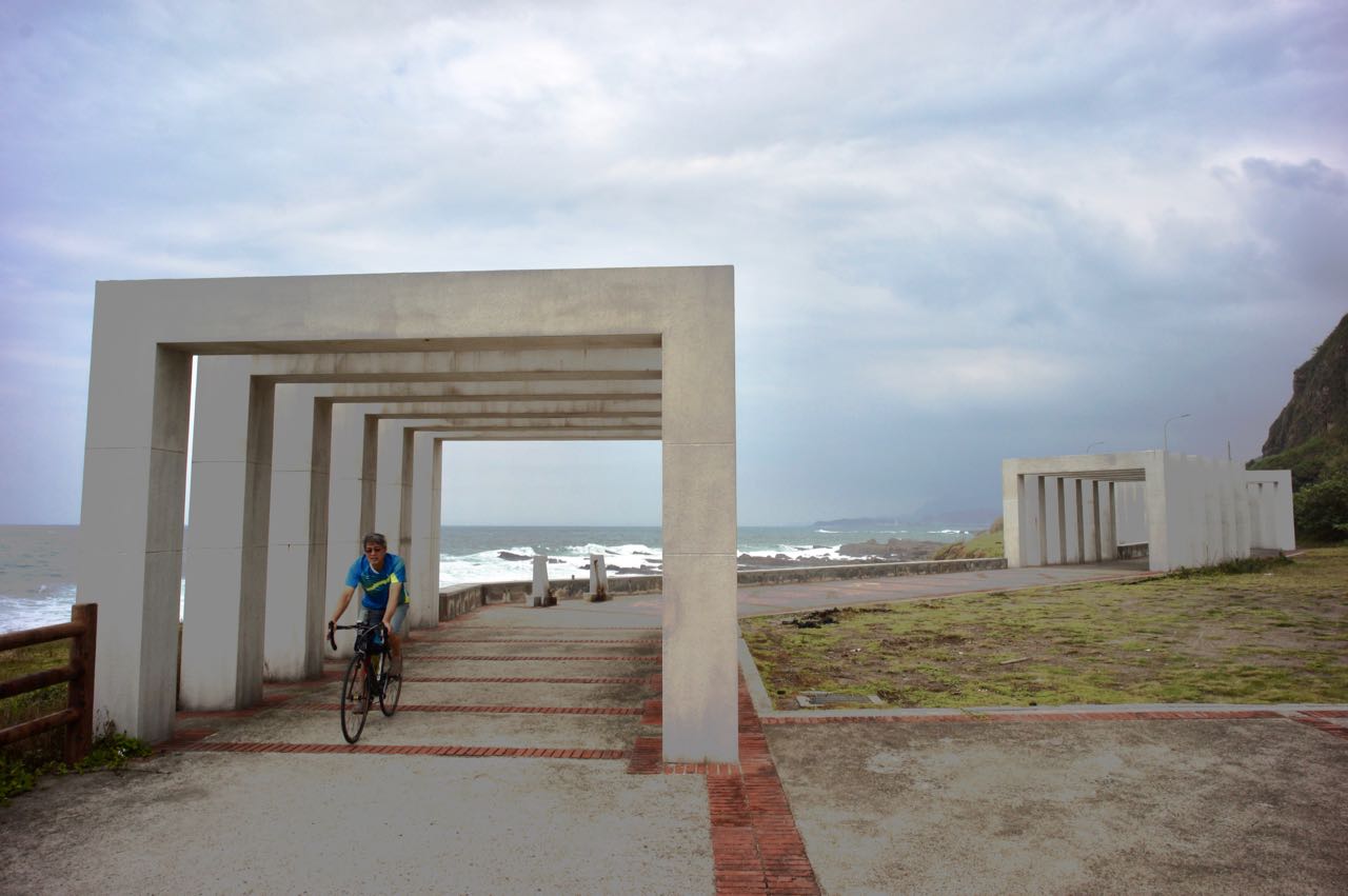
Fengguizui Lookout (風櫃嘴) is a very popular destination for those Taipei cyclists who want to get some quick training on climbing. Today, I tested myself to see if I can make it to the Lookout at 598m above sea level. I took the 6.5km Wanxi Industry Road (萬溪產業道路) and start climbing. It is a well shaded road with lots of fellow cyclists who would give you words of encouragement generously. And most importantly, there are not much other vehicles to share the road. The downloadable GPX file of this cycling route is at the end of this post.
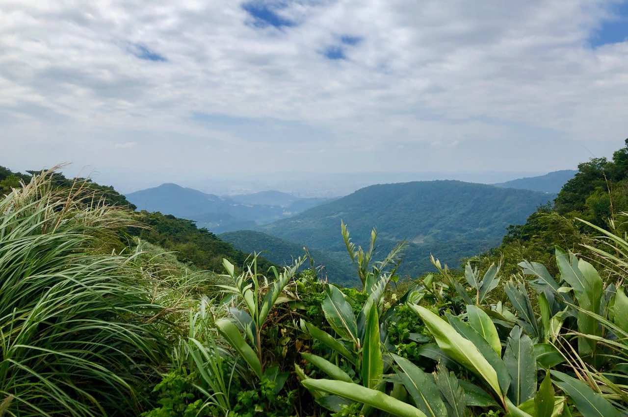
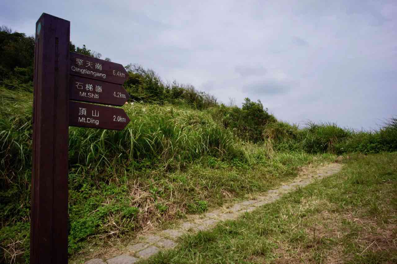
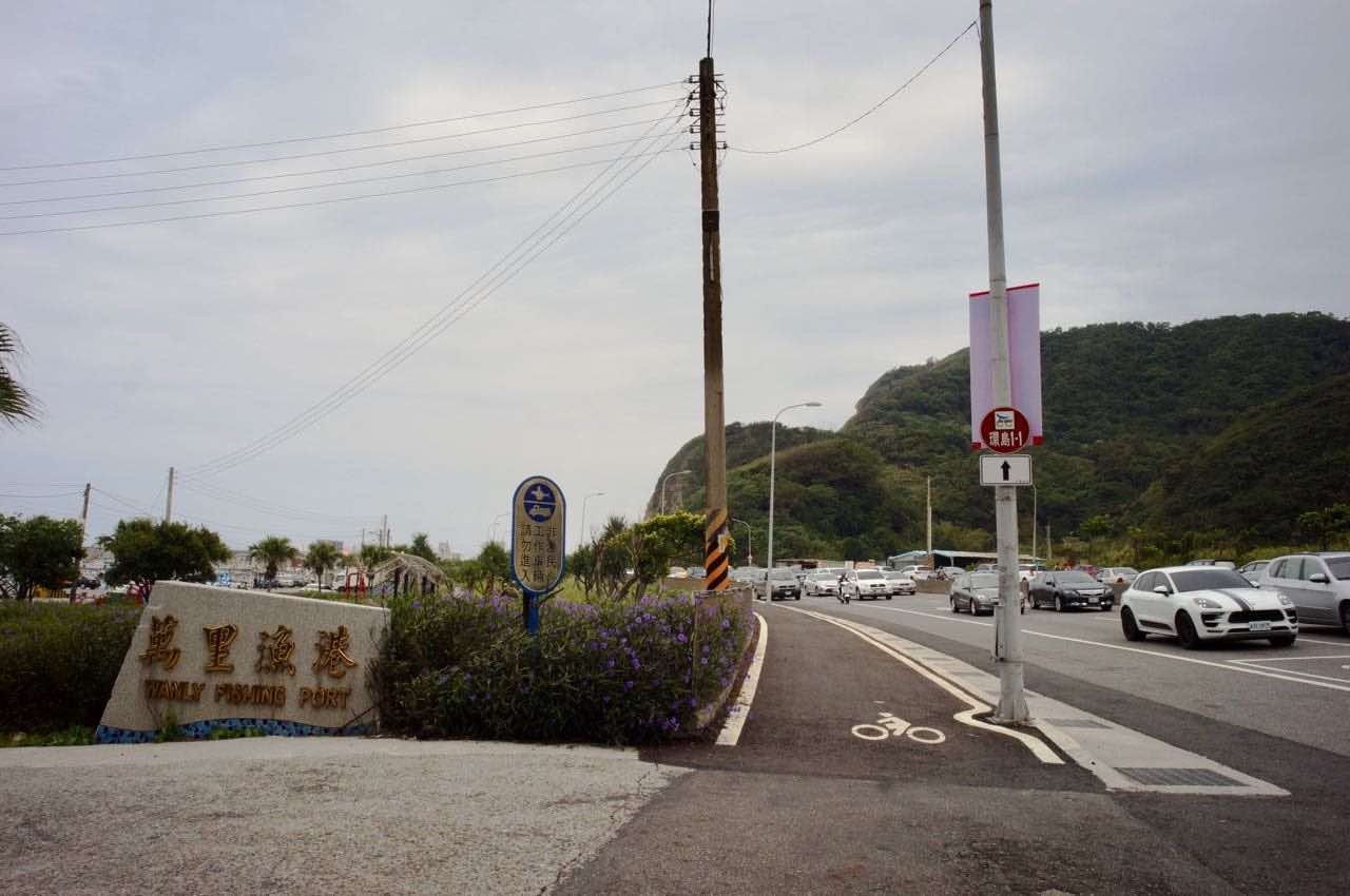
The view from the Lookout is not particularly impressive. It is a pass connecting Shilin District (士林區) and Wanli District(萬里區). If you are looking for a better view, you may join the hikers and take the trail to the Mt. Ding (頂山, 768m) and Mt. Shiti (石梯嶺, 886m) on foot. Or, let’s don’t leave our bicycles and take the “北 28” and descend to Wanli Fishing Harbour (萬里漁港) and then take the dedicated bikeway along the coast to Keelung (基隆).
If you have enough of cycling, try your luck to find a train to take you and your bicycle back to Taipei (e.g. Nangang station (南港車站), Songshan Station (松山車站) or Wanhua Station (萬華車站). But not for Taipei Station (台北車站)) . Some particular trains accept naked bicycles for half the fare. Otherwise, keep cycling and take Provincial Highway No. 5A (Shown on Google Maps as 5甲) to get back to Taipei (around 25km)
Most navigation apps will not route us to the dedicated bikeways along the costal line. Find this Bikeway Entrance right next to the Wanli Fishing Harbour (shown below) and stick to it, you would reach Dawulun Fishing Harbour (大武崙漁港) and then Waimushan Fishing Harbour (外木山漁港) and then Keelung city without much climbing. If you take the Provincial Highway No. 2, expect lots of climbing and traffics without much benefit of seaview.
When you reach Dawulun Fishing Harbour, Set Google Map Navigation: Keelung Station (基隆車站).
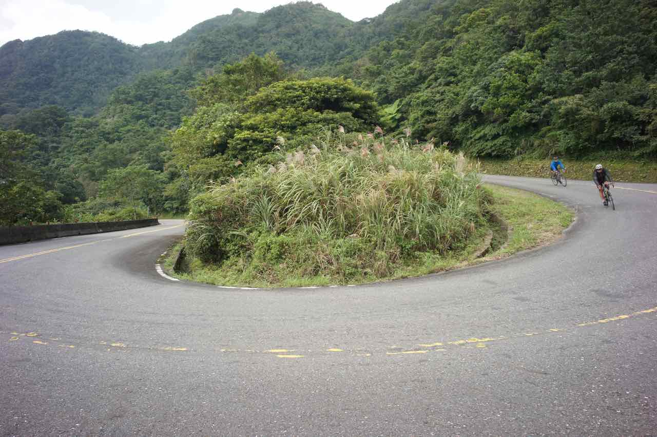
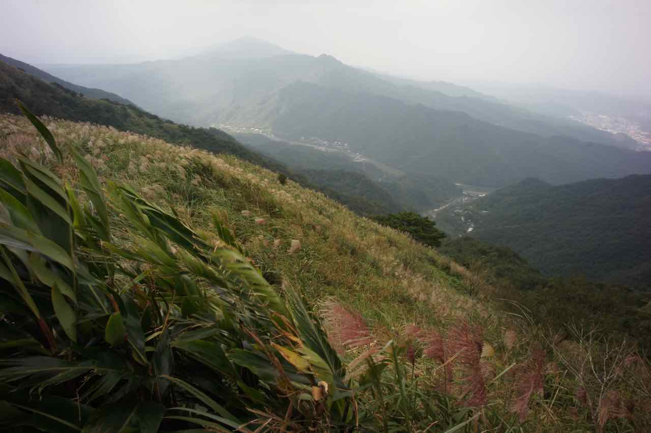
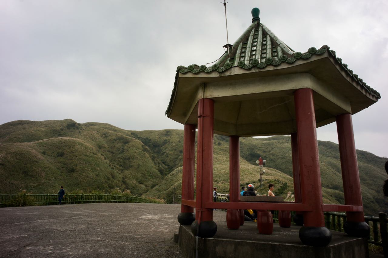
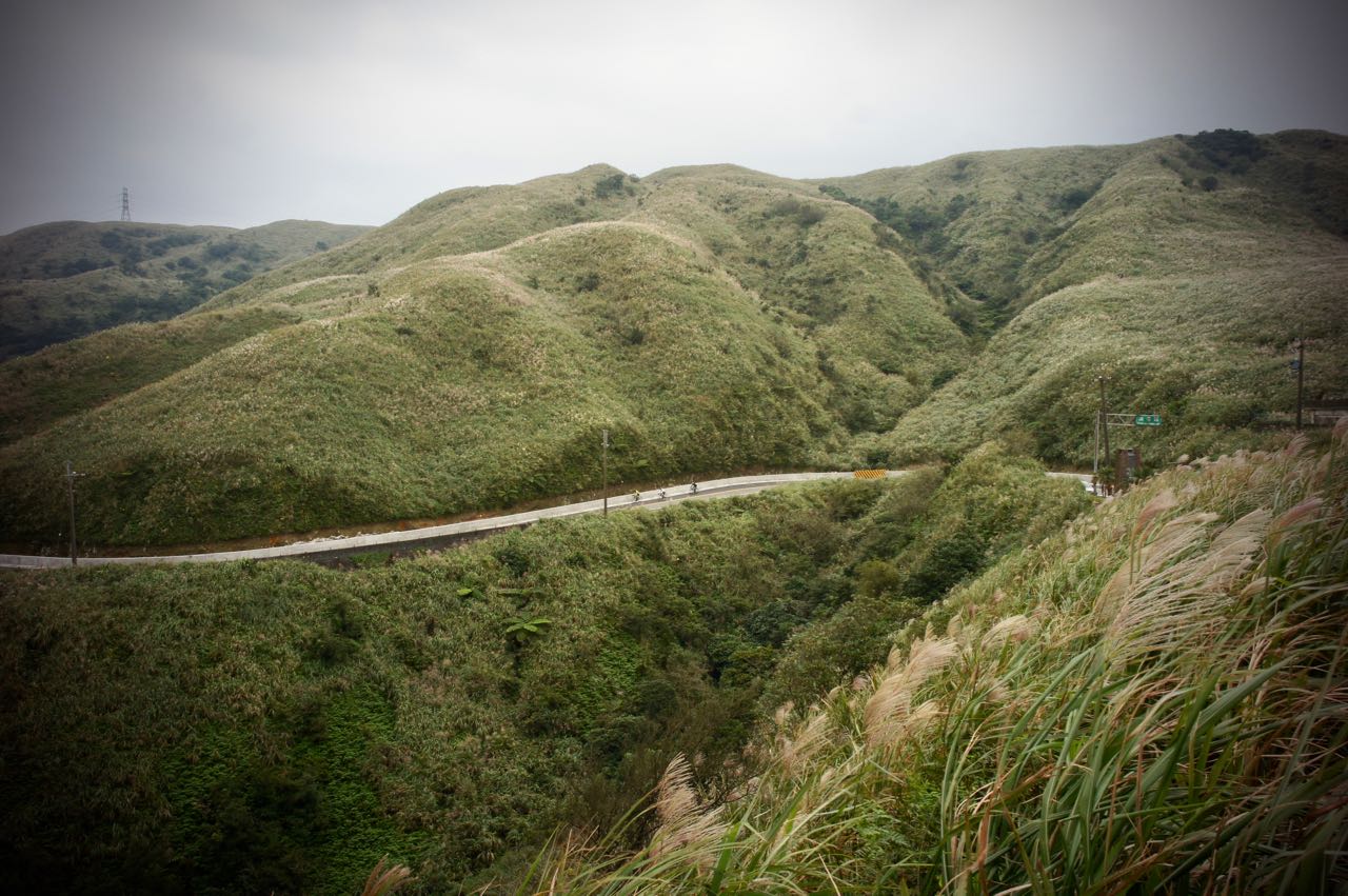
Buyan Pavilion (不厭亭), apart from Fengguizui (風櫃嘴), is another popular climb training route in the Greater Taipei Area. The pavilion can be found at the highest point (530m above sea level) of Ruifang – Shuangxi Highway, a segment of County Highway 102, which is about 11 km away from either Ruifan Station or Shuangxi Station. However, Jiufen Old Street, the busy tourist spot, lays somewhere en route Ruifan Station to Buyan Pavilion. If you don’t want to get stuck in the heavy traffic, breathing in car emissions while you are doing the climb, starting from Shuangxi Station is definitely a better idea. But if you have to approach Buyan Pavilion from the Ruifan side for some reason, you may take a detour to Ruibin Beach via the Provincial Highway 2D (shown on Google Maps as 2丁) and then start climbing from Bin’er Road (also shown on Google Maps as 北35) or Jinshui Highway (北34) to avoid the heavy traffic in Jiufen. The downloadable GPX file of this cycling route is at the end of this post.
Cyclists from Jiufen enjoying their descentLong winding climb for me
Some experienced cyclists may find this route too short for a one-day workout. In that case, County Highway 106 is a great route to bring you to Ruifan (44km, elevation gain 861m) or Shuangxi (40km, elevation gain 675m) from Taipei Zoo. Note that the county highways may be swamped with roaring motorbikes during weekends. If you happen to live around Nangang area, County Highway 109 could bring you to Shenkeng, where it meets County Highway 106.
For my trip this time, I would just take the train to Shuangxi from Nangang Station. Otherwise I would have exhausted all my strength and time before even reaching the starting point.
It was a Saturday in October 2018. I had planned to board the train no. 4148 at 07:44 because it would take a naked bike, but unfortunately the tickets for bikes were sold out when I got to Nangang Station. See? It’s indeed a popular cycling destination. The next train that carries naked bikes was not leaving until 12:47! My contingency plan: bag it. You just need to make sure the bagged bike is not over 150 cm on any side and the total measurement is under 220 cm.
I took the train no. 4152 that leaves Nangang at 08:05. Still early. Not many passengers. I could keep my bike comfortably with me in front of my seat. Then, around an hour later, I arrived at Shuangxi, a quiet, relaxing small town with enough breakfast kiosks and convenience stores for cyclists to stock up. For me, I tend to have my first meal only after cycling.
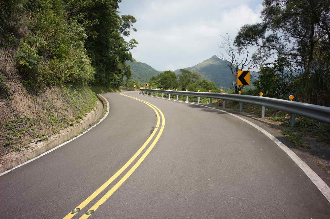
Navigation was straightforward. Just find County Highway 102 and go towards Ruifang and the climbing would soon begin. Vegetation is not as tall as what I saw on the route to Fengguizui. Not much shade. Anyway, it was a cloudy day. I found the weather quite comfortable and reached Buyan Pavilion without much struggles, though I’m sure most cyclists would find my speed pretty slow.
Silver grassthe Buyan Pavilion
The view from the top was much better than that of Fengguizui. There was silvergrass all over the place. There was a truck selling roasted sweet potato and water, which I think would only be there during weekends and holidays.
Three Cyclists Descending from Buyan Pavilion
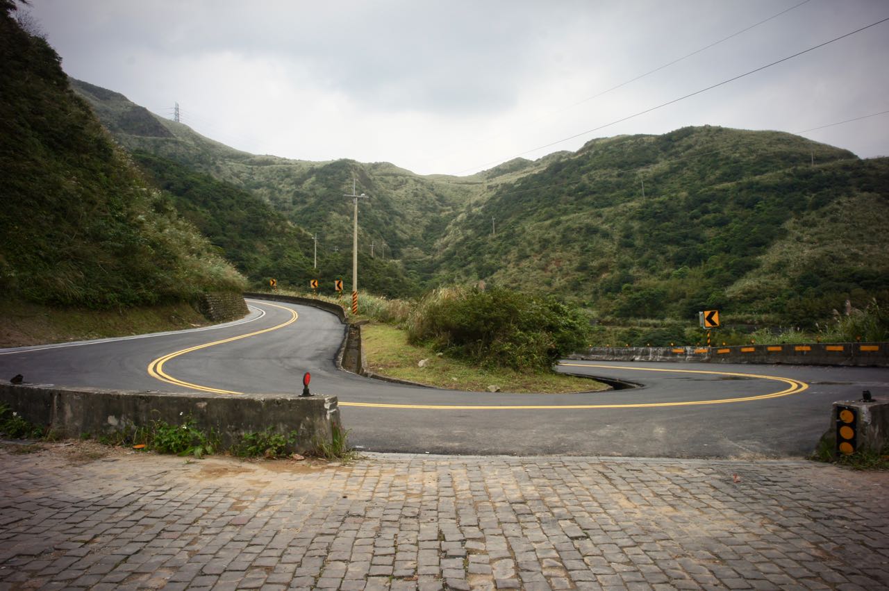
Then, I enjoyed my descend to Jiufen and met the busy traffic there. Going downhill with all the cars, buses and coaches requires extra caution. I had my lunch near Ruifang Station and took a detour via Provincial Highway 2D to visit Fanzi’ao Park (番仔澳酋長岩公園), Shen’ao Elephant Trunk Rock, and then Shen’ao Fishing Harbour. I should have left County Highway 102 at Jiufen and switched to Bin’er Road (北35), which would allow me to avoid the busy traffic and bring me to the coast directly. I should have had my lunch at the seafood restaurants there. Calling it a day, I completed my trip with the last leg to Keelung station and took a train home with my bike in the bag.
Lots of Hairpin turns for me, too.The Peak looks like a teapot without a handle – “Earless Teapot Mountain”. Another good place to visit.
If you still have time and strength to spare, switching to Jinshui Road (北34) from Jiufen will bring you to some less popular yet also interesting spots like Golden Waterfall and Gold Museum. You can even try climbing the Teapot Mountain (無耳茶壺山). It is also a less popular route as you have to come down on the same route and people find it boring. But it also makes it a less busy and perhaps more pleasant route.
NOTE: To use the routes, please install the App on your smartphone. The App will launch and load the route automatically after you tap the above links on your smartphone’s browser. For Garmin Connect, you can then use the APP to send the route to your garmin device. If your Garmin device is not purchased in Taiwan, you will also need make sure you have the Taiwan map on your device. Here is our blog post on this topic.
It’s been a decade since I first set foot on the island of Taiwan in 2009 for my first cycling trip in an attempt to Cycle around the Island. Why am I bothered to write a travel log about it now? Well, I made a lot of rookies’ mistakes that I was not aware of at that time. After visiting Taiwan for so many times afterwards and finally moving here for good in Taipei, I have accumulated many valuable experience. And now we are running this company to promote and facilitate bike touring in Taiwan. I am hoping I can share with you some tricks and ideas so that you can make the most of your precious holidays here.
Taiwan was referred to as Formosa by the Spanish, the Portuguese and the Dutch in the 1580’s. Some said the name was given by Portuguese sailors when they discovered the island in early sixteenth century. They were awestruck by the island’s beauty and exclaimed “Ilha Formosa”, literally “Beautiful Island”. Then the name stuck.
Taiwan had not been a complete stranger to me even before I first set foot in here. At around ten and living in Fujian, I watched Taiwanese puppet shows and romantic soap operas written by Chiung Yao on my mother’s 14-inch TV. Life was so boring there back then. People in our village would spent the whole afternoon trying to tune the antenna in order to pick up the faint TV signal from the other side of Taiwan Strait. We would settle for anything with sporadic bursts of white noise. Language is not a problem. People in Taiwan and Southern Fujian share the same dialect.
Then there I was in Taoyuan International Airport ready to embark on an adventure on bicycle with my friend, John. The airport MRT was not in operation yet at that time but there were many coach and bus companies competing for travelers bound for Taipei City, especially Taipei Main Station. You could find one departing every 5 minutes most of the time. But no, we were special travelers and we had a special destination, Songshan (Railway) Station. Our well-equipped bicycles were ready to be picked up at a bicycle shop there. We decided to take a bus to the closest train station, Zhongli Station, and then took a train to Songshan. It’s better, right? Wrong! It actually takes the same amount of time to get to Zhongli Station and Taipei Main Station. While Taipei Main Station is just one stop away from Songshan Station, it takes another hour to get to Songshana from Zhongli Station. And neither did we save any money by taking a “less touristic” path. Here’s one takeaway for you.
Eventually we collected the bicycles and the shop owner helped us set the check points on the GPS leased to us. At least we would know the way to get back to the shop. I got information overloaded with a long list of must-go’s and a crash course on how to replace the inner tube in the case of a punctured tyre. Not sure if I could do it. But there’s one thing worth remembering: find the culprit with patience and make sure it’s removed. Otherwise, the spare tube would be punctured again in no time.
We found a small hotel around the corner with only double rooms and very small twin beds that, even if we don’t mind sharing, couldn’t accommodate two grown men. We wondered if it might be a special kind of hotel, like a stripped-down love hotel or something. So, two rooms please. We are straight guys and I might have some amazing romantic encountering in Taipei like the Brit Colin Frissell did in the US in the movie Love Actually. I’m serious; I do speak mandarin with a heavy accent.
Then we headed to the nearby night market, Raohe Night Market, for dinner. There were so many enticing Xiaochi to offer. But Oops! We were running low on cash. We could only get some Stinky Tofu and Beef Noodles. I could not even buy a drink for any ladies if I got the chance. I used to believe that everything sold in the airport had a huge markup, including NTD. So, in the airport, we just got enough cash for the first day and planned to change the rest of our money to NTD at banks in the city. Banks here usually open 9:00 to 15:00, Monday to Friday. But after travelling to Taiwan for so many times, I have found a cheaper and more convenient way to get NTD. Viola! The 24-hour worldwide ATM networks like Cirrus, Plus and UnionPay. Although there will be a small handling fee (HK$40, ~ US$5, in my case) for each withdrawal, the exchange rate is more favourable than buying NTD with other currencies from a teller. Banks do not like physical banknotes. It involves the risks of getting counterfeit ones and there are costs for safe keeping and transferring the notes.
Now I always withdraw NTD 20,000 (the maximum) and saved enough of money from the ATM exchange rate to pay for the handling fee and several drinks in the night market. Of course you should check your bank’s handling fee first.
Talking about Raohe Night Market, the Ciyou Temple sitting next to its entrance had also left an impression on me with its friendly atmosphere. We were free to take a tour of the six-storey building and appreciate the decorations. It was also very handy to be able to use their toilets after feasting in the night market. It isn’t hard to find toilets in Taipei after leaving you hotel, like in shopping malls, MRT stations, train Stations, and some convenience stores. But those are not always easily found after leaving Taipei (or other major cities), while temples are ubiquitous in Taiwan. Cyclists could usually use their toilets. Sometimes, we could even help ourselves with some instant coffee at their drinking machines.
So, that’s my first day in Taiwan. The small hotel turned out to be perfectly fine. No weird noises came from other rooms
I hate cycling among busy traffic but we decided to stay in this busiest city of Taiwan the next day just in case there were any issues with the bikes. We also needed to buy SIM cards and go to the bank. These were the days when mobile data has not yet become as important as oxygen. I was traveling with my TREO 650 and film camera Nikon F801s. I had nothing to share instantly on social media. But we still needed to be able to call the hotels for room reservation and stay connected with each other. Today, if you need mobile data, you can buy a SIM card at the airport with a package of unlimited data within a fixed period. These are tailor-made for tourists and the procedure is quick and easy. It took only 5 minutes to complete the transaction. And Nope! It’s not more expensive. It’s actually a real bargain. Your only concern is whether your flight is arriving too late and those shops will be closed already.
We roamed in Taipei city on our bicycles with the overwhelming scooters, which made me feel like traveling with massive groups of hornets. Our touring bikes have drawn some attention from passersby. “Jia You! (add oil) some shouted at us with smiles. They probably thought we were making the 1,000km-around-the-island trip and wanted to give us some big pushes. Although Taiwan is home to the world’s two biggest bicycle manufacturers and has been making bikes for the world for decades, people here prefer their scooters for daily commute. Then there was this movie Island Etude released in 2007, about a hearing impaired college student making the round-the-island tour in Taiwan. The idea has been so impressive and inspiring that people started doing the tour themselves. It has kind of become a coming of age ceremony or a pilgrimage. No wonder we received so much encouragement. To me, it’s like giving a salute to the place.
Slowly we discovered some special rules for scooters and bicycles (機慢車). For those who don’t read Chinese characters, it might be tricky to figure it out. The following are some general ideas that I hope you may find useful. Click on the links of Chinese Characters to see the signs.
The Free Ways 國道 (sign: white, five-petal flower with a number inside), the red badge Provincial Highways (Express Ways, sign: red badge with numbers) and Urban Express Ways are not for scooters and bicycles.
Free WayExpress Highway
Everyone can use the Provincial Highways with blue badges (省道), County or City Highways (縣道), Township and District Roads (鄉道) and Industrial Roads (產業道). In those rural areas, it’s perfectly OK to use the overpasses, bridges or tunnels on these roads. Remember to turn on your lights in the tunnels.
A rural tunnel meant to be shared among cars, scooters and bicyclesProvincial HighwayCounty or City HighwayTownship or District Road
Sometimes, the lanes close to the centre (left) are not for slow vehicles. You would see the yellow Chinese characters 禁行機車 (No Scooters) arranged vertically on the tarmac. There are also lanes built for slow vehicles (機慢車道). In front of some traffic lights, there are boxes for slow vehicles to wait for the green light. Bikes are slower especially on starting; stay close to the sidewalks to give way to the others. On most intersections, slow vehicles should follow the two-stage-left-turning rule (二段式左轉), i.e. after going through a green light (the first stage), go to the left turning waiting zone, another box (左轉待轉區). You would be looking at a new traffic light. Wait for the new green light and go (the second stage). When you are not so sure, follow the scooters.
No Scooters in Yellow (禁行機車)Lanes for Scooters and Slow Vehicles (機慢車專用道)
The bikes turned out to be in perfect condition. There were showers of rain but we were ready! Nous étions prêts!
The third day, we started our cycle around the island tour in the drizzle. The preferred/recommended route was supposed to be cycling to Bali Old Street at the left bank of Tamsui River and then take the ferry from the Bali Ferryboat Wharf to the Tamsui Old Street. But we couldn’t. Why? Not my fault. We had a GPS with the proper check points set but it was not mounted on my bike. I just followed John. We made it to a wharf but there was no ferry. We thought that those ferries might only be in services on particular days. But that is not true. The ferries run daily. We just went to the wrong wharf. Anyway, we managed to bike to Tamsui around lunchtime as the drizzle became showers. We scurried into a seafood restaurant for shelter and for lunch. In order to boost up my morale, I ordered one of my favourite dishes, sautéed crab. It was expensive and tasteless. Oh no! I forgot to pick the crab by myself from the tank. They must have cooked a dying one for me. Sigh……!
Wrong wharf, no ferries. the red bridge behind has a lane especially for bikes connecting Bali to the north coast.
After our disappointing lunch, at least the rain stopped. And as we reached the outskirts of the city on the Provincial Highway No. 2, swarms of scooters and speeding cars disappeared. (Actually, Taipei is a great place to cycle if one can find the bikeways on the riverbanks.) There were some cafes and interesting spots. We just stopped briefly because we did not know where to stay for that night.
Township Road 北11 Chexin Road, a detour from Provincial Highway No. 2. Even less traffics
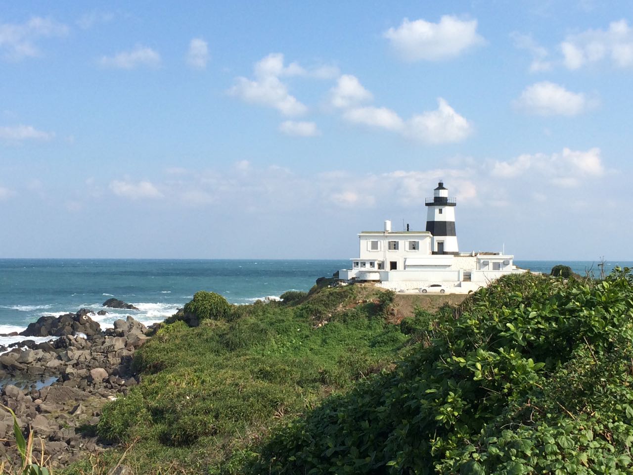
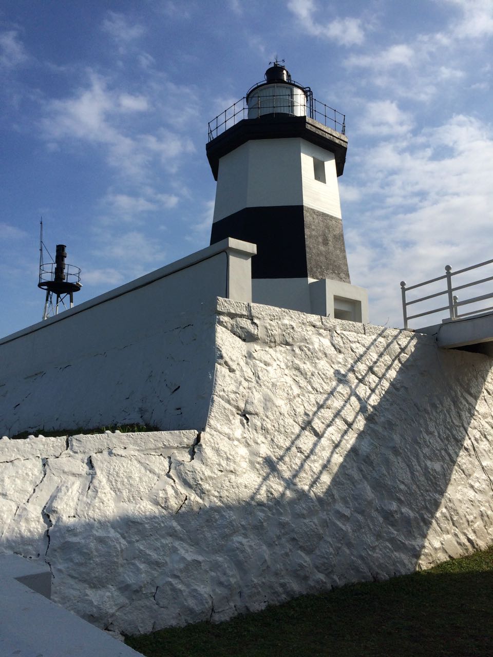
Then we reached the northern tip of the island, Fugueijiao Lighthouse (富貴角燈塔), when the sun was setting. I love lighthouses. They are altruistic, beautiful, committed and lonely. In the past, there were lighthouse keepers who would play chess with their colleagues on shore by flashing morse codes to the clouds. Read this story, The Fastnet Lighthouse on the Economist. The life of Fugueijiao Lighthouse keepers (if any) should be easier. The lighthouse sits next to a fishing port and some tourist spots and within an hour’s drive from the city.
I didn’t care that it’s going to be dark soon. I wanted to take a good look at the lighthouse. We followed the pleasant foot path to the lighthouse and then the pristine buildings appeared with a perfect angle for taking pictures. The lighthouse is a 14.3m octagonal structure with black stripes, which is supposed to improve the visibility in the thick fog. I could only look at it from outside the gate because it was not open to public until 2015. It opens Tuesday to Sunday, 09:00 – 18:00 (summer), 09:00 – 17:00 (winter).
Fugueijiao Lighthouse taken from a subsequent visit.Fugueijiao Lighthouse taken from a subsequent visit.
Leaving Fugueijiao, we found ourselves cycling in total darkness. It was perfectly safe but we still had not found a place to sleep yet. After 14km of pedalling on the dark coastal highway, I saw a shimmering light. It wasn’t Hotel California; it’s a coffee shop looking like a traditional building on the Greek island Santorini. We loaded up chunks of calories-rich cheese cakes and coffee into our stomachs there and then a kind staff member offered to help us finding a place to stay. She called a homestay owner nearby and told us to meet him at the next 7-eleven. The owner, riding a scooter, led us to his place. That’s the first night of our cycling tour. We had a good chat and played snooker with the owner before having a sound sleep in a clean bedroom big enough to house 6 people.
The next morning, I woke to a rural village surrounded by paddy fields and ponds in the Jinshan District. Breakfast, steamed meat buns, were ready on the table. I guess most homestays in Taiwan would serve breakfast. We were so refreshed and ready for another day of pedalling. But no, not yet! I did not remember having a proper dinner the previous day. We went to the Jinshan Old Street to buy some brined duck meats.
As I was leaving the homestay, I was so impressed that the trails were well maintained and laid with asphalt. The garbages were taken care of properly. The government has put in a lot of effort to deal with this since 1989. Visitors to Taiwan must have heard a loud, raw electronic melody every evening. These are garbage trucks summoning garbages. Recyclable items are collected free of charge. Kitchen wastes are diverted to pig farms. And the rest, before collected by the truck, must be put inside a certain kind of bags sold by the local government with levies to fund the operation. So, we should always ask for permission to use the garbage cans in some small shops. I was quite embarrassed that I had to discard the duck meat packing in a 7-Eleven.
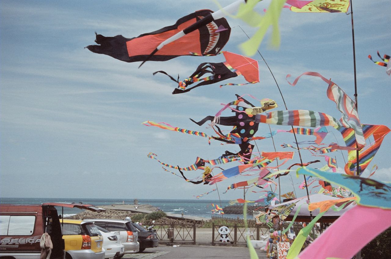
Gone was the dull sky. We had a sunny day with clear blue sky on the second day of our cycling trip. It looked particularly great with the colourful kites flying over a pier and the orange sandstone formations in the Yeliu Geopark in Wanli. There is this famous Queen’s Head inside the paid area which resembles the profile of Queen Elizabeth I at a certain angle. I used to think it’s Queen Millennia that they are talking about. Back in the 1960’s, the sculpture did look like a queen in real life. After half a century of erosion, her neck got chipped thinner and thinner, making her look rather like Yukino Yayoi (雪野 弥生) in the manga, Millennial Queen. Given the speed of erosion, the neck won’t be able to support the head for another decade, not to mention a thousand years. After taking a poll in which more than 60% of the voters agreed to take proactive measures to save the sculpture, the Tourism Bureau has tested various methods on other pedestal rocks in the vicinity to stop the erosion process. The results were unsatisfactory. Nothing can help save the queen yet.
After cycling in solitude for so many hours, Yeliu was a great place to hang around for its lively atmosphere. But we did not buy tickets and get inside the Geopark. We were in the biking mode. We would rather stick with our bikes and spend more time on the north coastal line and then head to the port city Keelung. We did not know how long it would take. We were told during lunch that there was a flat costal bikeway to Keelung. But this nice path has eluded us. We ended up climbing 180m with the busy traffic and breathed in lots of exhaust fumes from the cars and scooters before reaching the top. If you want to know how to find the easy path from Wanli to Keelung, check out my post here.
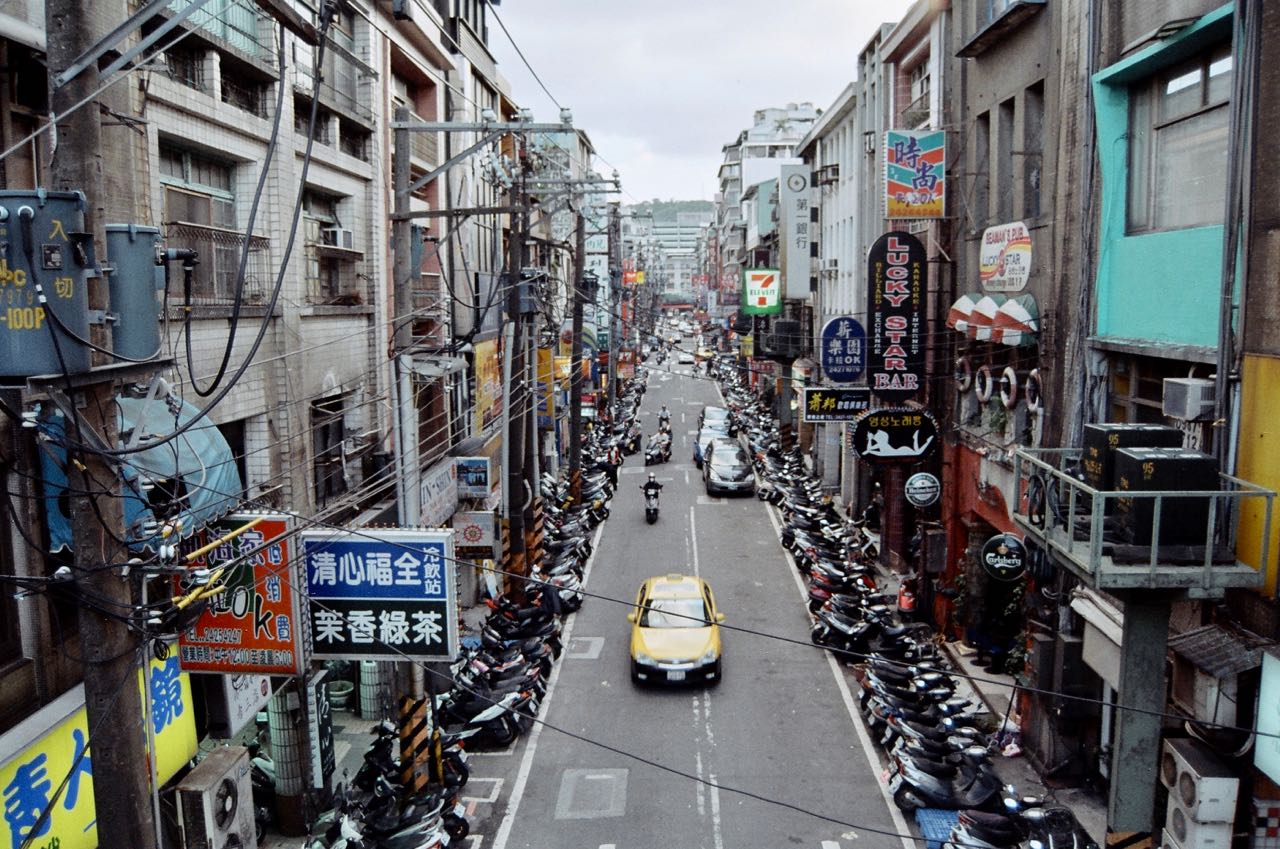
Keelung city is home to the third biggest port of Taiwan. It has been the northern gate for the island and strategically important for the past century. Numerous forts were built to guard the city against invaders and there are more than ten remains open to public. With two freeways and two railway lines starting there, the city is supposed to become even more prosperous. But its development has been limited by the surrounding hills. Narrow streets and old buildings are squeezed into the small area around the port, the others scattered in the hilly suburbs which consists of 95% of the city. Lacking space for renewal, Keelung remains more or less unchanged overtime. It’s like going back in time as we descended into the city centre. We checked into a small hotel and asked for a place to keep our bicycles. A staff member kindly brought us to their underground parking lots and let us use one of their mechanized parking systems. So much effort to squeeze more cars into an underground place.
While John was taking a rest in the hotel room, I took a walk and had the most delicious squid soup I have ever had at a food stall in an alley. I recommended it to John but I was not able to find the food stall again. The night market in Keelung has many great snacks to offer but nothing could compare to that squid soup. I even tried to find the store the second time when I was bike touring with Lois but also to no avail.
That was our two-day ride on the north coastal line. The next day, we would head east and cycle on the north east coastal line from Keelung to Yilan.