カテゴリー: 台湾一周

  • My First Cycling Trip in Taiwan Day 1

    My First Cycling Trip in Taiwan Day 1

    このブログ記事の翻訳を進行中です。もうすぐ完成しますので、後ほど再度ご確認ください。ご不便をおかけして申し訳ありません。現在は、こちらで提供されているGPXルートや地図などの情報を自由にご利用ください。

    15 April 2009

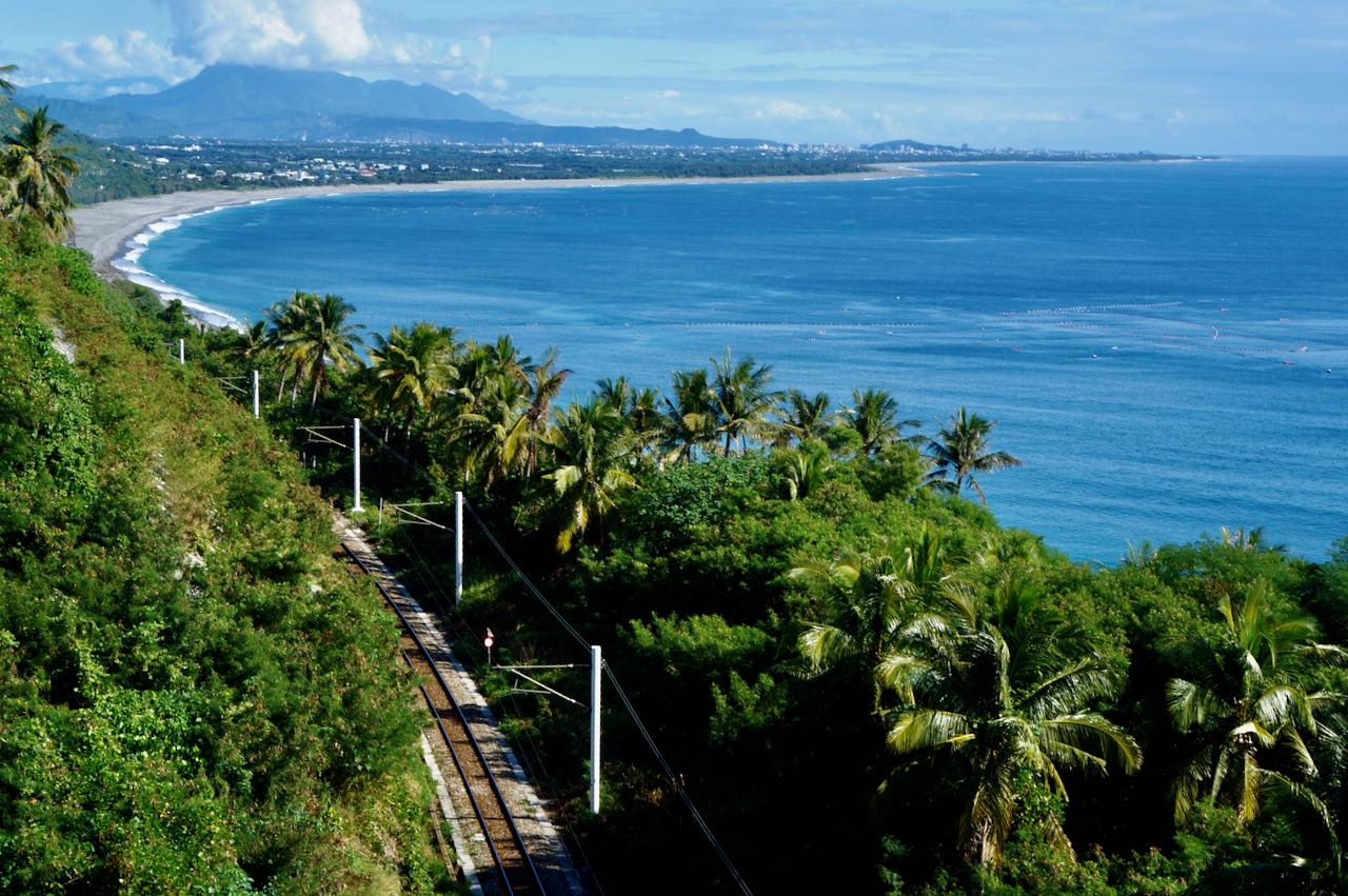
    It’s been a decade since I first set foot on the island of Taiwan in 2009 for my first cycling trip in an attempt to Cycle around the Island. Why am I bothered to write a travel log about it now? Well, I made a lot of rookies’ mistakes that I was not aware of at that time.  After visiting Taiwan for so many times afterwards and finally moving here for good in Taipei, I have accumulated many valuable experience. And now we are running this company to promote and facilitate bike touring in Taiwan. I am hoping I can share with you some tricks and ideas so that you can make the most of your precious holidays here.

    Taiwan was referred to as Formosa by the Spanish, the Portuguese and the Dutch in the 1580’s. Some said the name was given by Portuguese sailors when they discovered the island in early sixteenth century. They were awestruck by the island’s beauty and exclaimed “Ilha Formosa”, literally “Beautiful Island”. Then the name stuck.

    Taiwan had not been a complete stranger to me even before I first set foot in here. At around ten and living in Fujian, I watched Taiwanese puppet shows and romantic soap operas written by Chiung Yao on my mother’s 14-inch TV. Life was so boring there back then. People in our village would spent the whole afternoon trying to tune the antenna in order to pick up the faint TV signal from the other side of Taiwan Strait. We would settle for anything with sporadic bursts of white noise. Language is not a problem. People in Taiwan and Southern Fujian share the same dialect. 

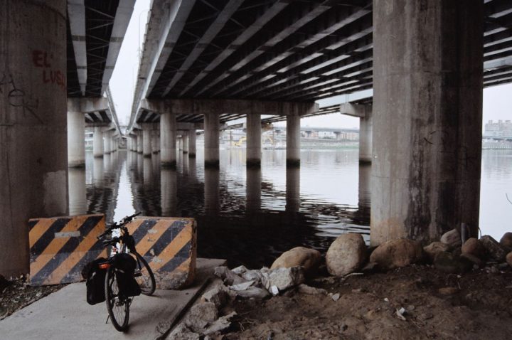
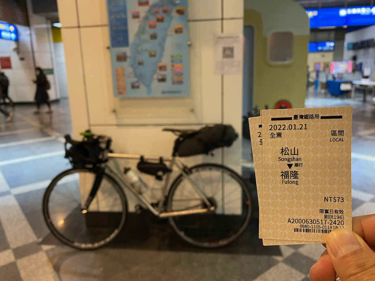
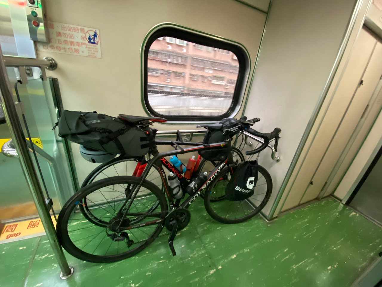
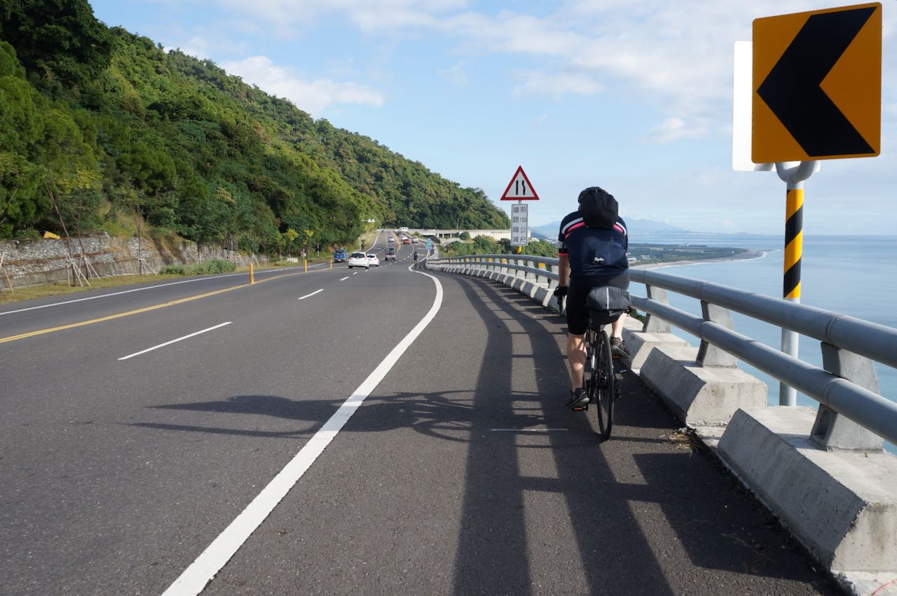
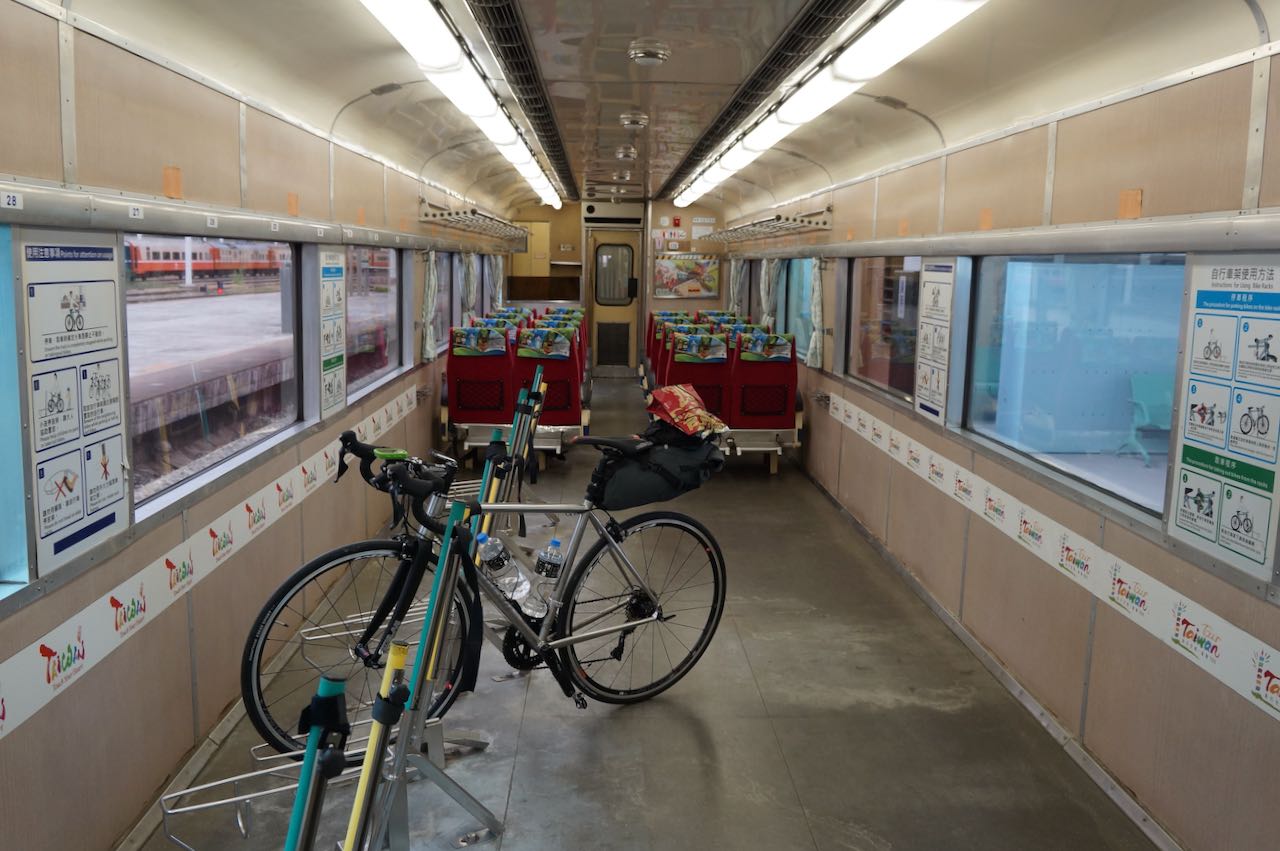
    Then there I was in Taoyuan International Airport ready to embark on an adventure on bicycle with my friend, John. The airport MRT was not in operation yet at that time but there were many coach and bus companies competing for travelers bound for Taipei City, especially Taipei Main Station. You could find one departing every 5 minutes most of the time. But no, we were special travelers and we had a special destination, Songshan (Railway) Station. Our well-equipped bicycles were ready to be picked up at a bicycle shop there. We decided to take a bus to the closest train station, Zhongli Station, and then took a train to Songshan. It’s better, right? Wrong! It actually takes the same amount of time to get to Zhongli Station and Taipei Main Station. While Taipei Main Station is just one stop away from Songshan Station, it takes another hour to get to Songshana from Zhongli Station. And neither did we save any money by taking a “less touristic” path. Here’s one takeaway for you. 

    Eventually we collected the bicycles and the shop owner helped us set the check points on the GPS leased to us. At least we would know the way to get back to the shop. I got information overloaded with a long list of must-go’s and a crash course on  how to replace the inner tube in the case of a punctured tyre. Not sure if I could do it. But there’s one thing worth remembering: find the culprit with patience and make sure it’s removed. Otherwise, the spare tube would be punctured again in no time. 

    We found a small hotel around the corner with only double rooms and very small twin beds that, even if we don’t mind sharing, couldn’t accommodate two grown men. We wondered if it might be a special kind of hotel, like a stripped-down love hotel or something. So, two rooms please. We are straight guys and I might have some amazing romantic encountering in Taipei like the Brit Colin Frissell did in the US in the movie Love Actually. I’m serious; I do speak mandarin with a heavy accent. 

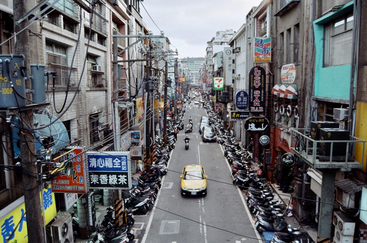
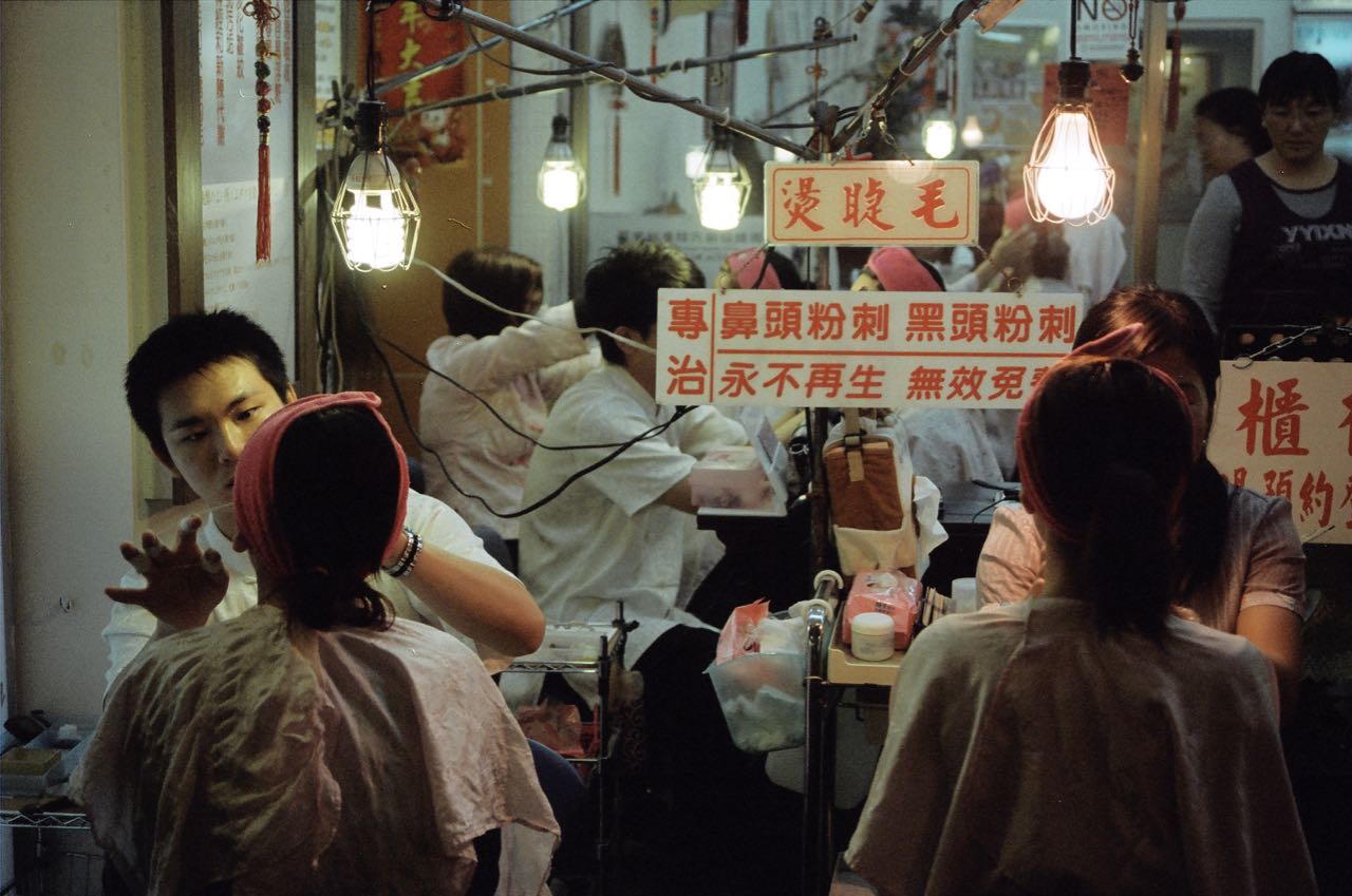
    Then we headed to the nearby night market, Raohe Night Market, for dinner. There were so many enticing Xiaochi to offer. But Oops! We were running low on cash. We could only get some Stinky Tofu and Beef Noodles. I could not even buy a drink for any ladies if I got the chance. I used to believe that everything sold in the airport had a huge markup, including NTD. So, in the airport, we just got enough cash for the first day and planned to change the rest of our money to NTD at banks in the city. Banks here usually open 9:00 to 15:00, Monday to Friday. But after travelling to Taiwan for so many times, I have found a cheaper and more convenient way to get NTD. Viola! The 24-hour worldwide ATM networks like Cirrus, Plus and UnionPay. Although there will be a small handling fee (HK$40, ~ US$5, in my case) for each withdrawal, the exchange rate is more favourable than buying NTD with other currencies from a teller. Banks do not like physical banknotes. It involves the risks of getting counterfeit ones and there are costs for safe keeping and transferring the notes. 

    Now I always withdraw NTD 20,000 (the maximum) and saved enough of money from the ATM exchange rate to pay for the handling fee and several drinks in the night market. Of course you should check your bank’s handling fee first. 

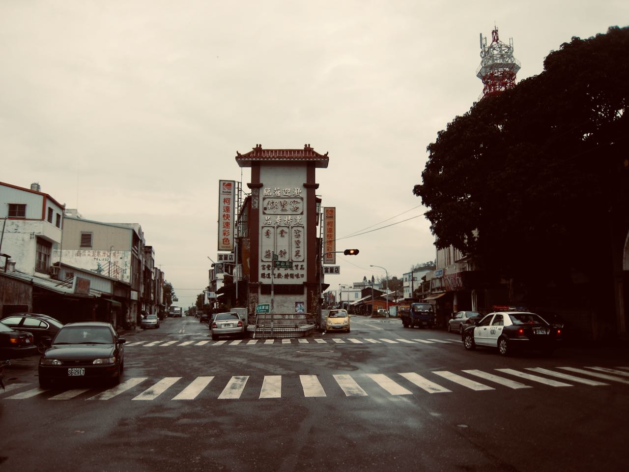
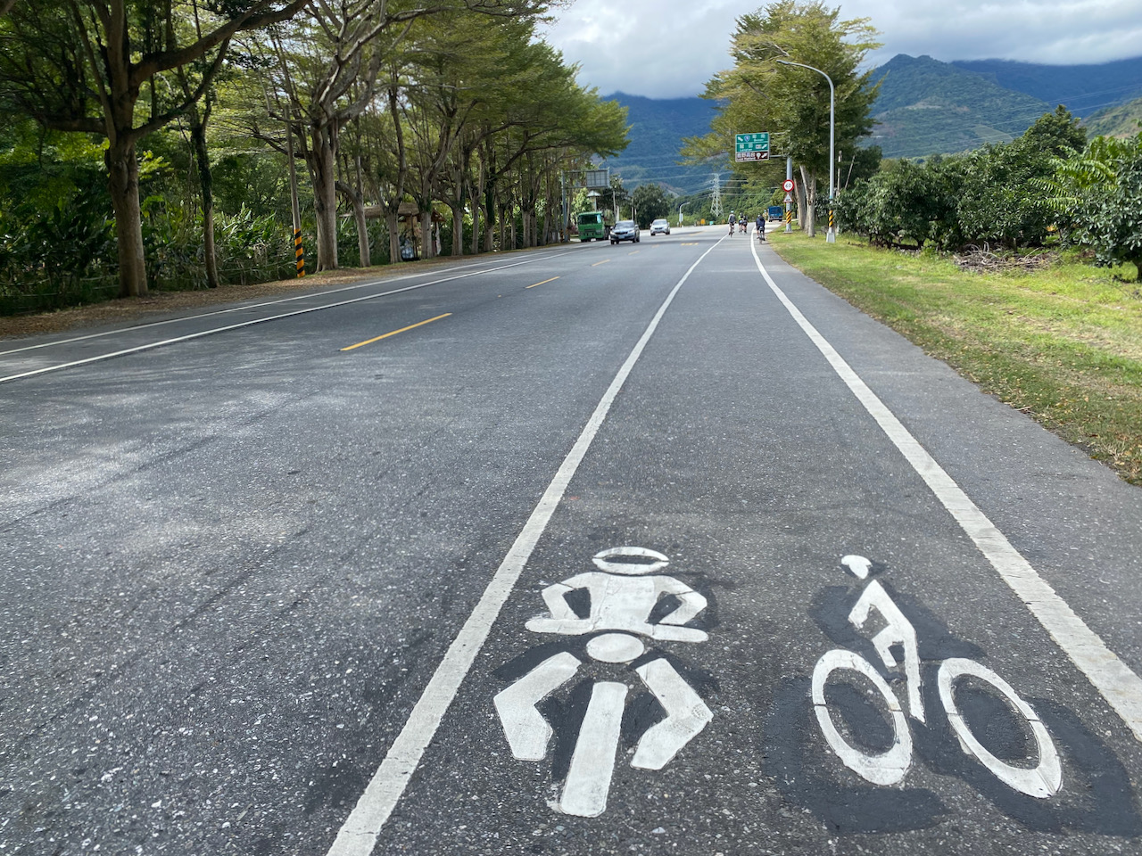
    Talking about Raohe Night Market, the Ciyou Temple sitting next to its entrance had also left an impression on me with its friendly atmosphere. We were free to take a tour of the six-storey building and appreciate the decorations. It was also very handy to be able to use their toilets after feasting in the night market. It isn’t hard to find toilets in Taipei after leaving you hotel, like in shopping malls, MRT stations, train Stations, and some convenience stores. But those are not always easily found after leaving Taipei (or other major cities), while temples are ubiquitous in Taiwan. Cyclists could usually use their toilets. Sometimes, we could even help ourselves with some instant coffee at their drinking machines. 

    So, that’s my first day in Taiwan. The small hotel turned out to be perfectly fine. No weird noises came from other rooms

  • My First Cycling Trip in Taiwan Day 2

    My First Cycling Trip in Taiwan Day 2

    このブログ記事の翻訳を進行中です。もうすぐ完成しますので、後ほど再度ご確認ください。ご不便をおかけして申し訳ありません。現在は、こちらで提供されているGPXルートや地図などの情報を自由にご利用ください。

    16 April 2009

    I hate cycling among busy traffic but we decided to stay in this busiest city of Taiwan the next day just in case there were any issues with the bikes. We also needed to buy SIM cards and go to the bank. These were the days when mobile data has not yet become as important as oxygen. I was traveling with my TREO 650 and film camera Nikon F801s. I had nothing to share instantly on social media. But we still needed to be able to call the hotels for room reservation and stay connected with each other. Today, if you need mobile data, you can buy a SIM card at the airport with a package of unlimited data within a fixed period. These are tailor-made for tourists  and the procedure is quick and easy. It took only 5 minutes to complete the transaction. And Nope! It’s not more expensive. It’s actually a real bargain. Your only concern is whether your flight is arriving too late and those shops will be closed already. 

    We roamed in Taipei city on our bicycles with the overwhelming scooters, which made me feel like traveling with massive groups of hornets. Our touring bikes have drawn some attention from passersby.  “Jia You! (add oil) some shouted at us with smiles. They probably thought we were making the 1,000km-around-the-island trip and wanted to give us some big pushes. Although Taiwan is home to the world’s two biggest bicycle manufacturers and has been making bikes for the world for decades, people here prefer their scooters for daily commute. Then there was this movie Island Etude released in 2007, about a hearing impaired college student making the round-the-island tour in Taiwan. The idea has been so impressive and inspiring that people started doing the tour themselves. It has kind of become a coming of age ceremony or a pilgrimage. No wonder we received so much encouragement. To me, it’s like giving a salute to the place. 

    Slowly we discovered some special rules for scooters and bicycles (機慢車). For those who don’t read Chinese characters, it might be tricky to figure it out. The following are some general ideas that I hope you may find useful. Click on the links of Chinese Characters to see the signs. 

    The Free Ways 國道 (sign: white, five-petal flower with a number inside), the red badge Provincial Highways (Express Ways, sign: red badge with numbers) and Urban Express Ways are not for scooters and bicycles. 

    Everyone can use the Provincial Highways with blue badges (省道),  County or City Highways (縣道), Township and District Roads (鄉道) and Industrial Roads (產業道). In those rural areas, it’s perfectly OK to use the overpasses, bridges or tunnels on these roads. Remember to turn on your lights in the tunnels.

    Rural Tunnel
    A rural tunnel meant to be shared among cars, scooters and bicycles

    Sometimes, the lanes close to the centre (left) are not for slow vehicles. You would see the yellow Chinese characters 禁行機車 (No Scooters) arranged vertically on the tarmac. There are also lanes built for slow vehicles (機慢車道). In front of some traffic lights, there are boxes for slow vehicles to wait for the green light. Bikes are slower especially on starting; stay close to the sidewalks to give way to the others. On most intersections, slow vehicles should follow the two-stage-left-turning rule (二段式左轉), i.e. after going through a green light (the first stage), go to the left turning waiting zone, another box (左轉待轉區). You would be looking at a new traffic light. Wait for the new green light and go (the second stage). When you are not so sure, follow the scooters.  

    The bikes turned out to be in perfect condition. There were showers of rain but we were ready! Nous étions prêts!

  • My First Cycling Trip in Taiwan Day 3

    My First Cycling Trip in Taiwan Day 3

    このブログ記事の翻訳を進行中です。もうすぐ完成しますので、後ほど再度ご確認ください。ご不便をおかけして申し訳ありません。現在は、こちらで提供されているGPXルートや地図などの情報を自由にご利用ください。

    17 April 2009

    The third day, we started our cycle around the island tour in the drizzle. The preferred/recommended route was supposed to be cycling to Bali Old Street at the left bank of Tamsui River and then take the ferry from the Bali Ferryboat Wharf to the Tamsui Old Street. But we couldn’t. Why? Not my fault. We had a GPS with the proper check points set but it was not mounted on my bike. I just followed John. We made it to a wharf but there was no ferry. We thought that those ferries might only be in services on particular days. But that is not true. The ferries run daily. We just went to the wrong wharf. Anyway, we managed to bike to Tamsui around lunchtime as the drizzle became showers. We scurried into a seafood restaurant for shelter and for lunch. In order to boost up my morale, I ordered one of my favourite dishes, sautéed crab. It was expensive and tasteless. Oh no! I forgot to pick the crab by myself from the tank. They must have cooked a dying one for me. Sigh……!

    cyclist on a wharf and Guandu bridge
    Wrong wharf, no ferries. the red bridge behind has a lane especially for bikes connecting Bali to the north coast.

    After our disappointing lunch, at least the rain stopped. And as we reached the outskirts of the city on the Provincial Highway No. 2, swarms of scooters and speeding cars disappeared. (Actually, Taipei is a great place to cycle if one can find the bikeways on the riverbanks.)  There were some cafes and interesting spots. We just stopped briefly because we did not know where to stay for that night.

    Township Road
    Township Road 北11 Chexin Road, a detour from Provincial Highway No. 2. Even less traffics

    Then we reached the northern tip of the island, Fugueijiao Lighthouse (富貴角燈塔), when the sun was setting. I love lighthouses. They are altruistic, beautiful, committed and lonely. In the past, there were lighthouse keepers who would play chess with their colleagues on shore by flashing morse codes to the clouds. Read this story, The Fastnet Lighthouse on the Economist. The life of Fugueijiao Lighthouse keepers (if any) should be easier. The lighthouse sits next to a fishing port and some tourist spots and within an hour’s drive from the city. 

    I didn’t care that it’s going to be dark soon. I wanted to take a good look at the lighthouse. We followed the pleasant foot path to the lighthouse and then the pristine buildings appeared with a perfect angle for taking pictures. The lighthouse is a 14.3m octagonal structure with black stripes, which is supposed to improve the visibility in the thick fog. I could only look at it from outside the gate because it was not open to public until 2015.  It opens Tuesday to Sunday, 09:00 – 18:00 (summer), 09:00 – 17:00 (winter).

    Leaving Fugueijiao, we found ourselves cycling in total darkness. It was perfectly safe but we still had not found a place to sleep yet. After 14km of pedalling on the dark coastal highway, I saw a shimmering light. It wasn’t Hotel California; it’s a coffee shop looking like a traditional building on the Greek island Santorini. We loaded up chunks of calories-rich cheese cakes and coffee into our stomachs there and then a kind staff member offered to help us finding a place to stay. She called a homestay owner nearby and told us to meet him at the next 7-eleven. The owner, riding a scooter, led us to his place. That’s the first night of our cycling tour. We had a good chat and played snooker with the owner before having a sound sleep in a clean bedroom big enough to house 6 people.

  • My First Cycling Trip in Taiwan Day 4

    My First Cycling Trip in Taiwan Day 4

    このブログ記事の翻訳を進行中です。もうすぐ完成しますので、後ほど再度ご確認ください。ご不便をおかけして申し訳ありません。現在は、こちらで提供されているGPXルートや地図などの情報を自由にご利用ください。

    18 April 2009

    The next morning, I woke to a rural village surrounded by paddy fields and ponds in the Jinshan District. Breakfast, steamed meat buns, were ready on the table. I guess most homestays in Taiwan would serve breakfast. We were so refreshed and ready for another day of pedalling. But no, not yet! I did not remember having a proper dinner the previous day. We went to the Jinshan Old Street to buy some brined duck meats. 

    As I was leaving the homestay, I was so impressed that the trails were well maintained and laid with asphalt. The garbages were taken care of properly. The government has put in a lot of effort to deal with this since 1989. Visitors to Taiwan must have heard a loud, raw electronic melody every evening. These are garbage trucks summoning garbages. Recyclable items are collected free of charge. Kitchen wastes are diverted to pig farms. And the rest, before collected by the truck, must be put inside a certain kind of bags sold by the local government with levies to fund the operation. So, we should always ask for permission to use the garbage cans in some small shops. I was quite embarrassed that I had to discard the duck meat packing in a 7-Eleven. 

    Gone was the dull sky. We had a sunny day with clear blue sky on the second day of our cycling trip. It looked particularly great with the colourful kites flying over a pier and the orange sandstone formations in the Yeliu Geopark in Wanli. There is this famous Queen’s Head inside the paid area which resembles the profile of Queen Elizabeth I at a certain angle. I used to think it’s Queen Millennia that they are talking about. Back in the 1960’s, the sculpture did look like a queen in real life. After half a century of erosion,   her neck got chipped thinner and thinner, making her look rather like Yukino Yayoi (雪野 弥生) in the manga, Millennial Queen. Given the speed of erosion, the neck won’t be able to support the head for another decade, not to mention a thousand years. After taking a poll in which more than 60% of the voters agreed to take proactive measures to save the sculpture, the Tourism Bureau has tested various methods on other pedestal rocks in the vicinity to stop the erosion process. The results were unsatisfactory. Nothing can help save the queen yet.

    After cycling in solitude for so many hours, Yeliu was a great place to hang around for its lively atmosphere. But we did not buy tickets and get inside the Geopark. We were in the biking mode. We would rather stick with our bikes and spend more time on the north coastal line and then head to the port city Keelung. We did not know how long it would take. We were told during lunch that there was a flat costal bikeway to Keelung. But this nice path has eluded us. We ended up climbing 180m with the busy traffic and breathed in lots of exhaust fumes from the cars and scooters before reaching the top. If you want to know how to find the easy path from Wanli to Keelung, check out my post here.

    Keelung city is home to the third biggest port of Taiwan. It has been the northern gate for the island and strategically important for the past century. Numerous forts were built to guard the city against invaders and there are more than ten remains open to public. With two freeways and two railway lines starting there, the city is supposed to become even more prosperous. But its development has been limited by the surrounding hills. Narrow streets and old buildings are squeezed into the small area around the port, the others scattered in the hilly suburbs which consists of 95% of the city. Lacking space for renewal, Keelung remains more or less unchanged overtime. It’s like going back in time as we descended into the city centre. We checked into a small hotel and asked for a place to keep our bicycles. A staff member kindly brought us to their underground parking lots and let us use one of their mechanized parking systems. So much effort to squeeze more cars into an underground place. 

    Street of Kee Lung

    While John was taking a rest in the hotel room, I took a walk and had the most delicious squid soup I have ever had at a food stall in an alley. I recommended it to John but I was not able to find the food stall again. The night market in Keelung has many great snacks to offer but nothing could compare to that squid soup. I even tried to find the store the second time when I was bike touring with Lois but also to no avail. 

    That was our two-day ride on the north coastal line. The next day, we would head east and cycle on the north east coastal line from Keelung to Yilan. 

  • My First Cycling Trip in Taiwan Day 5

    My First Cycling Trip in Taiwan Day 5

    このブログ記事の翻訳を進行中です。もうすぐ完成しますので、後ほど再度ご確認ください。ご不便をおかけして申し訳ありません。現在は、こちらで提供されているGPXルートや地図などの情報を自由にご利用ください。

    19 April 2009

    We started late this day at around 10:00. Weather turned wet and cloudy but there’s not much rain. Leaving Keelung and heading eastwards, there were quite a number of brown road signs showing the directions to some tourist spots. But we did not bother to stop and check. Cycling per se was just too enjoyable.  By 1:00 pm, we had covered 25km and arrived at a cape called Bitoujiao (鼻頭角, literally meaning cape nose tip). Lunch break. John seemed to be doing an experiment of spending his money as frugally as possible. He picked the smallest food stall at the fishing harbour, which served  only bowls of noodles. If you want to reward yourself with some delicious food, there are certainly some seafood restaurants.

    Little Fishing Harbour on a coast

    In spite of our meager lunch there, I had a great time in Bitoujiao. One of Taiwan’s most beautiful primary schools sits on the cape’s cliff with a view of the vast Pacific Ocean in different shades of blue. Like allother public schools in Taiwan, the outdoor area is open to public after school and during weekends. There are three hiking trails in Bitoujiao, all exalted by visitors. We picked the one along the ridge and found a great location where we could look back at the coastal line we had just cycled. Of course I would not miss the trail leading us to the Bitoujiao Lighthouse. (Sadly, this part is closed now because the cliff there has been cracking. Hopefully it will be fixed soon.) Then, we finished the walk with some coffee at the small hut (opens only on Saturday and Sunday) next to the entrance of the primary school. 

    The trails actually form a circuit that links with the fishing harbour. You may leave your bikes at the restaurant and come back in a loop.

    We spent more than 3 hours in Bitoujiao. It was getting dark when we started cycling again. Definitely not a problem; we have done that before. Slowly, we reached Fulong, a small resort village, before 7:00 p.m. The small area right outside the Fulong Train Station is packed with bento (lunchbox) shops. The Rustic Bento (鄉野便當) has been there since 1958. I think I had two of this for dinner. We were not ready to call it a day yet. We were about to reach the easternmost point of Taiwan main island, the Cape Santiago or Sandiaojiao (三貂角). An old train tunnel has been converted to a bikeway and forms a 20 km loop with the route around the peninsula. The Old Caoling Bikeway Loop (舊草嶺環狀線自行車道) was a dedicated bikeway separated from lanes for motor vehicles. With a big beach nearby, this small village does make a good place for families to spend a day or two. The tunnel, which became a short cut through the peninsula to the next village, was closed after 5:00 p.m. No problem at all.  I always have the desire to reach the “extremes” and certainly would not miss the easternmost point of Taiwan.  I would not have used the tunnel even if it were available. The Sandiaojiao lighthouse  is sitting on the peak of Cape Sandiaojiao, casting light onto the sea. We did not go up there as it involved some climbing and it was already too dark. In hindsight, we should have stayed the night at Fulong and visited the lighthouse. Instead, we found a small homestay run by an old lady at the next village, inside a small building with a light-box signage outside. She collected the fees and told us that she would need to go to the temple early the next morning. We could just leave by ourselves. Read: No breakfasts.

  • My First Cycling Trip in Taiwan Day 6

    My First Cycling Trip in Taiwan Day 6

    このブログ記事の翻訳を進行中です。もうすぐ完成しますので、後ほど再度ご確認ください。ご不便をおかけして申し訳ありません。現在は、こちらで提供されているGPXルートや地図などの情報を自由にご利用ください。

    20 April 2009

    We started cycling in drizzles. Without the fenders, soon I had two big vertical stripes on my chest and back, painted by the wet dirts thrown up by the wheels. We reached Toucheng Station (頭城車站) in no time. Some fellow cyclists told us that we could try our lucks here to  board certain trains (without bagging the bikes) to skip the hair-raising Suhua Highway and reach Hualien safely. The next train available was around 4:00 pm. Rain stopped. We headed South (8km) to the hot spring town Jiaoxi to munch on a whole chicken roasted in a kiln fuelled by the wood of litchi or longan. We even had enough time to take a dip in some hot spring before returning to Toucheng Station to board the train.

    In fact, Toucheng Station is no longer an ideal station to board a train with your bikes now. At the time of writing, there are only three trains a day that would carry naked bikes. That one we took has been cancelled. Instead, Luodong station (25km southwards) or Su’aoxin Station (33km southwards) have 9 trains a day, stretching from early morning to around 11:00p.m. You would also skip the most part of Yilan if you board the train at Toucheng as it locates at the northern part of Yilan. Here’s where you can check for relevant information but it’s in Chinese only: TRA Bike Trains. Clients of Bike Express Taiwan need not worry about this; we are happy to check it for you. (Note: The Taiwan Railways Administration has launched their official website on spring of 2019 with the options of Chinese, English, Japanese and Korean)

    Back to my trip. Again, we found ourselves in the dark when we arrived at Hualien and prepared our bikes outside the train station. A woman approached us and tried to persuade us to stay at her hostel. She appeared to be horrified by our idea of cycling in the dark. A man joined in to help. He claimed that he could predict the weather precisely after being a sailor for decades. He sticked one finger into the air and tasted it. “It’s sweet! it’s going to rain soon!”, he concluded and announced loudly. Sorry man! The north and north east coasts had made us experienced cyclists specializing in riding in the rain and in the dark. And please don’t be so sure. It’s very difficult to make predictions, especially about the future! I thought to myself.

    We turned down the woman’s offer and headed into the 180 km longitudinal valley connecting Hualien and Taitung, the Huadong Valley. It was created after the Eurasian Plate and the Philippine Sea Plate kept pushing each other for many many thousand years. It is believed that the Philippine Sea Plate crept above the Eurasian Plate and formed the Hai’an Range or Coastal Mountain Range (海岸山脈). And they are still doing it. That’s why the frequent earthquakes in the area. 

    The valley was more populous than the northern coast. We had a local person cycling with us as he was heading home. He told us that the valley was so full of homestays that we needed not worry about finding a place to stay. Then, we decided to stop for the day after passing several townships at a leisure pace. And nope! Mr. Sailor, there wasn’t a single drop of rain. 

    John, who speaks better mandarin, asked a cashier at a convenient store if there were any homestays around. He came back with a look of disbelief on his face while I was looking for some snacks. Turned out a young lady with a baby in her arm overheard the conversation and invited us to stay in their place, which was just a couple blocks away and where she lived with her husband. For free! Wow! what could I say? I did have a split second of wary thoughts but how could we turn down such a generous offer? If she did not worry about safety issues of having two strangers staying at their place, neither should we. So we accepted her invitation and followed her home. Her husband was a young jade carver. He was appreciating (evaluating?) several pieces of raw jade stones on his desk while we chatted. We were told that Yuli Township (玉里, translated literally as Jade Township) in the valley used to produce a special kind of jade with fibre patterns.

    Even though I could barely participate in the conversation with my broken Mandarin, I gained a new perspective on the Japanese rule in Taiwan (1895 – 1945). I used to think the older generations of Chinese must have all harbored a feeling of hostility towards the Japanese, who had been frequently in war with the Chinese in the past centuries. Being a former wartime foe of KMT and notoriously brutal during World War II, Japan was commonly thought to detest by the older Chinese from the other side of Taiwan strait.I was surprised to learn that some people in Taiwan had a nostalgic view of Japan’s colonial period. Like in all other colonial economies, human and natural resources were used to aid the development of Japan. But firstly, roads, railways, schools, clinics, water supplies, etc. had to be built to facilitate the extraction. After half a century of ruling, the Japanese had left behind numerous valuable infrastructures, historical buildings, sake breweries, sugar mills, logging railways and some intangible assets like agricultural technologies. Of course, the subjects weren’t treated equally. After we moved to Taipei, one of our neighbours told me that Chinese were not allowed to study law and politics during that period. The only prestigious profession left for those Chinese elites to pursue was medicine. This somehow became a convention within the Chinese community and that’s why people in Taiwan are enjoying superior medical services today. The living standard and population had grown significantly when Japan left Taiwan in 1945. Many old Taiwanese have a fondness towards the Japanese. I guess some people in Hong Kong share the same sentiment about the British rule (1841-1941, 1945-1997).

    That was an unforgettable day. 

  • My First Cycling Trip in Taiwan Day 7

    My First Cycling Trip in Taiwan Day 7

    このブログ記事の翻訳を進行中です。もうすぐ完成しますので、後ほど再度ご確認ください。ご不便をおかけして申し訳ありません。現在は、こちらで提供されているGPXルートや地図などの情報を自由にご利用ください。

    21 April 2009

    The next day we did exactly as the hostess told us the night before: leave by ourselves when we woke up. They probably had their own daily routines and did not want to put any time strain on us.

    Some intermittent drizzles again. We continued our tour southwards on the Provincial Highway No. 9 and got a chance to take a good look at the valley in broad day light. Roads were flat and straight and flanked by green paddy fields. It’s a very pleasant view.

    After lunch, we needed to pedal harder. After some serious climbing, I finally reached the top of a slope and stopped in front of a tea shop in the Wuhe village, 210 metres above sea level. As I was waiting for John, who lagged behind me, the tea shop owner waved me in and later offered us lots of tea for tasting. There used to be more than 100 tea farmers with 200 hectares of plantation. In the1990’s, failing to compete with the high mountain (over 1000 metres) tea from the west coast, half of the plantation has gone out of business. 

    Meanwhile in Taitung, inspired by the Oriental Beauty Tea, Chen Huicang (陳惠藏), a specialist of the Tea Research and Extension Station (茶葉改良場, an institute under the Council of Agriculture, Executive Yuan), has developed a special kind of tea that, among other aromas, carries a natural signature flavour of honey.

    Some research findings revealed that, when bitten by tea green leafhoppers, tea plants would secrete some chemicals that, even at an extremely low level, could attract a special kind of spider, Evarcha albaria, which is a predator of the leafhoppers. It seems after hundreds or thousands years of evolution, tea plants has developed a way to call for help. And those chemicals are the sources of that signature flavour.

    A tea farmer from Wuhe village, Gao Zhaoxu (高肇昫), went to consult Chen Huiceng and returned home with the tea processing technique. But he still needed the leafhoppers to bite his plants.

    He adopted the eco-friendly farming practices, including suspending the use of pesticide, as promoted by the government of Hualien Township. After years of development and improvement, the tea produced in Wuhe village has regained its competitive advantage and tea farms started to stand on their own feet again. Until 2007, the total area of tea plantation has returned to 160 hectares.

    Live in harmony with the nature and we will be rewarded with something precious. This is something I learned there.

    A cyclist standing in front of a tea shop
    One of the tea shops in Wuhe

    I did like their tea but I could only buy two bags because of the limited space in my saddle bags  and my reluctance to carry too much weight. Actually, if you find something you really want to buy during a cycling trip, you could send it back to Taipei using the railway system. Unfortunately I did not know that at the time.

    We left the tea shop and started descending to Yuli. There were small road signs put up by homestays to advertise themselves. It started raining. We picked one homestay at random and followed the direction on the road sign to to somewhere quite far away from the town centre. It was closed. That sucked, especially after the climb we had to do to reach that homestay. But then even if it’s not closed, we might still end up with a fully booked one. So, you should always call to check before actually committing any time and strength to get there. Homestay owners might not be able to communicate well in English over the phone. Again, the Bike Express Taiwan team is happy to do the job for our clients.

    John used the GPS to find the closest hostel. It must be up and running for some time to have its information stored in the GPS database. We did not have Google Maps back then. Anyway, we could finally take a good rest and wash our soaked cloths.

  • My First Cycling Trip in Taiwan Day 8

    My First Cycling Trip in Taiwan Day 8

    このブログ記事の翻訳を進行中です。もうすぐ完成しますので、後ほど再度ご確認ください。ご不便をおかけして申し訳ありません。現在は、こちらで提供されているGPXルートや地図などの情報を自由にご利用ください。

    22 April 2009

    We continued our trip and headed south along the Provincial Highway No. 9 in the southern part of the rift valley. Before long, we entered Taitung County officially but still needed to ride 50km before we would reach Taitung City. Townships in Taitung County, including Chishang, Guanshan and Luyeh, have been well known for producing the finest rice in Taiwan. There were endless views of paddy fields disappearing into the horizon. 

    The first township to see was Chishang (池上). If you have some knowledge of Chinese, you  would have recognized these two characters on many instances  because several chain stores selling bento (lunchbox) bear the name, eg. , 池上便當, 池上木片便當, 池上飯包. A perfect combination of climate, water, soil and altitude, together with farmers’ meticulous caring of the plants, rice grown in Chishang has been frequent winner in rice competitions. 

    Given that Chishang produces around 12,000 tonnes of rice annually, which is around 1% of Taiwan’s rice production, I wonder if there is enough rice for all those bento shops. Perhaps that’s why the township office is running accreditation programs for bento shops.

    Then after further travelling for 10 km, we stopped in front of a very colourful building with rice as cartoon characters painted on it’s facade. There was an enormous display of the word Guanshan Rice in Chinese (關山米) on the field, formed by crops of different colours. A platform was set up for visitors to take a bird’s-eye view of the display. The building used to be a rice mill and storage. The Guanshan Township Farmers’ Association had turned it into a tourist service centre. Visitors could sign up for a short demonstration of the process of rice milling. Rice produced in Guanshan used to be a tribute to the Japanese emperor during the Japan rule. But this legacy alone was not enough to ensure their products thrive in the market. We could tell that the Farmers’ Association had put in lots of efforts to polish their brand.

    We missed two famous tourist spots around Chishang because we did not know of them at the time: the Dapochi and the Brown Boulevard. They are definitely worth the trouble of taking a detour. It’s pretty easy when you have Google Maps. Just set the Destination to “Dapochi” when you are approaching Chishang Station. After you have enough fun there, use Google Maps again to guide you to “Brown Boulevard”. If you are travelling northwards, set your destination  to “Brown boulevard” when you are leaving Guanshan Township.

    We climbed a little bit to Luyeh Highland and then started a 20 km nice long descend from 240 metres to 40 metres above sea level towards Taitung City. It was awesome. We were moving like the wind. 

    And that’s it. It’s about the end of our trip. We found a random hotel to stay for the night and did some common tourist thing. The next day, we cycled to Taitung Train Station and shipped the bicycles to Songshang Station in Taipei. This simply is a wonderful service for cyclists like us who prefer travelling without a rigid plan. There are more than 50 stations scattered on the island with luggage rooms that allow you to drop off your bikes. Because of this, we can plan our routes with a lot more flexibilities. We can even send some personal belongs or souvenir we bought along the way to the next stop or the final destination in order to slim our saddle bags.

    Parted with our bikes, we completed the around-the-island tour by taking a train from Taitung to Kaohsiung and then the High Speed Rail to Taipei. We did some sightseeing in Kaohsiung and Taipei but it was kind of weird (cold turkey?) to switch from pedaling to bipedalism. I missed the bike, the mobility and freedom it brought me, and the encouraging smiles from strangers when I was breezing past their sides. 

    — End —

  • ステージ制で巡る台湾一周サイクリング(3):台東から花蓮、宜蘭へ

    ステージ制で巡る台湾一周サイクリング(3):台東から花蓮、宜蘭へ

    これは、分割で巡る台湾一周サイクリングの第3ステージです。今回は台東、花蓮、宜蘭を走破する予定でした。

    旅程の設計

    この区間を計画する際に考慮した点を紹介します。

    台東から花蓮へは、海岸山脈を挟んで二つのルートが選べます。「縦谷ルート」と「海岸ルート」です。

    縦谷ルートは人口が多く、水田が広がる風景や見どころが多くあります。補給地点や宿泊施設も見つけやすいです。一方で、海岸ルートでは壮大な太平洋の景色を楽しむことができ、これも見逃せません。

    理想的には、両方のルートを組み合わせたプランを立てるのが最適です。まず台東を出発し、縦谷ルートで北上して瑞穂に向かい、その後「瑞港産業道路(花64 / HL64)」を利用して海岸ルートへ移行します。こうすることで、縦谷ルートのハイライトと、海岸ルートの絶景の両方を楽しめます。

    特に、縦谷の見どころは南部に集中しており、海岸ルートの最も美しい景色は北部にあります。さらに、北上することで、太平洋に最も近い位置を走ることができるため、より安全に景色を楽しみながら観光スポットへ立ち寄ることができます(台湾では右側通行のため)。

    その後、花蓮市を経て太魯閣峡谷へ進みます。ここは中央横貫公路(中横公路)の起点であり、中央山脈を横断し、標高3,275mの武嶺峠に至る「台湾KOMチャレンジ」のルートです。

    今回は、挑戦の一端を味わうために、天祥遊憩区(標高485m)までの短いヒルクライムをルートに組み込みました。そこから北上し、宜蘭へ向かう際には、難関ルートとして知られる蘇花公路に挑みます。

    蘇花公路がなぜ難関なのか?

    蘇花公路を自転車で走るべきかどうかは、慎重に検討すべき重要なテーマです。このルートは、新城から蘇澳までの78kmの間に1,451mの獲得標高があり、難易度が高いことで知られています。

    加えて、多くの区間が切り立った崖のすぐ横に建設されており、道幅は車両2台がギリギリ通れる程度しかありません。左手には急峻な山の斜面がそびえ立ち、頻発する地震によって岩が緩み、いつ落石が発生してもおかしくない状況です。大雨や台風の後には、土砂崩れによって道路が完全に塞がれることもあります。

    また、ルート上には9つほどのトンネルがあり、内部は空気がこもりやすく、視界が悪くなるだけでなく、大型車両のエンジン音が反響し、耳をつんざくような轟音が響き渡るという厳しい環境になります。これらの要因が重なり、蘇花公路は台湾でも最も慎重に走行計画を立てるべきルートのひとつとされています。

    それでも、多くのサイクリストが「リスクを冒してでも走る価値がある」と言っています。私自身はまだ挑戦していませんが、このルートを調べるためにGoogleマップのストリートビューを見ただけで鳥肌が立つほどでした。

    しかし、状況は改善されつつあります。2020年に完了した「蘇花改」(蘇花公路改善計画)により、交通状況は大幅に向上しました。新しい区間は道幅が広くなり、道路が直線的に整備されたため、移動時間も短縮されました。

    自転車はこの新しいルート(省道9号)を走ることはできませんが、そのおかげで大型車や一般車両の多くが新ルートに流れ、旧ルート(省道9丁号または9D号)は交通量が減り、より快適に走れるようになりました。実際に、大型トラックの走行は禁止されています。ただし、ガスや可燃性液体などの危険物を運搬するトラックのみは例外的に通行が許可されていますが、そのトラックですら以下の時間帯は通行禁止となっています:

    • 7:00 – 9:00
    • 16:00 – 19:00

    ただし、旧蘇花公路と新ルートが重なる区間もあるため、その点には十分注意が必要です。

    良好な天候条件であれば、私は台湾一周のサイクリングをする際に旧蘇花公路を走りたいと思います。しかし、もしこの区間を飛ばしたい場合は、新城駅から蘇澳新駅まで電車で移動するのが簡単な選択肢となります。

    旧蘇花公路を北上し、蘇花公路の5つ目のピークを越えると、蘭陽渓が作り出した沖積扇状地に広がる宜蘭の平野へと下ることになります。このエリアには温泉ホテルが多く集まる礁溪があり、距離を抑えた1日を設けて、のんびりと過ごすのも良いアイデアです。

    多くのサイクリストは、ここから北東に進み、北宜公路(省道9号の一部)にある2つの峠を越えて新店へ戻り、台湾一周を完結させます。しかし、台湾北部・北東部の海岸線は美しすぎてスキップするのはもったいない。そのため、私はそのまま北へ向かい、福隆を経由しながら沿岸ルートを選ぶことにしました。

    これは理想的なプランではありますが、私たちが実際に選んだルートではありません。なぜなら、このルートは5月から9月にかけて、北風が吹かない時期に最適なものだからです。もしくは、向かい風の中を走ることを気にしない人に向いているルートとも言えます。

    私たちは1月にこのステージを実施しました。この時期は北からの季節風が吹くため、南へ向かうことで風を味方につける必要がありました。

    そこで、島の北東端である福隆からスタートし、初日は宜蘭をカバーしました。次に、蘇花公路の区間をスキップするため、蘇澳新駅から花蓮まで電車で移動しました。

    さらに、今回は南へ向かうルートだったため、沿岸ルートを走るメリットが少なく、花蓮から台東までの区間は終始「花東縦谷」を走行しました。

    以下がこのステージの詳細な旅程です。

    1日目:福隆 ~ 新城太魯閣(距離54km、登り143m、下り128m)

    台北から福隆に行くために、自転車をそのまま持ち込める朝の列車(No. 4148)に乗り、約1時間半の移動をしました。

    私の友人2人は万華駅から先に乗車しましたが、平日の朝は通勤ラッシュで非常に混雑しており、大きな荷物(自転車)を持って乗るのは勇気が必要でした。しかし、台北駅に到着すると、多くの乗客が降りて、車内はかなり余裕ができました。

    さらに、私が松山駅から乗る頃には、さらにスペースが増えて快適でした。台北には毎日90万人の通勤者がいるため、都市部を出発すると電車は空いてくる 傾向があります。そのため、北へ向かう列車に乗る場合は、松山駅や南港駅からの乗車を検討するのも良いアイデア です。

    こちらの投稿で、台湾で自転車を公共交通機関に持ち込む方法についてご覧ください

    すべてが完璧に進んだものの、雨だけが問題でした。土砂降りではなかったものの、すべてが濡れる程度には降り続き、道路の穴もすっかり水たまりに なっていました。そこで、できるだけ早く旅を終えることを決めました。

    私は専用の自転車道にグループを誘導しようとしましたが、ぬかるんでいるようだった ので、幹線道路を走るほうが良い という判断に。私の友人は靴の中が水浸し(私はサンダルを履いていました)。休憩のたびに靴と靴下を脱ぎ、中の水を流さなければなりませんでした。

    彼らは防水ジャケットを着ていましたが、袖口や腰の部分から水がしみ込むと内部までずぶ濡れになり、バッグの中の服もすべて濡れていました。実は、コンビニで売っている使い捨てレインコートなら、この問題を簡単に解決できた のですが、薄くて破れやすい のが難点です。

    早めに蘇澳新駅に到着 しましたが、駅構内にはお店がなく、周辺にも7-Elevenと数軒の屋台しかありませんでした(1kmほど手前にあったのを見逃しました)。そこで、チケットを早めの電車に変更し、7-Elevenで昼食 をとることにしました。

    この列車は車両をほぼ貸し切り状態 で快適でした。今回は天祥への寄り道を予定していなかったため、新城には宿泊せず、もう少し南の北埔駅付近で宿泊 することにしました。

    チェックインしてシャワーを浴びる準備をしていた友人が、バッグの中の服もすべて濡れていることに気づきました。「防水」や「耐水性」をうたうバッグも、数回使ううちに必ず浸水する運命にある ので、私はいつも服をジップロックに入れて 持ち歩いています。ちょっとした優越感はさておき(笑)、読者の皆さんにはこの違いを知っておいてほしい です。

    結局、午後はコインランドリーで服と靴を洗って乾燥させることになりました(あっ、靴もね…)。

    ルート

    ルートのご利用方法

    紹介したルートを使用するには、アプリのインストールが必要です。スマートフォンのブラウザで上記のリンクをタップすると、アプリが自動的に起動してルートを読み込みます。Garmin Connectの場合、アプリを使用してルートをGarminデバイスに登録できます。台湾で購入したGarminデバイスではない場合は、デバイスに台湾地図がインストールされていることも確認する必要があります。Garminデバイスのご利用方法を説明した当社のブログ投稿もこちらからご覧いただけます。

    2日目:新城太魯閣 ~光復(距離72km、登り530m、下り435m)

    私たちは花蓮では海岸線ルートではなく、縦谷ルートを選択しました。しかし、この縦谷ルートには省道9号線と県道193号線という2つの選択肢があります。

    省道9号線:

    • 道幅が広く、平坦で走りやすい
    • 交通量が多い
    • 補給ポイントが多い

    県道193号線:

    • 道幅が狭く、短い登り坂がある
    • 交通量が少なく静か
    • 補給ポイントは少なめ

    私たちは満場一致で県道193号線を選択しましたが、結果的にこれが大正解でした。

    花蓮市街を抜け、県道193号線へ入ると、そこからはまさに貸切状態。とても静かで、リラックスしながら会話を楽しみつつ走ることができました。ただし、この日も雨が降り続いていました。路面は完全に濡れていたものの、交通量が少ないため、他の車両が跳ね上げる泥水を浴びることはなく、快適に走ることができました。

    県道193号線沿いには、小さな食料品店が点在しているものの、レストランはほぼ皆無でした。運よく開いている店があったとしても、食事の選択肢は限られ、まともな食事をとるのは難しいです。スナックや飲み物を購入できる場所はあるものの、種類はあまり期待できません。そのため、このルートを選ぶ場合は、事前に補給をしっかり準備することをおすすめします。

    昼食後、空腹のままB&Bに遅れて到着しましたが、まずは自転車を掃除する必要がありました。幸運なことに、B&Bには広い庭があり、ホースを使って自転車の泥を洗い流すことができました。

    その後、皆は急いで部屋へ向かいシャワーを浴び、私は同じ優先事項を持つ仲間と共に、さっと昼食をとりに出かけました。

    その晩は、運よく素敵なレストランを見つけることができ、美味しい食事を楽しむことができました。

    ルート

    ルートのご利用方法

    紹介したルートを使用するには、アプリのインストールが必要です。スマートフォンのブラウザで上記のリンクをタップすると、アプリが自動的に起動してルートを読み込みます。Garmin Connectの場合、アプリを使用してルートをGarminデバイスに登録できます。台湾で購入したGarminデバイスではない場合は、デバイスに台湾地図がインストールされていることも確認する必要があります。Garminデバイスのご利用方法を説明した当社のブログ投稿もこちらからご覧いただけます。

    3日目:光復 ~ 富里(65km、登り424m、下り310m)

    ついに太陽が顔を出しました。私たちは平坦で広い省道9号線を走りましたが、途中に標高150メートルの舞鶴台地への短い登りがありました。そこにはいくつかの茶店や北回帰線標がありました。この台地を下ると、私たちのルートと並行する2つの自転車道がありました。

    最初の富源旧鉄道自転車道は、富源駅から南へ続くもので、新しい高架鉄道が建設された後に旧線が自転車道に転用されました。次に現れたのが玉富自転車道で、玉里から旧東里駅へと続くルートでした。ここは写真撮影やのんびり過ごすのに適したスポットです。

    これら2つの自転車道以外は、省道9号線を走りました。この道路は広く、スクーターや自転車専用の路側帯が設けられています。2つ目の自転車道を抜けると、省道9号線沿いにある農会の直売所が目に入りました。ここでは地元の特産品を購入でき、時折、稲刈り後の藁を使った彫刻が展示されていることもあります。

    この日は比較的楽な行程でした。私たちは早めに民宿にチェックインし、日没前にビールを飲みながらくつろぎました。富里はとても小さな町で、店の選択肢は限られており、唯一のイートイン可能なレストランで夕食をとりました。

    ルート

    ルートのご利用方法

    紹介したルートを使用するには、アプリのインストールが必要です。スマートフォンのブラウザで上記のリンクをタップすると、アプリが自動的に起動してルートを読み込みます。Garmin Connectの場合、アプリを使用してルートをGarminデバイスに登録できます。台湾で購入したGarminデバイスではない場合は、デバイスに台湾地図がインストールされていることも確認する必要があります。Garminデバイスのご利用方法を説明した当社のブログ投稿もこちらからご覧いただけます。

    4日目:富里 ~ 台東(60km、登り324m、下り517m)

    この日は、台湾最高級の米が栽培される池上に広がる「伯朗大道」を走るルートでした。広大な田園風景の中を駆け抜けるこの道は、台湾でも特に美しいサイクリングロードのひとつです。また、省道9号線のこの区間も同様に素晴らしく、快適に走ることができました。

    小さな登り(約100m)を越えた後、台東駅へと下り、ここで自転車を台北行きの荷物配送サービスに預けました。

    さらに、台東市内でフライトまでの時間を過ごす間、スパ施設を見つけ、スタッフのシャワールームを利用できるプランを利用しました。少しの金額を支払うことで施設のサービスを受けることができ、汗を流してリフレッシュした状態で台北行きの飛行機に乗ることができました。

    ルート

    ルートのご利用方法

    紹介したルートを使用するには、アプリのインストールが必要です。スマートフォンのブラウザで上記のリンクをタップすると、アプリが自動的に起動してルートを読み込みます。Garmin Connectの場合、アプリを使用してルートをGarminデバイスに登録できます。台湾で購入したGarminデバイスではない場合は、デバイスに台湾地図がインストールされていることも確認する必要があります。Garminデバイスのご利用方法を説明した当社のブログ投稿もこちらからご覧いただけます。

    旅の締めくくり

    このステージを完了したことで、台湾一周のルートはほぼ完成しました。しかし、正式には台北から福隆までの区間をもう一度走らなければ、完全なループにはなりません。ただし、友人たちはすでに週末に何度も福隆まで自転車で行ったことがあるため、「もうチャレンジは達成した!」と満足しているようでした。

    これで台湾一周の旅は一区切りとなりますが、台湾にはまだまだ探索すべき場所がたくさんあります。特に、山岳地帯には魅力的なルートが無数に広がっており、新たな冒険が待っています。

  • ステージ制で巡る台湾一周サイクリング(2):高雄~台東

    ステージ制で巡る台湾一周サイクリング(2):高雄~台東

    私たちは、一度に台湾を一周する時間がなかったため、複数回に分けてサイクリングを行いました。各セクションの最後に、ダウンロード可能なGPXファイルを掲載しています。

    これは、「台湾一周を複数のステージで走る旅」の第2ステージです。このステージでは、高雄から台東までをカバーしました。私たちは、西海岸から東海岸へと移動するために、標高460mの壽卡峠、または壽卡バイカーズレストストップを越えるルートを選びました。高雄を出発し、車城まで走行しました。

    壽卡バイカーズレストストップへ登るには、2つのルートがあります。ひとつは省道9号線、もうひとつは県道199号線です。省道9号線は交通量が多いため快適とは言えません。そのため、県道199号線を選択するのが賢明です。3日目の夜は金崙(金崙)で宿泊しました。このエリアには小規模なホテルがいくつかあり、中には温泉を提供しているところもあります。

    最終日は比較的楽なルートで、台東駅までわずか41kmの道のりでした。台東駅では、自転車を台北の萬華駅または松山駅へ送ることができます。その後、台北松山空港まで国内線で飛ぶか、列車で帰宅することができます。私自身は、特別仕様の自転車ラック付き列車「C.K. EXP No. 81」に乗車しました。この列車は、自転車をそのまま車両に押し込むことができ、16:02に出発し、5時間後に松山駅に到着しました。「C.K. EXP No. 81」は、毎週金曜日、土曜日、日曜日、月曜日のみ運行されています。

    もしこのステージが短すぎると感じる場合は、さらに南へ向かい、鵝鑾鼻灯台を訪れる追加ルートも用意しています。

    1日目:高雄 ~ 車城(99km、上昇310m、下降323m)

    このステージでは3日間しか確保できなかったため、前回の終点である台南ではなく、高雄からスタートすることにしました。そのため、よりスムーズに進めるために、水曜日に自転車を鳳山駅へ送り、金曜日の午後8時までに受け取りました。その後、高雄で前泊し、翌朝できるだけ早く出発しました。

    振り返ると、自転車の受け取り場所としては、鳳山駅よりも楠梓駅の方が良い選択だったかもしれません。楠梓は高鉄(HSR)駅に近く、荷物室の場所も分かりやすいためです。もう一つの選択肢としては、土曜日の朝に最も早い高鉄(HSR)に乗り、輪行袋に入れた自転車を持ち込んで左営(高雄)駅に到着し、そこからライドをスタートする方法もありました。ただし、高雄の左営駅に到着する最も早い高鉄は午前8時40分なので、出発時間が遅くなってしまうというデメリットがあります。

    高雄は台湾で3番目に大きな都市です。市の中心部からのスタート時は4車線の大通りを走りましたが、南へ進むにつれてサイクリングロードが現れ、より快適に走れるようになりました。その後、さらに郊外に進むと交通量も減少しました。

    途中、私たちはスポークが1本折れてしまうトラブルに見舞われましたが、幸いにも枋寮駅前に親切な自転車ショップを見つけることができました。修理を待つ間、3時間のランチ休憩を取ることになりましたが、特に不満はありませんでした。カーボンホイールの修理は難しいものですが、それでも午後3時半までには車城に到着することができました。このルートは比較的楽で、追い風のおかげでさらにスムーズに走ることができました。

    時間に余裕がある場合は、駁二芸術特区へ立ち寄り、その後フェリーで旗津区へ渡るのもおすすめです。旗津の細長い島を南東方向へサイクリングし、中洲フェリー乗り場から再びフェリーで本土側に戻ることで、メインルートへ合流することができます。

    ルート

    代替ルート

    ルートのご利用方法

    紹介したルートを使用するには、アプリのインストールが必要です。スマートフォンのブラウザで上記のリンクをタップすると、アプリが自動的に起動してルートを読み込みます。Garmin Connectの場合、アプリを使用してルートをGarminデバイスに登録できます。台湾で購入したGarminデバイスではない場合は、デバイスに台湾地図がインストールされていることも確認する必要があります。Garminデバイスのご利用方法を説明した当社のブログ投稿もこちらからご覧いただけます。

    2日目:車城 ~ 金崙(距離78km、上昇650m、下降629m)

    2日目の最初の37kmは、累積標高が530mと比較的厳しい登りが続きます。しかし、壽卡峠に到達すれば、東海岸へ向かう長く爽快な下り坂が待っています。金崙に到着する直前には、台湾で最も美しい駅として知られる多良駅への寄り道が可能です。この駅は省道9号線沿いに位置しています。

    ルート

    ルートのご利用方法

    紹介したルートを使用するには、アプリのインストールが必要です。スマートフォンのブラウザで上記のリンクをタップすると、アプリが自動的に起動してルートを読み込みます。Garmin Connectの場合、アプリを使用してルートをGarminデバイスに登録できます。台湾で購入したGarminデバイスではない場合は、デバイスに台湾地図がインストールされていることも確認する必要があります。Garminデバイスのご利用方法を説明した当社のブログ投稿もこちらからご覧いただけます。

    2日目エクストラ: 車城から鵝鑾鼻灯台を経由して金崙へ (136km、上昇1170m、下降1148m)

    県道199号線を東に進むのではなく、南へ進み、台湾最南端の鵝鑾鼻灯台まで行った後、北上して東海岸の景色を楽しみ、そこから避けられない壽卡峠の登りに挑むこともできます。このルートを選ぶと、総距離136km、上昇1093m、下降1070mの長い1日となります。

    ただし、鵝鑾鼻灯台を過ぎて北へ向かうと、補給や宿泊施設が限られるため、このルートを利用する場合は、満州郷で1泊追加することをおすすめします。この場合、2日目は45kmの距離しか進めませんが、満州郷にはホームステイや食堂、コンビニなどがあり、補給がしやすくなります。もしくは、1日目により長い距離を走り、墾丁で宿泊することで、2日目の負担を軽くするのも良い選択肢です。墾丁夜市周辺には多くの小規模なホテルがあります。

    どのプランを選ぶにせよ、壽卡峠からの下りを暗闇の中で走ることにならないよう、しっかりと計画を立てましょう。

    ルート

    ルートのご利用方法

    紹介したルートを使用するには、アプリのインストールが必要です。スマートフォンのブラウザで上記のリンクをタップすると、アプリが自動的に起動してルートを読み込みます。Garmin Connectの場合、アプリを使用してルートをGarminデバイスに登録できます。台湾で購入したGarminデバイスではない場合は、デバイスに台湾地図がインストールされていることも確認する必要があります。Garminデバイスのご利用方法を説明した当社のブログ投稿もこちらからご覧いただけます。

    3日目:金崙 ~ 台東(41km、上昇263m、下降256m)

    この日はステージ2の最終日となります。予定を短めに設定し、余裕を持たせることで、何らかのトラブルが発生した場合でも帰りの列車に間に合うようにしました。

    台東は台湾本島の中でも最も遠隔地にある都市の一つであり、台北直通の列車チケットは販売開始から数時間で売り切れることがよくあります。また、台北松山空港への国内線フライトもありますが、座席数が限られています。万が一、これらの手段を逃してしまった場合、台東から高雄まで列車または長距離バスで移動し、そこから台湾高速鉄道(HSR)やバスで台北へ戻る必要があります。

    そのため、この日の行程は短く設定し、最終目的地の台東駅までの移動をできるだけスムーズにしました。

    私たちは直接台東駅へ向かい、友人たちは駅の荷物預かり所で自転車を預け、台北へ送る手続きをしました。その後、市内中心部(駅から約5km)でゆったりとランチを楽しみました。友人たちは飛行機で台北へ戻る一方で、私は自転車を載せて5時間かけて松山駅まで列車で帰りました。

    ※編集:この列車は現在運行していません。現在、台東から台北まで裸の自転車(袋に入れない状態)をそのまま載せられる唯一の列車は、莒光号667で、毎週日曜日の22:45に出発し、翌日の04:31に到着します。

    台東市内では公共交通機関の便があまり良くありません。Uberのサービスも提供されていないため、移動手段としてタクシーを利用することが一般的です。ただし、多くのタクシーは台東駅で待機しているため、市内のレストランなどで食事をする際に、店のスタッフにタクシーの手配をお願いしておくとスムーズに移動できます。

    ルート

    ルートのご利用方法

    紹介したルートを使用するには、アプリのインストールが必要です。スマートフォンのブラウザで上記のリンクをタップすると、アプリが自動的に起動してルートを読み込みます。Garmin Connectの場合、アプリを使用してルートをGarminデバイスに登録できます。台湾で購入したGarminデバイスではない場合は、デバイスに台湾地図がインストールされていることも確認する必要があります。Garminデバイスのご利用方法を説明した当社のブログ投稿もこちらからご覧いただけます。