カテゴリー: 北台湾

  • Cycling Route: Fengzhongjian – Climb Training

    Cycling Route: Fengzhongjian – Climb Training

    このブログ記事の翻訳を進行中です。もうすぐ完成しますので、後ほど再度ご確認ください。ご不便をおかけして申し訳ありません。現在は、こちらで提供されているGPXルートや地図などの情報を自由にご利用ください。

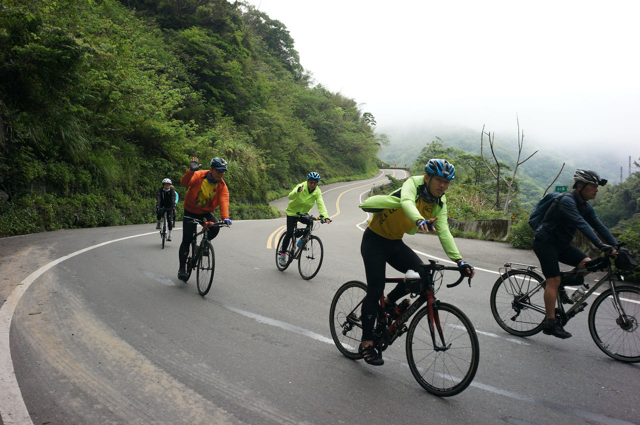
    Fengzhongjian 風中劍 is a 24km cycling route linking up a numbers of roads sprawling across Shilin District 士林區 and Neihu District 內湖區 of Taipei City. It comes with three peaks at 160m, 321m and 600m respectively, and therefore ideal for climb training. The downloadable GPX file of this cycling route is at the end of this post. 

    Its usual starting point as set in this post, Meiti Evacuation Gate, is less than 8km from most parts within the city and easily accessible via the Riverside Bikeways, which also helps make the route popular among Taipei cyclists. After each climb, you can decide whether to keep going or not, subject to your own preference, capability, or time constraint etc. The name of this route, Feng Zhong Jian, is coined by the local cycling communities by taking the first character out of the names of the major roads and locations (Fengguizui, Zhongshe Road, Jiannan Road) that make up this route. The coinage ends up with a hint of grandeur, carrying the meaning “Sword in the Wind” in English.

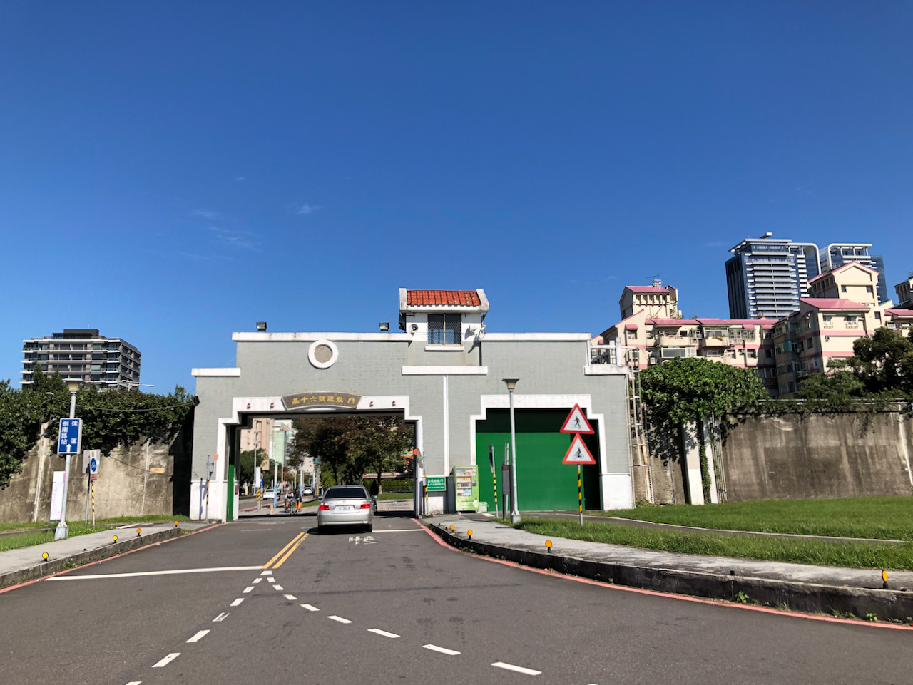
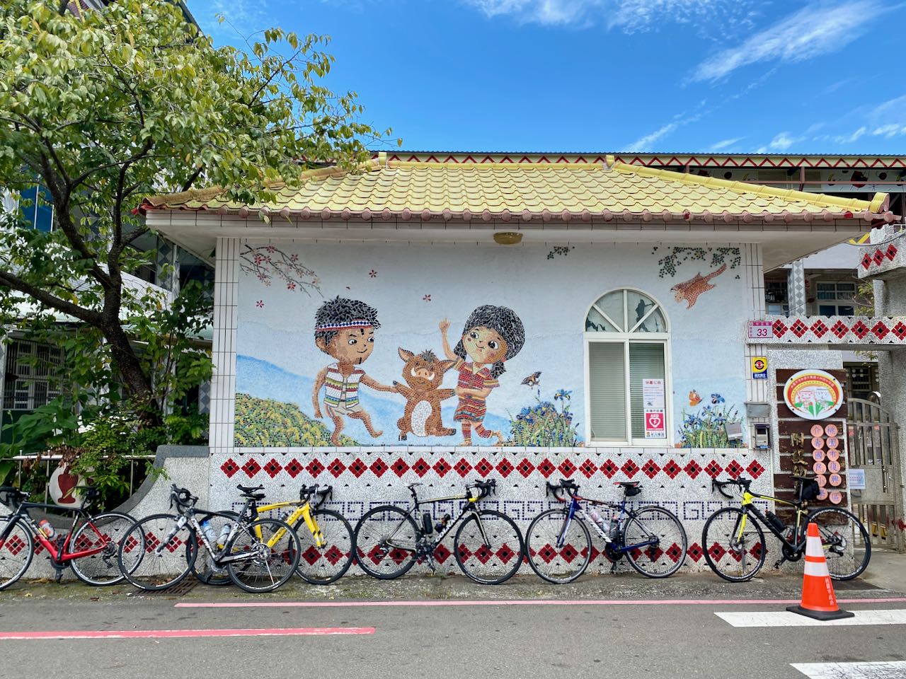
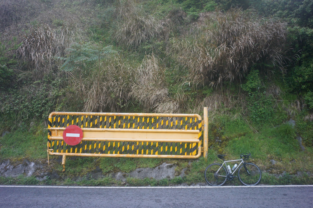
    Meiti Evacuation Gate is one of the access points to the Riverside Bikeways in Taipei. I can’t emphasize enough how enjoyable these bikeways are with their motor vehicle free and traffic light free paths, tranquilising views offered by the surrounding rivers and grasslands, and their vast coverage. You may refer to this post to find the access point closest to your location and have a nice warm up before the climb. Then the GPS links available at the end of this post will guide you through the route from Meiti Evacuation Gate.

    Jiannan Road 劍南路

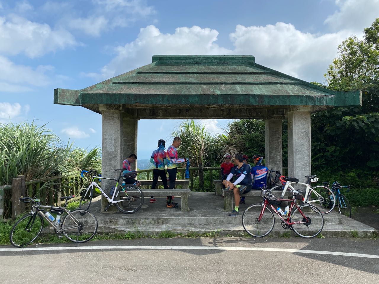
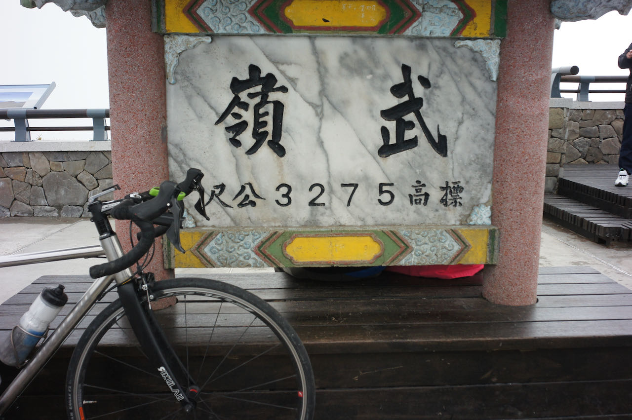
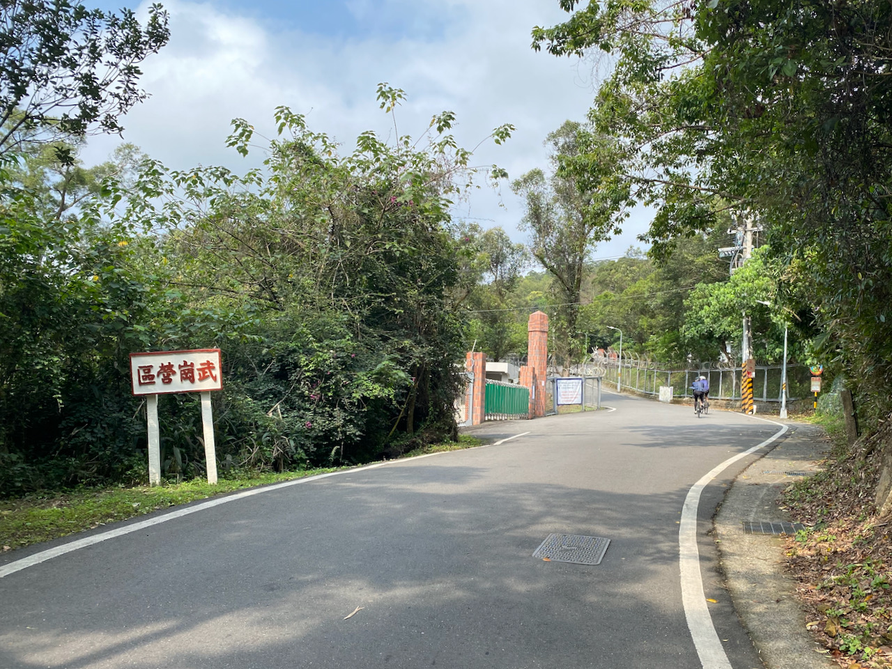
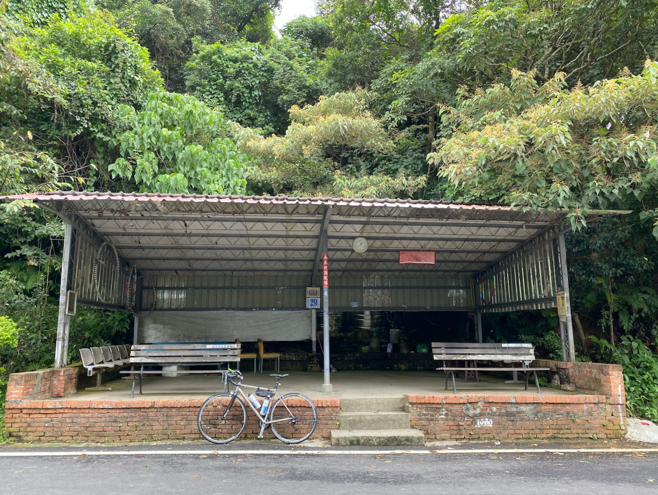
    The first climb you would soon encounter after leaving Meiti Evacuation Gate is Jiannan Road. It is short with little elevation gain. The climb from the southern side is steeper than from the northern side. An elevation gain of 145m in 2.25km means you have an average gradient of 6.4%. Traffic is not busy on this road. Besides some fellow cyclists, you may also meet hikers occasionally. When you see the sign of Wugang Barrack 武山營區, you would have finished half the climb. When you reach the top, there will be a simple shelter for you to take a break.

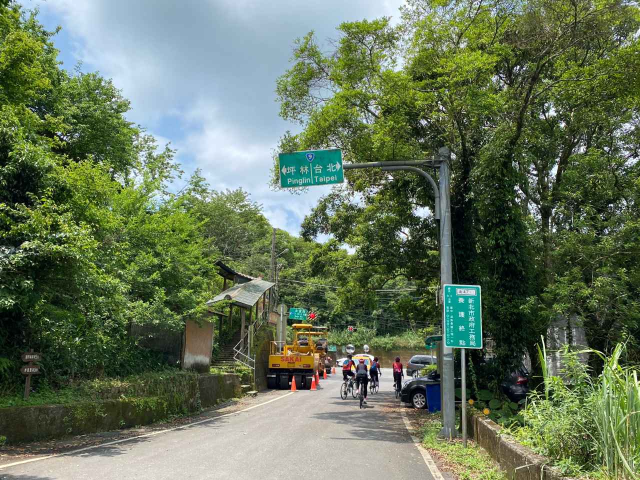
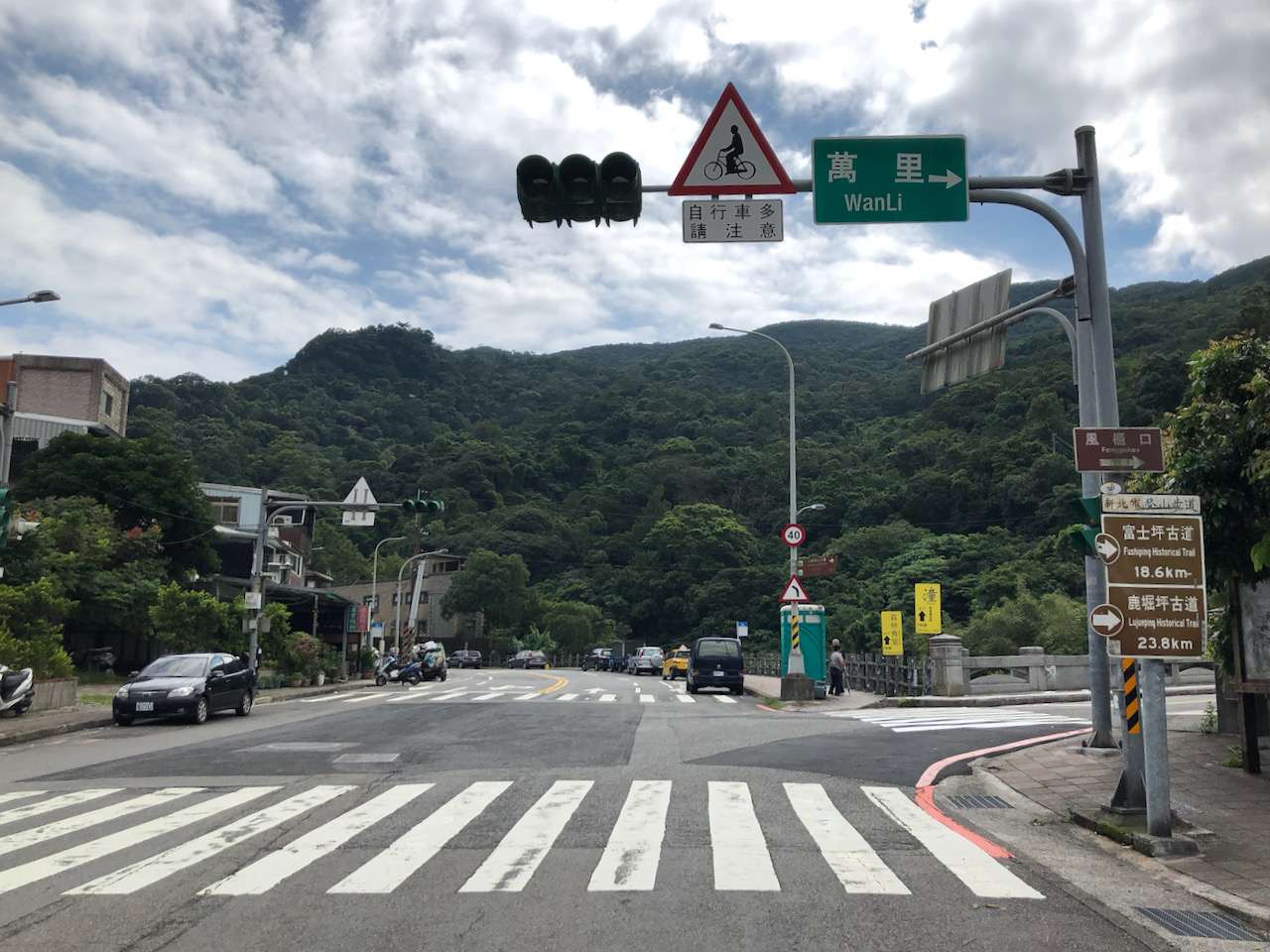
    After that, head north and descend to Zhishan Road 至善路. On this side of the hill the road surface could sometimes be wet as water overflows from the drainage during wet season or after days of rain. There is also a sharp narrow turn. So, take it easy when you do it the first time. 

    When you reach Zhishan Road, you are at an elevation of 50m. Turn right for Zhongshe Road for the next climb.

    Zhongshe Road 中社路

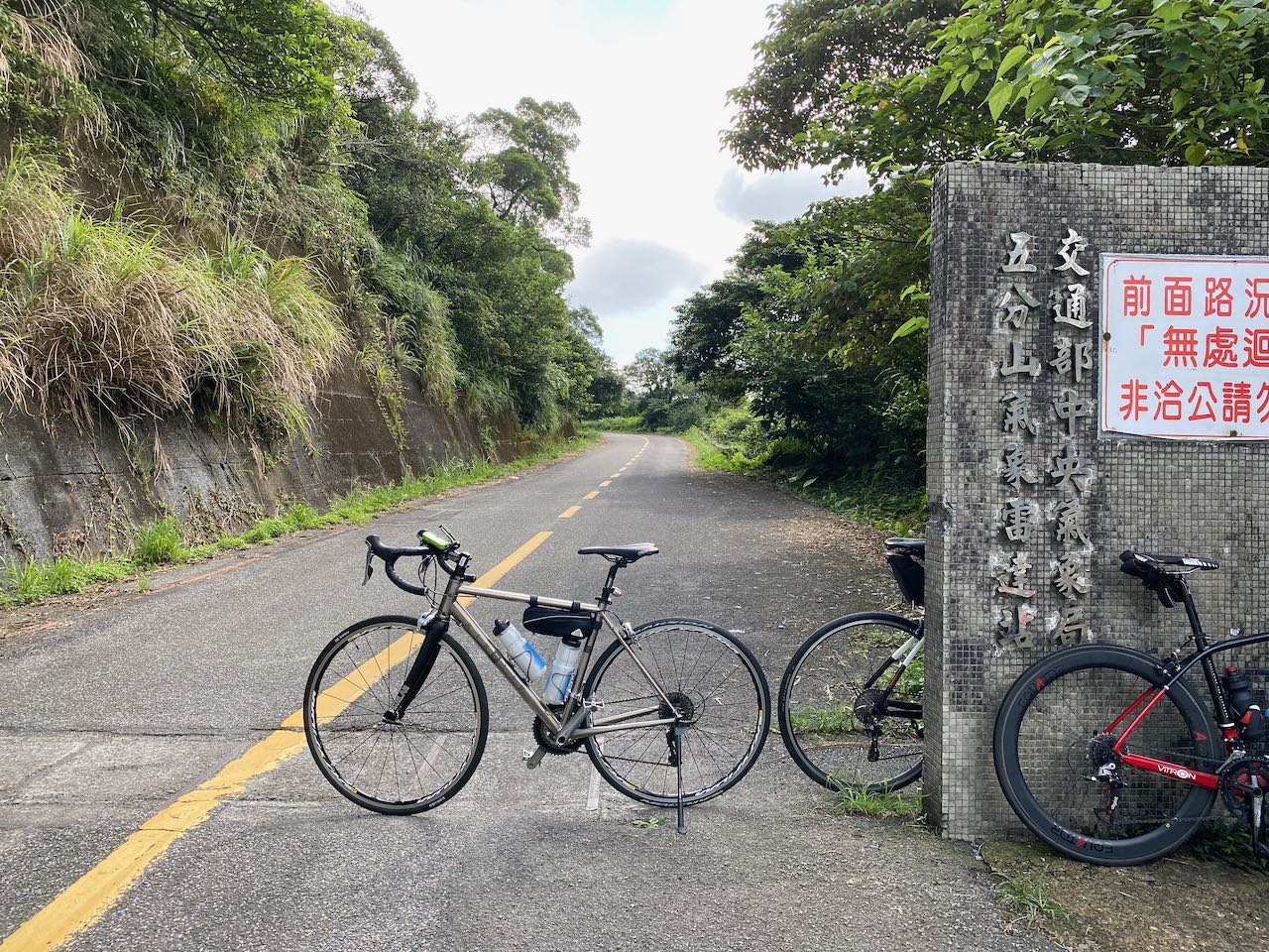
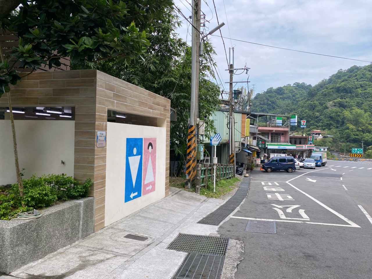
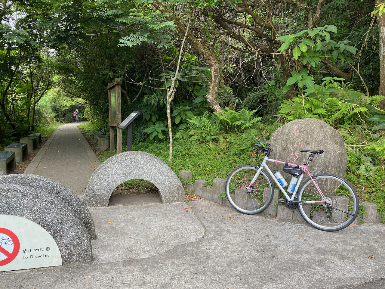
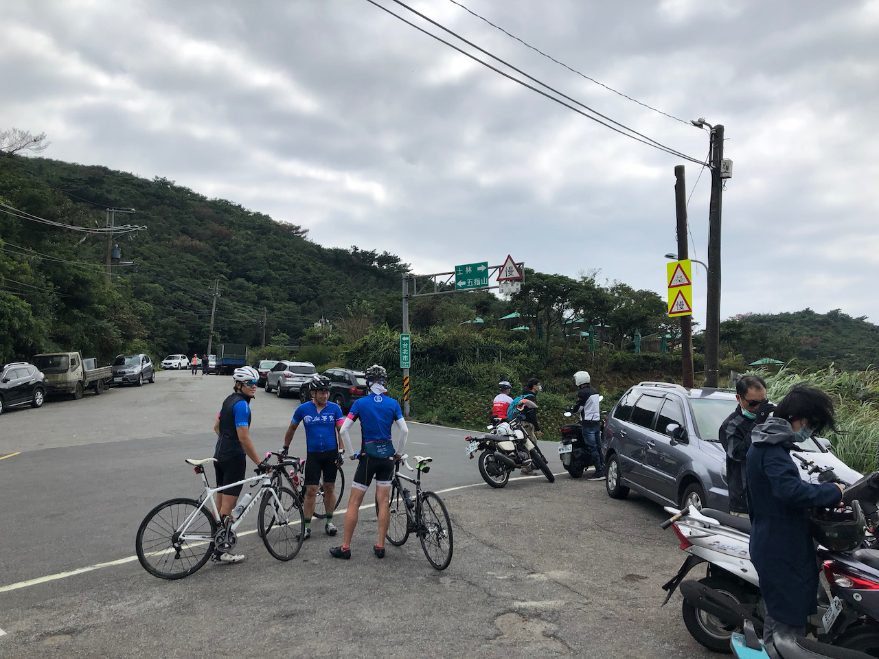
    An elevation gain of 250m in 3.9km makes an average gradient of 6.2%. It is a cul-de-sac leading only to the residents up the hill. There are buses and cars occasionally. But it is totally fine when climbing because the road is wide with a shoulder that serves as a bike lane. At the top, there is a trail for hikers and a portable toilet. 

    Descending on Zhongshe Road is fun because there are several wide hairpin turns. But be careful with the cars and buses as we will use more road surface for turns and some cars may try to overtake bikes.

    Back to Zhishan Road, it’s time to head for the last climb.
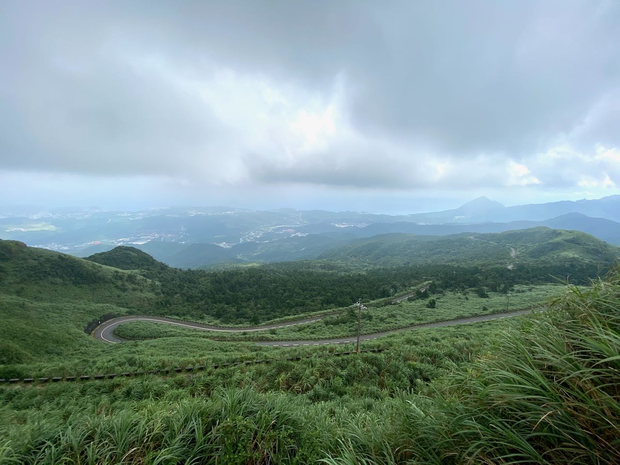
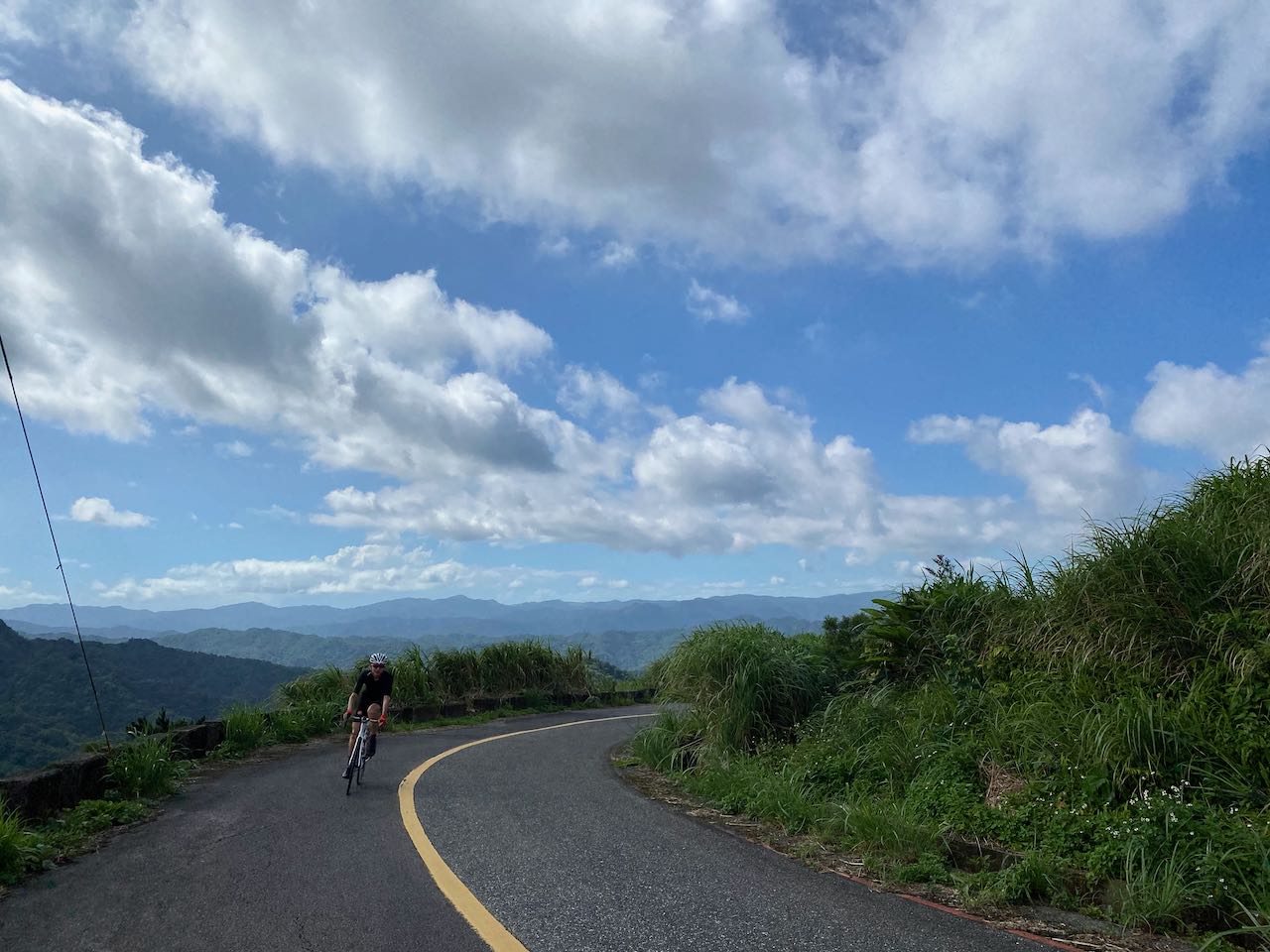
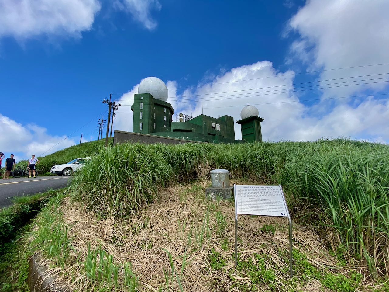
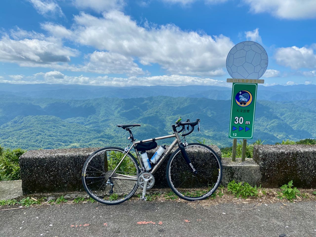
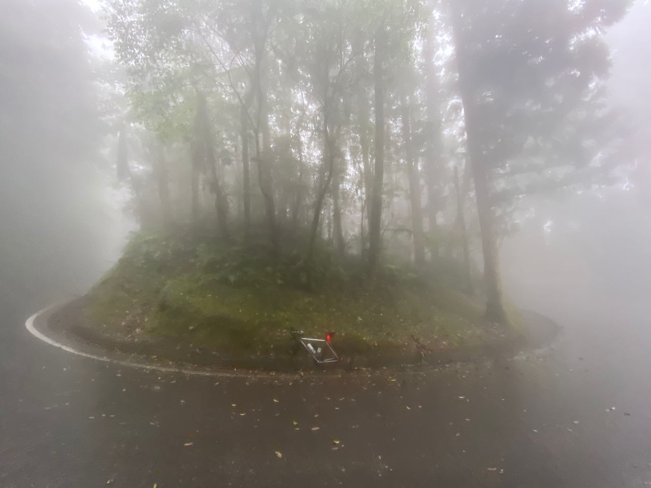
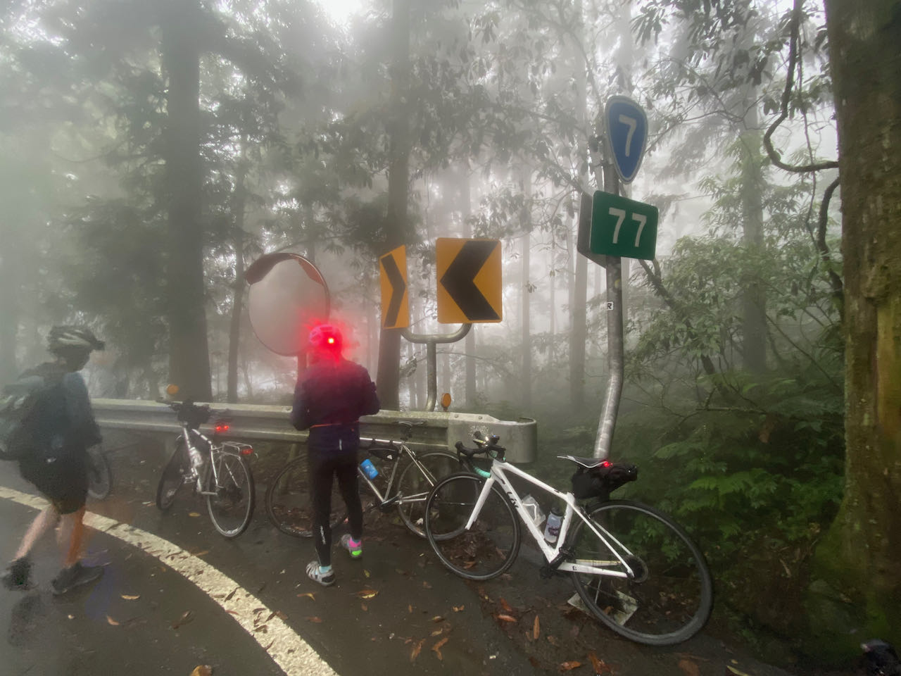
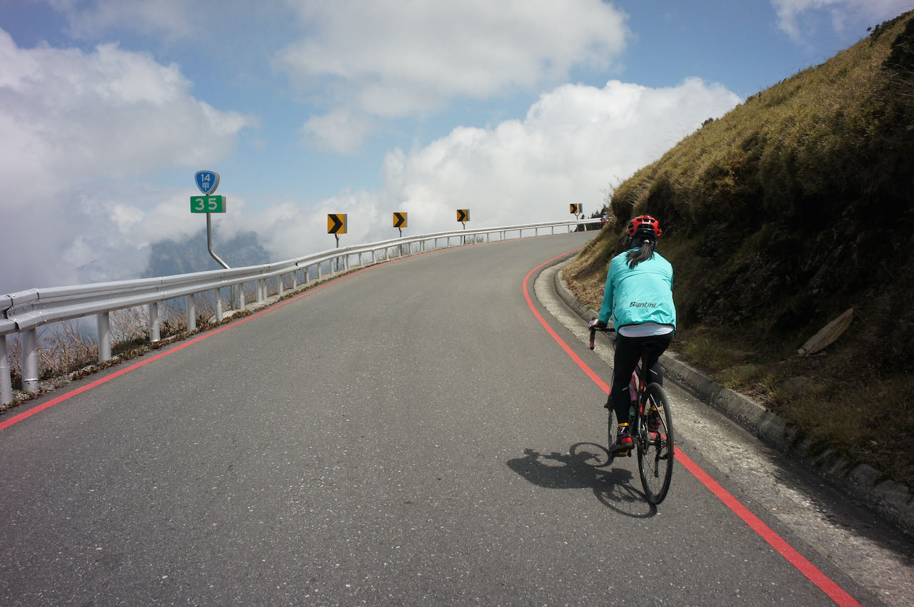
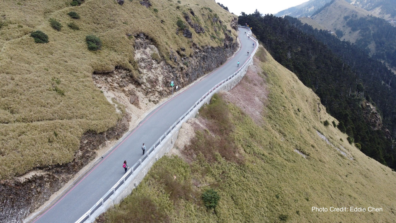
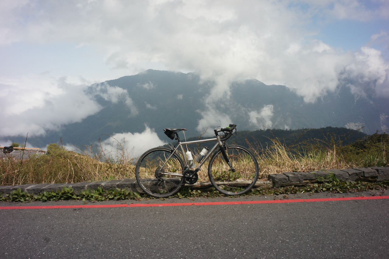
    Fengguizui 風櫃嘴

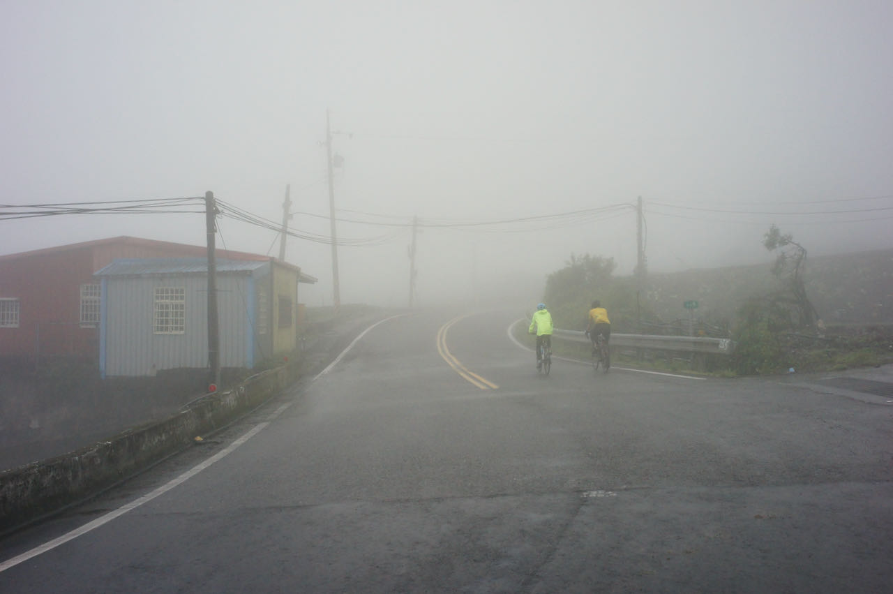
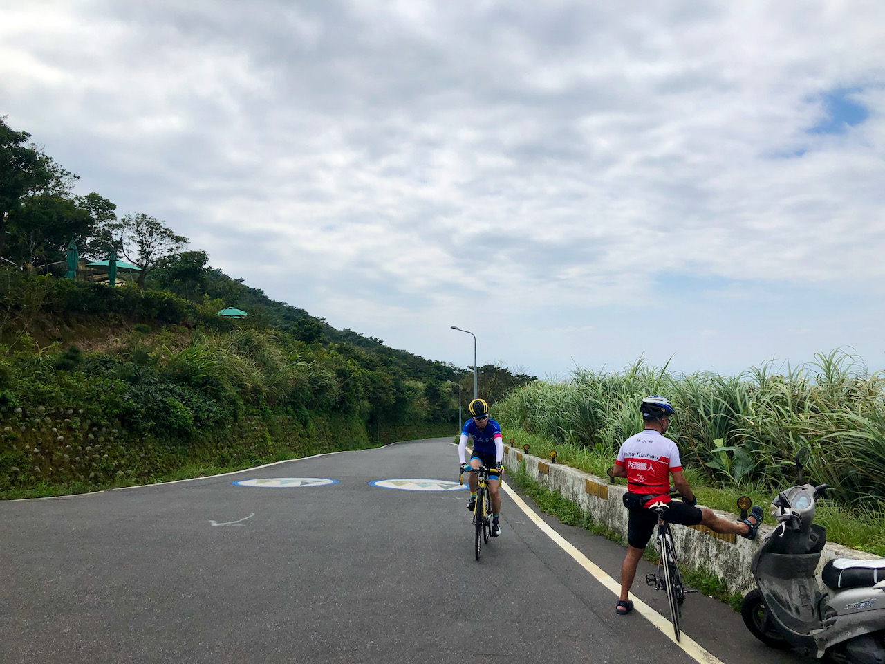
    Shuangxi Industry Road 雙溪產業道路 and Wanxi Industry Road 萬溪產業道路 make up the climbing route to Fengguizui Lookout. An elevation gain of 412m in 6.4km makes an average gradient of 6.4% again. Although this climb is longer with more elevation gain, I found it the most enjoyable and it is one of the most popular cycling routes in Taipei.

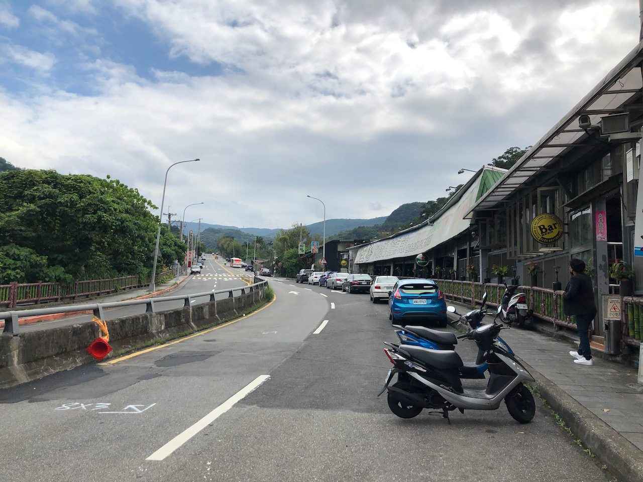
    When you reach the top, the GPX route provided here will bring you back to Zhishan Road and the Riverside Bikeways via the National Palace Museum, using the same route that you have just climbed. Zhishan Road will reward you with a mild long descent but please be aware of the thick rumble strips, which could shake your hands off from your handlebars. So hold them tight.

    Another post for Fengguizui here

    Fengzhongjian is one of my favourite because it offers a lot of flexibility, especially for those who do not have a whole day for cycling or who are not yet competent in climbing. You can always decide when you want to stop and turn around. The route is also so accessible that some people do it in the evening.

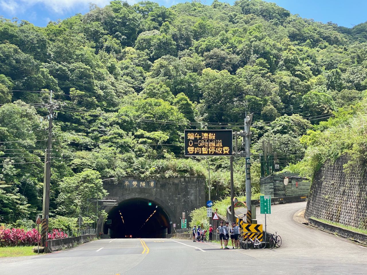
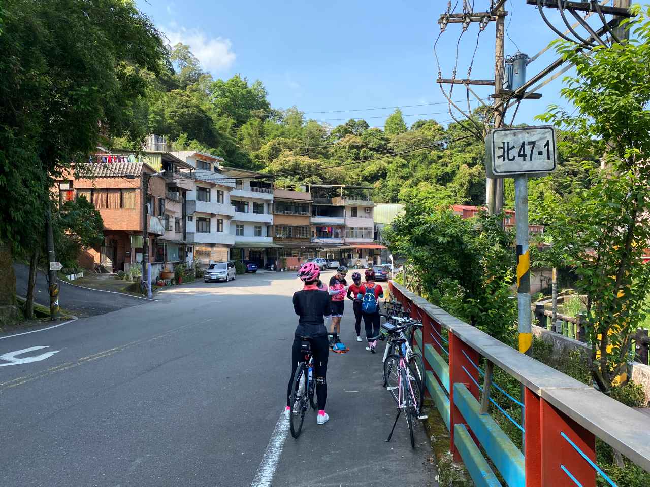
    But if you have time to spare and don’t like returning on the same route, you may head south east after Fengguizui, which will lead you to Dahu Park 大湖公園 in Neihu District of Taipei City (TP28 → Dahu Street 大湖街) or Xizhi 汐止 in New Taipei City (TP28 → TP29) . The route to Dahu Park is quite steep while the route to Xizhi is more agreeable, wide and well maintained. 

    You may also head north along TP28 for the north coast and do a counter-clockwise route to return to Taipei via Tamsui District. There are many points of interests en route and will probably take up a full day.

    Route:

    NOTE: To use the routes, please install the App on your smartphone. The App will launch and load the route automatically after you tap the above links on your smartphone’s browser. For Garmin Connect, you can then use the APP to send the route to your garmin device. If your Garmin device is not purchased in Taiwan, you will also need make sure you have the Taiwan map on your device. Here is our blog post on this topic.

  • Cycling Route: Yulao Lookout – Climb Training

    Cycling Route: Yulao Lookout – Climb Training

    このブログ記事の翻訳を進行中です。もうすぐ完成しますので、後ほど再度ご確認ください。ご不便をおかけして申し訳ありません。現在は、こちらで提供されているGPXルートや地図などの情報を自由にご利用ください。

    On a Friday in October 2020, I went cycling from Yingge District 鶯歌 to Yulao Lookout 宇老觀景台 (altitude 1500m) via the Northern Cross-Island Highway 北部橫貫公路 / 北橫, and then descended to Hsinchu High Speed Railway Station 新竹高鐵站. It was a 127km route with a maximum elevation of 1500m, plotted by my friend Sandy, who would be joining a cycling event the next day in Zhudong Township 竹東鎮 with her friend Teresa. The downloadable GPX file of this cycling route is at the end of this post. 

    She wanted to challenge herself by climbing to the lookout en route. She invited me to join them because the two ladies wanted a guy for company in the wilds. The route looked much like the one we did in Dongyanshan 東眼山, which I had enjoyed a lot. So I immediately said yes without putting much thought into it nor doing any further research. 

    We took a train from Taipei to Yingge and started our trip there at 7:00 am (more details about bikes on public transportations can be found here). We made good progress and merged with the Northern Cross-Island Highway at San-min before 9:00. Then we had some supplies in the convenience store Hilife at Jiaobanshan 角板山. Toilets are available in the gas station nearby. Beyond this little town, the only supplies available (bottled water and soft drinks) will be from those small stalls outside the settlements of the indigenous tribes along the road. From the two Fuxing Bridges 復興橋,  I saw some big trucks on the river bed loading up sand. That explained why there had been heavy trucks passing by occasionally.

    After hanging around there for some photos, Sandy found that she got a flat tire on her tubeless wheel. The sealant inside could only slow down the leaking, so I fixed it by installing an inner tube and at the same time gave the ladies a short course on how to do it. 30 minutes later, we were good to go.

    The Northern Cross-Island Highway (Provincial Highway No. 7) linking Taoyuan to Yilan is one of the three cross-island highways that connect the island’s east coast to its west coast by climbing over the Central Mountain Range 中央山脈. The other two are the Central Cross-Island Highway 中部橫貫公路 / 中橫 (Taichung to Hualien) and the Southern Cross-Island Highway 南部橫貫公路 / 南橫 (Tainan to Taitung supposedly). While the Central Cross-Island Highway becomes so famous because of the Taiwan KOM Challenge, the Southern Cross-Island Highway is still being reconstructed after damages caused by a typhoon in 2009. Some sections of the highway are reopening and attracting many cycling enthusiasts.

    With a total length of 130km and maximum altitude of 1250m, the Northern Cross-Island Highway is so enjoyable and suitable for cycling that I sometimes wonder if it was built especially for bikes. Road surfaces are well maintained except for some sections with the hazard of falling rocks.

    We had a great time cycling in the gorge and reached a junction called Sule 蘇樂 for lunch before 14:00. The small restaurant there was open and serving hot meals. Lucky! At that time, we had covered 53km and reached 660m altitude without spending too much effort on climbing. Yulao Lookout was around 25km away and there was around 900m to climb. And once we reached the top, we just needed to glide back to the ground level without pedalling.

    After lunch, we left the Northern Cross-Island Highway and turned to Yufend Road 玉峰道路  (TY113 or 桃113 and then 竹60-1 or HC60-1) for Yulao Lookout and then Zhudong Township, the east fringe of Hsinchu. The views were even better and we had the whole route to ourselves. Sandy was in the mood of taking short detours to find indigenous tribes settlements and take photos for her social media account. I told Teresa that we might have to descend from Yulao Lookout in the dark because the sun sets around 17:30 in October.

    The mild slopes in front of us fooled us into believing that the route ahead would be easy. Then, we hit the real climb after Yufeng Bridge 玉峰橋. It is a 750m gain in 10km to reach Yulao Outlook, an average gradient of 7.5%. We had long passed the point of no return. We had no choice but to keep going. I was not worn out yet but I needed to get off and push the bike half the time. I needed to be conservative lest I got spasm on my legs. We finally made it to the top to catch the last glimpse of sunlight at around 17:45. All the stalls were closed. Even the police station was vacant. 

    Then it went dark completely when we started to descend. The 20km of 8% downhill slope ahead was not lit. The countless hairpin turns made the descending even trickier. We had bike lights but they could not light up the road far enough. If we went too fast we would not have enough reaction time and could have thrown ourselves into the bush or rocks on any one of the sharp turns. On the other hand, my inability to descend with my hands on the drops had created another problem. I have only been using drop bar road bikes for less than 2 years. I can only do a decent with my hands on the hoods, where the braking leverage is substantially less than that on the drops. Therefore I had to squeeze the brakes very hard to limit my speed because of the slope and poor lighting. Soon I was losing my gripping power. We had to take breaks regularly for my hands to recover. The effortless downhill dive I had imagined turned out to be a survival challenge. There were cars passing by though I had no idea where they came from. One gentleman rolled down his window and yelled “Jiayou 加油” at us to give us some moral support. Thank you! That really helped. I meant it.  At least he did not say that we were stupid. 

    Sandy was not bothered by the aggressive downhill slope even though she could only cycle with her hands on the hoods, too. It’s probably because she weighs around half my weight. Less braking force was needed to control the speed. But she started to worry about the lights. We did not expect to be stuck in the mountain like this and we did not know how long the lights would last because we could not recall when was the last time we charged them. Anyway, this was just a potential problem. We should focus on getting back to the ground level. After something like forever, we finally saw a betel nut stall, the first sign of civilization. I stopped to buy a bottle of water just to reconnect with other human beings. The road was still not lit but the slope got milder which was easier to handle. Then, we were back to those well lit county highways and were able to pick up some speed to get to Zhudong Township, where the two ladies would stay overnight for the event next day.

    After a quick dinner, they went to collect their luggage from a convenience store before checking in to a hotel. They used the courier service of the convenience stores to send their stuff over so that they wouldn’t need to carry the luggages while cycling. For me, there were buses bound for Taipei that could take my bike, but I decided to take the High Speed Railway instead because it is much faster and I live close to one of the stations in Taipei. So, I hopped on my bike and cycled 12km more to the Hsinchu HSR station. When I reached the station, it was around 3.5 hours after we left Yulao Lookout. In an hour, I would be home.

    It is an unforgettable cycling trip. I will definitely try to complete the Northern Cross-Island Highway in the future. But we have to be more careful when planning for a long cycling trip in an area where the population is so sparse. We were really lucky this time. There were many things that could have gone wrong. What if the restaurant was not open? We would have to climb with empty stomachs.  What if it got cold and wet when we were heading down from the top? Our fingers would have been frozen and unable to control our speed. What if either one of our lights were out of battery… 

    Be well prepared. I don’t just mean your bike, but also your muscles. Fuel them with plenty of carbohydrates. Don’t follow your friends blindly. They don’t know your limits. Study the route beforehand and plan your time carefully. This is a lesson I learned from this trip. 

    Routes:

    NOTE: To use the routes, please install the App on your smartphone. The App will launch and load the route automatically after you tap the above links on your smartphone’s browser. For Garmin Connect, you can then use the APP to send the route to your garmin device. If your Garmin device is not purchased in Taiwan, you will also need make sure you have the Taiwan map on your device. Here is our blog post on this topic.

    Afterwords

    After writing this post, I learned the story about Daniel Greenhoe, an American PhD student studying in Hsinchu years ago, who once volunteered to teach English in a small primary school in Shihlei 石磊, after learning that the school was struggling to find an English teacher to teach the kids of the indiginous Taiya tribe. He started to travel the 60km with 1700m of climbing in the small hour of every Monday for 3 years. The vehicle he used was a mountain bike. The route he climbed was the one that had freaked me out when I was descending.

    More details here:

    https://www.taipeitimes.com/News/taiwan/archives/2006/01/17/2003289400

  • Cycling Route: Dongyanshan – Climb Training

    Cycling Route: Dongyanshan – Climb Training

    このブログ記事の翻訳を進行中です。もうすぐ完成しますので、後ほど再度ご確認ください。ご不便をおかけして申し訳ありません。現在は、こちらで提供されているGPXルートや地図などの情報を自由にご利用ください。

    I went cycling from New Taipei’s Tucheng (土城) to Dongyanshan (東眼山; literally “Eastern Eye Mountain”) National Forest Recreation Area in Taoyuan County with a small group of friends on a Sunday in September 2020. It was a 71km loop with the maximum elevation of 913m, plotted by Sandy Wang, a cycling enthusiast. The starting point, and also the end point, is at the southern terminus of Taipei Metro’s Blue Line, Dingpu Station. The downloadable GPX file of this cycling route is at the end of this post. 

    I took the earliest metro with my bike from home and arrived at Dingpu before 7:00 am. There were already some other cycling groups gathering outside the convenience stores, of which you can be pretty sure to find one or two within the proximity of MRT stations, train stations, etc. We then had a quick breakfast and set off on Provincial Highway No. 3.

    Traffic was not very busy but there was some overhead road construction work going on along the route. It got quieter and the air became fresher as we headed into the valley on Township Road TP110 and TP TP114 (shown on Google Maps as 北110 and 北114 respectively). I loved this route already. 

    After crossing a small bridge, we switched to Provincial Highway 7B (Shown on Google Maps as 7乙). This is the Northern Cross-Island Highway (北部橫貫公路/北橫), which is one of the 3 Cross-Island Highways (橫貫公路) that could bring you to the other side of the island by climbing over the Central Mountain Range 中央山脈, and this is one of the favorite highways among cyclists and motorcyclists. We soon left the highway by turning into a small road to take a look at an old small church built by the local Atayal tribe, Jiguopai Church. Some pictures of the Jiguopai Church here.

    We had to get off our bikes midway and push them uphill because it was too steep to cycle. We heard dogs barking somewhere nearby. We made sure to stay on the road and not to step into their territory. We then met a young guy heading towards the same destination, who stopped to ask us direction. He was doing the around-the-island on his motorbike. We knew this because he had a foam board on his back showing his progress. To cheer him on and to show support, a breakfast shop owner had given him more sandwiches than he could finish before they went bad. We had the honor and pleasure to share some.

    Unfortunately, when we arrived at the church at last, we found it closed temporarily but without a solid plan as to when to open again. So, before you can be certain that it is reopened, if you are going to follow this route, it may be a good idea just to stay on Provincial Highway 7B and instead pay a visit to the Daxi Tea Factory (大溪老茶廠) enroute before heading for the next stop. 

    The next stop, a small town named Fuxing (復興), is where you can get a cup of nice peach smoothies and a roasted pork sausage seasoned with May Chang or Maqaw, a special kind of pepper. The peach smoothies store that sits right opposite the Jieshou Elementary School (介壽國小) offers unlimited refills for people with cycling outfits. Getting a refill there was on the bucket list of a member in our group. She had one item ticked off that day.

    After the treat, we were back on Provincial Highway No. 7 and then switched to County Highway TY119 (shown on Google Maps as 桃119) for the last climb to Dongyanshan. TY119 is another nice route to climb: quiet with fresh air, lots of shades, and well maintained road surfaces. 

    As we were getting closer to the top, the slope became milder and the dense vegetation disappeared, replaced by a vast view of the mountain ridges. We reached a gate (altitude 913 m) leading to the recreational area. An entrance fee of NTD 100 per head will be charged. There is a viewing platform at the peak (altitude 1212m) around 4 km from the gate. But unfortunately, the hiking trails in the paid area are not cyclable. We were also told that we could not push bikes into the paid area, where there was parking space for cars, which seems really unreasonable for me. Although there was a rack for parking bikes outside the gate, we did not want to leave our bikes unattended for hours. So, we decided to call it a day and started our return leg.

    We were back at a Y- junction, supposedly with County Highway TY119 on the left and County Highway TP113 on the right. But the road on the right looked so small and rugged that we wondered if that was really TP113. A cyclist climbing up from that road confirmed it was and the condition was not as bad as it looked outside. We descended 630 metres in 8.7km (average gradient 7.2%) via that road and had lunch in the first restaurant we saw. The descent was so quick that I had to equalize pressure on either side of the eardrum.

    Then it was a straightforward way back to Dingpu for an MRT ride home. 

    I would suggest avoiding using this road for descent when it is wet because I saw some residue of mosses even on the centre of the road. That means the road will get really slippery if it gets wet. It may be a good idea to cycle this route clockwise. The climb would be much harder but the descent would be mild and safer. Dongyanshan is said to be a difficult climb because most cyclists will do it this way.

    Follow Up:

    We wrote to the Forestry Bureau for the possibility of parking the bikes inside the gate. The message was heard and they will consider doing it.

    Routes:

    NOTE: To use the routes, please install the App on your smartphone. The App will launch and load the route automatically after you tap the above links on your smartphone’s browser. For Garmin Connect, you can then use the APP to send the route to your garmin device. If your Garmin device is not purchased in Taiwan, you will also need make sure you have the Taiwan map on your device. Here is our blog post on this topic.

  • Cycling Route: Wufenshan and Buyan Pavilion – Climb Training

    Cycling Route: Wufenshan and Buyan Pavilion – Climb Training

    このブログ記事の翻訳を進行中です。もうすぐ完成しますので、後ほど再度ご確認ください。ご不便をおかけして申し訳ありません。現在は、こちらで提供されているGPXルートや地図などの情報を自由にご利用ください。

    I went for a cycling trip with a group of cyclists in the outskirts of Taipei on a Saturday in mid June. It is a 67km loop with two climbs to Wufenshan Meteorological Radar  Observatory 五分山氣象雷達站 (757m) and Buyan Pavilion 不厭亭 (530m). The route is designed by Sandy, my cycling enthusiast friend who wanted to offer a group of cyclists from the southern part of Taiwan an unique cycling experience here in the northern part of the island. The downloadable GPX file of this cycling route is at the end of this post. 

    For people living in Taipei city, we can just hop on our bike, head towards a random direction, and there will be a cycling route waiting for us. We can reach those small quiet towns in the outskirts of the city in 1-2 hours. However, in order to get away from the city traffic as soon as possible and spend more time in the countryside, we sometimes take the train with our bikes to get away from Taipei first and begin our ride somewhere else. That day I was to meet my friends in Ruifang Station 瑞芳站 at 6:30 am. I bagged my bike, boarded the earliest north-bound train at Nangang Station 南港站, and arrived at Ruifang Station in 40 minutes. Please refer to this post for more information about traveling with your bikes on public Transportation in Taiwan

    I found a breakfast shop next to two convenience stores (7-Eleven and OK mart) outside Ruifang Station. It offers a wide range of traditional picks that turn plain flour into different kinds of products like deep fried bread sticks, clay oven rolls, and steamed buns of sweet or savory favors. The soybean milk had a slightly burnt taste, which I found really good to go with a clay oven roll. I usually prefer not to eat too much carbohydrate but I needed to load up some energy for the climbs that day. 

    After meeting up and exchanging some greetings, we headed off to County Highway 106 via Provincial Highway 2D (Shown on Google Maps as 2丁) for the first climb. I had cycled on County Highway 106 a couple times before, but all in the opposite direction, starting off from Nangang, and for a descent. I always found the road rather steep. However, when doing the climb, it wasn’t as bad as I had expected. The first part of the first climb, which is around 7.63km, with an elevation of 476m (average gradient around 6.2%) was completed in an hour. It was probably the 14 sharp turns on this route, rather than the gradient, that made me nervous when I was descending.

    After taking a short break chatting with the teammates underneath a small pavilion, where we enjoyed some breeze and the sea view, I reached a familiar junction with a U-turn that leads to a small path for more climbing. I had passed this junction in my previous rides and had always felt relieved for the fact that I didn’t have to take this route after cycling for around 40km from Nangang. But this time, we were going this way because it was the detour mapped out by Sandy that would bring us to the Wufenshan Meteorological Radar Observatory. It turned out to be one of the most enjoyable climbs I have ever done. I reached a state of euphoria in a split second as soon as I arrived at the first turn, which rewarded us with a panoramic view of the peaks sitting on multiple layers of ridges and the sea afar. It was another climb of 281m in 4.55km but I did not notice making any effort reaching the top. There were fellow cyclists doing climb sprinting along the route. If you stop to take pictures, please watch out for speedy bikes coming both ways. 

    We took a dive from the top (757m) all the way to Shifen 十分 (elevation 175m), a small town in a valley, for a short break and some supplies. Shifen had been attracting hordes of tourists for its signature activity of sky lantern launching. Before sending your sky lantern up into the air, you can make wishes by writing them down on the lantern. It must be fun to do that. However, the industry is under the accusation of causing environmental issues and wildfire risks. I surely don’t want the lantern with my wishes on it dangling on a tree and becoming an eyesore of an otherwise beautiful valley, nor do I want it setting fire to someone’s home. To address these issues, the industry and the Tourism Bureau have formulated some countermeasures, including restricting the launch to certain areas, limiting the amount of fuel in the lanterns so as to prevent them from traveling afar. There are also schemes implemented to retrieve and recycle the used lanterns. A local cultural preservation group even developed a new kind of lantern that will self-incinerate in the air after launching, which I find a very good idea. Now I’m more willing to have a try. 

    We took the Provincial Highway 2C (shown on Google Maps as 2丙) to the next town, Shuangxi 雙溪, for lunch. It was another thrilling speedy glide on the wide and straight highway, after climbing a short slope to the tunnel. If you see a spike on the elevation profile on your GPS route, it’s probably because your GPS App fails to recognise the tunnel and tracks it as if you have climbed over the hill. Before we reached Shuangxi, we switched to a small road along a stream for less traffic and more shade. GPS route is available at the end of this post.

    We set off to Buyan Pavilion refreshed. It’s harder for this climb because of the heat in the afternoon. On the other side of the hill sits an interesting town, Jiufen 九份, where Sandy had plotted an eventful route full of interesting spots for the group to visit. But I realized mid-way through the climb that I probably shouldn’t stick with the plan. As I had another cycling trip with a new friend early next morning and I had no idea what his average speed would be, I did not want to exhaust all my strength, risking not being able to keep up with him. So, not without regret, I returned to Shuangxi, packed my bike and took the next train home. 

    That was a wonderful trip. I will surely do it more in the future. As shown on the GPX route at the end of this post, after descending from Buyan Pavilion, there are two branches before reaching the coastal line. The first one to Jioufen Elementary School is for a dessert shop that serves shredded ice topped with taro balls. Located on the edge of the hillside, the shop offers a nice sea view to customers along with delicious desserts. It’s very popular amonglocal cyclists. The other branch leads to an old small canal bridge, which is very photogenic. And there are yet more to be visited. 

    Thank you Sandy for designing such a wonderful route. 

    For more information about Buyan Pavilion, here is another post. https://www.bikeexpress.com.tw/2019/cycling-route-buyan-pavilion-climb-training/

    Routes:

    NOTE: To use the routes, please install the App on your smartphone. The App will launch and load the route automatically after you tap the above links on your smartphone’s browser. For Garmin Connect, you can then use the APP to send the route to your garmin device. If your Garmin device is not purchased in Taiwan, you will also need make sure you have the Taiwan map on your device. Here is our blog post on this topic.

  • Cycling Route: Crocodile Island – Climb Training

    Cycling Route: Crocodile Island – Climb Training

    このブログ記事の翻訳を進行中です。もうすぐ完成しますので、後ほど再度ご確認ください。ご不便をおかけして申し訳ありません。現在は、こちらで提供されているGPXルートや地図などの情報を自由にご利用ください。

    I went for a cycling trip with a small group of local cyclists on a Saturday in May, to get a good look at the Crocodile Island 鱷魚島, which can be found in the Fei-ts’ui Reservoir 翡翠水庫 in Shiding District 石碇區 of New Taipei City. It is a 41km route with a maximum altitude of 583m and an elevation gain 1871m. The cycling route is designed by the group leader Sean Fang. The GPX file is downloadable at the end of this post. 

    We met at 7:30 am outside Taipei Zoo, and then took County Highway 106B (shown on Google Maps as 106乙) to a junction where 106B meets 106. With two big convenience stores (7-Eleven and Family Mart) and some parking space available, this junction has become a popular stop among cyclists and motorcyclists for toilet breaks and supply. It’s particularly crowded during weekends, so you better park your bike securely before getting into the stores, lest some careless souls may hurt your beloved one by accident.

    After getting what I needed in one of the convenience stores, I was called by my friends to help a young lady cyclist who can’t speak mandarin. Turned out she was looking for the toilet, which was apparently in short supply in this area. The shopkeeper was so kind that he let her use the one reserved for staff. 

    Let me sidetrack a bit to talk about toilets in Taiwan. Only a special kind of toilet paper, which is specifically designed to be dissolvable in water, can be flushed down the toilets in Taiwan. But in old buildings or many rural areas where the draining pipes are old and narrow, toilets get clogged very easily, especially when they are in heavy use. That’s why you can always find a garbage bin inside the compartment of those toilets, which is where the used toilet paper is meant to go. Please do not hesitate to use it. Otherwise you may be left in a very embarrassing situation. And when enough toilets are clogged, shopkeepers may stop letting us use their toilets. 

    So, we continued on the County Highway 106B and then made a right turn onto the Township Road TP47 (Shown on Google Maps as 北47) after passing the small town called Shiding.

    TP47 splitted into TP47 and TP47-1. We were supposed to take TP47-1 and start the climbing. But this turn is a bit tricky – Sean had led us to a wrong path even though he was the one who plotted the route and it was not his first time here. Anyway, we realized our mistake soon enough as the road became impossible for cycling.

    TP47-1 is good for cycling in late spring and summer as the trees along the route will protect us from the sun. That day there were practically zero motor vehicles but we had several cycling groups doing the climb with us. Around midway of the route, there was a handmade noodle workshop, HSU’s Noodle, where visitors could try making their own. For us, it was a nice location for taking a break and getting some supplies. It’s also interesting to see how noodles are made in the traditional way. 

    We reached the top and met Beiyi Road (Provincial Highway No. 9). It was a good climb, but I don’t think it’s a good idea to descend on this route because the shade beneath the trees keeps the surface wet and thus makes it a hotbed for slippery mosses. We actually saw an ambulance rushing past us that day, possible for a bike accident. A member of our group told me that they would have cancelled this trip if it had rained heavily the previous day because the road surface might not have enough time to dry. And if it’s summer, you’d better end the trip around noon because there usually are thunderstorms in the afternoon. 

    So, we were on one of the twin peaks on Beiyi Road, which connects Taipei and Yilan County. Some cyclists who do the around-the-island anti-clockwisely would take this route to get back to Taipei. It is the final leg and the end of the final climb. After that, all they need to do is a long descent all the way to Taipei to complete the loop. A coffee shop and some traditional food stalls are here to help make an early celebration. 

    We were also heading to Taipei from here but would make a detour first to take a look at the Crocodile Island. We needed to switch to a small road right next to a small police station after a short descend. So, take it easy and don’t go too fast or you will miss the turn. 

    The detour was around 2.5 km on a small road with an elevation profile shaped like a “V”. It was so steep that, when descending, some in our group found themselves not able to keep their grips firm on the brakes. And when ascending, we all gave up riding and pushed our bikes to the first viewing platform after passing by a beautiful tea farm. Those on motor vehicles were so impressed that we could make it there on bikes. 

    In order to get to a better viewing spot, we left our bikes and hiked a short trial. It may be a good idea to bring a bike lock if you want to have greater peace of mind. 

    The return leg was simple. We headed back to Beiyi Road and took a long thrilling descent to Xindian MRT station. 

    That was a wonderful route. Thank you, Sean.

    Routes

    NOTE: To use the routes, please install the App on your smartphone. The App will launch and load the route automatically after you tap the above links on your smartphone’s browser. For Garmin Connect, you can then use the APP to send the route to your garmin device. If your Garmin device is not purchased in Taiwan, you will also need make sure you have the Taiwan map on your device. Here is our blog post on this topic.

  • Cycling Route: Xiong Kong Tea Plantation – Climb Training

    Cycling Route: Xiong Kong Tea Plantation – Climb Training

    このブログ記事の翻訳を進行中です。もうすぐ完成しますので、後ほど再度ご確認ください。ご不便をおかけして申し訳ありません。現在は、こちらで提供されているGPXルートや地図などの情報を自由にご利用ください。

    I went for a cycling trip from Xindian 新店 to Xiong Kong Tea Plantation 熊空茶園 with a group of local cyclists on a weekend in May. It was a 60km route with two climbs (338m, 728m), planned by one of our fellow cyclists Martin. The tea plantation is operated by Taiwan Tea Corporation 台灣農林 (TPE: 2913), formerly known as Mitsui & Co., Ltd., which was founded in 1899 during the Japanese rule. The downloadable GPX file of this cycling route is at the end of this post. 

    We met at 7:20 am in the convenience store near Xindian MRT station. It had been transformed, by different cycling groups meeting up there, into an outdoor showroom of advanced bikes, cycling outfits, and various cycling accessories. With two convenience stores located conveniently near the MRT station, and a well-maintained toilet inside the MRT station, this spot serves as the default starting point for a number of popular cycling routes, including the section of Provincial Highway No. 9 connecting Taipei and Yilan (Beiyi Road 北宜公路), and the No. 9A (9甲) which brings you to the Wulai District 烏來區 (Xinwu Road 新屋路). 

    After socialising with others and filling up my bottles, I set off with the group to cycle along County Highway No. 110. The first climb soon appeared on our left-hand side on Chezi Road 車子路, leading to Daguan Road 達觀路. Motor traffic was practically zero as it is a cul-de-sac at the top with only a handful of residential buildings sitting along the road. We took a long break at a small pavilion just before we reached the top of the climb. It was a good warm-up to climb 305m.

    Then, Martin showed us a shortcut right next to the pavilion, which leads to the Erbazi Botanical Garden (二叭子植物園) via a series of short stairways. You will have to carry your bikes if you want to take this shortcut, but we all found it worth the effort as it was a beautiful garden. Also, by taking this shortcut, you can avoid descending on the same route.

    Where the botanical garden is located is a humid valley. Plants love humidity. Mosses are growing on the cement surface of the paths in this area, which make them slippery all the time except for a bright sunny day. It’s especially dangerous on the steeper parts, so walking with your bike is mandatory in this case. Go with your walkable pedal shoes if you plan to take this route. We were lucky to have the sun high up and dry the mosses, so that we could ride on our bikes slowly back to the main road.

    When we were back on County Highway No. 110, we started heading to the Sanxia District 三峽. Traffic was not busy and we could set our own pace without pressure. We reached a small town called Jiou Jiou 九鬮 with several stalls selling very juicy roasted pork sausages. Make sure you have more of those before the real climb to Xiong Kong because, at the top, there is only one small restaurant with very limited capacity. On that day it took them 45 minutes to prepare some very standard meal sets for us. 

    After the feast of pork sausages, we went to the 7-Eleven (address: No. 241, Chengfu Road, Sanxia District, New Taipei City, 237) around 300m ahead along County Highway No. 110 for water supply. It’s also good for some more snacks. I would have done that if I had known I would need to wait that long for my meal. The 7-Eleven also comes with a toilet. If you miss this chance, there is another toilet stop 2.3km away at the Daliao Tea House. The tea house is an old Japanese building built in 1944 as the residence of the chairman of the Taiwan Tea Plantation Corporation. We visited it only on the return leg because we did not want to start our climbing late. It’s better time management, I think.

    The climbing starts on the quiet Zhulun Road 竹崙路 (Township Road 北109). Road signs for the tea plantation were clearly displayed along the road. First half of the path was wide. Road surface was well maintained and smooth. The slope was moderate. There were cars and motorbikes passing by sporadically. We all shared the same destination as this road is also a dead end. After the first half, cracked surfaces and small pieces of broken concrete appeared. Roads got narrower, cracks deeper, slopes steeper, and turns sharper as we were approaching the top. I was told that a cyclist friend once had a minor accident on the descending leg when a trailing car imposed pressure on her. Her wheels slipped sideways on the edge of the cracks. She lost balance and fell. Fortunately, her bike was fine and she had minor injuries only. Anyway, this must be an enjoyable route for her, or she wouldn’t have joined us this time. 

    I made it to the top sooner than I had expected. A short, mild downward slope brought me to the entrance of the tea plantation. A wide planform with tables for people to enjoy the vast view of the hills caught my eyes. On my right-hand side, there was a trail leading into a small forest of tall straight pine trees (Japanese Cedar). A billboard showing the elevation of 700 metre was set up right next to the gate of the tea plantation on the other side. They charge NTD100 per head for each visit, which will be rebated when you shop in the souvenir shop. Fair deal. But for us, it’s enough just to stay outside for the views and some food. 

    The descent from the top was tricky because of the condition of the road. When my bike rolled over the cracked surface, my hands were almost shaked off the handlebar. I was lucky to do the ride with a Rikulau Audax Hercules, a flat-bar road bike. I could hold the grip and the brakes securely without making my hands numb. If I had been on a drop-bar, I might have had to stop and let my hands take a break. 

    The return trip to Xindian was very straight forward. That was enough for the day. It was a weekend and I took MRT home with my bike.

    For those who want more, the New Taipei City Yingge Ceramics Museum is 10km away from Jiou Jiou 九鬮. The building itself is nice and worth a visit even if you are not interested in ceramics. There is an outdoor water plaza for some water fun in the summer. Kids love it. Then you may either take a train back to Taipei or cycling back along the Dahan River Bikeway. 

    Routes

    NOTE: To use the routes, please install the App on your smartphone. The App will launch and load the route automatically after you tap the above links on your smartphone’s browser. For Garmin Connect, you can then use the APP to send the route to your garmin device. If your Garmin device is not purchased in Taiwan, you will also need make sure you have the Taiwan map on your device. Here is our blog post on this topic.

  • Cycling Route: Maokong Loop – Climb Training

    Cycling Route: Maokong Loop – Climb Training

    このブログ記事の翻訳を進行中です。もうすぐ完成しますので、後ほど再度ご確認ください。ご不便をおかけして申し訳ありません。現在は、こちらで提供されているGPXルートや地図などの情報を自由にご利用ください。

    Maokong Loop is a 13km long, single-peak (326m) cycling route in Wenshan District, South East of Taipei City. We went there on a public holiday in May, me on a Rikulau Audax Hercules and Lois on a Klever Q Comfort. The downloadable GPX file of this cycling route is at the end of this post. 

    Maokong is a popular tourist area where people can take the Maokong Gondola at the Taipei Zoo Station (next to the Taipei Zoo MRT Station of the Brown Line) to the top of the hill, take a leisure walk along the route on the peak, and enjoy the panoramic view of Taipei City with a cup of tea grown locally in one of the many tea cafes scattered around. This area used to be the biggest tea plantation in Taipei. As for kids, there is of course the amazing Taipei Zoo at the foot of the hill that never fails to offer joy and wonder. 

    To get to the starting point of this route, simply set your GPS navigation to this address: “No. 12, Section 1, Xinguang Road, Wenshan District”. It’s a 7-Eleven with a spacious area outside where you can park your bikes. If you start your ride early enough in the morning, say around 6:00, road traffic should be quite sparse and you will take less than an hour to get there from the centre of Taipei. 

    Strava (anti-clockwise): https://www.strava.com/routes/26747667

    If you start late and want to avoid the traffic, you may take the MRT Green Line to Jingmei Station, as the Brown Line does not take bicycles, and then use the following route to get to the starting point:

    Strava: https://www.strava.com/routes/26748715

    Taipei MRT takes bikes during weekends and between 10:00-16:00 on weekdays, except the Brown Line and a few busy stations. 

    If you are in the west side of the city like Datong District, Zhongzheng District, or Wanhua District, you may take a pleasant detour along the Riverside Bikeways to get to Maokong. We have compiled a list of the access points to the Riverside Bikeways in this post.

    As to us, we live on the east end of Taipei. There is a popular and well shaded cycling route linking up that part of the city and the area around Taipei Zoo, by going along Section 1, 2, 3, and 4 of the Academia Road (also known as Yanjiuyuan Road), followed by Lane 43, Section 5 of Muzha Road. It’s a 15.5km ride with 177m of elevation gain and very sparse motorized traffic:

    Strava: https://www.strava.com/routes/26403740

    We took a brief break and fueled up at the 7-Eleven before heading for the real climb. Traffic was busier than usual because it’s a holiday but still not too bad for cycling. I had done the loop anti-clockwise before, so this time we opted for a clockwise ride by taking the left branch at the Y junction on Section 3 of Zhinan Road.

    It was a straight, continuous climb all the way up to the top without much shade at noon time. The climbing ended shortly after we took a right turn and cross a short bridge called Caonan Bridge 草湳橋. There was then a mild downward road winding around the peak, lined with tea houses and cafes. Once you reach the busy Gondola Terminal, the descent back to the ground level starts. It may be a good idea to bring along a book if you have the whole day. It is said that the sunset and night views there are really great, so night rides along this route are popular among local cyclists. If you googled 夜騎貓空, which means night rides in Maokong, you will find lots of blog posts in Chinese. But for first-timers, it may be better to do it during daytime for safety consideration.

    Now I have done it both clockwise and anti-clockwise. Which way is better? My vote goes to the anti-clockwise one. It’s because the climbing is less steep and there seems to be more shading. The Gondola Terminal will again greet you at the end of the climb. 

    Strava (clockwise): https://www.strava.com/routes/21611174

    We had a late lunch after the ride, which wasn’t worth mentioning, and then headed back home following the same route.

    There is another route to climb Maokong, via the Hengguang Bridge. It is said that the traffic is sparser. I will have a try later.

    Routes

    NOTE: To use the routes, please install the App on your smartphone. The App will launch and load the route automatically after you tap the above links on your smartphone’s browser. For Garmin Connect, you can then use the APP to send the route to your garmin device. If your Garmin device is not purchased in Taiwan, you will also need make sure you have the Taiwan map on your device. Here is our blog post on this topic.

  • サツマイモを切り裂く – 台湾の壮大な山岳地帯を巡るサイクリング

    サツマイモを切り裂く – 台湾の壮大な山岳地帯を巡るサイクリング

    台湾本島はサツマイモの形をしており、全長394km、幅144km です。この小さな島には、標高3,000メートル以上の山が274座 も存在します。これらの山々は、島の中央部と東部に集中しており、主に阿里山山脈、中央山脈、雪山山脈、玉山山脈に属しています。台湾の地形のうち、平地はわずか26%しかなく、そのほとんどが西海岸に広がっています。

    山岳地帯には、先住民族の集落や農場を結ぶ整備された道路 が通っています。台風や豪雨、地震によって頻繁に土砂崩れが発生し、一部の道路が破壊・封鎖される ことがありますが、修復作業は迅速に行われます。修復に時間がかかる場合は、交通規制が実施される こともあります。

    私が初めてEddie Chen(著名なサイクリングライター、Vlogger、「台灣 ‧ 用騎的最美 (台湾 ‧ 自転車で巡る最高の美しさ)」の創設者) が2019年に始めたプロジェクト「北進武嶺・南出鵝鑾鼻、台湾縦断500マイル」について知ったとき、衝撃を受けました。富貴角(台湾最北端)から鵝鑾鼻(最南端)まで、山岳地帯を縦断するルート。これは大胆かつ野心的な挑戦です。しかし、サイクリング愛好者にとっては非常に魅力的なルートでもあります。標高差を避けるのではなく、サツマイモを切り裂くように山岳地帯を力強く駆け抜ける のです。このルートの総距離は760km、獲得標高は26,087m、最高地点は標高3,275mの武嶺です。

    そして、2023年4月、私はついにEddieがガイドする5日間のサイクリングツアーに参加し、このルートの前半を走ることができました。ここでは、その経験を共有します。これが、ルートを計画するサイクリストの参考 になれば幸いです。

    第1日目:富貴角灯台から角板山へ(距離 109km、獲得標高 1,789m)

    午前6時に松山駅で集合し、サポートカーに乗り込み、出発地点である富貴角灯台へ向かいました。サポートカーなしで自力で行く場合は、前日に白沙湾または三芝区の小さなホテルに宿泊するのが良い選択肢です。

    灯台はいつも通り魅力的でしたが、天候はあまり良くありませんでした。登坂を開始したときにはすでに雨が降り始め、陽明山の頂上に近づくにつれ、霧がどんどん濃くなっていきました。私はこれまでに何度も陽明山を訪れたことがありますが、このような天候の中で走るのは初めてでした。泥が車輪のリムに付着し、ブレーキをかけるたびに不快な摩擦音がしました。特に急な下り坂では、その音がさらに際立ちました。

    私のホイールセットは頑丈なアルミ製ですが、長く急な下り坂を5日間も走るとなると、ブレーキパッドが持つか心配でした。昼休憩の際、チームメンバーの1人がブレーキパッドが限界まで摩耗しているのを発見しました。台北市内を通過する際に、念のため予備のブレーキパッドを購入しました。

    午後4時、大稻埕碼頭広場でその日のライドを終え、サポートカーに乗って角板山へ移動しました。夕食は午後6時に予約しており、そのレストランは私たちのためだけに営業を開けてくれていました。夕方になると交通量が増えるため、彼らを待たせないように時間厳守で向かいました。

    ルート

    ルートのご利用方法

    紹介したルートを使用するには、アプリのインストールが必要です。スマートフォンのブラウザで上記のリンクをタップすると、アプリが自動的に起動してルートを読み込みます。Garmin Connectの場合、アプリを使用してルートをGarminデバイスに登録できます。台湾で購入したGarminデバイスではない場合は、デバイスに台湾地図がインストールされていることも確認する必要があります。Garminデバイスのご利用方法を説明した当社のブログ投稿もこちらからご覧いただけます。

    第2日目:角板山から宜蘭県大同郷へ(距離 86km、獲得標高 1,930m)

    これは主に私のお気に入りの北横公路を走るルートでした。省道7号線の巴陵を過ぎた49.7km地点には交通規制があり、通行可能な時間帯は 11:00 – 12:00 と 16:00 – 17:00 の2回のみです。サポートカーは、私たちが閉鎖前に到着できるように、規制地点の近くまで運んでくれました。Eddie はサポートカーをうまく活用し、静かな渓谷の橋まで私たちを連れて行き、そこでサイクリングを開始しました。シンガポールの熱心なサイクリストであり、人気のサイクリンググループ「Cycling SG to Malaysia」を創設した Richard が、Eddie に提案し、私たちは全員で輪になって横たわり、素晴らしい写真を撮影しました。

    天気は最高でした。みんな、美しい曲がりくねった道を楽しみながらサイクリングしていました。しかし、注意すべき危険もいくつかありました。落石が発生しやすい区間を示す標識を見かけ、実際に道路上にいくつかの石が落ちていました。Eddie は、「落石の音が聞こえたら、すぐに逃げるべきだ。それはより大きな岩が落ちてくる前兆かもしれない」と言いました。

    交通規制のある地点を通過するとき、山岳地帯ではどれほど無力になり得るかを痛感しました。大規模な地滑りで広範囲の緑が剥がれ落ち、不安定な泥の斜面がむき出しになっていました。道路工事作業員が数か月にわたって復旧作業を続けていたにもかかわらず、道路はまだ原型を留めていませんでした。私は自転車を降りて、ぬかるんだ道を押して進みました。

    ペースを落とさずにカメラを構えて写真を撮ろうとした瞬間、作業員に大声で怒鳴られました。本来なら、何もせずにできるだけ素早く通過しなければならなかったのです。落石はいつでも起こり得る状況でした。怒られるのも当然でした。完全に私のミスでした。

    北横公路の巴陵を過ぎて交通規制エリアを抜けると、走行はとても快適になりました。勾配は緩やかで、ほとんど車も通らず、静かな道でした。沿道には奇妙で興味深い植物が生い茂り、どこか神秘的な雰囲気が漂っていました。14:30頃、明池国家森林遊楽区に到着し、この日最後のピークを迎えました。北横公路は私たちを深く静かな森の中へと導いていました。ここのリゾートは、宿泊や長期の滞在に適した素晴らしい場所です。

    山の東側へ下り始めると、霧が次第に濃くなってきました。太平洋からの湿気が季節風によって山肌を這い上がり、この標高の冷えた空気で凝縮して霧を作り出していたのです。ある時点では、目の前の道路脇に描かれた白線を頼りに進むしかありませんでした。チームの姿はすでに遠く、見えなくなっていました。タイヤは道路の水と泥を巻き上げ、ブレーキパッドとの摩擦が激しくなり、異音を立てるようになりました。ブレーキを少し緩めて泥を落とし、再びブレーキをかけるという動作を繰り返しましたが、しばらくするとまた不気味な音が大きくなってきました。予備のブレーキパッドを持っていたことを心底ありがたく思いました。

    途中、赤い旗がはためいているのが見え、近づくと道路補修作業をしているチームでした。彼らが何をしていたのかは分かりませんでしたが、こうした過酷な環境の中で働く姿に敬意を抱きました。今振り返ると、この体験全体がどこか現実離れしていて、とても美しく感じられます。

    私たちは省道7号線の77K地点で集合し、サポートカーに乗って宿泊先の農場兼B&Bへ向かいました。チームと合流し、車に乗り込んだ瞬間、それまでの不思議な旅から目覚めたような気分になりました。この先、百韜橋に向かう道には、さらに急勾配で湿った下り坂が続くと言われています。自力で下りたい人は、その点を念頭に置いておくべきでしょう。

    ルート

    ルートのご利用方法

    紹介したルートを使用するには、アプリのインストールが必要です。スマートフォンのブラウザで上記のリンクをタップすると、アプリが自動的に起動してルートを読み込みます。Garmin Connectの場合、アプリを使用してルートをGarminデバイスに登録できます。台湾で購入したGarminデバイスではない場合は、デバイスに台湾地図がインストールされていることも確認する必要があります。Garminデバイスのご利用方法を説明した当社のブログ投稿もこちらからご覧いただけます。

    第3日目:宜蘭・大同郷から梨山へ(距離 61km、獲得標高 2,085m)

    それは、省道7甲(7A)をひたすら登り続ける長い安定したクライムだった。標高が上がるにつれて、再び幻想的な霧の世界に包まれた。今日は、精神的にリラックスして楽しむことができた。下りと違って、登りではそれほど集中力を要しないからだ。

    道の両側にはキャベツ畑が広がっていた。これらの白い野菜は、台湾のレストランや食卓でよく見かける日常的な食材だ。メインロード沿いに点在するタイヤル族の集落の中でも、南山部落は最も重要な補給地点だった。ここには、2軒のコンビニとガソリンスタンドがある。Eddieとドライバーは、さらに登って思源埡口(以前は匹亞南鞍部として知られていた)に到達する前に、ここで昼食を調達してくれた。この峠は、中央山脈から雪山山脈へと移る地点に位置する。

    昼食のために思源埡口に停まると、一気に寒さを感じた。私は、フリースのセーター、軽量ダウンジャケット、ウインドブレーカーをすべて着込まなければならなかった。湿気と薄い空気が、メンバーの一人の体温を奪い、彼は軽いめまいを感じていた。

    しかし、山は不思議な力を見せた。思源埡口からわずか数分下ると、一転して青空の下、日差しを浴びることができた。気温は一気に10度以上上昇し、私たちは活気を取り戻した。そのままの勢いで梨山へと走り続け、ついに自力で到達することができた。

    ルート

    ルートのご利用方法

    紹介したルートを使用するには、アプリのインストールが必要です。スマートフォンのブラウザで上記のリンクをタップすると、アプリが自動的に起動してルートを読み込みます。Garmin Connectの場合、アプリを使用してルートをGarminデバイスに登録できます。台湾で購入したGarminデバイスではない場合は、デバイスに台湾地図がインストールされていることも確認する必要があります。Garminデバイスのご利用方法を説明した当社のブログ投稿もこちらからご覧いただけます。

    第4日目:梨山から武嶺峠、そして春陽温泉へ(距離 78.8km、獲得標高 1,655m)

    今日は、標高3,275メートルに位置する台湾最高峰の舗装道路、武嶺峠に到達した。獲得標高は「たったの」1,655メートルで、私にとっては典型的な長距離クライムの1日だ。しかし、薄い空気と急勾配のため、極めて過酷な挑戦となった。

    梨山を出発し、そのまま登りを続けた。平均勾配は3.1%で、それほど厳しくはなかった。しかし、大禹嶺(標高2,565メートル)に到達すると、勾配が一気に8.3%に跳ね上がった。特に急カーブのヘアピン内では、数値以上の急勾配を体感し、体力を大きく奪われた。大禹嶺から合歓山サービスステーションまでの5km区間は、花蓮側から登る場合でも宜蘭側から登る場合でも、最も急な登坂だと言われている。

    カーブの手前で写真を撮るために停車したとき、頂上から下ってくるオートバイや車が、ブレーキを強くかけなければならないのを目にした。焦げたブレーキパッドの匂いが空気中に充満していた。もしスピードを落とせずに曲がりきれなかった場合に備えて、壁には古いタイヤがクッション材として設置されていた。

    もし無理をしすぎれば、高山病を引き起こすかもしれないという不安があった。数年前にネパールでトレッキングをした際に経験したことがあり、その症状をよく知っている。5年前、サイクリングを始めたばかりの頃、武嶺峠への登頂に失敗したことがあった。今回は2回目の挑戦であり、何としても成功させたかった。

    前夜に大きな缶ビールを飲んだことを後悔した。それが体調に影響しているかもしれないと思ったからだ。ゆっくりと進み、ときには自転車を押しながら登った。ペースが遅くても気にしなかった。むしろ、頻繁に立ち止まり、写真を撮った。なぜなら、カーブを曲がるたびに現れる壮大な景色を無視することはできなかったからだ。

    最後の登りに入る前に、山はわずかな休息を与えてくれた。1.2kmの区間で76メートルの下りがあり、その後、11%以上の勾配で最後の162メートルを登ることになった。

    幸運なことに、天候は素晴らしかった。私は忍耐強く坂を登り続け、ついに頂上に到達した。そこからの景色は壮観だった。しばらくその場にとどまり、達成感に浸りながら周囲の山々を眺めた。一方で、チームの仲間たちはすでに車に乗り込み、ホテルへ向かう準備ができていた。私は確信している。きっとまたこの峠に挑戦するだろう。

    ルート

    ルートのご利用方法

    紹介したルートを使用するには、アプリのインストールが必要です。スマートフォンのブラウザで上記のリンクをタップすると、アプリが自動的に起動してルートを読み込みます。Garmin Connectの場合、アプリを使用してルートをGarminデバイスに登録できます。台湾で購入したGarminデバイスではない場合は、デバイスに台湾地図がインストールされていることも確認する必要があります。Garminデバイスのご利用方法を説明した当社のブログ投稿もこちらからご覧いただけます。

    第5日目:春陽温泉から埔里へ(距離 55km、獲得標高 855m)

    この旅の最終日だった。武嶺を登った後、大半の人は省道14甲(14A)を使って直接埔里へ下る。しかし、Eddie は私たちを武界へ案内してくれた。そこは、先住民族の布農族の人々が暮らす地域だ。このルートは登りが多かったが、交通量が少なく、より快適に走ることができた。昼食は、布農族出身のシェフが用意してくれた美味しい料理だった。武界から埔里への最後の下りは油断できなかった。長く急な下り坂が続き、道路には金属製の排水グレーチングが敷かれている箇所がいくつもあった。路面が濡れていると滑りやすくなるため、細心の注意を払う必要があった。

    これで、私の5日間の旅は終わった。最後の3日間は天気に恵まれたおかげで、ブレーキパッドは何とか持ちこたえた。実際には、まだ少し余裕があった。

    ルート

    ルートのご利用方法

    紹介したルートを使用するには、アプリのインストールが必要です。スマートフォンのブラウザで上記のリンクをタップすると、アプリが自動的に起動してルートを読み込みます。Garmin Connectの場合、アプリを使用してルートをGarminデバイスに登録できます。台湾で購入したGarminデバイスではない場合は、デバイスに台湾地図がインストールされていることも確認する必要があります。Garminデバイスのご利用方法を説明した当社のブログ投稿もこちらからご覧いただけます。

    旅の締めくくり 

    Eddie とチームメンバーと共にサイクリングした時間は素晴らしいものだった。彼らは皆、並外れた忍耐力を持つサイクリストだ。山岳地帯にはさまざまな制約があるものの、Eddie は、1日のライドの後に清潔で快適な宿泊先を手配してくれた。食事も多彩で十分に満たされた。サポートカーは絶妙なタイミングで現れ、補給や個人の荷物へのアクセスを可能にしてくれた。私は計画されたルートのすべてを自転車で走りきることはできなかったが、Eddie のツアーのおかげで、高地を含む山岳地帯でのサイクリングの雰囲気を味わうことができた。

    Eddie は何年にもわたって山岳地帯を走り続けており、そこに住む先住民族とも親交がある。毎年クリスマスには、バリン(Baling)でのライドを企画し、タイヤル族(Atayal)の人々と交流している。しかし、今回の旅では、先住民族との触れ合いの機会はほとんどなかった。Eddie によると、その理由はサポートカーの存在にあるという。サポートカーが同行していると、周囲の人々は「私たちは十分に世話を受けている」と認識し、特に関わる必要がないと判断するのだ。しかし、Eddie が単独で自転車旅行をしていると、人々との間の垣根はなくなり、温かいもてなしを受けることが多いという。彼は、見ず知らずの人々から家庭料理をごちそうになったり、親切に接してもらったりすることがよくあるそうだ。

    私は自由な旅を好むタイプであり、本来なら自分で計画したルートを自転車で巡るのが理想だ。自分の荷物を背負い、山岳地帯を気ままに走るのが最も楽しい。しかし、幼い子どもが2人おり、会社を経営している今の生活では、それは難しい。

    経験豊富なサイクリストであれば、このような旅を自力で 行うことも可能だ。ただし、ルートを入念に計画し、補給ポイントや宿泊施設を事前に把握しておくことが不可欠である。天候や道路の封鎖情報にも十分注意する必要がある。また、一部のエリアでは携帯電話の電波が届かないこともあるため、その点も考慮すべきだ。

    私たちのお客様の中にも、事前にしっかりとリサーチを行い、自分で山岳ルートを設定して走る人がいる。彼らが私に求めるのは、最新の道路状況に関する簡単なコメントと、自転車や必要なアクセサリーの手配だけだ。

    もし自分で旅を計画したいなら、以下の情報源が役立つだろう。

  • Cycling in Taiwan: A 7-day Ride on the East Coast by Alaric Lester

    Cycling in Taiwan: A 7-day Ride on the East Coast by Alaric Lester

    Guest Contribution from Alaric Lester

    このブログ記事は英語のみで提供されています。ご迷惑をおかけして申し訳ありません。

    “Fancy riding the east coast of Taiwan in November?” asked my mate Jon last August. Before then, Taiwan had meant little more to me than Giant cycles – the world’s biggest cycle manufacturer – and the infamous Taiwan KOM challenge, but my interest was piqued. 

    A little research and my mind was made up. Encouraged by Giant, Taiwan has developed excellent cycling infrastructure in recent years. Cycle tourism is increasingly popular. The best routes are on the less developed eastern side of the island, where one can choose between flatter coastal routes and any number of dramatic mountain passes. Jon rides sporadically and I was recovering from a couple of months’ illness, so we sketched out a relatively unambitious clockwise route from the capital Taipei to its second city, Khaosiung. 

    Arrival 

    I landed mid-morning at Taoyuan International Airport and took the train to Taipei Central station and the metro to our BnB. All was civilised, calm and welcoming. The train was fast, clean and efficient. Most signs are in English as well as Chinese, which helps no end with navigation. Some metro stations play ambient music as trains approach, as if to say, “Your train is approaching. Queue calmly, relax and enjoy the ride.” 

    The city was busy, but not hectic like some Asian metropolises. People keep to themselves, often separated from their wider surroundings by a face mask and a mobile phone screen. This is a highly connected country and the younger generation is permanently plugged in. The weather was a comfortable 26 degrees, a little humid, but by no means oppressive. I liked this place already. 

    Jon arrived separately and we soon set about exploring the neighbourhood. We were staying in Datong district, one of the older parts of Taipei. Untidy, older low-rise buildings nestle next to taller modern ones. Temples are everywhere, some on imposing large plots, others in small gaps between shop fronts. Taiwanese are superstitious people and even non-believers feel compelled to make regular prayers and offerings. Our favourite temple was the magnificent Dalongdong Baoan Temple, where we marvelled at the architecture and paid homage to the gods.

    The next morning, we headed to the nearest Giant store to hire bikes. The network of official Giant stores has a good-value cycle hire scheme, where you can even drop the bikes off at a different location. The shop assistant was friendly enough, but explained that they needed two weeks’ notice for bookings. The remaining stock bikes were too small, unsurprising in a country where the average male height is just 171 cm. A quick, panicked web search found the excellent Bike Express Taiwan, who arranged to deliver bikes and accessories to our door the next day. 


    Day 1 – Taipei to Jiufen, 46 km 

    Our bikes arrived just as promised. We loaded up the panniers, fuelled ourselves with street food and headed off into the city streets. A little intimidated at first by the chaotic traffic, we soon got to grips with the flow of things. There are shared cycle and scooter lanes on most major roads, with large advance-stop boxes at junctions. After around 3 km we reached the Keelung River cycle path, where we enjoyed traffic-free riding for the next 15 km – easier on the lungs, as well as the nerves. From Hengke onwards, though, we were back on busy roads as we weaved our way through the urban sprawl of the river basin. Only in the last 4km, as we climbed towards Jiufen, we were in anything remotely resembling countryside. 

    Jiufen itself is a stunning mountain town, with narrow alleyways scattered on the hillside of the old town. It is rumoured to have influenced Studio Ghibli anime films such as Spirited Away and Howl’s Moving Castle. 

    We stayed at Rita’s House homestay, just below the old town. Our hosts were most welcoming and helpful, a benefit that was to become a theme of our Taiwan tour. Rita advised us to go into town before 7pm, so we just had time for a quick shower before dragging ourselves up the many, many steps to the old town. The alleys were full of street food, trinket shops and lanterns, not to mention hundreds of Japanese and Korean tourists. We grabbed a bite to eat and I bought souvenirs for my children – and just in time, because, sure enough, everything but the 7-Eleven and Family Mart closed dead on 7pm and busloads of tourists were spirited off into the night. 

    Continue to read Alaric’s article on Strava