投稿者: admin

  • Cycling Route: Dongyanshan – Climb Training

    Cycling Route: Dongyanshan – Climb Training

    このブログ記事の翻訳を進行中です。もうすぐ完成しますので、後ほど再度ご確認ください。ご不便をおかけして申し訳ありません。現在は、こちらで提供されているGPXルートや地図などの情報を自由にご利用ください。

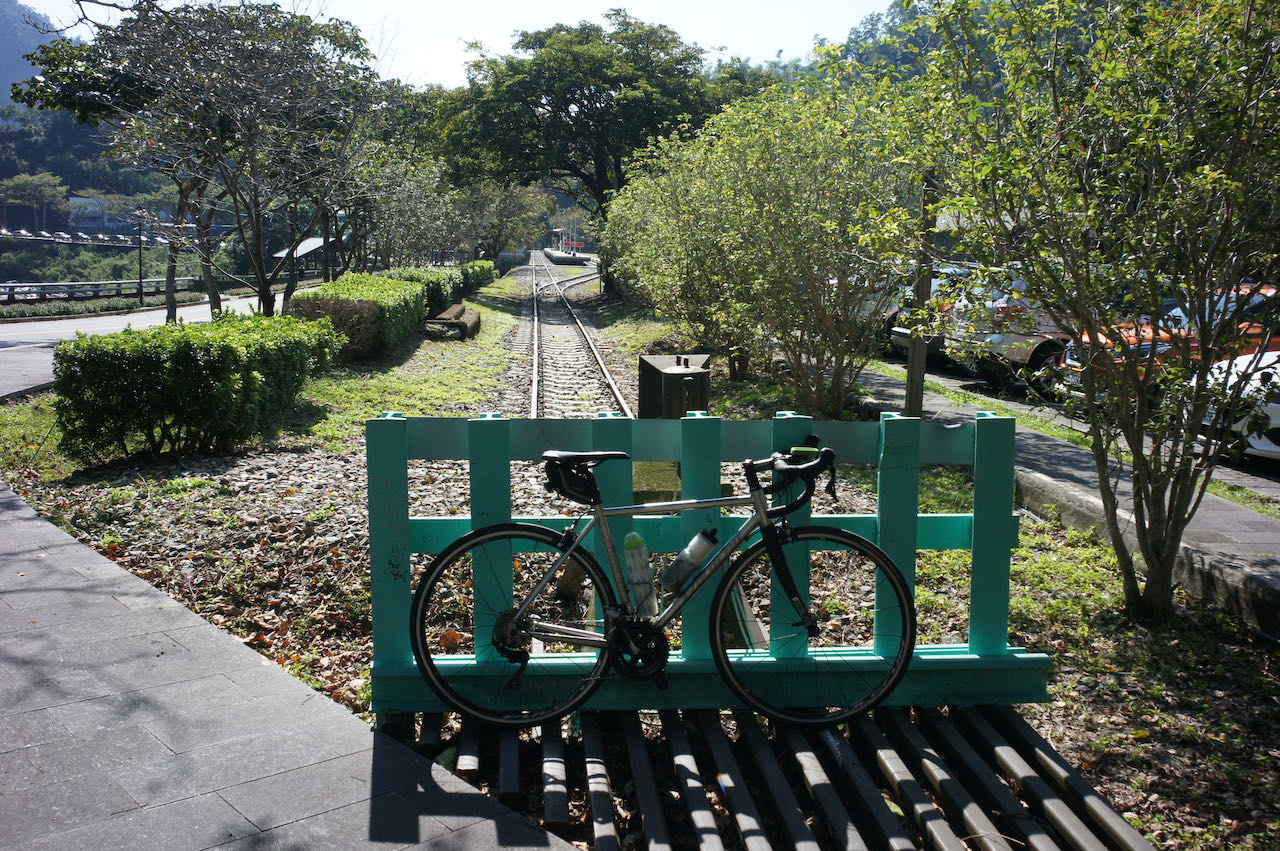
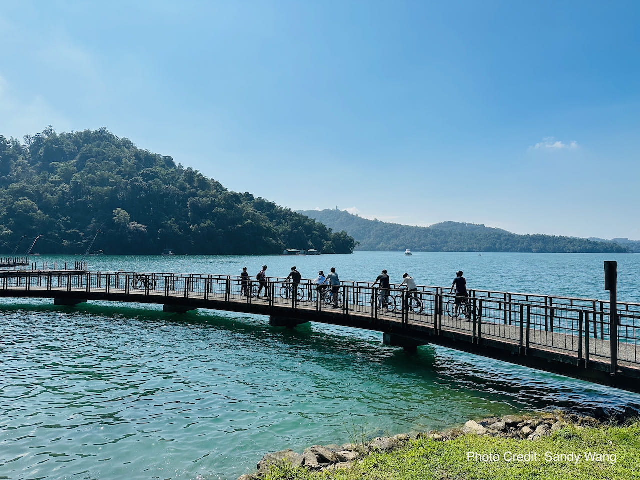
    I went cycling from New Taipei’s Tucheng (土城) to Dongyanshan (東眼山; literally “Eastern Eye Mountain”) National Forest Recreation Area in Taoyuan County with a small group of friends on a Sunday in September 2020. It was a 71km loop with the maximum elevation of 913m, plotted by Sandy Wang, a cycling enthusiast. The starting point, and also the end point, is at the southern terminus of Taipei Metro’s Blue Line, Dingpu Station. The downloadable GPX file of this cycling route is at the end of this post. 

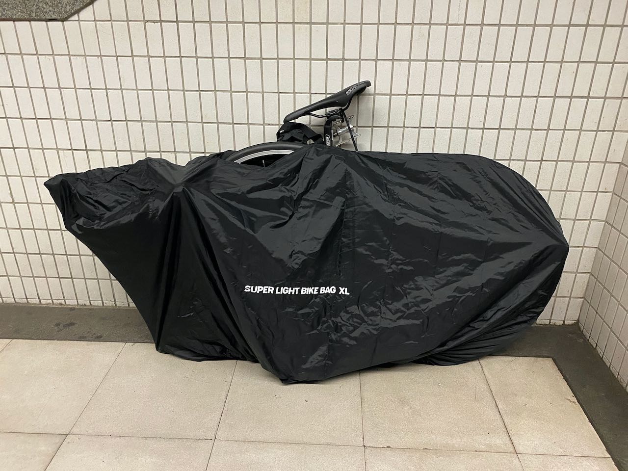
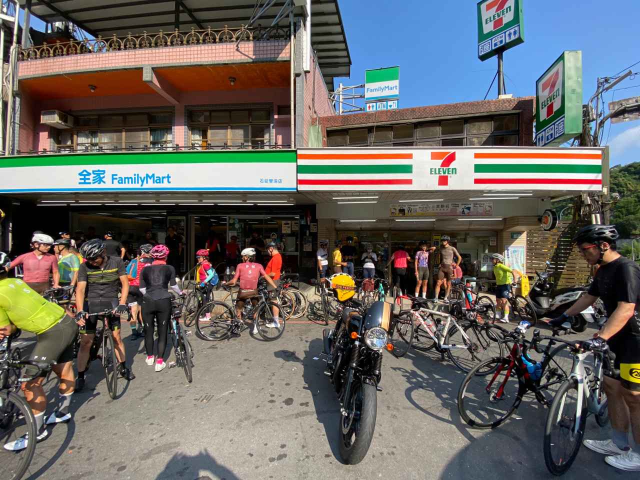
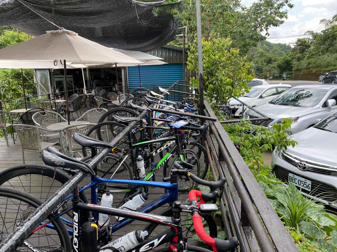
    I took the earliest metro with my bike from home and arrived at Dingpu before 7:00 am. There were already some other cycling groups gathering outside the convenience stores, of which you can be pretty sure to find one or two within the proximity of MRT stations, train stations, etc. We then had a quick breakfast and set off on Provincial Highway No. 3.

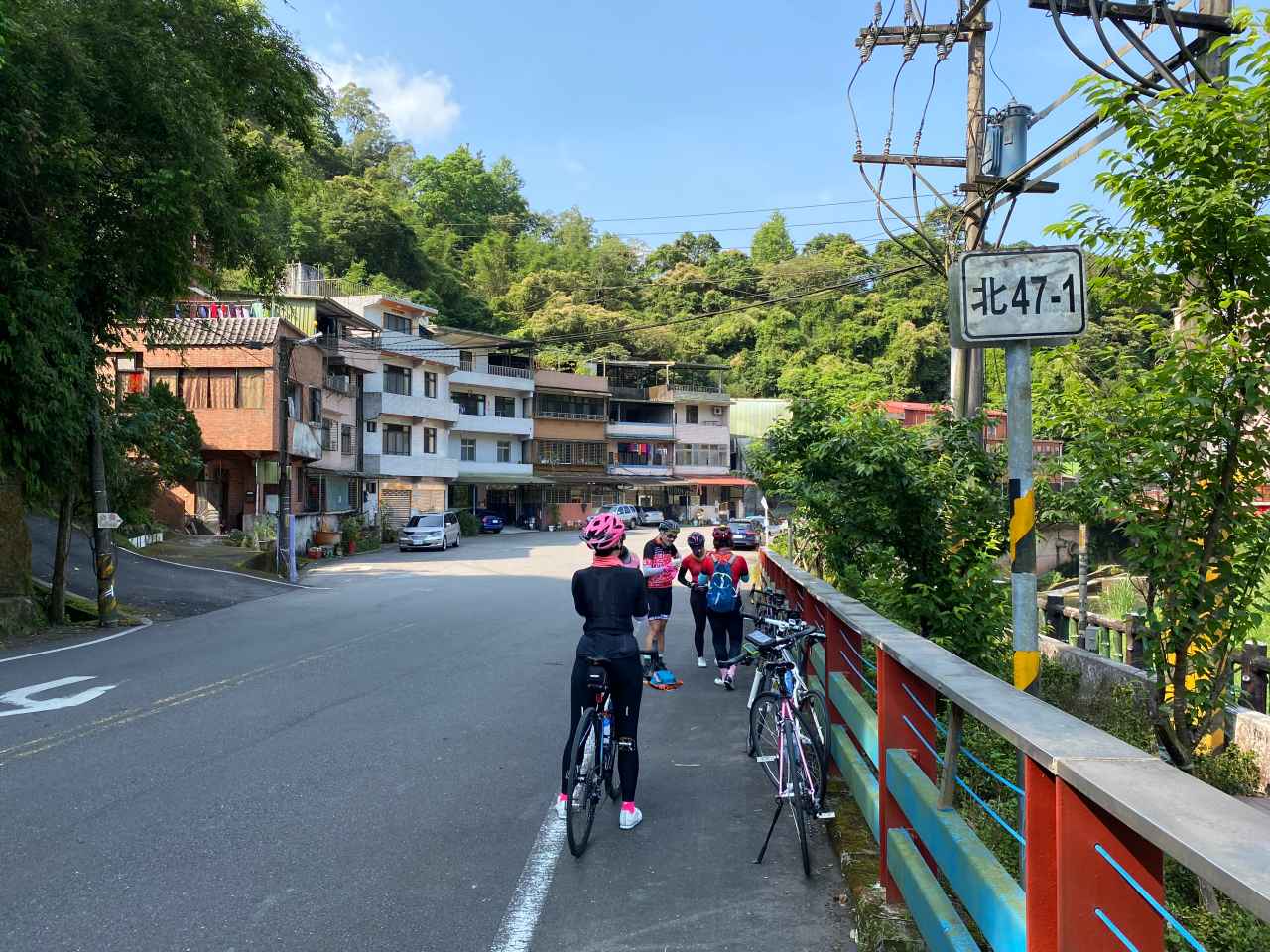
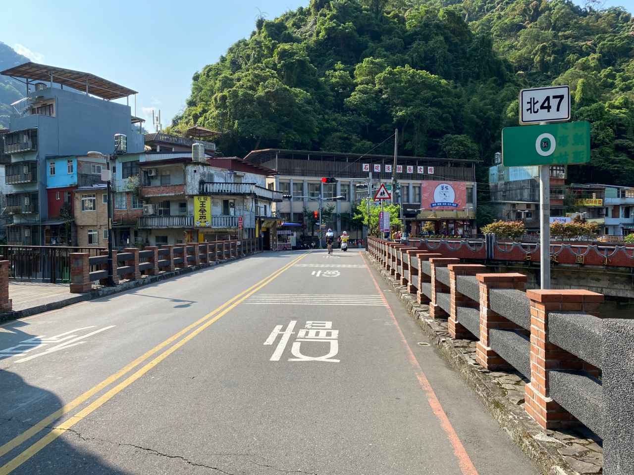
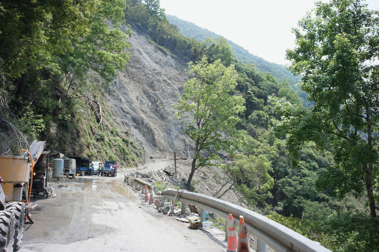
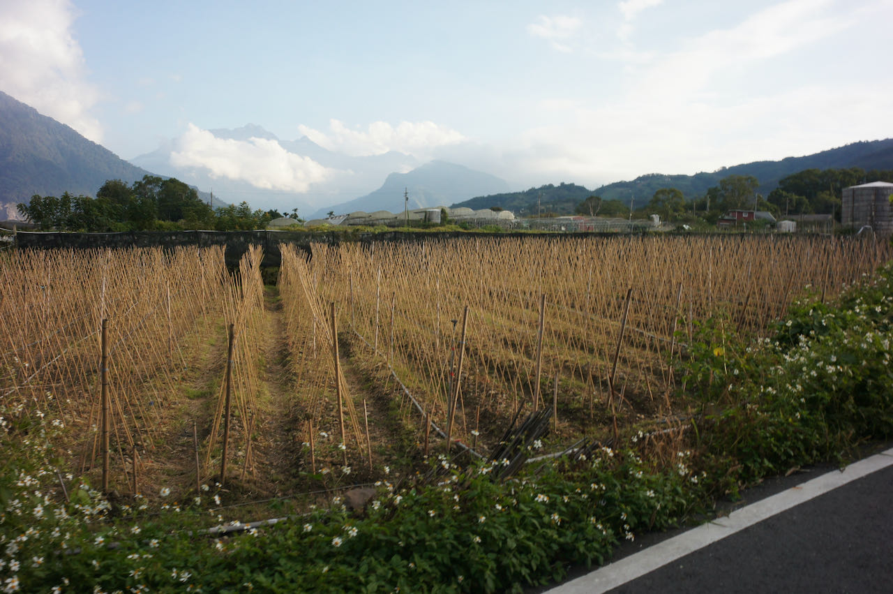
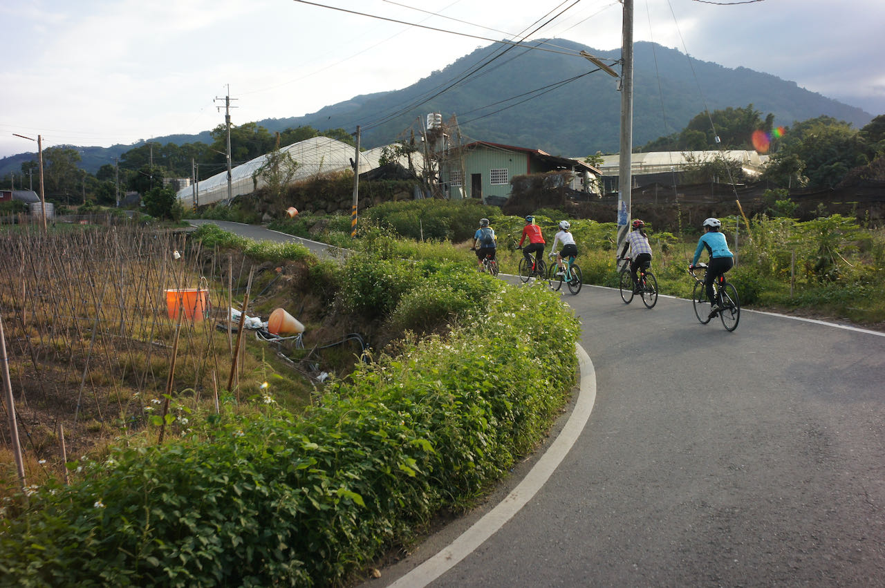
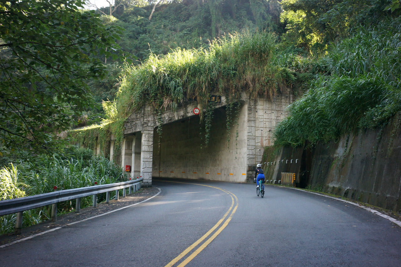
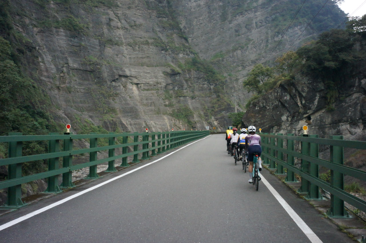
    Traffic was not very busy but there was some overhead road construction work going on along the route. It got quieter and the air became fresher as we headed into the valley on Township Road TP110 and TP TP114 (shown on Google Maps as 北110 and 北114 respectively). I loved this route already. 

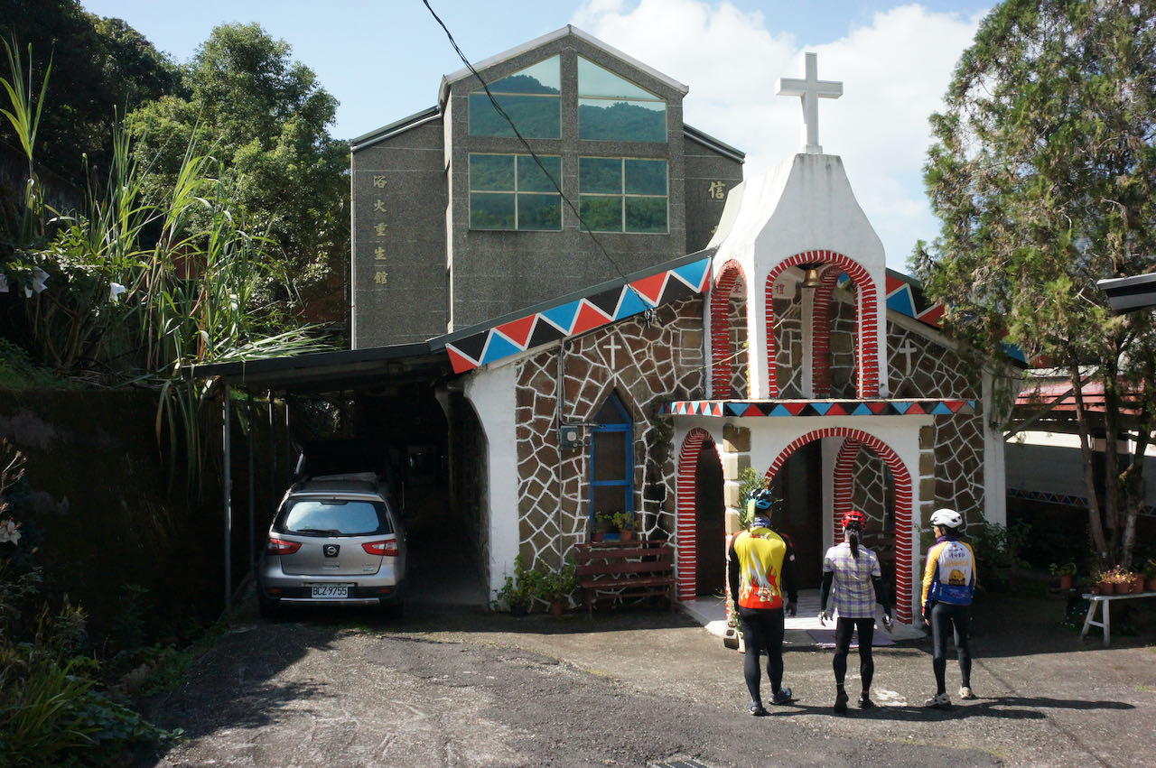
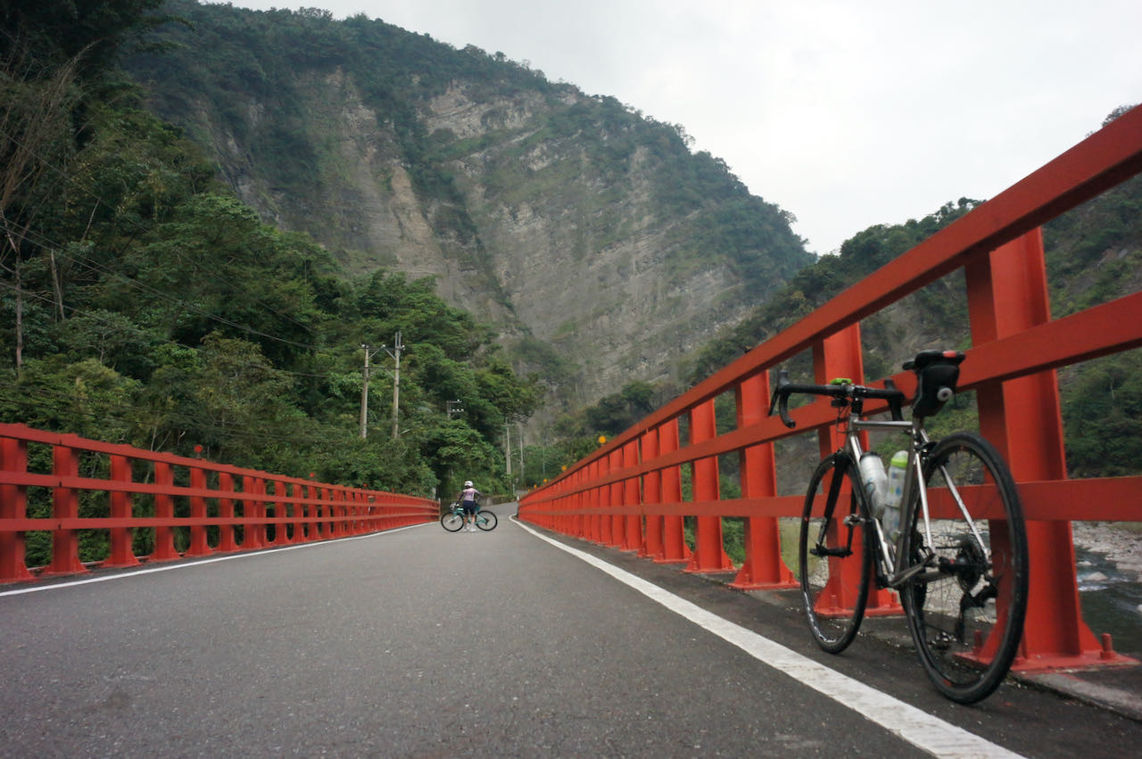
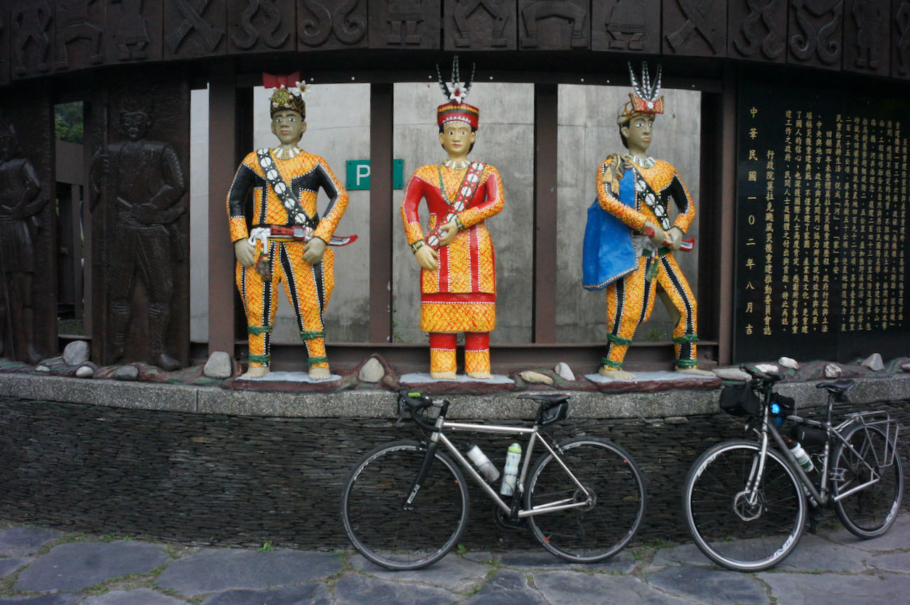
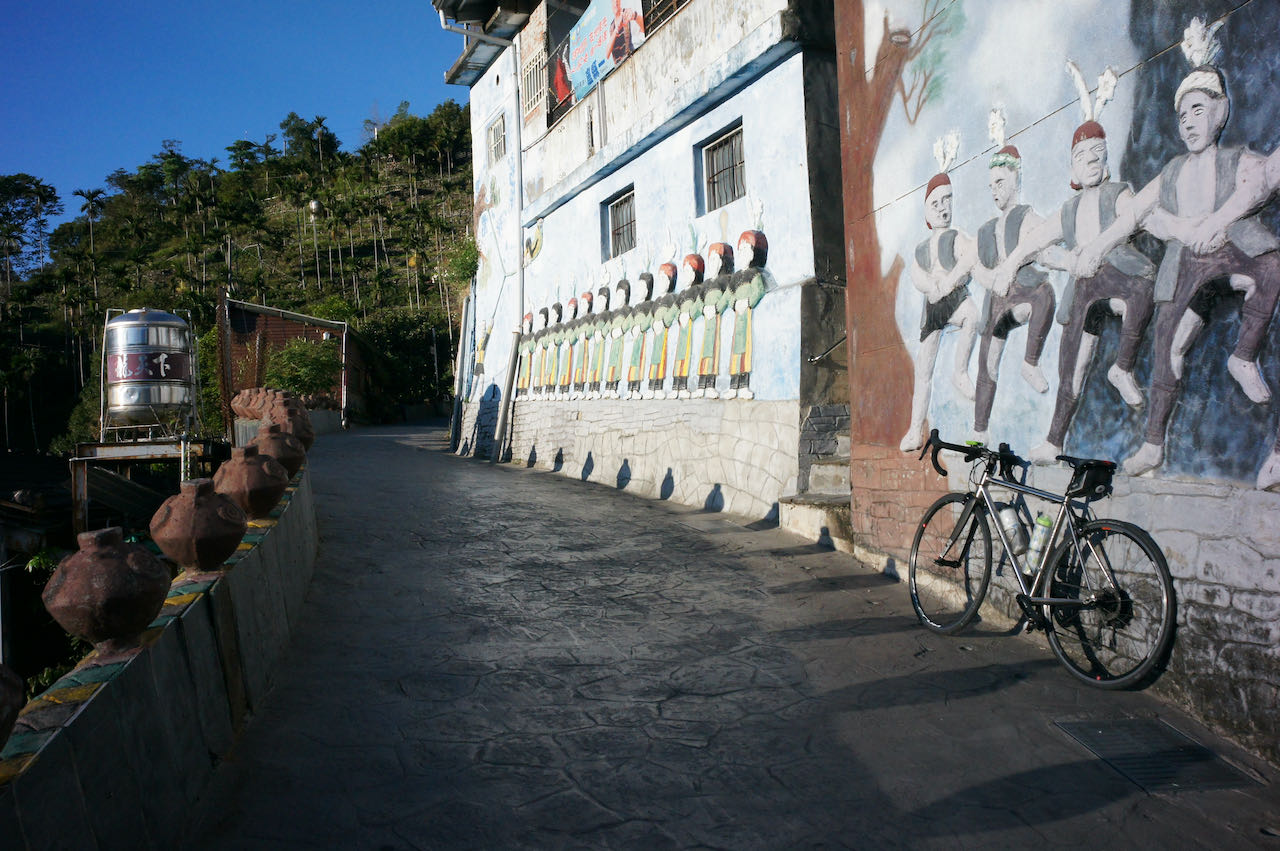
    After crossing a small bridge, we switched to Provincial Highway 7B (Shown on Google Maps as 7乙). This is the Northern Cross-Island Highway (北部橫貫公路/北橫), which is one of the 3 Cross-Island Highways (橫貫公路) that could bring you to the other side of the island by climbing over the Central Mountain Range 中央山脈, and this is one of the favorite highways among cyclists and motorcyclists. We soon left the highway by turning into a small road to take a look at an old small church built by the local Atayal tribe, Jiguopai Church. Some pictures of the Jiguopai Church here.

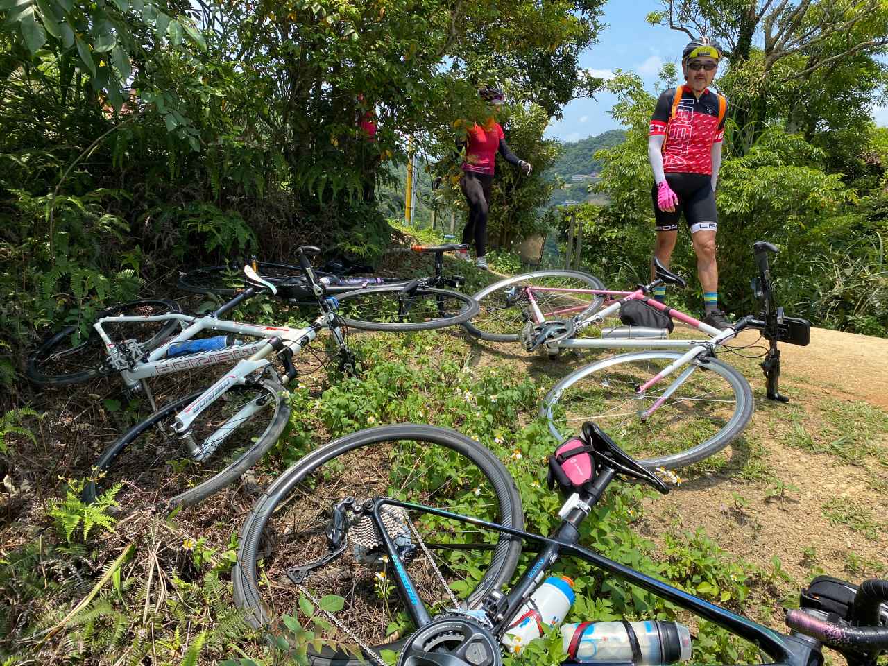
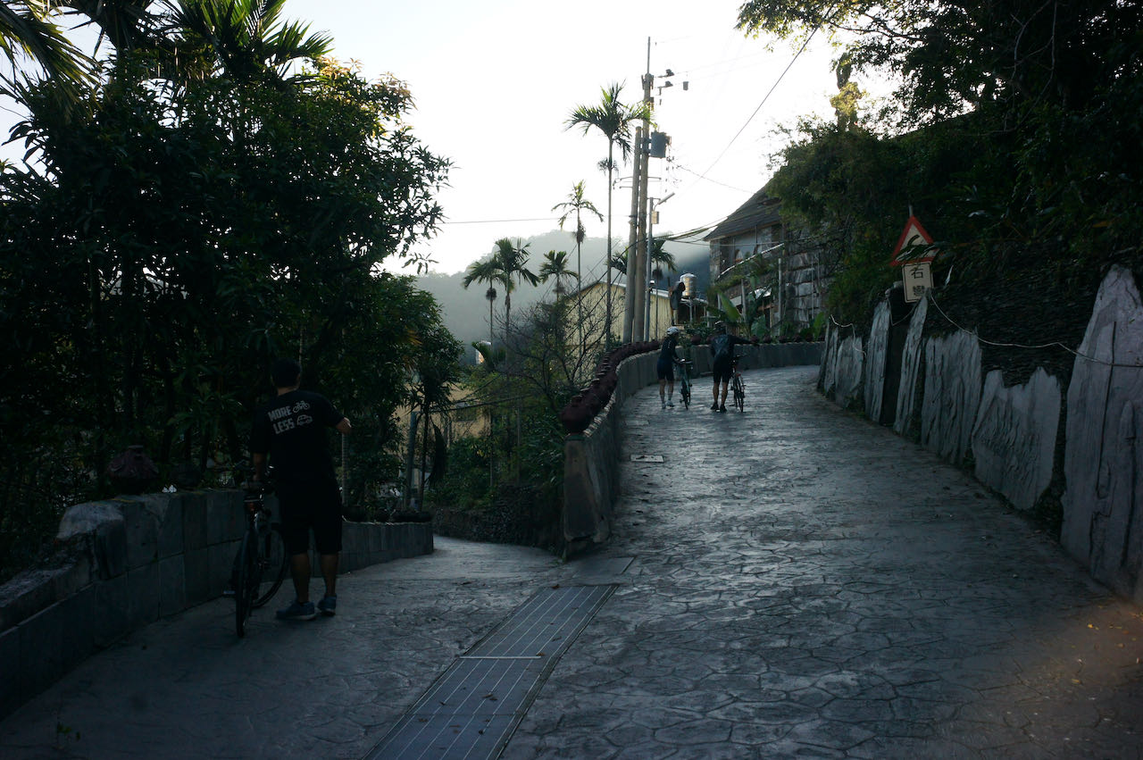
    We had to get off our bikes midway and push them uphill because it was too steep to cycle. We heard dogs barking somewhere nearby. We made sure to stay on the road and not to step into their territory. We then met a young guy heading towards the same destination, who stopped to ask us direction. He was doing the around-the-island on his motorbike. We knew this because he had a foam board on his back showing his progress. To cheer him on and to show support, a breakfast shop owner had given him more sandwiches than he could finish before they went bad. We had the honor and pleasure to share some.

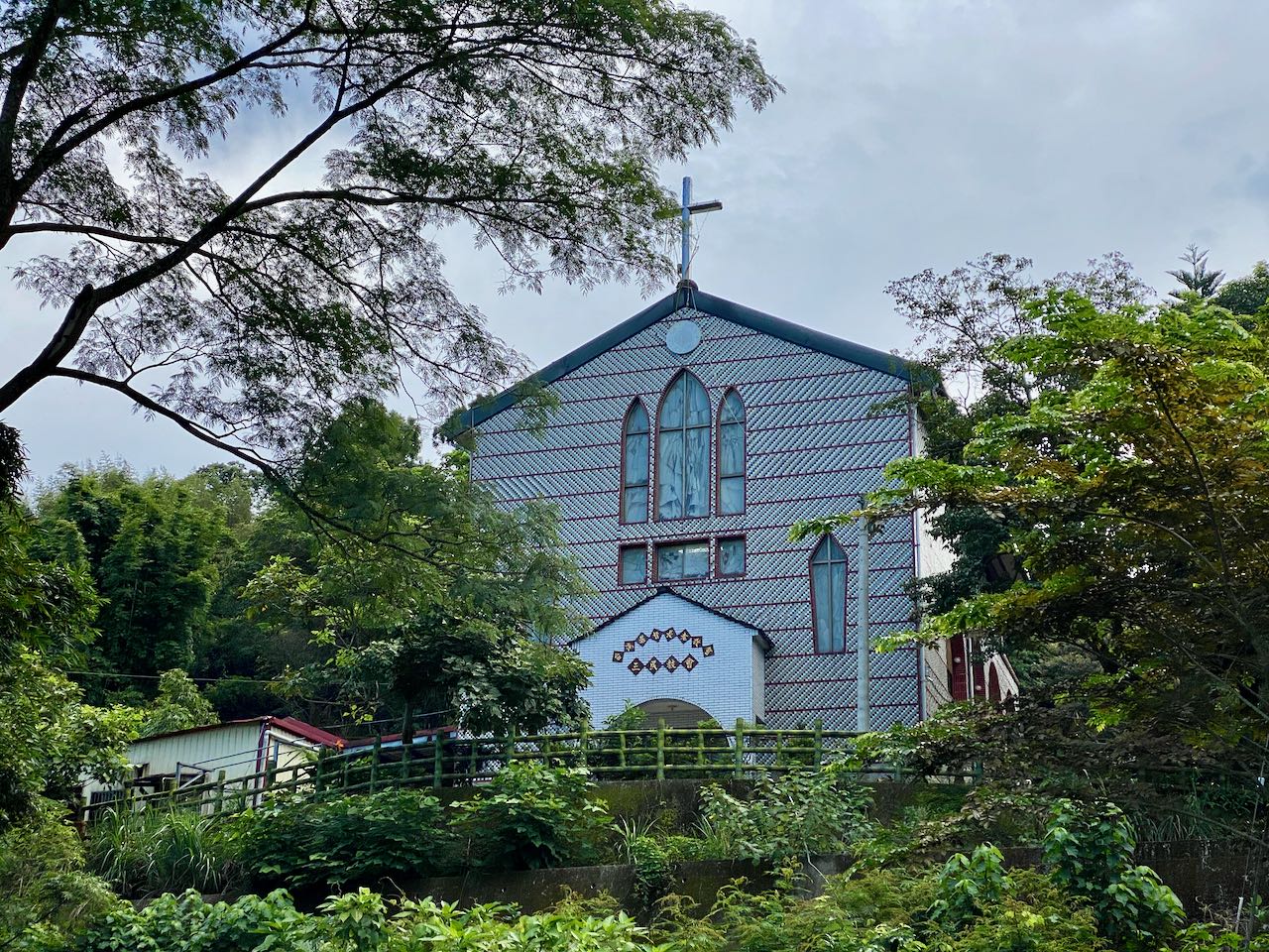
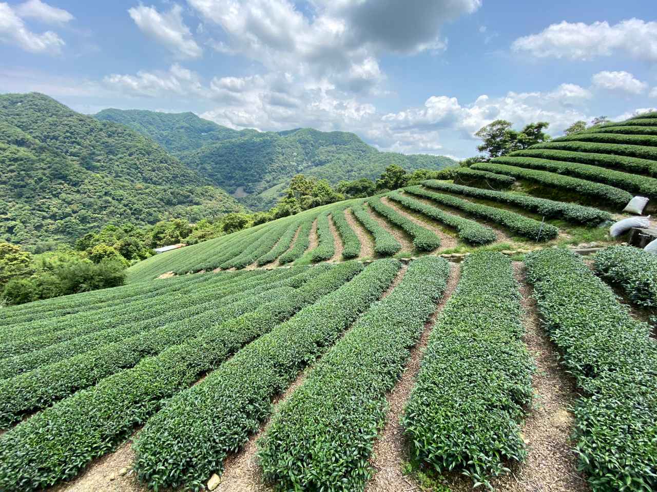
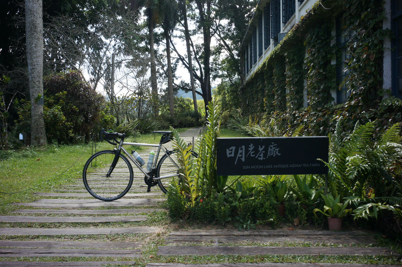
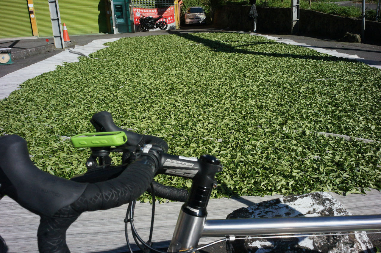
    Unfortunately, when we arrived at the church at last, we found it closed temporarily but without a solid plan as to when to open again. So, before you can be certain that it is reopened, if you are going to follow this route, it may be a good idea just to stay on Provincial Highway 7B and instead pay a visit to the Daxi Tea Factory (大溪老茶廠) enroute before heading for the next stop. 

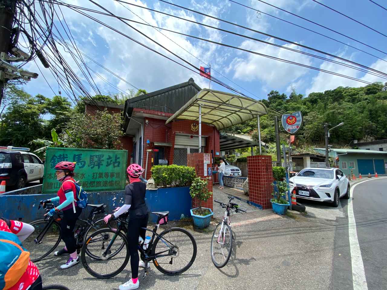
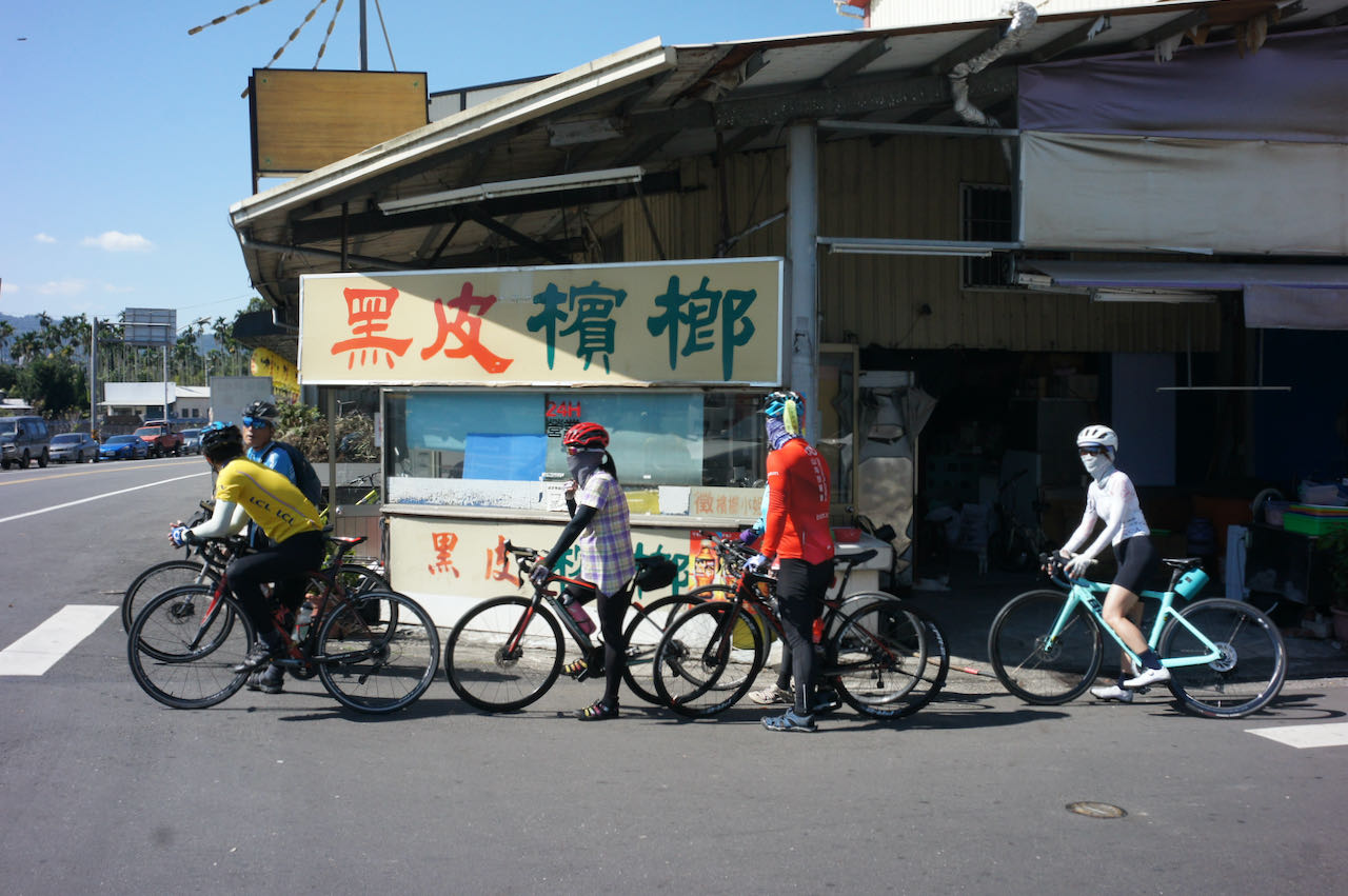
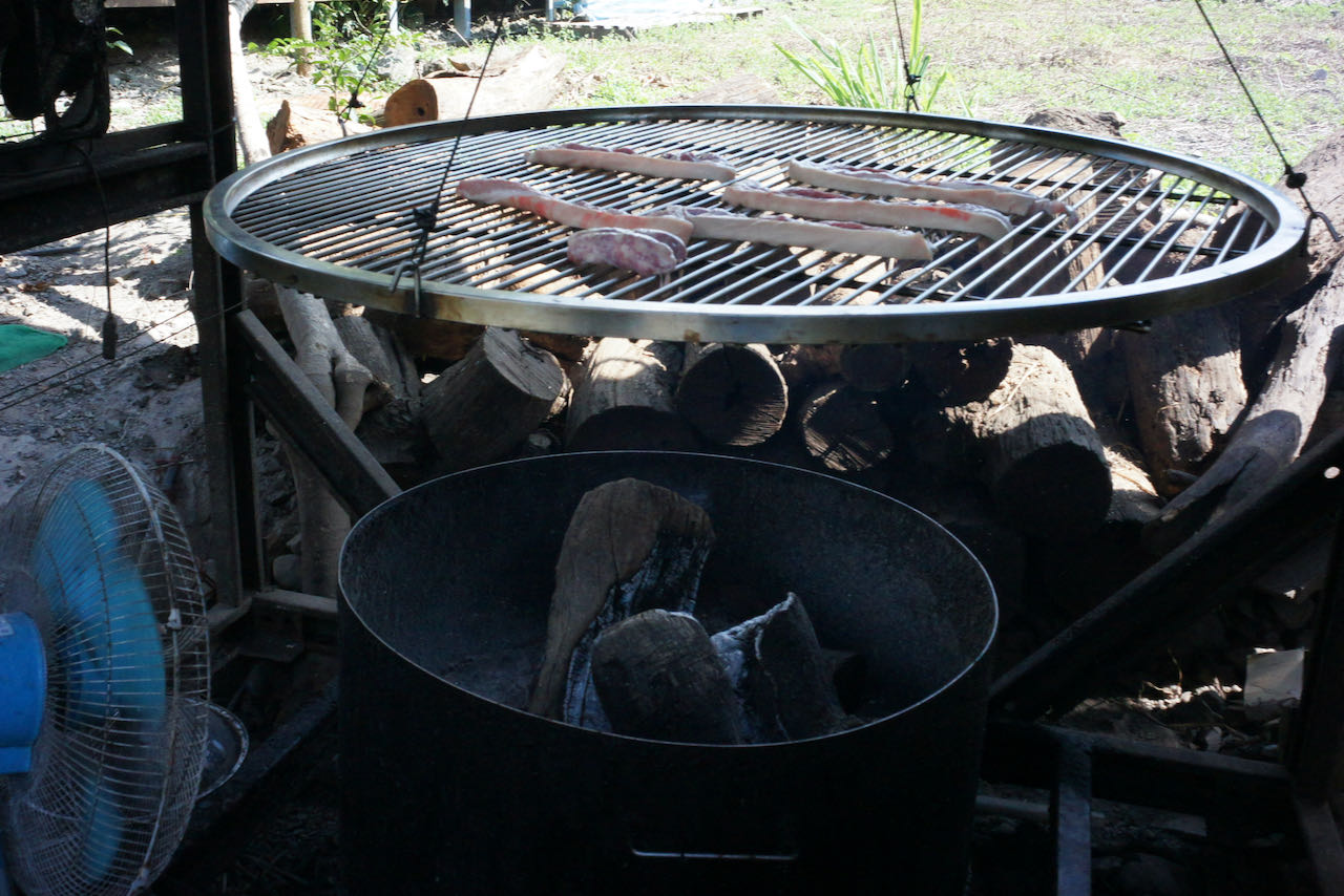
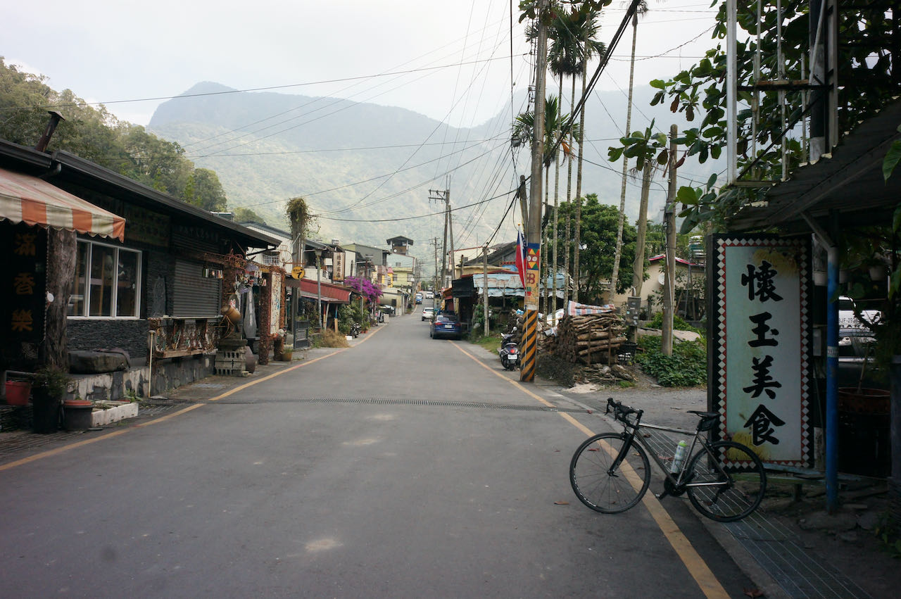
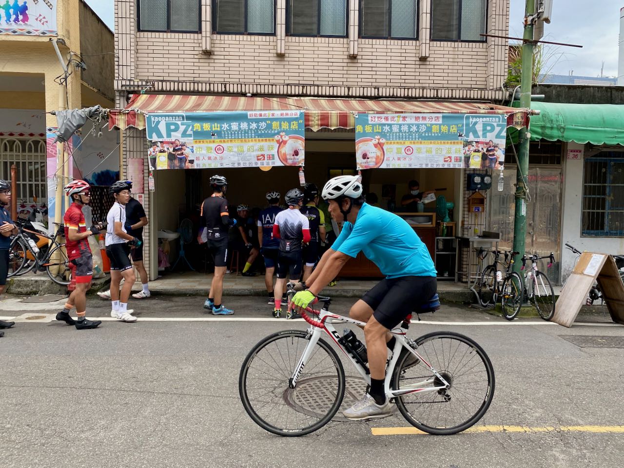
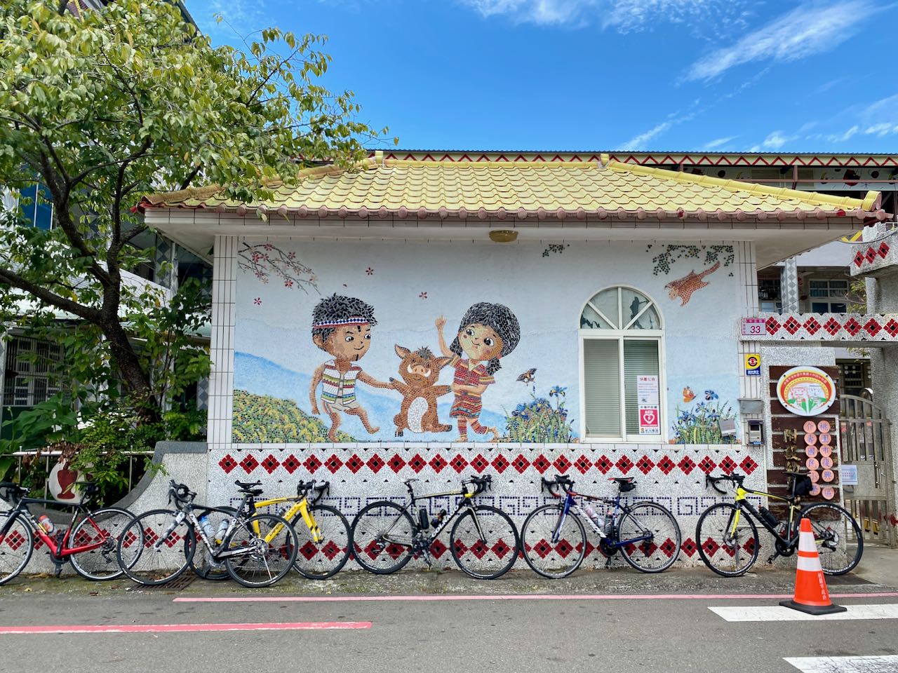
    The next stop, a small town named Fuxing (復興), is where you can get a cup of nice peach smoothies and a roasted pork sausage seasoned with May Chang or Maqaw, a special kind of pepper. The peach smoothies store that sits right opposite the Jieshou Elementary School (介壽國小) offers unlimited refills for people with cycling outfits. Getting a refill there was on the bucket list of a member in our group. She had one item ticked off that day.

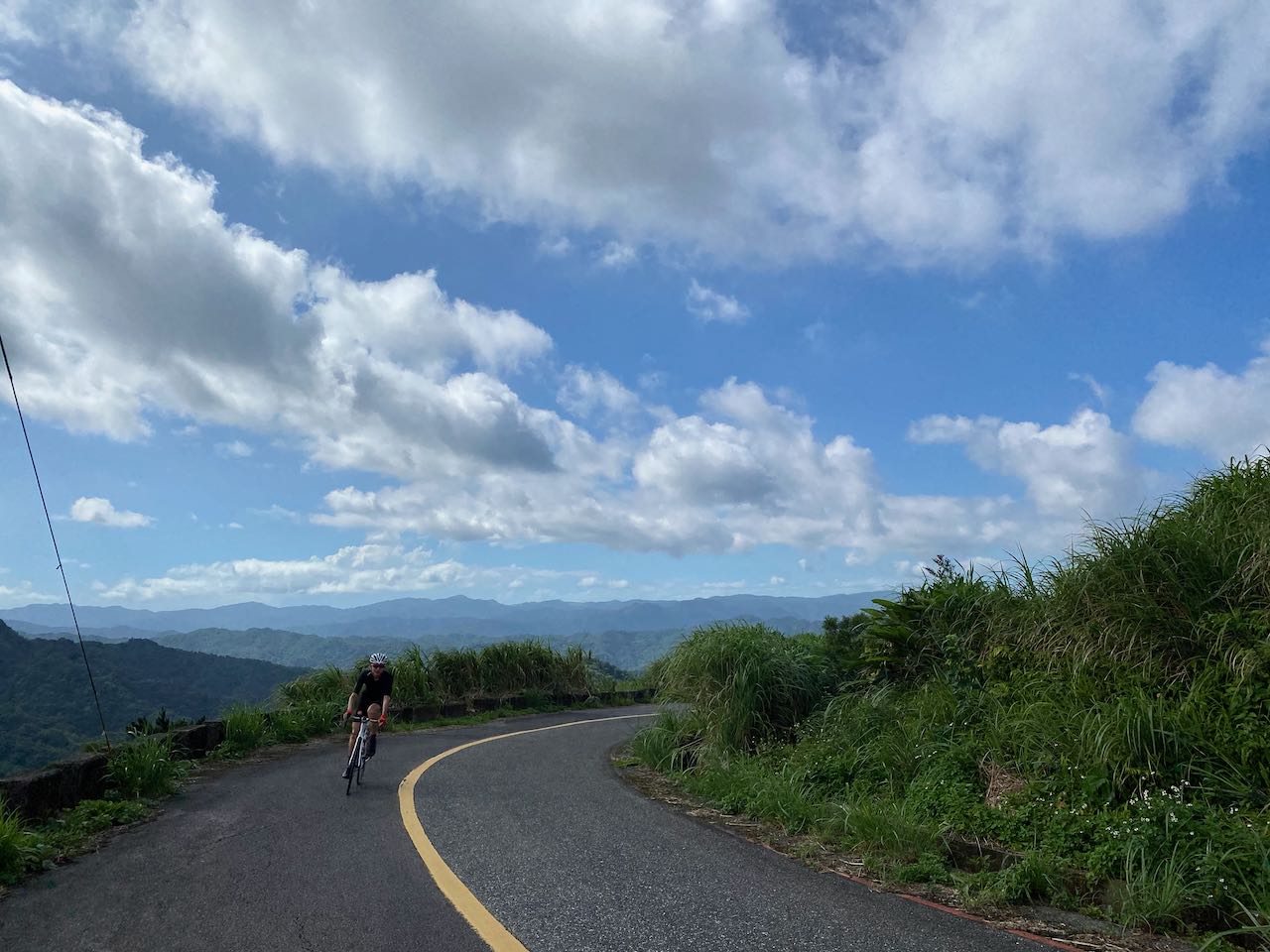
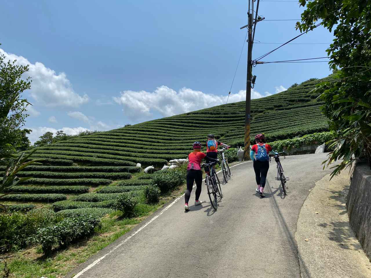
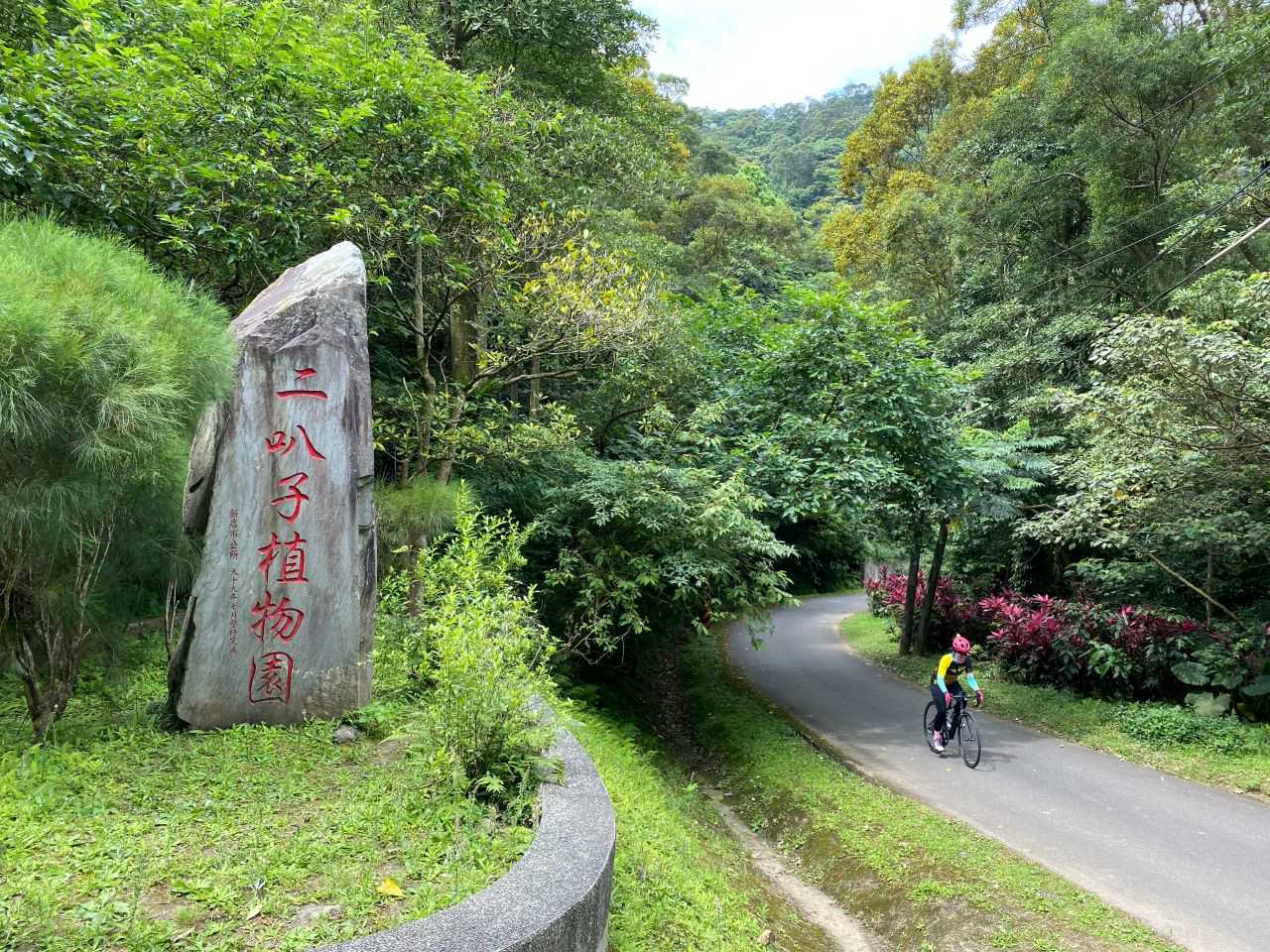
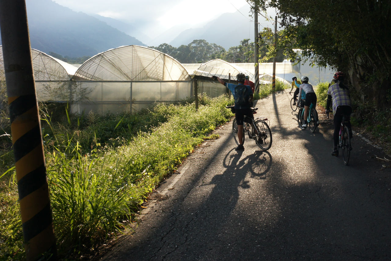
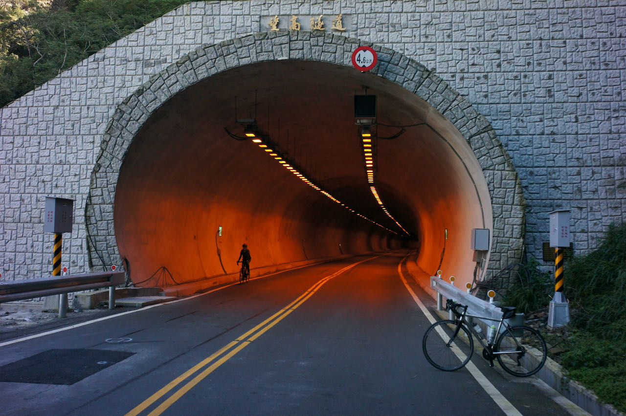
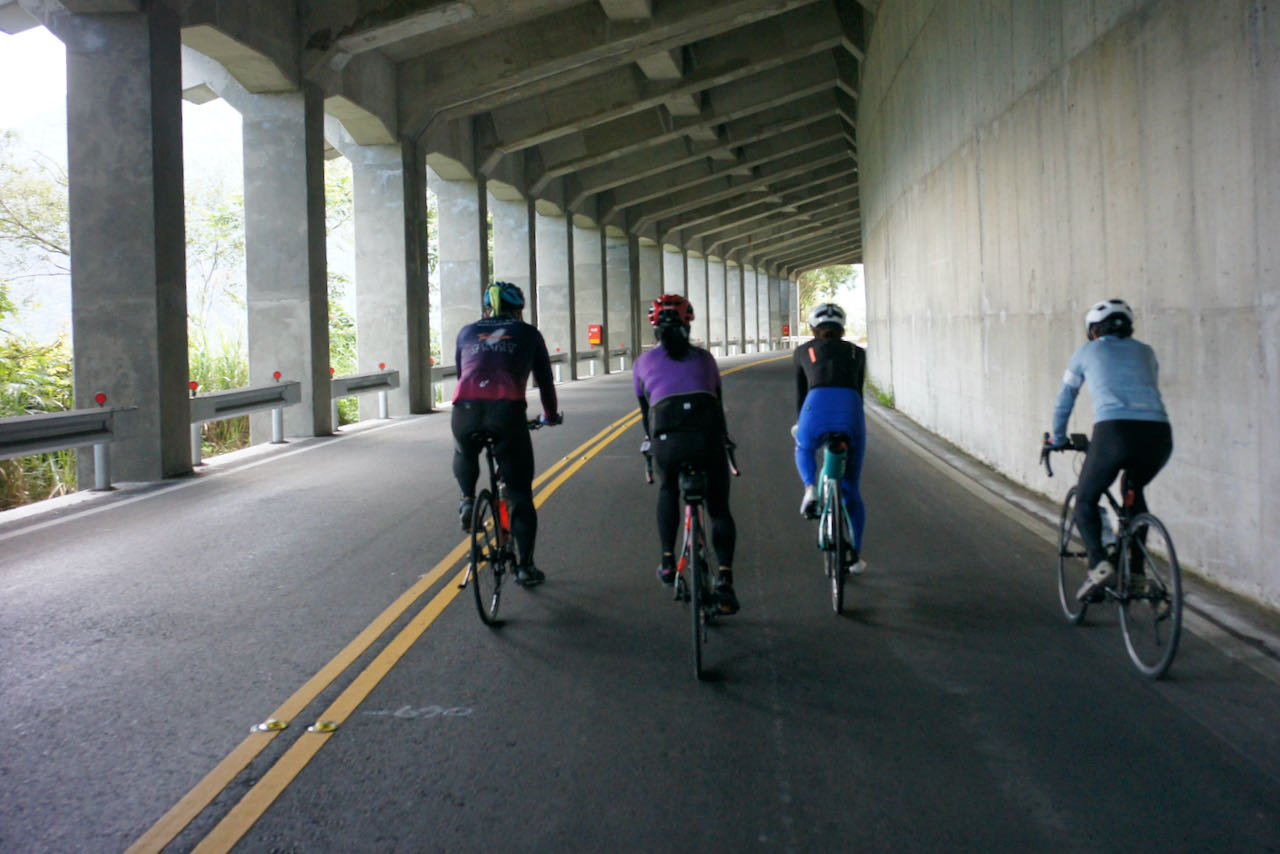
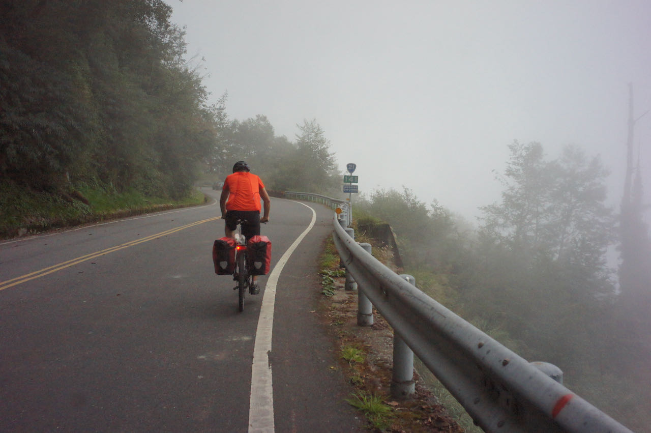
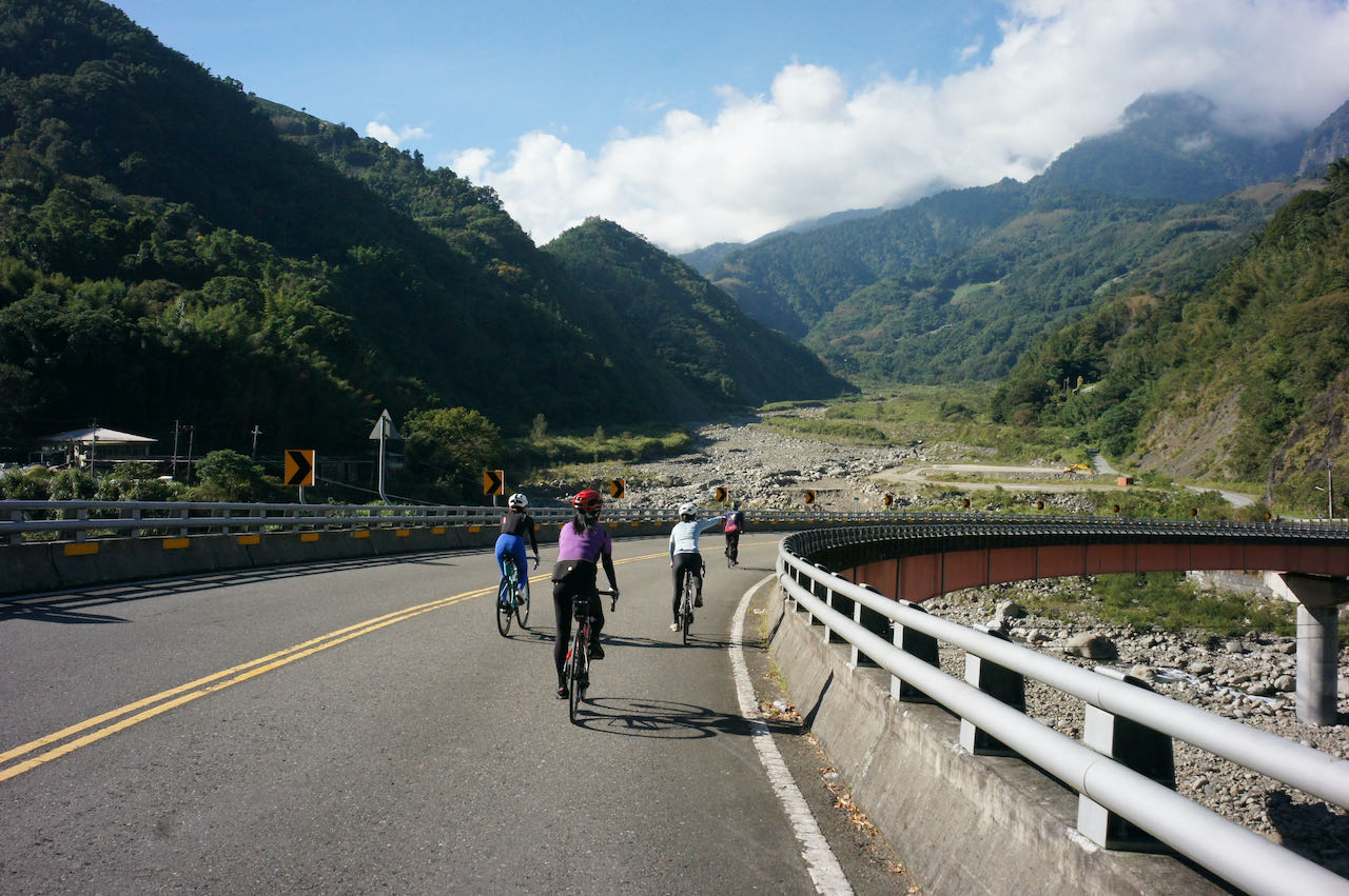
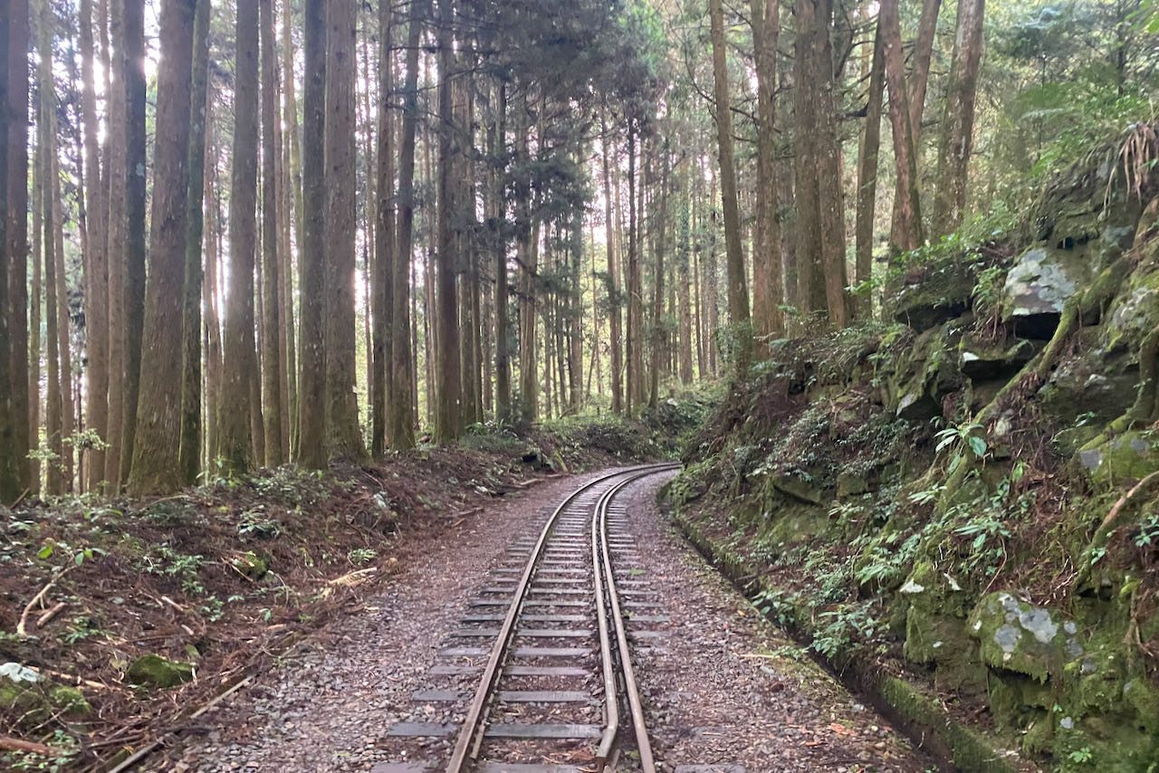
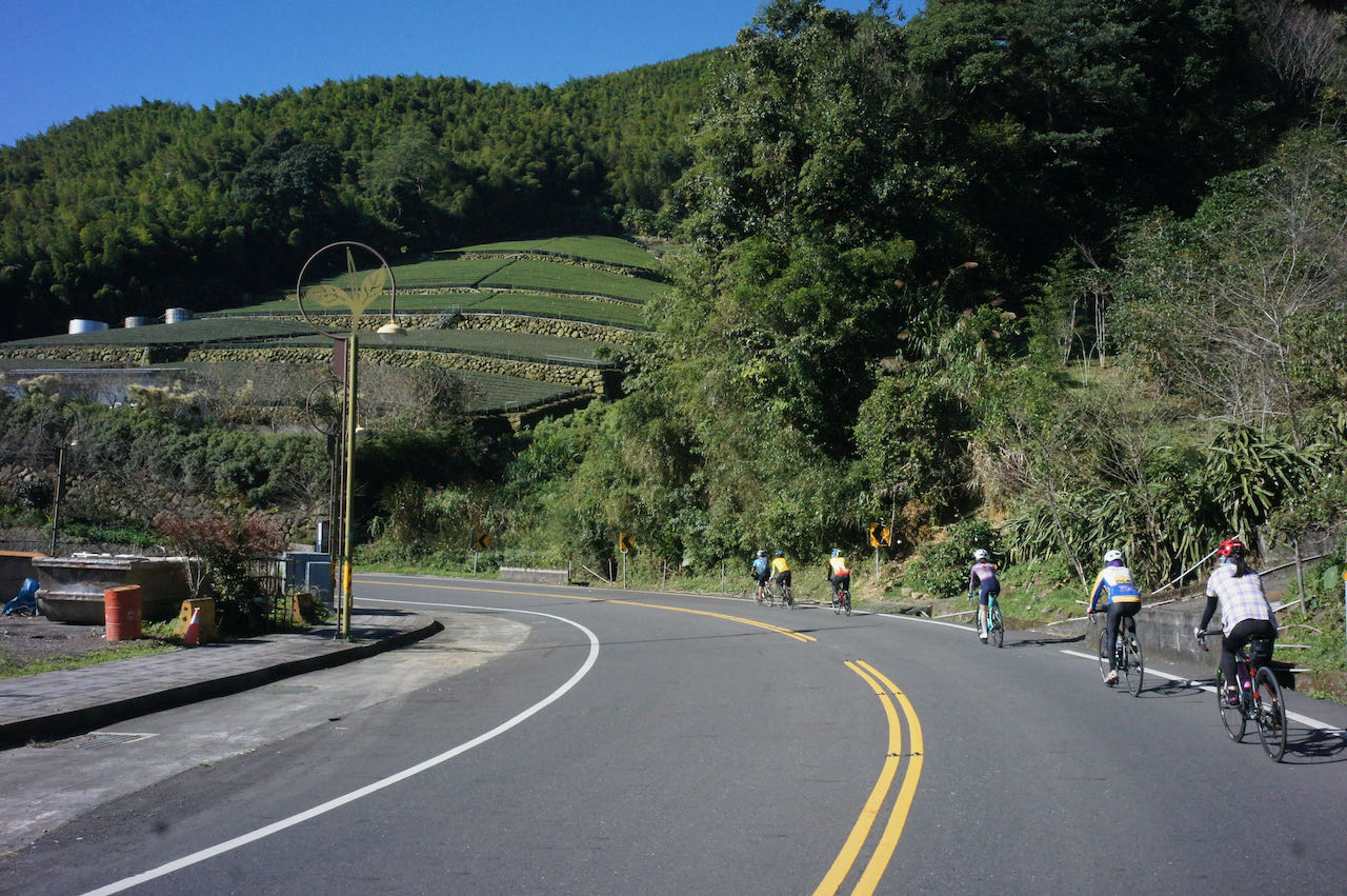
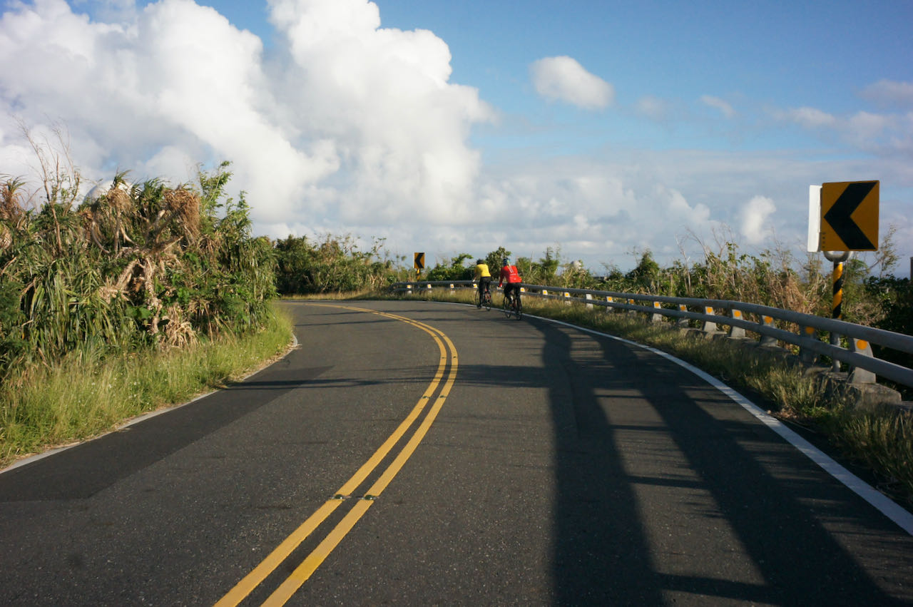
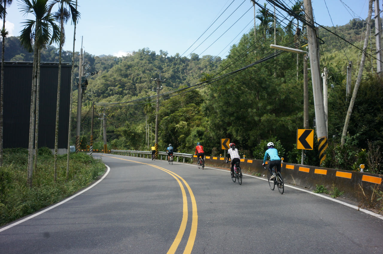
    After the treat, we were back on Provincial Highway No. 7 and then switched to County Highway TY119 (shown on Google Maps as 桃119) for the last climb to Dongyanshan. TY119 is another nice route to climb: quiet with fresh air, lots of shades, and well maintained road surfaces. 

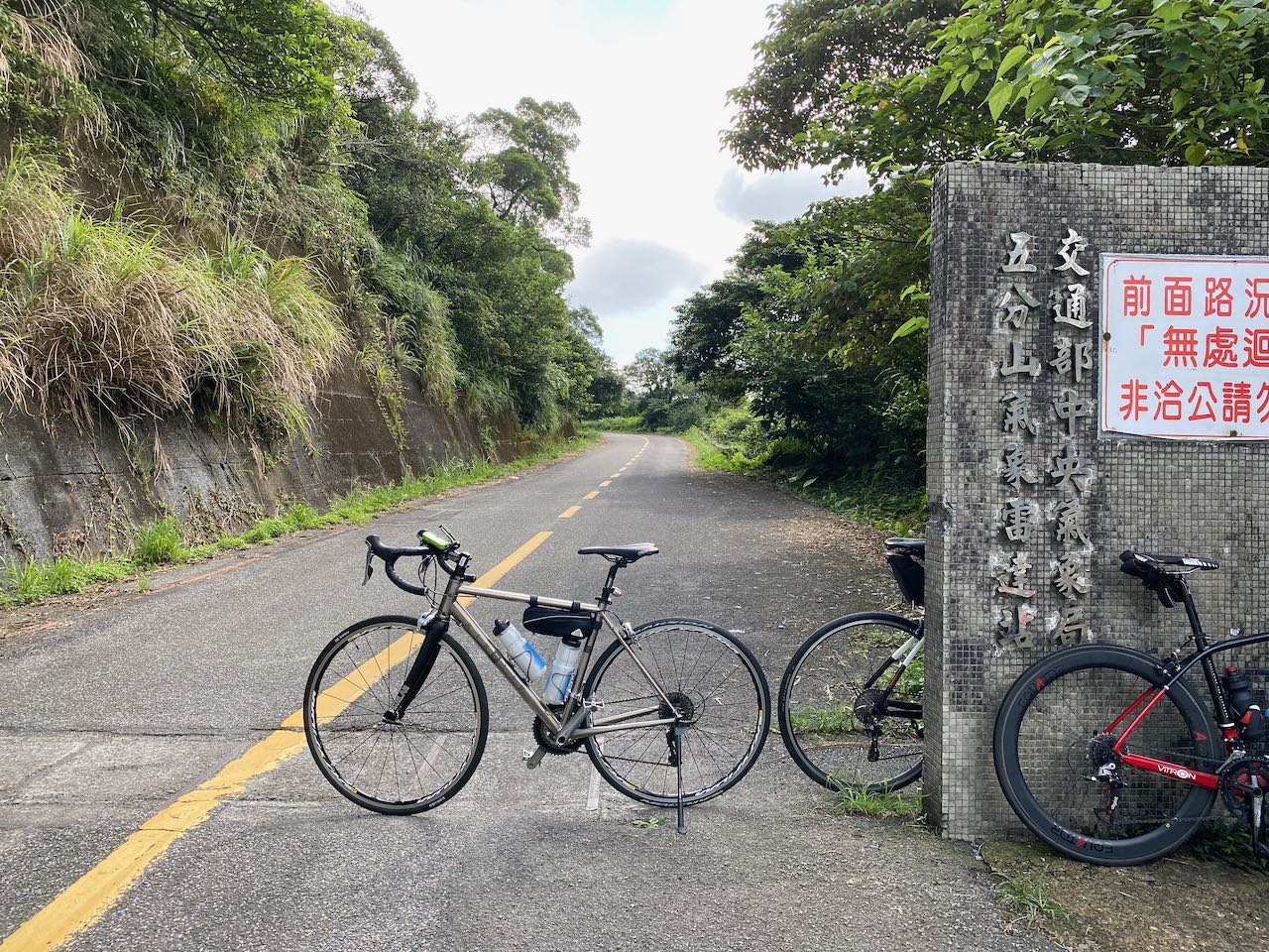
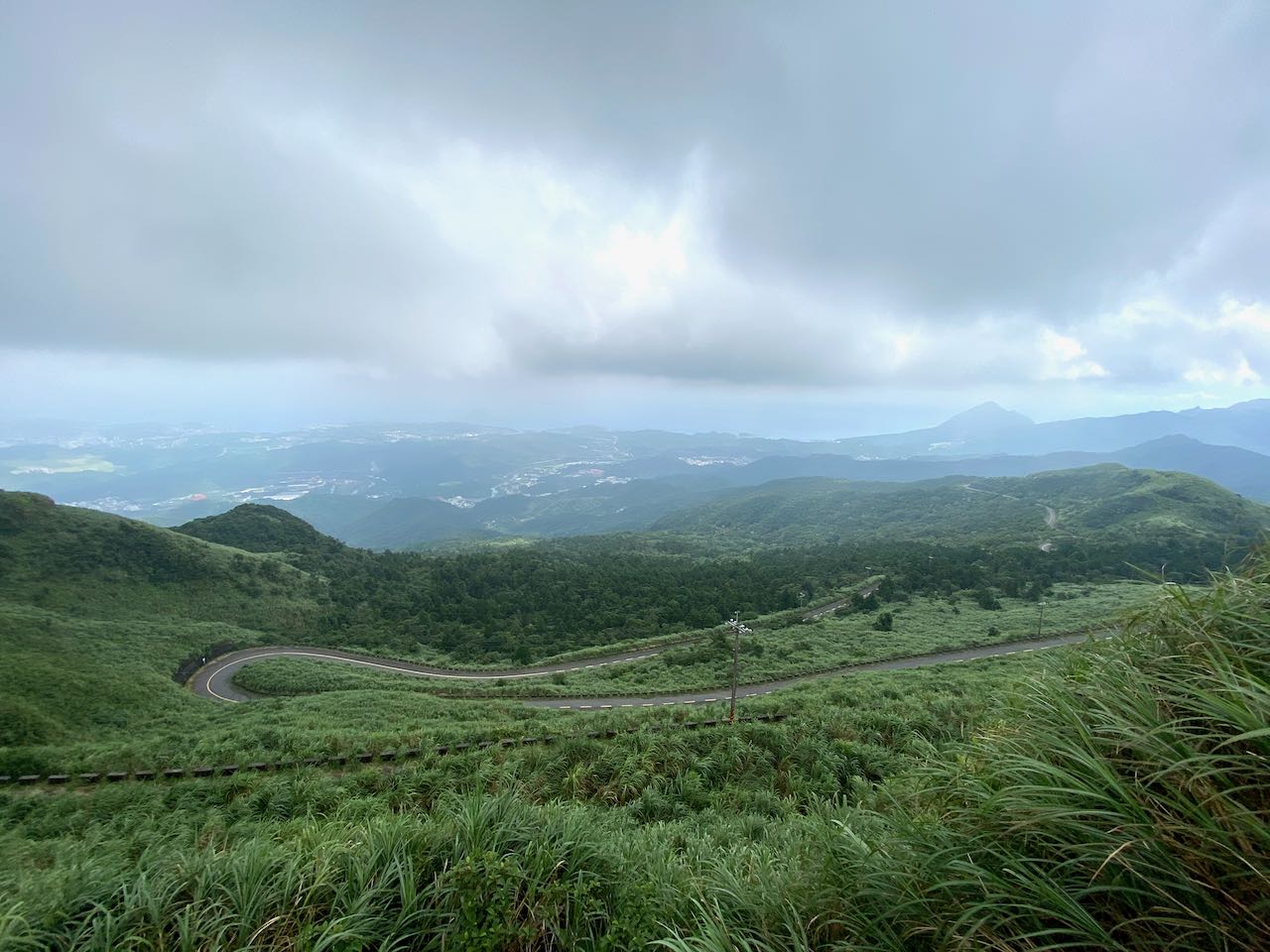
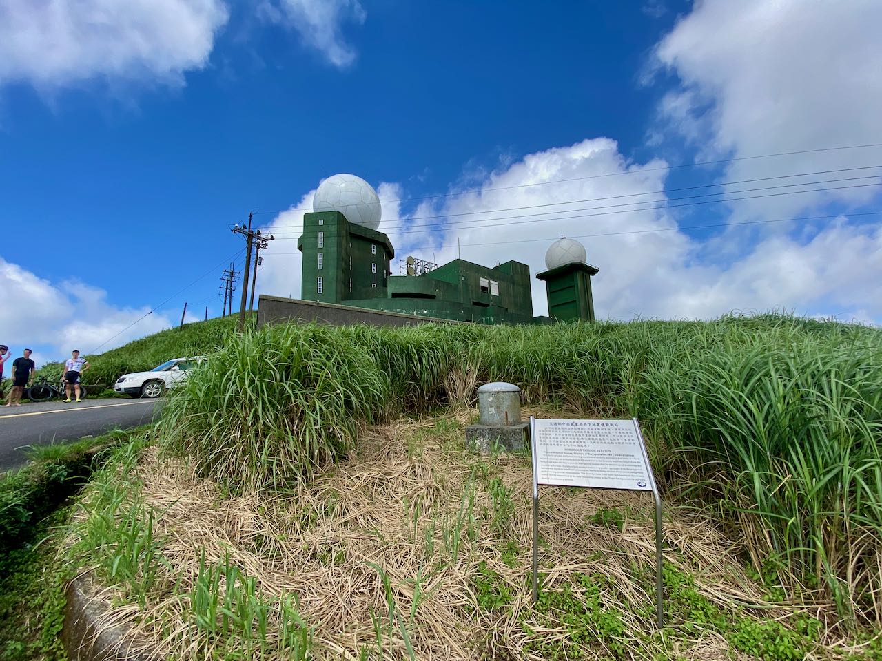
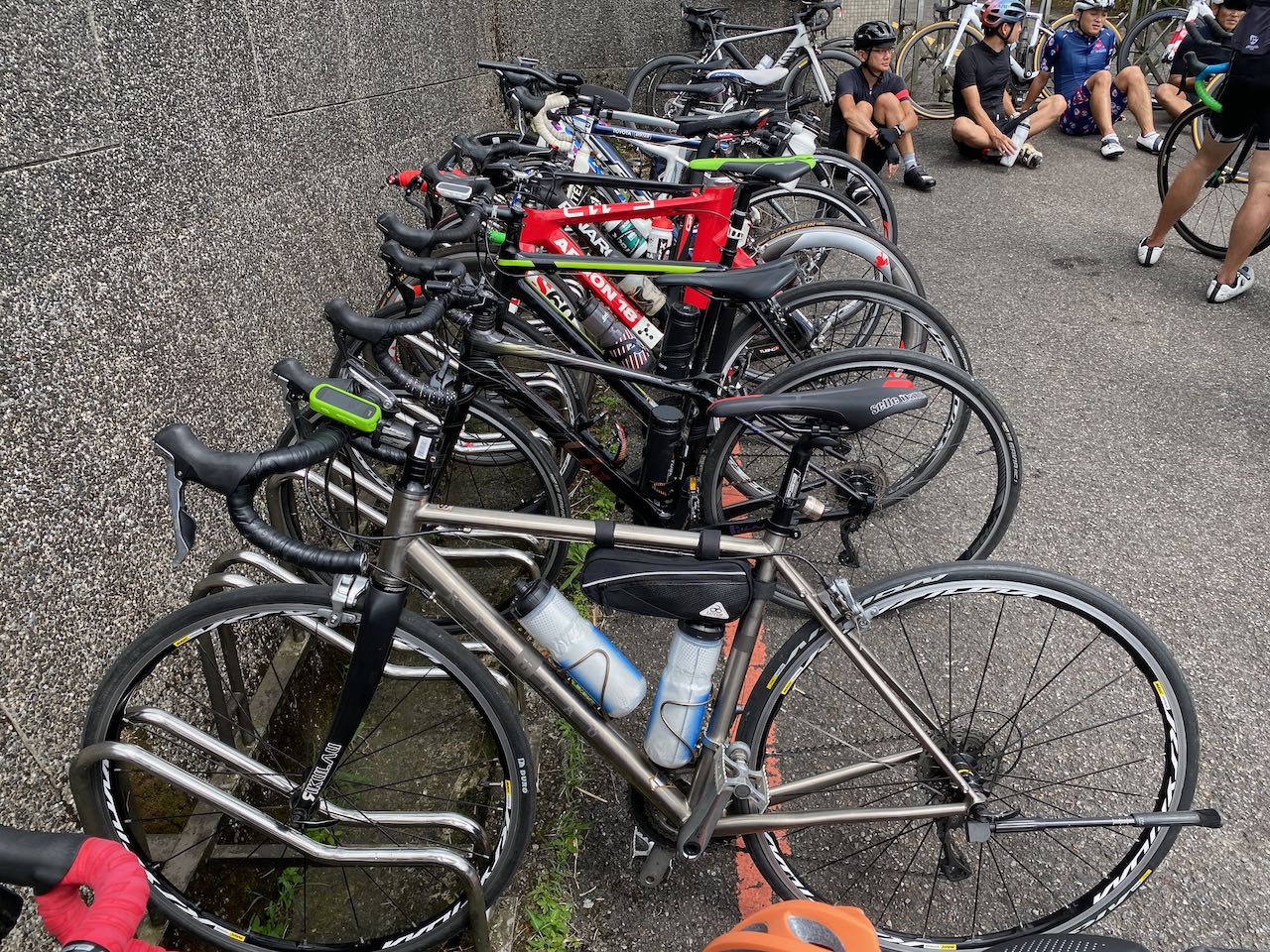
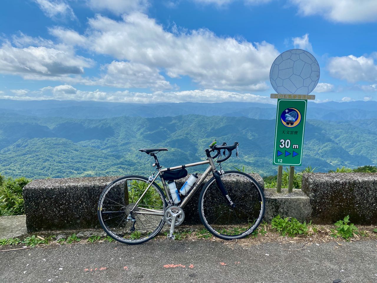
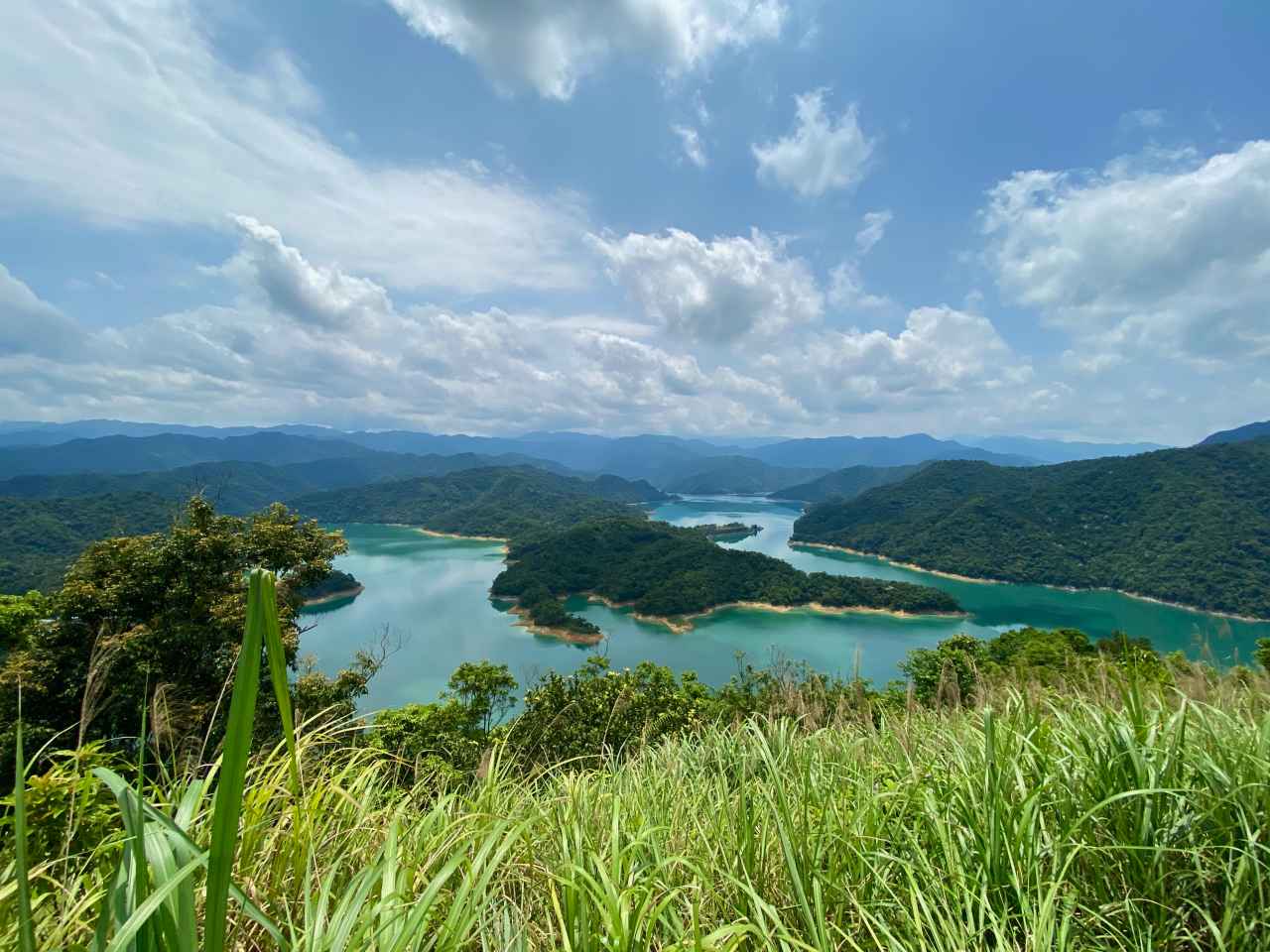
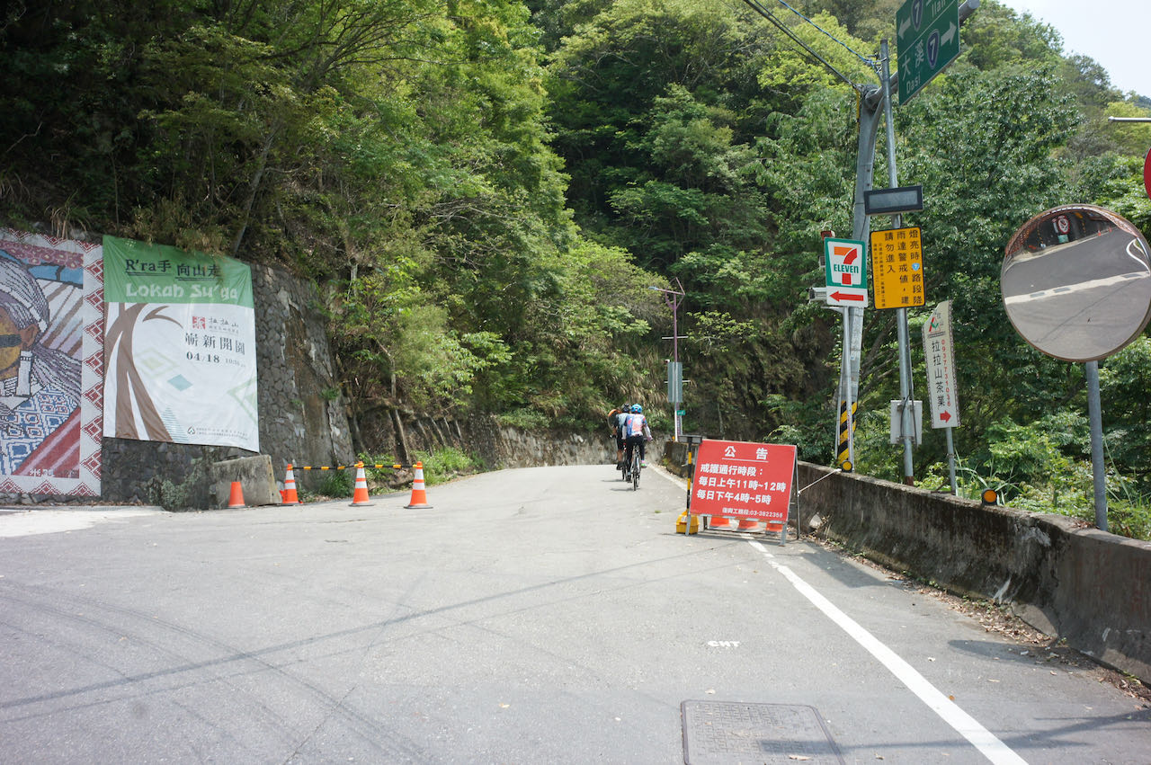
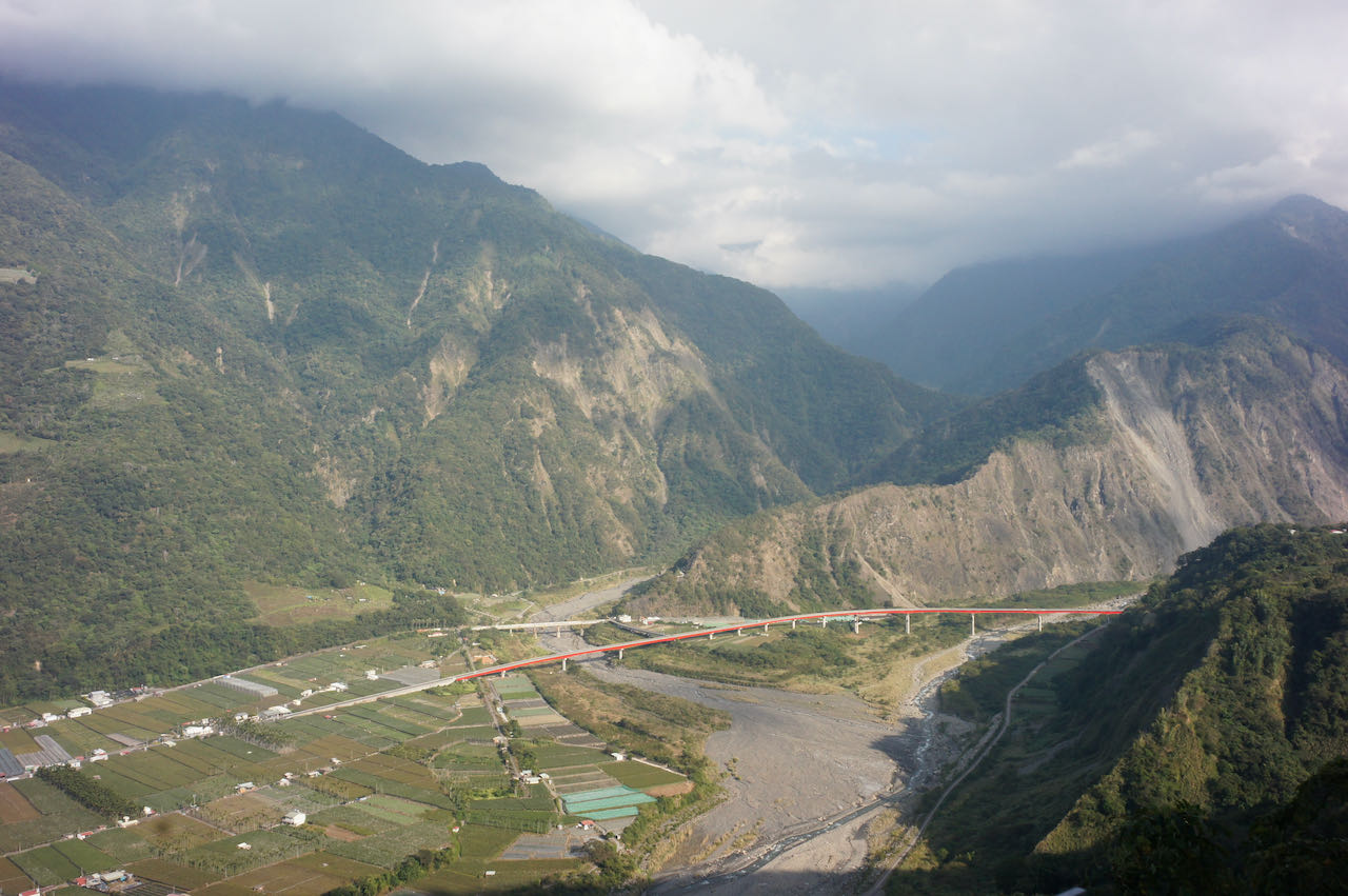
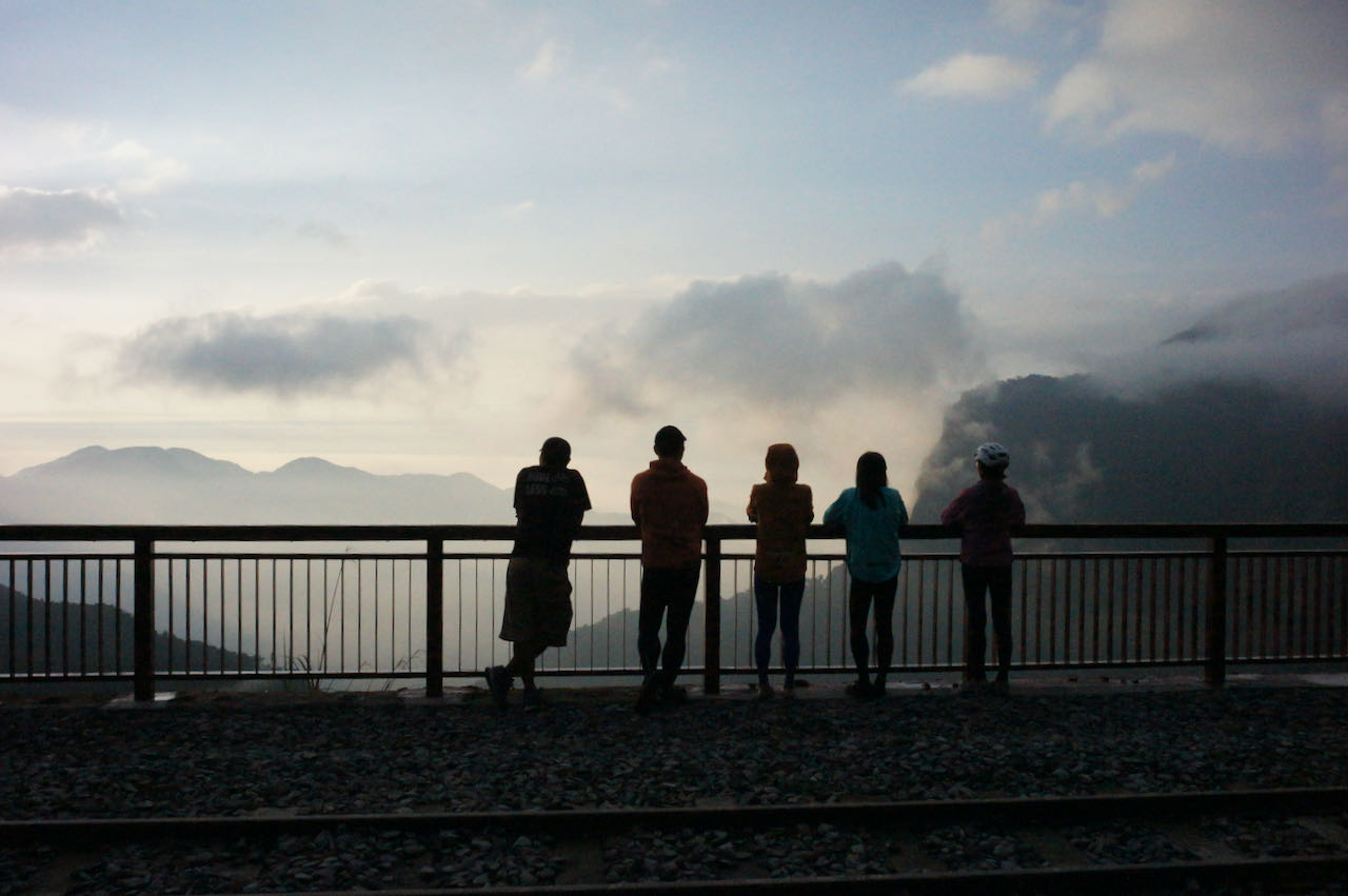
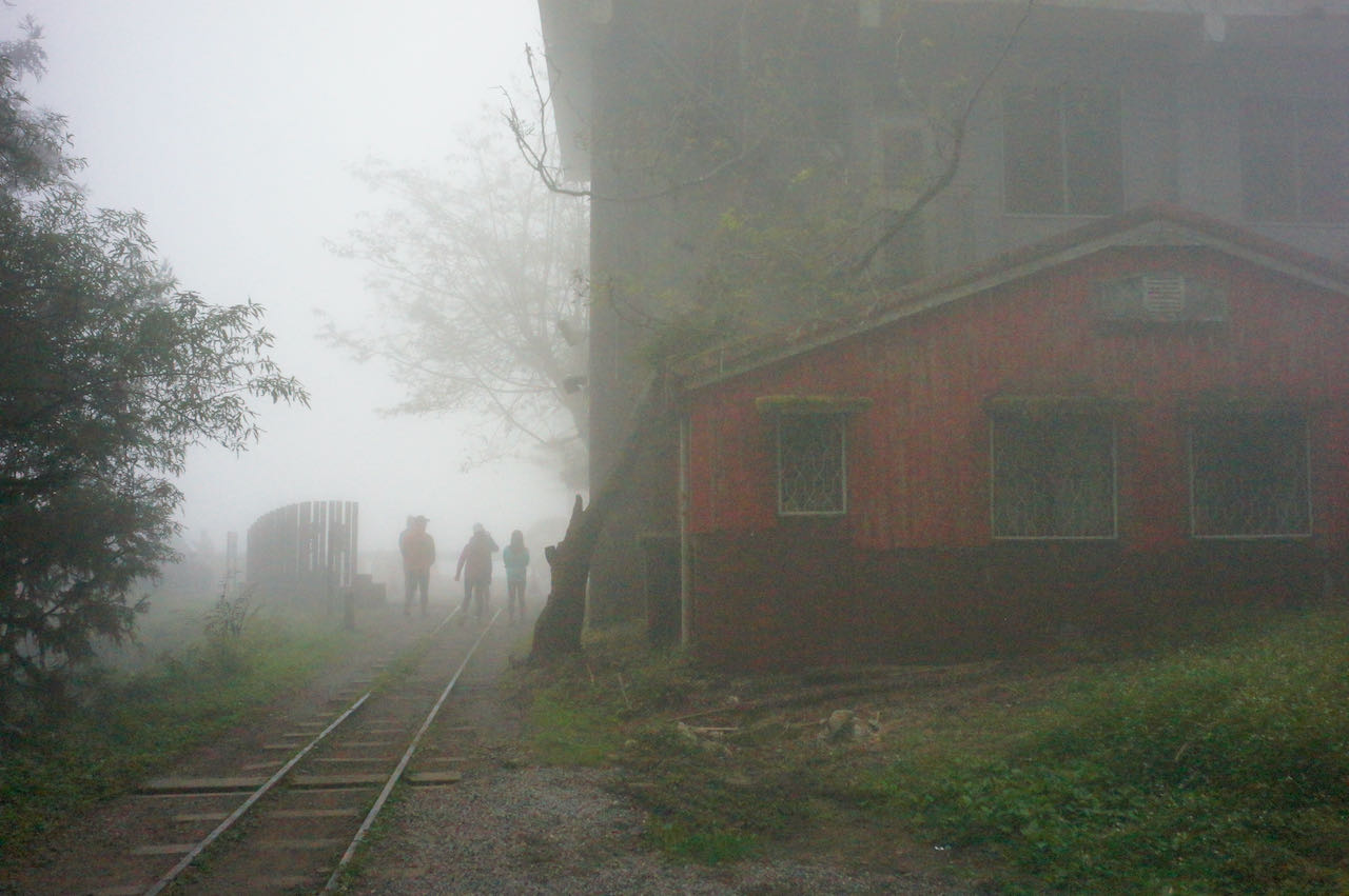
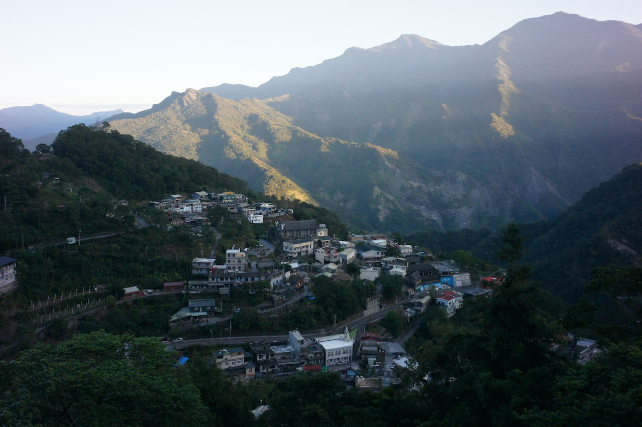
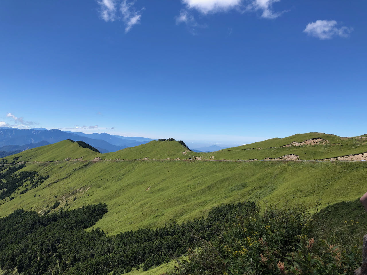
    As we were getting closer to the top, the slope became milder and the dense vegetation disappeared, replaced by a vast view of the mountain ridges. We reached a gate (altitude 913 m) leading to the recreational area. An entrance fee of NTD 100 per head will be charged. There is a viewing platform at the peak (altitude 1212m) around 4 km from the gate. But unfortunately, the hiking trails in the paid area are not cyclable. We were also told that we could not push bikes into the paid area, where there was parking space for cars, which seems really unreasonable for me. Although there was a rack for parking bikes outside the gate, we did not want to leave our bikes unattended for hours. So, we decided to call it a day and started our return leg.

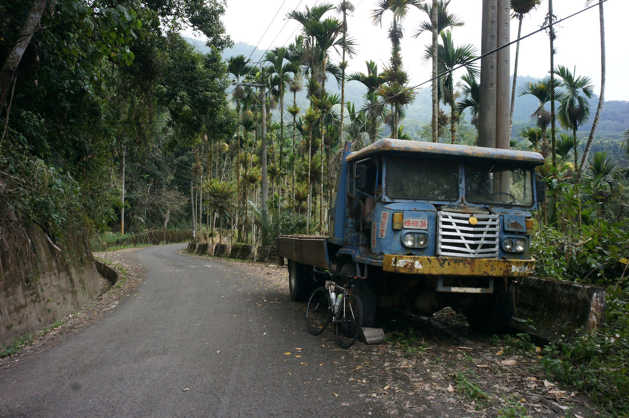
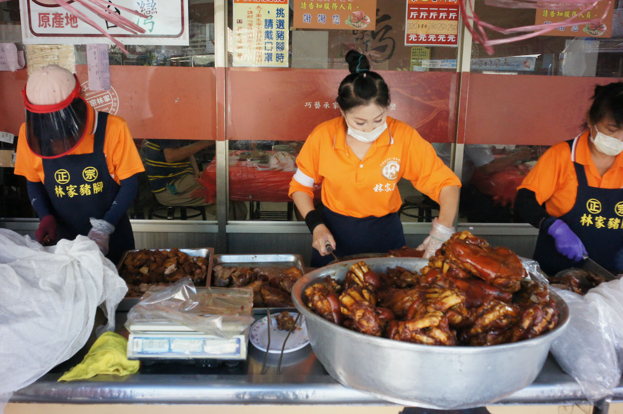
    We were back at a Y- junction, supposedly with County Highway TY119 on the left and County Highway TP113 on the right. But the road on the right looked so small and rugged that we wondered if that was really TP113. A cyclist climbing up from that road confirmed it was and the condition was not as bad as it looked outside. We descended 630 metres in 8.7km (average gradient 7.2%) via that road and had lunch in the first restaurant we saw. The descent was so quick that I had to equalize pressure on either side of the eardrum.

    Then it was a straightforward way back to Dingpu for an MRT ride home. 

    I would suggest avoiding using this road for descent when it is wet because I saw some residue of mosses even on the centre of the road. That means the road will get really slippery if it gets wet. It may be a good idea to cycle this route clockwise. The climb would be much harder but the descent would be mild and safer. Dongyanshan is said to be a difficult climb because most cyclists will do it this way.

    Follow Up:

    We wrote to the Forestry Bureau for the possibility of parking the bikes inside the gate. The message was heard and they will consider doing it.

    Routes:

    NOTE: To use the routes, please install the App on your smartphone. The App will launch and load the route automatically after you tap the above links on your smartphone’s browser. For Garmin Connect, you can then use the APP to send the route to your garmin device. If your Garmin device is not purchased in Taiwan, you will also need make sure you have the Taiwan map on your device. Here is our blog post on this topic.

  • Cycling Route: Wufenshan and Buyan Pavilion – Climb Training

    Cycling Route: Wufenshan and Buyan Pavilion – Climb Training

    このブログ記事の翻訳を進行中です。もうすぐ完成しますので、後ほど再度ご確認ください。ご不便をおかけして申し訳ありません。現在は、こちらで提供されているGPXルートや地図などの情報を自由にご利用ください。

    I went for a cycling trip with a group of cyclists in the outskirts of Taipei on a Saturday in mid June. It is a 67km loop with two climbs to Wufenshan Meteorological Radar  Observatory 五分山氣象雷達站 (757m) and Buyan Pavilion 不厭亭 (530m). The route is designed by Sandy, my cycling enthusiast friend who wanted to offer a group of cyclists from the southern part of Taiwan an unique cycling experience here in the northern part of the island. The downloadable GPX file of this cycling route is at the end of this post. 

    For people living in Taipei city, we can just hop on our bike, head towards a random direction, and there will be a cycling route waiting for us. We can reach those small quiet towns in the outskirts of the city in 1-2 hours. However, in order to get away from the city traffic as soon as possible and spend more time in the countryside, we sometimes take the train with our bikes to get away from Taipei first and begin our ride somewhere else. That day I was to meet my friends in Ruifang Station 瑞芳站 at 6:30 am. I bagged my bike, boarded the earliest north-bound train at Nangang Station 南港站, and arrived at Ruifang Station in 40 minutes. Please refer to this post for more information about traveling with your bikes on public Transportation in Taiwan

    I found a breakfast shop next to two convenience stores (7-Eleven and OK mart) outside Ruifang Station. It offers a wide range of traditional picks that turn plain flour into different kinds of products like deep fried bread sticks, clay oven rolls, and steamed buns of sweet or savory favors. The soybean milk had a slightly burnt taste, which I found really good to go with a clay oven roll. I usually prefer not to eat too much carbohydrate but I needed to load up some energy for the climbs that day. 

    After meeting up and exchanging some greetings, we headed off to County Highway 106 via Provincial Highway 2D (Shown on Google Maps as 2丁) for the first climb. I had cycled on County Highway 106 a couple times before, but all in the opposite direction, starting off from Nangang, and for a descent. I always found the road rather steep. However, when doing the climb, it wasn’t as bad as I had expected. The first part of the first climb, which is around 7.63km, with an elevation of 476m (average gradient around 6.2%) was completed in an hour. It was probably the 14 sharp turns on this route, rather than the gradient, that made me nervous when I was descending.

    After taking a short break chatting with the teammates underneath a small pavilion, where we enjoyed some breeze and the sea view, I reached a familiar junction with a U-turn that leads to a small path for more climbing. I had passed this junction in my previous rides and had always felt relieved for the fact that I didn’t have to take this route after cycling for around 40km from Nangang. But this time, we were going this way because it was the detour mapped out by Sandy that would bring us to the Wufenshan Meteorological Radar Observatory. It turned out to be one of the most enjoyable climbs I have ever done. I reached a state of euphoria in a split second as soon as I arrived at the first turn, which rewarded us with a panoramic view of the peaks sitting on multiple layers of ridges and the sea afar. It was another climb of 281m in 4.55km but I did not notice making any effort reaching the top. There were fellow cyclists doing climb sprinting along the route. If you stop to take pictures, please watch out for speedy bikes coming both ways. 

    We took a dive from the top (757m) all the way to Shifen 十分 (elevation 175m), a small town in a valley, for a short break and some supplies. Shifen had been attracting hordes of tourists for its signature activity of sky lantern launching. Before sending your sky lantern up into the air, you can make wishes by writing them down on the lantern. It must be fun to do that. However, the industry is under the accusation of causing environmental issues and wildfire risks. I surely don’t want the lantern with my wishes on it dangling on a tree and becoming an eyesore of an otherwise beautiful valley, nor do I want it setting fire to someone’s home. To address these issues, the industry and the Tourism Bureau have formulated some countermeasures, including restricting the launch to certain areas, limiting the amount of fuel in the lanterns so as to prevent them from traveling afar. There are also schemes implemented to retrieve and recycle the used lanterns. A local cultural preservation group even developed a new kind of lantern that will self-incinerate in the air after launching, which I find a very good idea. Now I’m more willing to have a try. 

    We took the Provincial Highway 2C (shown on Google Maps as 2丙) to the next town, Shuangxi 雙溪, for lunch. It was another thrilling speedy glide on the wide and straight highway, after climbing a short slope to the tunnel. If you see a spike on the elevation profile on your GPS route, it’s probably because your GPS App fails to recognise the tunnel and tracks it as if you have climbed over the hill. Before we reached Shuangxi, we switched to a small road along a stream for less traffic and more shade. GPS route is available at the end of this post.

    We set off to Buyan Pavilion refreshed. It’s harder for this climb because of the heat in the afternoon. On the other side of the hill sits an interesting town, Jiufen 九份, where Sandy had plotted an eventful route full of interesting spots for the group to visit. But I realized mid-way through the climb that I probably shouldn’t stick with the plan. As I had another cycling trip with a new friend early next morning and I had no idea what his average speed would be, I did not want to exhaust all my strength, risking not being able to keep up with him. So, not without regret, I returned to Shuangxi, packed my bike and took the next train home. 

    That was a wonderful trip. I will surely do it more in the future. As shown on the GPX route at the end of this post, after descending from Buyan Pavilion, there are two branches before reaching the coastal line. The first one to Jioufen Elementary School is for a dessert shop that serves shredded ice topped with taro balls. Located on the edge of the hillside, the shop offers a nice sea view to customers along with delicious desserts. It’s very popular amonglocal cyclists. The other branch leads to an old small canal bridge, which is very photogenic. And there are yet more to be visited. 

    Thank you Sandy for designing such a wonderful route. 

    For more information about Buyan Pavilion, here is another post. https://www.bikeexpress.com.tw/2019/cycling-route-buyan-pavilion-climb-training/

    Routes:

    NOTE: To use the routes, please install the App on your smartphone. The App will launch and load the route automatically after you tap the above links on your smartphone’s browser. For Garmin Connect, you can then use the APP to send the route to your garmin device. If your Garmin device is not purchased in Taiwan, you will also need make sure you have the Taiwan map on your device. Here is our blog post on this topic.

  • Cycling Route: Crocodile Island – Climb Training

    Cycling Route: Crocodile Island – Climb Training

    このブログ記事の翻訳を進行中です。もうすぐ完成しますので、後ほど再度ご確認ください。ご不便をおかけして申し訳ありません。現在は、こちらで提供されているGPXルートや地図などの情報を自由にご利用ください。

    I went for a cycling trip with a small group of local cyclists on a Saturday in May, to get a good look at the Crocodile Island 鱷魚島, which can be found in the Fei-ts’ui Reservoir 翡翠水庫 in Shiding District 石碇區 of New Taipei City. It is a 41km route with a maximum altitude of 583m and an elevation gain 1871m. The cycling route is designed by the group leader Sean Fang. The GPX file is downloadable at the end of this post. 

    We met at 7:30 am outside Taipei Zoo, and then took County Highway 106B (shown on Google Maps as 106乙) to a junction where 106B meets 106. With two big convenience stores (7-Eleven and Family Mart) and some parking space available, this junction has become a popular stop among cyclists and motorcyclists for toilet breaks and supply. It’s particularly crowded during weekends, so you better park your bike securely before getting into the stores, lest some careless souls may hurt your beloved one by accident.

    After getting what I needed in one of the convenience stores, I was called by my friends to help a young lady cyclist who can’t speak mandarin. Turned out she was looking for the toilet, which was apparently in short supply in this area. The shopkeeper was so kind that he let her use the one reserved for staff. 

    Let me sidetrack a bit to talk about toilets in Taiwan. Only a special kind of toilet paper, which is specifically designed to be dissolvable in water, can be flushed down the toilets in Taiwan. But in old buildings or many rural areas where the draining pipes are old and narrow, toilets get clogged very easily, especially when they are in heavy use. That’s why you can always find a garbage bin inside the compartment of those toilets, which is where the used toilet paper is meant to go. Please do not hesitate to use it. Otherwise you may be left in a very embarrassing situation. And when enough toilets are clogged, shopkeepers may stop letting us use their toilets. 

    So, we continued on the County Highway 106B and then made a right turn onto the Township Road TP47 (Shown on Google Maps as 北47) after passing the small town called Shiding.

    TP47 splitted into TP47 and TP47-1. We were supposed to take TP47-1 and start the climbing. But this turn is a bit tricky – Sean had led us to a wrong path even though he was the one who plotted the route and it was not his first time here. Anyway, we realized our mistake soon enough as the road became impossible for cycling.

    TP47-1 is good for cycling in late spring and summer as the trees along the route will protect us from the sun. That day there were practically zero motor vehicles but we had several cycling groups doing the climb with us. Around midway of the route, there was a handmade noodle workshop, HSU’s Noodle, where visitors could try making their own. For us, it was a nice location for taking a break and getting some supplies. It’s also interesting to see how noodles are made in the traditional way. 

    We reached the top and met Beiyi Road (Provincial Highway No. 9). It was a good climb, but I don’t think it’s a good idea to descend on this route because the shade beneath the trees keeps the surface wet and thus makes it a hotbed for slippery mosses. We actually saw an ambulance rushing past us that day, possible for a bike accident. A member of our group told me that they would have cancelled this trip if it had rained heavily the previous day because the road surface might not have enough time to dry. And if it’s summer, you’d better end the trip around noon because there usually are thunderstorms in the afternoon. 

    So, we were on one of the twin peaks on Beiyi Road, which connects Taipei and Yilan County. Some cyclists who do the around-the-island anti-clockwisely would take this route to get back to Taipei. It is the final leg and the end of the final climb. After that, all they need to do is a long descent all the way to Taipei to complete the loop. A coffee shop and some traditional food stalls are here to help make an early celebration. 

    We were also heading to Taipei from here but would make a detour first to take a look at the Crocodile Island. We needed to switch to a small road right next to a small police station after a short descend. So, take it easy and don’t go too fast or you will miss the turn. 

    The detour was around 2.5 km on a small road with an elevation profile shaped like a “V”. It was so steep that, when descending, some in our group found themselves not able to keep their grips firm on the brakes. And when ascending, we all gave up riding and pushed our bikes to the first viewing platform after passing by a beautiful tea farm. Those on motor vehicles were so impressed that we could make it there on bikes. 

    In order to get to a better viewing spot, we left our bikes and hiked a short trial. It may be a good idea to bring a bike lock if you want to have greater peace of mind. 

    The return leg was simple. We headed back to Beiyi Road and took a long thrilling descent to Xindian MRT station. 

    That was a wonderful route. Thank you, Sean.

    Routes

    NOTE: To use the routes, please install the App on your smartphone. The App will launch and load the route automatically after you tap the above links on your smartphone’s browser. For Garmin Connect, you can then use the APP to send the route to your garmin device. If your Garmin device is not purchased in Taiwan, you will also need make sure you have the Taiwan map on your device. Here is our blog post on this topic.

  • Cycling Route: Xiong Kong Tea Plantation – Climb Training

    Cycling Route: Xiong Kong Tea Plantation – Climb Training

    このブログ記事の翻訳を進行中です。もうすぐ完成しますので、後ほど再度ご確認ください。ご不便をおかけして申し訳ありません。現在は、こちらで提供されているGPXルートや地図などの情報を自由にご利用ください。

    I went for a cycling trip from Xindian 新店 to Xiong Kong Tea Plantation 熊空茶園 with a group of local cyclists on a weekend in May. It was a 60km route with two climbs (338m, 728m), planned by one of our fellow cyclists Martin. The tea plantation is operated by Taiwan Tea Corporation 台灣農林 (TPE: 2913), formerly known as Mitsui & Co., Ltd., which was founded in 1899 during the Japanese rule. The downloadable GPX file of this cycling route is at the end of this post. 

    We met at 7:20 am in the convenience store near Xindian MRT station. It had been transformed, by different cycling groups meeting up there, into an outdoor showroom of advanced bikes, cycling outfits, and various cycling accessories. With two convenience stores located conveniently near the MRT station, and a well-maintained toilet inside the MRT station, this spot serves as the default starting point for a number of popular cycling routes, including the section of Provincial Highway No. 9 connecting Taipei and Yilan (Beiyi Road 北宜公路), and the No. 9A (9甲) which brings you to the Wulai District 烏來區 (Xinwu Road 新屋路). 

    After socialising with others and filling up my bottles, I set off with the group to cycle along County Highway No. 110. The first climb soon appeared on our left-hand side on Chezi Road 車子路, leading to Daguan Road 達觀路. Motor traffic was practically zero as it is a cul-de-sac at the top with only a handful of residential buildings sitting along the road. We took a long break at a small pavilion just before we reached the top of the climb. It was a good warm-up to climb 305m.

    Then, Martin showed us a shortcut right next to the pavilion, which leads to the Erbazi Botanical Garden (二叭子植物園) via a series of short stairways. You will have to carry your bikes if you want to take this shortcut, but we all found it worth the effort as it was a beautiful garden. Also, by taking this shortcut, you can avoid descending on the same route.

    Where the botanical garden is located is a humid valley. Plants love humidity. Mosses are growing on the cement surface of the paths in this area, which make them slippery all the time except for a bright sunny day. It’s especially dangerous on the steeper parts, so walking with your bike is mandatory in this case. Go with your walkable pedal shoes if you plan to take this route. We were lucky to have the sun high up and dry the mosses, so that we could ride on our bikes slowly back to the main road.

    When we were back on County Highway No. 110, we started heading to the Sanxia District 三峽. Traffic was not busy and we could set our own pace without pressure. We reached a small town called Jiou Jiou 九鬮 with several stalls selling very juicy roasted pork sausages. Make sure you have more of those before the real climb to Xiong Kong because, at the top, there is only one small restaurant with very limited capacity. On that day it took them 45 minutes to prepare some very standard meal sets for us. 

    After the feast of pork sausages, we went to the 7-Eleven (address: No. 241, Chengfu Road, Sanxia District, New Taipei City, 237) around 300m ahead along County Highway No. 110 for water supply. It’s also good for some more snacks. I would have done that if I had known I would need to wait that long for my meal. The 7-Eleven also comes with a toilet. If you miss this chance, there is another toilet stop 2.3km away at the Daliao Tea House. The tea house is an old Japanese building built in 1944 as the residence of the chairman of the Taiwan Tea Plantation Corporation. We visited it only on the return leg because we did not want to start our climbing late. It’s better time management, I think.

    The climbing starts on the quiet Zhulun Road 竹崙路 (Township Road 北109). Road signs for the tea plantation were clearly displayed along the road. First half of the path was wide. Road surface was well maintained and smooth. The slope was moderate. There were cars and motorbikes passing by sporadically. We all shared the same destination as this road is also a dead end. After the first half, cracked surfaces and small pieces of broken concrete appeared. Roads got narrower, cracks deeper, slopes steeper, and turns sharper as we were approaching the top. I was told that a cyclist friend once had a minor accident on the descending leg when a trailing car imposed pressure on her. Her wheels slipped sideways on the edge of the cracks. She lost balance and fell. Fortunately, her bike was fine and she had minor injuries only. Anyway, this must be an enjoyable route for her, or she wouldn’t have joined us this time. 

    I made it to the top sooner than I had expected. A short, mild downward slope brought me to the entrance of the tea plantation. A wide planform with tables for people to enjoy the vast view of the hills caught my eyes. On my right-hand side, there was a trail leading into a small forest of tall straight pine trees (Japanese Cedar). A billboard showing the elevation of 700 metre was set up right next to the gate of the tea plantation on the other side. They charge NTD100 per head for each visit, which will be rebated when you shop in the souvenir shop. Fair deal. But for us, it’s enough just to stay outside for the views and some food. 

    The descent from the top was tricky because of the condition of the road. When my bike rolled over the cracked surface, my hands were almost shaked off the handlebar. I was lucky to do the ride with a Rikulau Audax Hercules, a flat-bar road bike. I could hold the grip and the brakes securely without making my hands numb. If I had been on a drop-bar, I might have had to stop and let my hands take a break. 

    The return trip to Xindian was very straight forward. That was enough for the day. It was a weekend and I took MRT home with my bike.

    For those who want more, the New Taipei City Yingge Ceramics Museum is 10km away from Jiou Jiou 九鬮. The building itself is nice and worth a visit even if you are not interested in ceramics. There is an outdoor water plaza for some water fun in the summer. Kids love it. Then you may either take a train back to Taipei or cycling back along the Dahan River Bikeway. 

    Routes

    NOTE: To use the routes, please install the App on your smartphone. The App will launch and load the route automatically after you tap the above links on your smartphone’s browser. For Garmin Connect, you can then use the APP to send the route to your garmin device. If your Garmin device is not purchased in Taiwan, you will also need make sure you have the Taiwan map on your device. Here is our blog post on this topic.

  • Step-by-step Installation Guide for SPIN UP F12W-PRO Bicycle USB Charger Dynamo

    Step-by-step Installation Guide for SPIN UP F12W-PRO Bicycle USB Charger Dynamo

    このブログ記事の翻訳を進行中です。もうすぐ完成しますので、後ほど再度ご確認ください。ご不便をおかけして申し訳ありません。現在は、こちらで提供されているGPXルートや地図などの情報を自由にご利用ください。

    In this post I am going to show you how to install the SPIN UP F12W-PRO Bicycle USB Charger Dynamo. It is pretty easy and the box comes with detailed instructions and necessary tools. What I want to share with you are some little tricks that will make the process even easier. 

    My wheel comes with radial spokes. I will suggest you wash the wheel and let it dry completely before installing the SPIN UP Dynamo. 

    After completing the first part of the installation process, we should have the Dynamo securely mounted to the wheel with the little stripes holding the spokes. There should be at least 3 spokes being held, and spaced evenly, to the moving ring of the Dynamo. In my case, there are 10 spokes on each side of the wheel. 3 spokes should be enough but I have used 5. When rolling over the rumble stripes, the bike will usually rattle very violently. I want to make sure the Dynamo is secured.

    Step 1. Get your wheel, Dynamo, and tools ready

    Step 2. Attached the Dynamo to the black stand holder. It will ensure the wheel and the Dynamo lay stably on a flat surface while we work on the screws. It also makes sure the Dynamo’s ring is attached to the centre of the wheel.

    Step 3. Remove the quick release cap and conical spring completely from the skewer. Keep the conical spring and the cap in a safe place.

    Step 4. Attached the Dynamo to the wheel. Screw gently the skewer into the black stand holder.

    Step 5. Decide which spokes to be mounted and mark the screw holes to be used. Inspect if there is any gap between the spoke and the Dynamo’s ring. If any, put the little metal stripes between them until the gap is filled. This is important as we will later press the spokes to the ring with quite some pressure. If there is any gap in between, the spoke will be deformed or even cut. The metal stripes underneath are to protect the spokes. Take note of how many metal stripes will be needed to fill up the gap. In my case, I need only one piece of stripe for each gap.

    Step 6. Unscrew the quick release skewer and remove the wheel. Fix the metal stripes on the dynamo’s ring with the screws provided as shown in the picture. Just insert the screws into the holes with a couple turns. Don’t fully tighten them yet. As observed in Step 5, I need one stripe under each spoke, and another one above the spoke. If you do this with the wheels on, you will find the stripes keep falling into the hole. It is easier to work with the stripes and the screws without the wheels.

    Step 7. Put the wheel back on the Dynamo and screw the quick release skewer gently into the stand holder until the metal stripes underneath are pressed against the Dynamo’s ring. Make sure there is one spoke on each stripe.

    Step 8. Fix both ends of the top metal stripes to the Dynamo’s ring. Again insert just a couple turns of the screws.

    Step 9. The stripes are now held in place and ready to be tightened. We want the pressure evenly applied to the ring. So, tighten each screws only 2 – 3 turns and then switch to the next one. Then when it gets harder, make a quarter turn one by one.

    How tight should it be? The metal stripes should be bended, forming a curve as shown in this picture. They are made with soft steel and are designed to be maneuvered like this.

    Step 10. Remove the quick release skewer.

    Step 11. Remove the stand holder from the Dynamo. Remember: don’t grab the Dynamo and turn the wheel, and don’t hold the wheel by the Dynamo. Otherwise, it will be thrown off-center.

    Step 12. Put the quick release cap and the conical spring back on.

    Voila! Now we have finished part one of the installation process, let’s get the USB charging unit ready and move on to part two. Here are the components included.

    Step 13. Put the front wheel back to your bike, the usual way.

    Step 14. Use the cable tie to hold the Dynamo to the fork really tightly. So tightly that even when the bike rattles on uneven roads, the Dynamo rattle with fork as one. Do not  tie the spoke to the fork. This is not impossible as the spokes may be very close to the fork. The cable tie is releasable and reusable, which is convenient when you need to remove the front wheel.

    Step 15. Connect the Dynamo to the USB charging unit. There are 3 pins.

    Step 16. Run the cable to the handle bar; use the rubber bands provided to secure the cables.

    Step 17. Fix the USB charging unit to any location you like. This is one possibility.

    That’s it! Get your phone connected, start pedaling, and get it charged!

    By the way, SPIN UP F12W-PRO is capable of powering the front and rear bike lights while charging your phone at the same time. The USB charger comes with a wiring branch (the yellow part shown in the photo above) for connecting the lights. A light set by Herrmans, H-flow and H-trace, can be bought separately on SPIN UP’s official site. I don’t have the need for powerful lights like this right now, as I don’t cycle much at night. A pair of rechargeable lights, which can be also be charged by the Dynamo, is good enough for me. I will write another post when I have the chance to try out the Herrmans light set.

    For a complete visual guide, including connection to the lights, here’s a video clip from SPIN UP:

  • Cycling Route: Maokong Loop – Climb Training

    Cycling Route: Maokong Loop – Climb Training

    このブログ記事の翻訳を進行中です。もうすぐ完成しますので、後ほど再度ご確認ください。ご不便をおかけして申し訳ありません。現在は、こちらで提供されているGPXルートや地図などの情報を自由にご利用ください。

    Maokong Loop is a 13km long, single-peak (326m) cycling route in Wenshan District, South East of Taipei City. We went there on a public holiday in May, me on a Rikulau Audax Hercules and Lois on a Klever Q Comfort. The downloadable GPX file of this cycling route is at the end of this post. 

    Maokong is a popular tourist area where people can take the Maokong Gondola at the Taipei Zoo Station (next to the Taipei Zoo MRT Station of the Brown Line) to the top of the hill, take a leisure walk along the route on the peak, and enjoy the panoramic view of Taipei City with a cup of tea grown locally in one of the many tea cafes scattered around. This area used to be the biggest tea plantation in Taipei. As for kids, there is of course the amazing Taipei Zoo at the foot of the hill that never fails to offer joy and wonder. 

    To get to the starting point of this route, simply set your GPS navigation to this address: “No. 12, Section 1, Xinguang Road, Wenshan District”. It’s a 7-Eleven with a spacious area outside where you can park your bikes. If you start your ride early enough in the morning, say around 6:00, road traffic should be quite sparse and you will take less than an hour to get there from the centre of Taipei. 

    Strava (anti-clockwise): https://www.strava.com/routes/26747667

    If you start late and want to avoid the traffic, you may take the MRT Green Line to Jingmei Station, as the Brown Line does not take bicycles, and then use the following route to get to the starting point:

    Strava: https://www.strava.com/routes/26748715

    Taipei MRT takes bikes during weekends and between 10:00-16:00 on weekdays, except the Brown Line and a few busy stations. 

    If you are in the west side of the city like Datong District, Zhongzheng District, or Wanhua District, you may take a pleasant detour along the Riverside Bikeways to get to Maokong. We have compiled a list of the access points to the Riverside Bikeways in this post.

    As to us, we live on the east end of Taipei. There is a popular and well shaded cycling route linking up that part of the city and the area around Taipei Zoo, by going along Section 1, 2, 3, and 4 of the Academia Road (also known as Yanjiuyuan Road), followed by Lane 43, Section 5 of Muzha Road. It’s a 15.5km ride with 177m of elevation gain and very sparse motorized traffic:

    Strava: https://www.strava.com/routes/26403740

    We took a brief break and fueled up at the 7-Eleven before heading for the real climb. Traffic was busier than usual because it’s a holiday but still not too bad for cycling. I had done the loop anti-clockwise before, so this time we opted for a clockwise ride by taking the left branch at the Y junction on Section 3 of Zhinan Road.

    It was a straight, continuous climb all the way up to the top without much shade at noon time. The climbing ended shortly after we took a right turn and cross a short bridge called Caonan Bridge 草湳橋. There was then a mild downward road winding around the peak, lined with tea houses and cafes. Once you reach the busy Gondola Terminal, the descent back to the ground level starts. It may be a good idea to bring along a book if you have the whole day. It is said that the sunset and night views there are really great, so night rides along this route are popular among local cyclists. If you googled 夜騎貓空, which means night rides in Maokong, you will find lots of blog posts in Chinese. But for first-timers, it may be better to do it during daytime for safety consideration.

    Now I have done it both clockwise and anti-clockwise. Which way is better? My vote goes to the anti-clockwise one. It’s because the climbing is less steep and there seems to be more shading. The Gondola Terminal will again greet you at the end of the climb. 

    Strava (clockwise): https://www.strava.com/routes/21611174

    We had a late lunch after the ride, which wasn’t worth mentioning, and then headed back home following the same route.

    There is another route to climb Maokong, via the Hengguang Bridge. It is said that the traffic is sparser. I will have a try later.

    Routes

    NOTE: To use the routes, please install the App on your smartphone. The App will launch and load the route automatically after you tap the above links on your smartphone’s browser. For Garmin Connect, you can then use the APP to send the route to your garmin device. If your Garmin device is not purchased in Taiwan, you will also need make sure you have the Taiwan map on your device. Here is our blog post on this topic.

  • 台湾のサイクリング道路状況:最新情報の確認方法

    台湾のサイクリング道路状況:最新情報の確認方法

    台湾の道路は非常に良く整備されている。地震や台風による損傷が発生した場合でも、迅速に修復作業が行われ、島を一周するサイクリングルートを含む道路は速やかに復旧される。しかし、山岳地帯などの遠隔地では、修復作業がより困難となり、復旧に時間がかかることもある。

    修復作業中の道路では、一時的に通行止めとなる場合や、特定の時間帯のみ通行が許可される場合があり、サイクリングの計画に影響を及ぼす可能性がある。スムーズに走行するためには、交通部公路総局が提供する「省道即時資訊服務」を確認することが重要 だ。

    • 以下のウェブサイトで最新情報をチェックできる:https://168.thb.gov.tw/thb168
    • 右上の「Switch Language」をクリックし、English または 中文 を選択する。
    • 「省道影像(Prov. Highway CCTV)」をクリックして選択を解除する。次に、「施工路段(Construction Info.)」と「災害路段(Disaster Info.)」をクリックして選択する。
    • 地図上で訪れる予定のエリアをズームイン する。
    • 地図上のアイコンをクリック して詳細情報を確認する。
    • テキストを選択し、コピーする。その後、Google 翻訳 や ChatGPT などの翻訳サービスに貼り付けて内容を確認する。

    「施工路段(Construction Info.)」と「災害路段(Disaster Info.)」のどちらにも交通規制情報が掲載されることがあるため、両方のカテゴリの情報を確認することが重要だ。翻訳がわかりにくい場合でも、翻訳サービスのせいにしないでほしい。原文自体が中国語話者にとっても理解しづらい場合があり、私自身も内容を正確に把握するために最寄りの警察署に電話で確認することがある。

    また、このウェブサイトは省道(Provincial Highways)のみの道路状況を提供している ことに注意が必要だ。

    より交通量が少なく景色の良い県道(County Highways)、郷道(Township Roads)、産業道路(Industrial Roads) を選びたい場合、これらの道路の情報をまとめた中央管理のウェブサイトは現時点では見つかっていない。そのため、特定の道路の最新情報をニュースで検索したり、最寄りの警察署に問い合わせたりすることが不可欠 となる。

    さらに、ホテルやレストランを予約する際にスタッフから道路閉鎖に関する有益な情報を得られることもあるので、事前に尋ねてみるのも良い方法だ。もし道路状況が悪い場合は、より大きな道路へ迂回する方が安全 である。

  • サツマイモを切り裂く – 台湾の壮大な山岳地帯を巡るサイクリング(2)

    サツマイモを切り裂く – 台湾の壮大な山岳地帯を巡るサイクリング(2)

    2023年11月初、Eddie Chen の「北進武嶺・南出鵝鑾鼻、台湾縦断500マイル」の南半分に参加し、自転車で台湾の山岳地帯を走破する「サツマイモを切り裂く」プロジェクトを完遂した。この旅の北半分については、本シリーズの最初の投稿を参照してほしい。

    北半分の旅では、すでに台湾で最も標高の高い舗装道路である武嶺を登った。後半では、数多くの茶畑や先住民族の集落を巡り、豊かな文化遺産に触れる旅となった。

    第1日目:埔里 → 水里 → 和社(同富)

    北半分の旅では、台湾地理中心碑で最初の区切りを迎えた。今回、私たちは再びサポートカーでそこまで移動し、ライドを開始した。

    県道131号線を南下すると、無数のビンロウ(檳榔) の木々が並ぶ美しく静かなルート が続いていた。最初の目的地は日月老茶廠。ここは、紅茶の製造工程を展示する素晴らしい建物を有する茶園で、製茶機械も見学することができた。

    その後、県道131号線を少し離れ、二水駅から延びる集集線の終着駅「車埕駅」へと下った。現在、集集駅から車埕駅までの区間は修復工事中であり、2025年末まで運行予定がない。

    この日のハイライトは郷道投59号線だった。このルートをより長く楽しむため、水里で昼食をとった後、サポートカーを利用して省道21号線の15kmをショートカットした。郷道投59号線は、南投県和社にある布農族と鄒族の集落を結ぶ狭い山道だ。途中、羅娜(この村についての興味深い投稿はこちら)、馬馬哈瓦娜(Mamahavana)、同富(Toungfu) などの村を通過する。このルートを走ることで、地元農家が栽培するさまざまな作物 を目にし、谷全体を見渡せる絶景 を楽しみ、村々の暮らしを間近に感じることができた。

    ルート

    ルートのご利用方法

    紹介したルートを使用するには、アプリのインストールが必要です。スマートフォンのブラウザで上記のリンクをタップすると、アプリが自動的に起動してルートを読み込みます。Garmin Connectの場合、アプリを使用してルートをGarminデバイスに登録できます。台湾で購入したGarminデバイスではない場合は、デバイスに台湾地図がインストールされていることも確認する必要があります。Garminデバイスのご利用方法を説明した当社のブログ投稿もこちらからご覧いただけます。

    第2日目:同富 → 塔塔加 → 石卓(竹崎郷)

    同富に別れを告げ、壮大な山々に囲まれた省道21号線を41kmかけて登坂 した。塔塔加は、玉山を含む登山者が集まる人気の拠点 であり、そこへ到達するには2,000メートル以上の標高差を登る必要があった。なお、草坪頭から塔塔加までの区間は、落石の危険があるため、17:00から翌朝7:00まで通行禁止 となっている。そのため、日中の時間帯にこの区間を通過する計画を立てることが不可欠だった。

    幸い、山を貫く短いトンネルがいくつも設けられており、これによって坂の勾配が和らげられていた。標高が上がるにつれて霧が発生し、空気中の水蒸気が冷えて水滴となり、幻想的な風景を作り出していた。

    写真を撮るために立ち止まった際、自転車にパニアバッグを2つずつ積んだ強靭なサイクリスト2人に出会った。彼らは完全自給自足のツーリングをしており、その日の朝に日月潭を出発し、阿里山を目指していた。ルートの総距離は110km、獲得標高は2,620メートルにも及ぶチャレンジングな行程だった。私たちの補給ポイントで、ドライバーが彼らに高カロリーのスナックを提供し、目的地までの「燃料」を補給できるようサポートした。

    標高2,600メートルに位置する塔塔加は、この旅で最も標高の高い地点だった。Eddie によると、この地点を超えると天候が変わりやすく、特に南風が吹くと雨が降ることが多いという。この日、私たちは塔塔加の頂上でライドを終え、車で特富野古道二萬坪駅に向かった。そこでは短いハイキングを楽しんだ。

    特富野古道はかつて鄒族の狩猟道として利用されていたが、日本統治時代には伐採した木材を運ぶための鉄道ルートとして活用されていた。現在では、全長10km以上に及ぶ美しいハイキングコースとなっている。

    二萬坪駅は、阿里山森林鉄道の駅のひとつである。しかし、この鉄道は2024年夏まで完全運行には至っていない。この駅のプラットフォームからは、雄大な山々を見渡すことができる。現在、列車が運行していないため、線路上を歩きながら、巨大な空洞を持つ木を見に行った。ここで南投県を離れ、嘉義県に入った。

    ルート

    ルートのご利用方法

    紹介したルートを使用するには、アプリのインストールが必要です。スマートフォンのブラウザで上記のリンクをタップすると、アプリが自動的に起動してルートを読み込みます。Garmin Connectの場合、アプリを使用してルートをGarminデバイスに登録できます。台湾で購入したGarminデバイスではない場合は、デバイスに台湾地図がインストールされていることも確認する必要があります。Garminデバイスのご利用方法を説明した当社のブログ投稿もこちらからご覧いただけます。

    第3日目:石卓から小林村記念公園へ、車で宝来温泉へ移動

    前日に塔塔加に到達した後、阿里山郷の省道18号線を引き続き下っていった。標高が下がっても、周囲の山々に広がる茶畑の景色は依然として美しかった。その後、Eddie の案内で勤山産業道路に入った。この道は急勾配で曲がりくねった細い道 で、最終的に茶山村(別名チャヤマヴァナ Chayamavana) にたどり着いた。この村には、布農族、鄒族、漢民族が共に暮らしている。ここでは、先住民族によって栽培されたコーヒーの木を見る機会があった。

    午後は、ナマーシャ区から南へ向かい、省道29号線を通る壮大な渓谷を駆け抜けるライドがハイライトとなった。省道29号線は旗山渓沿いに走り、右岸と左岸を何度も行き来するルートになっている。川を渡るたびに、まるで映画スクリーンのようにそびえ立つ巨大な岩壁 が現れ、その迫力に圧倒された。まさに他では味わえない特別なサイクリング体験 だった。

    私たちは小林村記念公園でライドを締めくくった。この公園の地下には、2009年の台風モラコットによる土砂崩れで400人以上の命が奪われた村 が眠っている。ここは、自然の力に敬意を払い、山を探検する際には常に安全を最優先にすべきであることを思い出させる場所 でもある。

    その夜は、高雄の宝来温泉のホテルでゆっくりと過ごし、旅の疲れを癒した。

    We concluded our ride at Xiaolin Village Memorial Park. Beneath this memorial park lies a village where over 400 lives were buried in a landslide caused by Typhoon Morakot in 2009. It serves as a poignant reminder to respect Mother Nature and prioritise safety when exploring the mountains.

    We spent a relaxing night in a hot spring hotel in Baolai, Kaohsiung.

    ルート

    ルートのご利用方法

    紹介したルートを使用するには、アプリのインストールが必要です。スマートフォンのブラウザで上記のリンクをタップすると、アプリが自動的に起動してルートを読み込みます。Garmin Connectの場合、アプリを使用してルートをGarminデバイスに登録できます。台湾で購入したGarminデバイスではない場合は、デバイスに台湾地図がインストールされていることも確認する必要があります。Garminデバイスのご利用方法を説明した当社のブログ投稿もこちらからご覧いただけます。

    第4日目:宝来温泉から霧台へ

    今日は、ルカイ族の領域 に足を踏み入れた。私にとって特別な意味を持つ場所でもある。というのも、私のバイクのブランドであるリクライ(Rikulau)は、ルカイ族の聖なる動物であるウンピョウ(Clouded Leopard)にちなんで名付けられているからだ。伝説によると、この神秘的な生き物が足跡を残し、ルカイ族の祖先を大武山(Da-Wu Mountain)のふもとにある深い森の中の永住の地 へと導いたという。

    私たちは、「サツマイモを切り裂く」ルートを進みながら、途中で二つのルカイ族の村に立ち寄った。一つ目の村は茂林区の多納で、昼食のために登った。もう一つは、今夜の宿泊地である霧台だ。

    村の建物の壁には、ユリの花を頭に飾った人々の漆喰のレリーフ が数多く見られた。これは、ルカイ族において特別な地位を示すものであり、簡単には得られない名誉を象徴している。ルカイ族の男性がこのユリを身につけるためには、5~6頭のイノシシを狩る ことが必要とされる。一方、女性にとっては、美徳と貞節を意味する ものだった。

    ルート

    ルートのご利用方法

    紹介したルートを使用するには、アプリのインストールが必要です。スマートフォンのブラウザで上記のリンクをタップすると、アプリが自動的に起動してルートを読み込みます。Garmin Connectの場合、アプリを使用してルートをGarminデバイスに登録できます。台湾で購入したGarminデバイスではない場合は、デバイスに台湾地図がインストールされていることも確認する必要があります。Garminデバイスのご利用方法を説明した当社のブログ投稿もこちらからご覧いただけます。

    第5日目:霧台から鵝鑾鼻へ

    今日は早朝に霧台を出発し、山々の中での美しい日の出を見るライドを楽しんだ。その後、朝食前にルカイ族の村を散策 し、彼らの文化や暮らしに触れた。

    私たちの旅の最後の先住民族の村となったのはリナリ村だった。この村は2009年の台風モラコットによって家を失ったパイワン族とルカイ族の人々のために設立された 移住村である。この村で文化を守ろうと奮闘するアーティストの活動について詳しく書かれた記事があるので、興味のある方はぜひ読んでほしい。

    標高を下げながら海に近づき、万巒郷に入ると、漢民族が多く住む地域に移っていた。1683年から1695年頃の清朝統治時代、この地域は先住民族と漢民族の境界線 となっており、清の行政が及ばない未開の地とされていた。この空白を埋める形で、カトリック教会が福祉と保護を提供 するようになった。この地に建てられた万金聖母聖殿は、1869年に完成した美しい教会である。しかし、その歴史はさらに遡り、1861年にはすでに教会活動が始まっていた。1875年、清の皇帝はこの教会を正式に認め、皇帝の使者が視察報告を行った後、教会の前に石碑を建てた。この地の人々がカトリックの影響のもとで調和のとれた生活を送っていることを評価したためである。そして、1984年にはローマ教皇ヨハネ・パウロ2世が、この教会に「バシリカ」の称号を授与した。これはカトリック教会における最高位の格付け である。

    万巒で名物の滷豬腳を昼食に楽しんだ後、サポートカーで恒春まで移動し、旅の最後の区間となる鵝鑾鼻へのライドを開始した。私たちはまず、県道200号線と200甲号線 を東へ進み、その後、省道26号線を南下した。このルートは東海岸沿いを走る ため、雄大な景色と深く鮮やかな青い海 を眺めながら走ることができた。

    ついに、台湾本島の最南端 に到達し、静かに佇む美しい鵝鑾鼻灯台を訪れた。灯台は公園内にあり、自然に囲まれた穏やかな雰囲気が漂っていた。

    ルート

    ルートのご利用方法

    紹介したルートを使用するには、アプリのインストールが必要です。スマートフォンのブラウザで上記のリンクをタップすると、アプリが自動的に起動してルートを読み込みます。Garmin Connectの場合、アプリを使用してルートをGarminデバイスに登録できます。台湾で購入したGarminデバイスではない場合は、デバイスに台湾地図がインストールされていることも確認する必要があります。Garminデバイスのご利用方法を説明した当社のブログ投稿もこちらからご覧いただけます。

    旅の締めくくり

    Eddie は限られた時間の中で台湾の山岳地帯の魅力を最大限に引き出す素晴らしい旅程 を作り上げてくれた。彼は単にルートの道路状況に精通しているだけでなく、特定の場所に最適な時間帯に到達する方法 も熟知していた。ドライバーとの連携も見事で、あまり見どころのない区間をうまく省略しながら、ベストなタイミングで訪れるべき場所へと導いてくれた。Eddie が長年にわたり山を探検し、数々の丘を登り、先住民族と出会いながら台湾の山岳地帯の魅力を発信してきたことは、彼のこの島への深い愛情の表れ だと感じた。彼のツアーに参加できたことを、心から幸運に思う。

    台湾の山岳地帯を自転車で体験する方法は、グループでサポートカー付きのツアー に参加するだけではない。例えば、決まったスケジュールを持たずに山中を自由に旅し、村に滞在しながら地元の人々と交流を深めることもできる。あるいは、3日間のショートトリップで一部の山岳地帯を巡る のも良い選択肢だ。都市部へのアクセスが容易なため、短期間でも十分に楽しめる。また、より過酷な挑戦を求めるなら、スピーディーに山を駆け抜けるスタイルも可能 だ。例えば、台湾瘋單車協會(Taiwan Mad Bike Association)は台湾中央山脈を3日間で走破する「台湾ツインタワーズ中央ルート」というチャレンジライドを開催している。

    どのスタイルを選ぶにせよ、綿密な計画、道路状況の確認、天候の把握は不可欠だ。自分の安全を守ることが何よりも大切。それを心がければ、山々は忘れられない体験を与えてくれるだろう。

  • 日月潭へのサイクリングルート:絶景ルートと旅行のヒント

    日月潭へのサイクリングルート:絶景ルートと旅行のヒント

    日月潭は、台湾のサイクリング愛好者や観光客に人気のある目的地の一つです。南投県の中央部に位置するこの湖は、美しい景観に囲まれ、世界中のサイクリストを魅了する絶景ルートを提供しています。

    日月潭へサイクリングで向かう方法はいくつかあり、クラシック9日間台湾一周ルートからの寄り道や、電車を利用して異なる駅からライドを開始する方法もあります。ここでは、いくつかのルートを提案します。

    多くのサイクリストは交通量の少ないルートを好むため、今回は 県道を中心とした小道を通るルートを選びました。これらの道は走っていて楽しいですが、暗い時間帯はナビゲーションが難しくなる ため注意が必要です。また、悪天候時には道路の状態が悪化することもあります。その場合は、省道などの主要道路に切り替えることをおすすめします。

    彰化から日月潭へのサイクリング

    彰化から日月潭へ向かうルートは、クラシック9日間台湾一周旅程の寄り道として人気のあるルートの一つです。2日目に彰化に到着し、翌日に日月潭または嘉義へ向かう選択肢があります。

    公式のサイクリングルートNo.1(3日目+1)は、省道14号線と21号線を主に通るルートを推奨しており、舗装状態が良く、最短距離でアップダウンも少なめです。しかし、このルートは交通量が多く、大型トラックが頻繁に通るため、特に草屯鎮を過ぎたあたりから走行が不快に感じる可能性があります。

    そこで、今回は 県道を中心とした代替ルートを提案します。

    出発地点は彰化駅で、すぐに 県道139号線 に入ります。地元のサイクリング雑誌によると、県道139号線は台湾中部で最も人気のあるサイクリングルートの一つ です。この区間を終えると、ルート全体の 3分の1を走破し、距離は 33km、獲得標高は 550m となります。

    ルートの中盤は、名間郷から水里 までの区間で、約28km、獲得標高は 310m です。名間郷は 茶畑が広がるエリア として知られています。また、集集郷では 鉄道沿いに小道が続く区間 もあります。

    最後の日月潭へのアプローチは、県道131号線を通る21kmのルート で、獲得標高は 523m となります。このルートを進むと 湖の北側 に到着します。もしホテルが湖の反対側にある場合は、省道21号線を選ぶのも良い選択肢です。このルートは 15km で、獲得標高は 582m となります。

    このルートを台湾一周の旅程に組み込むだけでなく、直接電車で彰化駅まで行き、そこからライドを開始するという選択肢もあります。以下は、台北の松山駅から彰化駅まで、輪行袋なしで自転車を持ち込める電車の一覧(平日) です。自転車を持ち込める電車の時刻表の確認方法については、公共交通機関での自転車移動に関するブログ記事をご参照ください。

    公式ルート:彰化から日月潭

    代替ルート1:彰化から日月潭(北側)

    代替ルート2:彰化から日月潭(南側)

    日月潭を訪れた後、公式サイクリングルートNo.1の3日目+2 は主に省道を走るルートとなります。このルートは最短距離で、登りも少なく、サイクリストにとって便利で効率的な選択肢です。しかし、中には距離が長くなっても、より静かな道を走りたい というライダーもいるかもしれません。そこで、ここでは日月潭から嘉義へ向かう代替ルートを提案します。

    公式ルート:日月潭から嘉義

    代替ルート1:日月潭から嘉義

    登りが少ないルート

    私が提案する彰化から日月潭への代替ルート1と2は、公式ルート(獲得標高866m)よりも多くの登り(1,400m〜1,435m)を含んでいます。あるお客様は、登りを避けるために公式ルートを選びました。彼女は、前半の景色は良かったものの、トラックや車の通行量がかなり多く、道路の幅が限られていたと話していました。

    私は、登りが少なく交通量が軽い別のルートについてEddie Chenに相談しました。彼は、彰化から県道137号線を走行し、その後県道152号線を経由して集集(Jiji)へ進むルートを提案しました。そこから、県道を利用して水里(Shuili)へ向かい、投66号線を経由して日月潭の北側に到達できます。もしホテルが湖の南側にある場合は、水里に到達した後、省道21号線を利用できます。

    このルートを利用すると、登りは933m〜973mに抑えられ、交通量の多い道路を避けることができます。

    彰化から日月潭北側ルート – by Eddie Chen

    彰化から日月潭南側ルート – by Eddie Chen

    台中から日月潭へ

    台中も日月潭へ向かうサイクリングの出発地点として人気があります。また、電車で台中駅まで行き、そこからライドを開始することも可能です。

    ここでは県道を活用したルートを提案します。このルートには 3つの主要な登りが含まれています。

    最初の登りは県道136号線にあり、台中のサイクリストに人気のトレーニングルートです。21kmの距離で獲得標高は690m。特に頂上付近で勾配が急になるため、徐々にきつくなっていきます。

    10kmの下りで国姓郷に到着した後、県道147号線 の登りが続きます。ここは20kmの距離で獲得標高470m となります。

    その後、短い下りを経て、最後の登りとなる県道131号線 に入ります。ここは10kmの距離で獲得標高281mの比較的短い登りです。

    これら3つの登りをクリアすると、日月潭の北側に到着します。

    台北から台中へ電車で移動したい場合は、松山駅から台中駅まで、輪行袋なしで自転車を持ち込める平日の電車時刻表を以下に掲載しています。

    ルート:

    二水駅から日月潭へ

    二水駅は、日月潭に最も近い自転車持ち込み可能な鉄道駅です。

    二水駅から車埕駅まで結ぶ集集線がありますが、この路線では輪行袋なしの自転車持ち込みが禁止されています。一応、輪行袋に入れた状態での持ち込みは可能とされていますが、列車のサイズが小さいため実際には自転車を持ち込むのは難しいです。

    さらに、2022年の台風または地震の影響で、集集駅から車埕駅までの区間が破壊され、現在は運行していません。そのため、車埕駅へ向かう場合は、集集駅でバスに乗り換える必要があります。

    このような状況を考慮すると、集集線を利用して自転車と一緒に移動するのはおすすめできません。

    ユーチューバーのEddie Chenは、二水から日月潭までの1日サイクリング旅を妻と一緒に走った様子を動画で記録しています。これは彼が共有してくれたルートです。

    ルート:

    その他の選択肢

    事前に自転車を送る

    彰化駅と二水駅では、自転車の配送サービスを提供しています。このサービスを利用すれば、事前に自転車を目的の駅へ送り、到着後すぐに受け取ってライドを開始できます。通常、自転車の配送には 1~2日程度 かかります。以下に、自転車配送サービスを提供している駅の一覧を掲載しています。

    2025年6月の更新:現在、二水駅での自転車発送サービスは工事のため一時停止中です。

    高速鉄道(HSR)

    電車移動に時間がかかりすぎると感じる場合は、高速鉄道(HSR)を利用して 台中または彰化まで移動するのも選択肢の一つです。

    • HSR台中駅 は 台中駅から8.5km
    • HSR彰化駅 は 二水駅から9.5km

    台北から台中や彰化までの通常の鉄道移動は 3.5~4.5時間 かかりますが、HSRを利用すれば 約1時間で到着できます。HSRに自転車を持ち込む場合は、必ず輪行袋に入れ、前後の車輪を外す必要があります。

  • 台湾五極点サイクリング:武嶺制覇への挑戦

    台湾五極点サイクリング:武嶺制覇への挑戦

    台湾五極点サイクリングは、台湾本島の五つの極点を巡るチャレンジです。これには、最北端、最東端、最南端、最西端 に加え、標高3,275メートルの武嶺という台湾で最も高い舗装道路 が含まれます。このチャレンジを完遂すると、総走行距離は 1,237km に達し、総獲得標高は 11,143m となります。

    四極点サイクリングは、すでにクラシック9日間台湾一周よりも難易度の高いルートですが、一部のサイクリストは、さらに過酷な登坂を組み込みたいと考えています。そのため、五つ目の極点として武嶺を追加し、「五極点チャレンジ」として紹介します。

    本記事では、最高地点である武嶺に到達するための戦略について解説します。他の四極点については、「台湾四極点サイクリング」をご参照ください。

    武嶺に登るベストシーズン

    武嶺へ200回以上登った経験を持つ王慎志氏がインタビューで語った内容によると、最適な登坂時期は秋です。この季節は晴天が多く、降水確率が低いため、安定したコンディションで登ることができます。

    夏も選択肢の一つ ですが、山頂の気温はそれほど高くないため、比較的快適に登れます。 ただし、午後には雷雨が発生しやすいため、下山は午前中に計画するのが望ましい です。

    一方で、春は雨が多く、気温が10℃以下まで下がることがあるため注意が必要 です。

    冬は登坂に最も不向きな季節 とされています。雨や霧によって衣服が濡れ、体温が奪われることで大きな負担となります。さらに、真冬には積雪や路面凍結が発生する可能性があり、特に下り区間が危険 になります。

    通行止めの可能性と交通規制

    旅行を計画する際は、山岳地帯の高速道路での通行止めや交通規制の可能性に注意してください。これらの山岳道路は、台風や地震の影響で損傷を受けることがあります。修復作業は通常迅速に行われますが、完全な復旧には数ヶ月かかる場合もあります。また、工事作業のために道路の一部が封鎖されることがあり、通行可能な時間帯が制限される場合があります。

    現在の日付(2023年10月18日)時点で、新城から武嶺にかけての省道8号線の4つの区間で修復作業が行われています。例えば、白沙第二橋付近(179K+500) では、通行可能時間は10:00、11:30、14:00、17:00以降です。觀雲区間(117K+400) では、通行可能時間は07:00 – 08:00、10:00 – 10:10、12:00 – 13:00、15:00 – 15:10、17:00 – 17:10で、それ以外の時間は通行止めとなります。残りの2区間 については、固定された通行時間はなく、通常は片側通行 で、交互に通行が行われています。

    これらの通行時間の制限は、ライディングスケジュールに大きく影響 します。計画を慎重に立て、予期せぬ遅延に備えた代替案を準備することが重要です。 山頂付近で足止めされることのないよう注意してください。

    最新の道路状況の確認方法については、以下の投稿をご参照ください。

    反時計回りで走るための戦略

    ルート

    武嶺への登坂

    台湾五極点サイクリングを反時計回りで走行する場合、花蓮・新城から武嶺への厳しい登坂に挑むことになります。この区間は、総距離87km、獲得標高3,768m に及ぶ厳しいコースであり、KOM(King of the Mountain)レースの主要ルート としても知られ、「東進武嶺」 と呼ばれています。

    このルートは距離が長く、補給ポイントが限られているため、計画的に走行することが重要です。1日で登り切れない場合は、途中で宿泊できる場所が2か所あります。最初の選択肢は天祥で、新城から約20km、獲得標高636mの地点にあります。天祥には太魯閣天祥青年活動中心太魯閣晶英酒店の2つのホテルがあり、7-Elevenも利用できます。

    2つ目の選択肢は、標高2,374mに位置する觀雲山荘で、山頂により近いため、宿泊場所として好まれます。觀雲山荘の夕食は特定の時間に提供されるため、食事の時間を逃さないよう注意が必要です。もし夕食の提供時間を逃したり、量が足りないと感じた場合、公式サイトによると、21:30まで営業している売店でインスタントラーメンを購入できます。

    最も過酷な区間は、標高2,565mの大禹嶺から武嶺までの最後の10kmです。この時点ではすでに多くの体力を消耗しており、標高が上がるにつれて空気が薄くなるため、さらに厳しい登坂となります。この最後の10.14kmでの獲得標高は767mあり、1kmの下り区間を除くと、残りの登坂区間は常に10%以上の勾配となります。

    約5km地点には合歓山サービスステーションがあり、ここが最後の補給ポイントとなります。この地点を過ぎると、武嶺の山頂まで補給できる場所はありません。

    しかし、この標高では天候が急変する可能性が高い ことに注意が必要です。もし登坂が厳しすぎると感じたり、悪天候に遭遇した場合、または安全に進むには時間が遅くなりすぎたと判断した場合は、登坂を中止し、梨山へ下山するのが賢明な選択 です。梨山へのルートは30kmの距離で、標高差700mの下り坂 となります。

    長く急な下り坂に注意

    武嶺への登坂は困難ですが、下りも慎重に進む必要があります。 天候が良く、十分な日照がある場合でも、下り坂にはリスクが伴うため、注意が必要です。下山前に必ずブレーキの状態を確認してください。一部の区間は非常に急勾配で、オートバイや車のブレーキパッドが焼ける匂いが漂うこともあるほどです。特に急なカーブでは、万が一曲がりきれなかった場合に備えて、使用済みのタイヤが壁に設置されている場所もあります。

    武嶺からの夜間下山は極めて危険なため、強く推奨されません。 夜間は視界が大幅に制限されるため、通常よりもはるかに低速で下る必要があり、ブレーキシステムへの負担が大きくなります。 安全のために、必ず日中のうちに下山計画を立て、十分な時間を確保 してください。

    また、防寒対策も必須 です。一般的に、標高が100m上がるごとに気温は0.65℃低下 します。武嶺の標高は3,275mのため、海抜0m地点よりも気温が約21℃低くなります。

    下りでは、登りの時ほど体温を生み出すことができず、下る速度が上がることで風冷効果が強まり、体感温度がさらに低下 します。万が一、下山中に雨が降ると、命の危険にさらされる可能性もあるため、慎重に判断する必要があります。

    そのため、大禹嶺から武嶺までの最後の10kmの登坂は、天候が良好な場合にのみ挑戦するのが望ましい です。もし天候が悪化しそうな場合は、大禹嶺から直接梨山へ向かうルートを選ぶことで、安全かつ安定したライドを確保できます。

    梨山は観光地としても人気があり、ホテルやレストランが多く、宿泊するには快適な場所 です。

    梨山から宜蘭へのルート

    梨山から宜蘭への下りは一般的に長く緩やかですが、途中で2つの大きな登りがあるため考慮が必要です。2つの下り(9km、-468m;3.6km、-195m)の後、2つの登り(9km、490m;6.5km、155m)を越えると、思源埡口という峠に到達します。

    思源埡口を通過する際は、特に冬や春において気候の大きな変化に備えることが重要です。この山は北東の季節風を遮るため、湿った空気が峠の北側に溜まりやすくなります。その結果、気温が大きく低下し、霧雨や濃霧が発生しやすく、路面が濡れることがあります。こうした状況では、高速での下りが難しくなり、頻繁にブレーキを使用する必要があります。その結果、ブレーキパッドが早く摩耗しやすく、特に水分とともにブレーキ面に砂が付着すると、さらに摩耗が進みます。予備のブレーキパッドを携行することが安全な選択となり、安心につながります。

    時計回りで走るための戦略

    ルート

    このルートを時計回りで進む場合、北の極点(富貴角) と 東の極点(三貂角) を訪れた後、宜蘭から省道7号線および7甲(7A)を経由して武嶺へ向かう過酷な登坂が続きます。このルートは「北進武嶺」とも呼ばれています。

    梨山と宜蘭の間には、省道7甲(7A)沿いに点在する宿泊施設 があります。宿泊を予約する際は、近くにレストランがないため、食事の提供があるかを必ず確認してください。補給ポイントとしては、太平に1軒の食料品店、南山部落に1軒のファミリーマート、黄山部落に1軒のセブンイレブンがあります。これらを利用しながら、標高を上げて梨山へ向かいます。

    梨山は武嶺への最後の登坂(40km、獲得標高1,474m)の出発点であるため、宿泊地として最適 とされています。この距離自体は長くありませんが、次の宿泊施設までの移動を考慮し、しっかりと計画を立てることが重要です。

    大禹嶺に到達し、象徴的な「合歓山トンネル」を通過すると、反時計回りルートと合流 し、前述の過酷な10kmの登坂 を含むルートとなります。また、武嶺からの下山は特に注意が必要 です。これは、大禹嶺までの急な10kmの下りだけでなく、大禹嶺から新城までの長い下り(標高3,022mの下降、77km)にも当てはまります。もし海抜0m地点に到達する前に宿泊が必要な場合は、観雲山荘を検討してください。あるいは、新城駅や花蓮の北埔駅に到着すれば、複数のホテルオプションがあります。

    花蓮403地震後の代替ルート

    台北から北東へ向かい、東の極点(三貂角) に到達した後、美しい海岸線を反時計回り に走り、北の極点(富貴角) を訪れます。この2つの極点を制覇した後、台北へ戻り、河岸自転車道を経由して桃園へ向かいます。そこから、北横公路を登り、宜蘭の大同郷を経由して、省道7甲(7A)を通り梨山へ向かいます。

    梨山を過ぎると、武嶺に到達するまでホテルがほとんどないため、ここで一泊するのが推奨 されます。その後、武嶺を越え、清境または埔里でさらに一泊するのが一般的です。

    提案ルートでは、西海岸へ向かい、西の極点(国聖灯台)と南の極点(鵝鑾鼻灯台) を訪れるよう案内しています。ただし、山岳ルートを通って南下するルートを選択しても問題ありません。

    ルート パート1:

    ルート パート2: