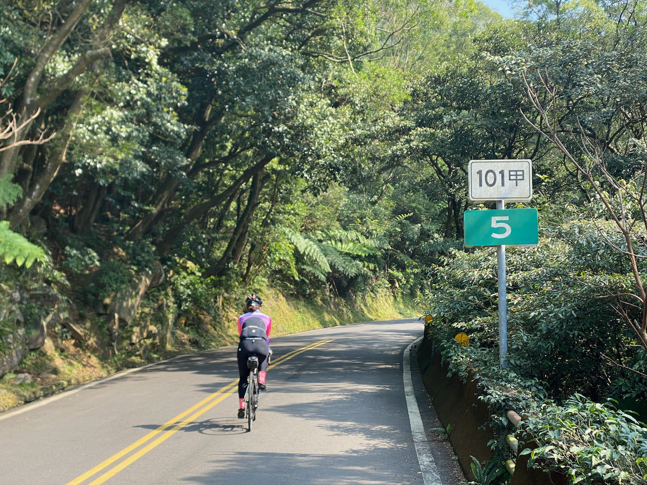
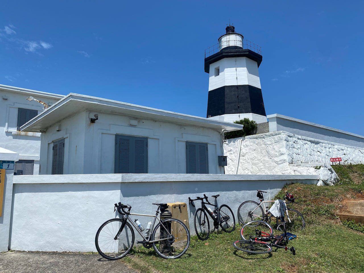
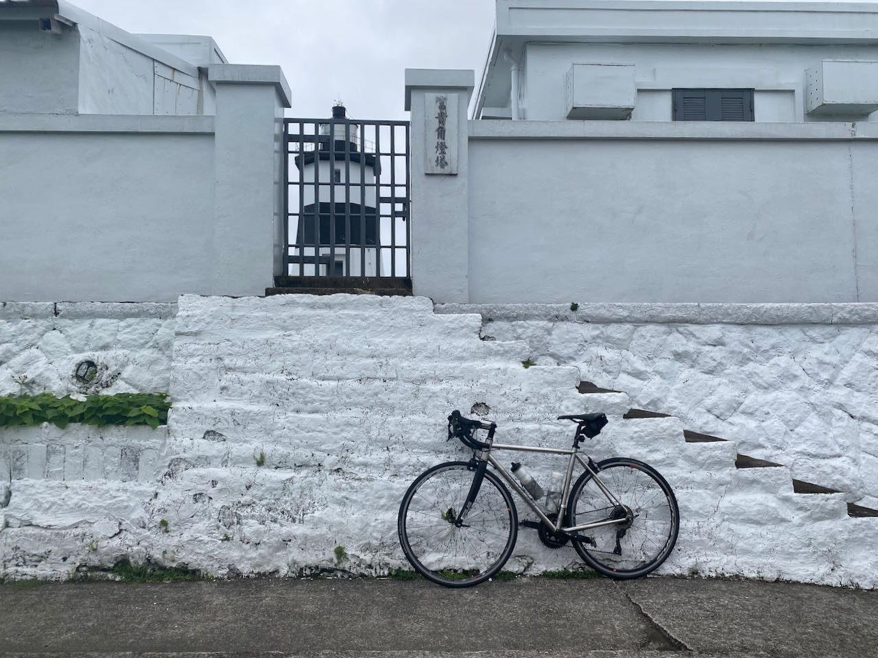
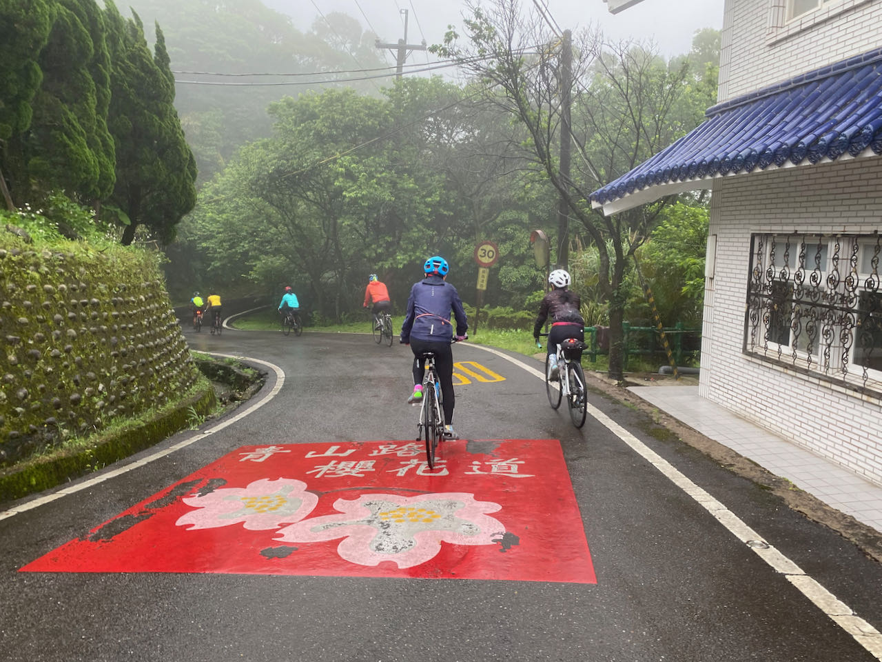
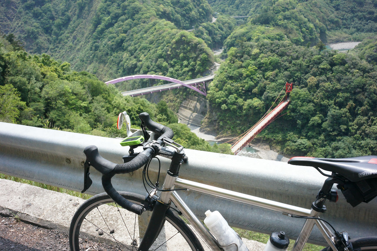
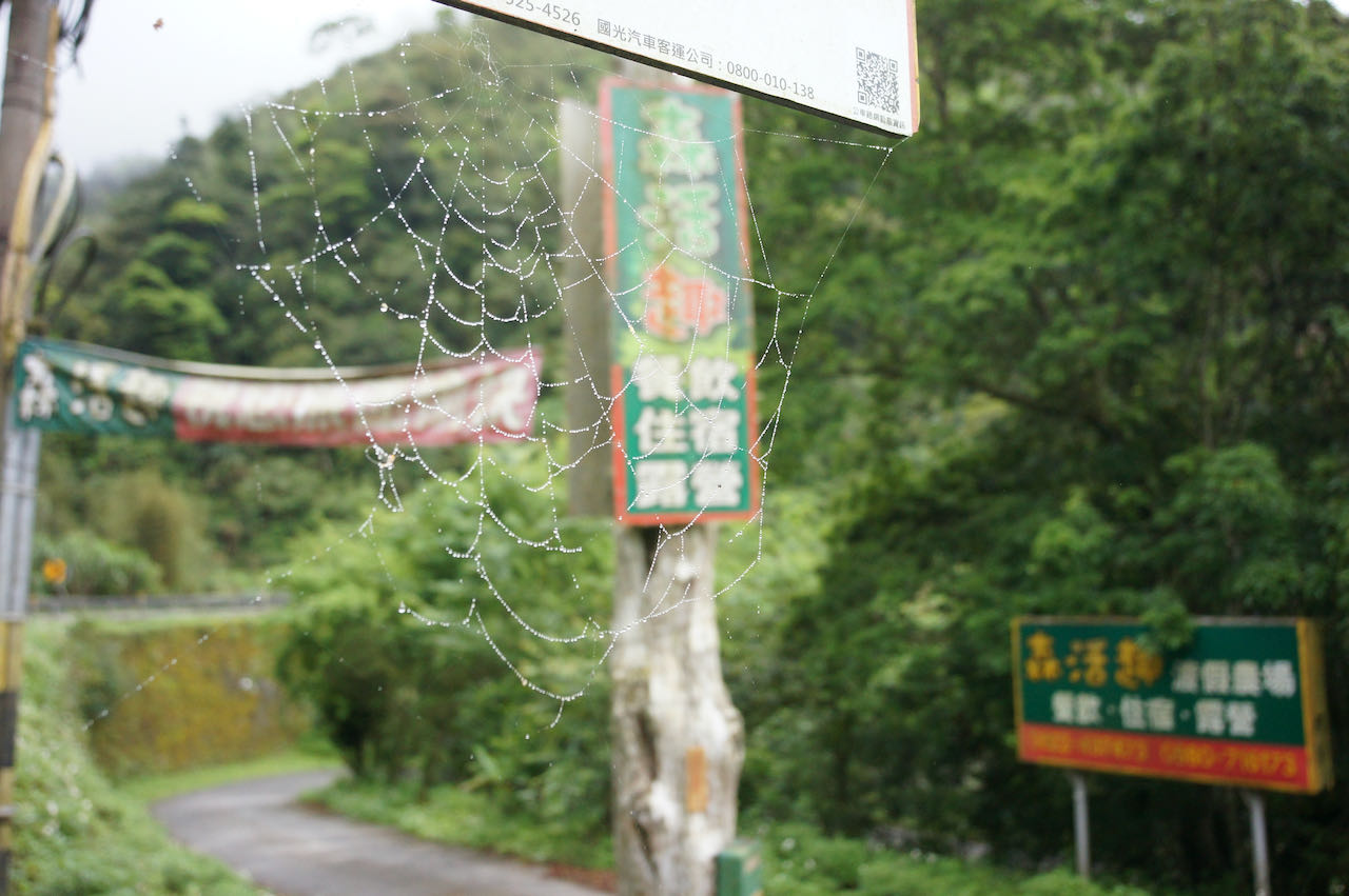
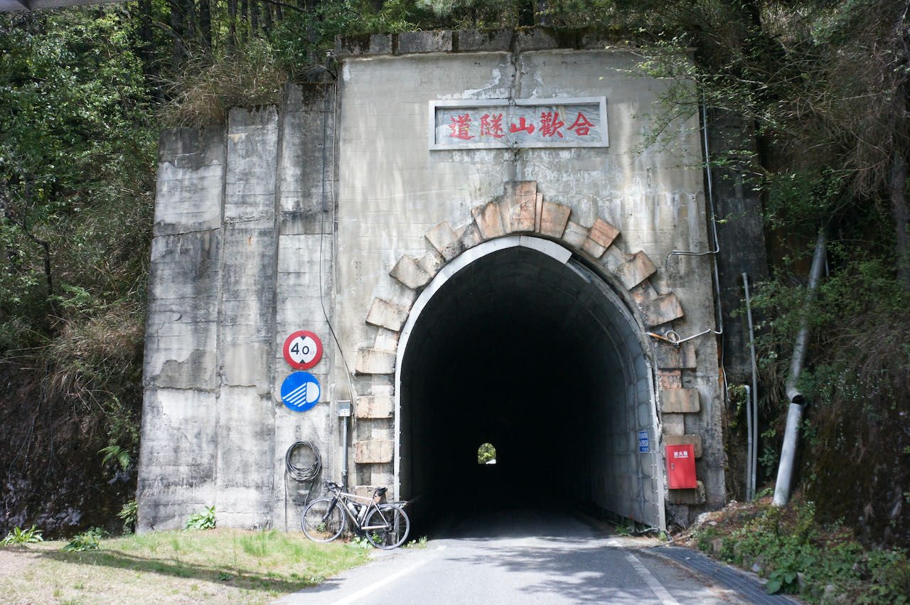
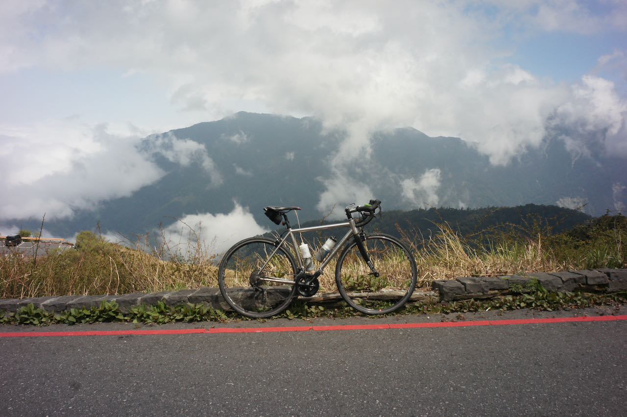
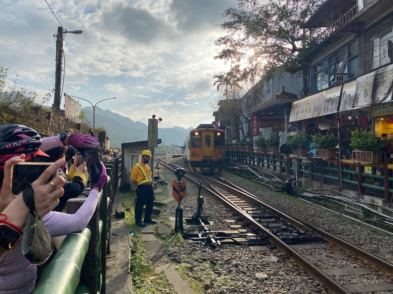
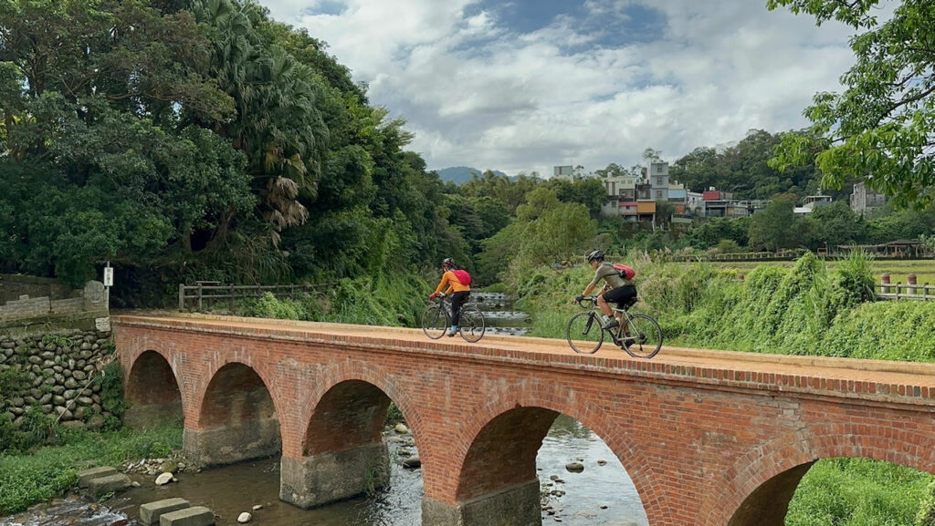
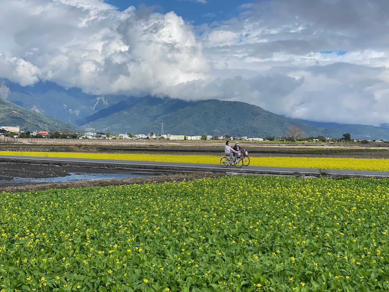
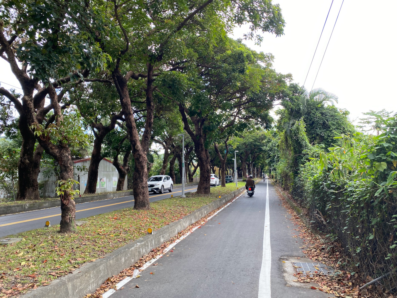
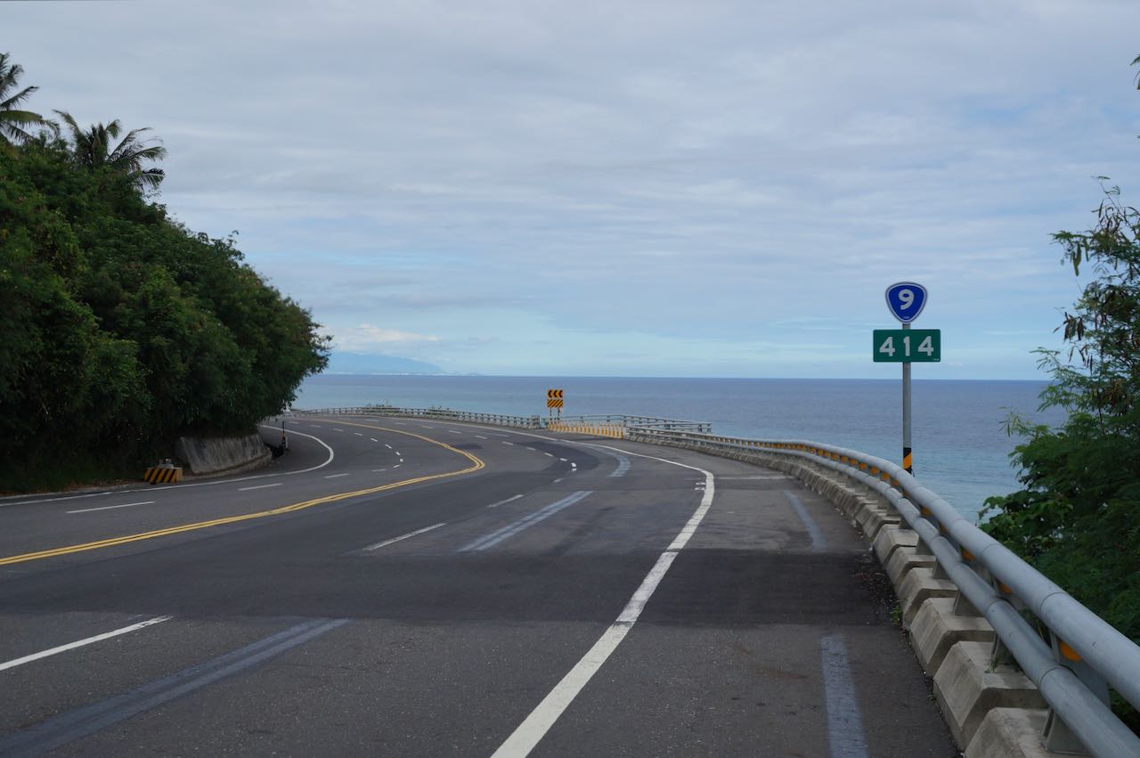
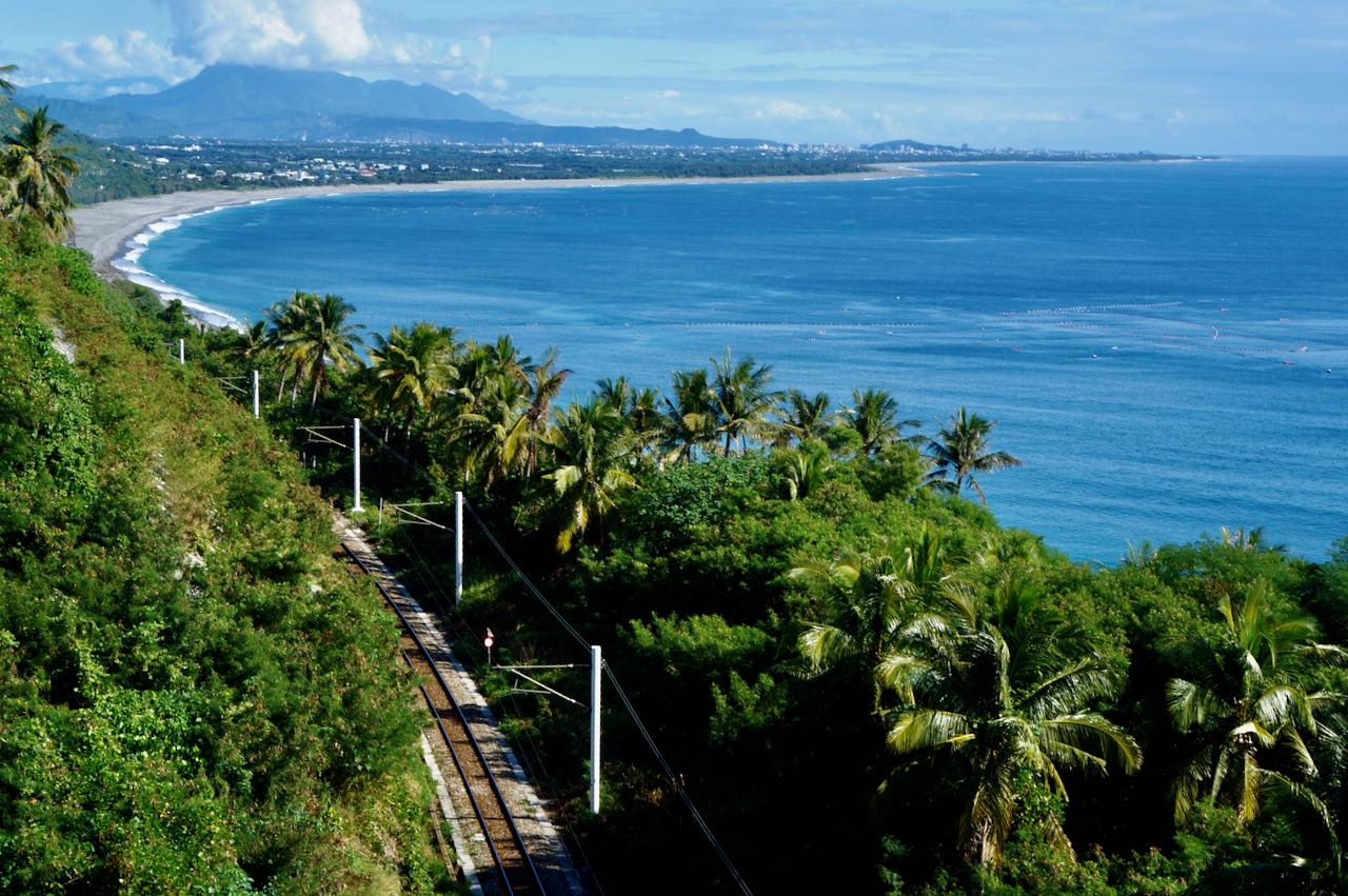
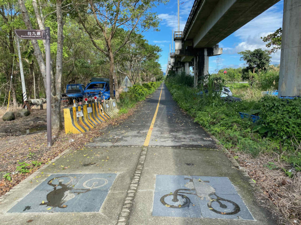
Farewell to the section of Daqingshui to Horen (Provincial Highway 9D 64K to 69K)
The 403 Earthquake in 2024 and the subsequent typhoons brought severe damage to the 5km section of Provincial Highway 9D (9丁) between Daqingshui (大清水) and Horen 和仁. The government announced in January 2026 that they won’t be repairing this section (Provincial Highway 9D 64K to 69K) anymore. all traffic is now redirected through Provincial Highway 9 between Daqingshui and Horen.
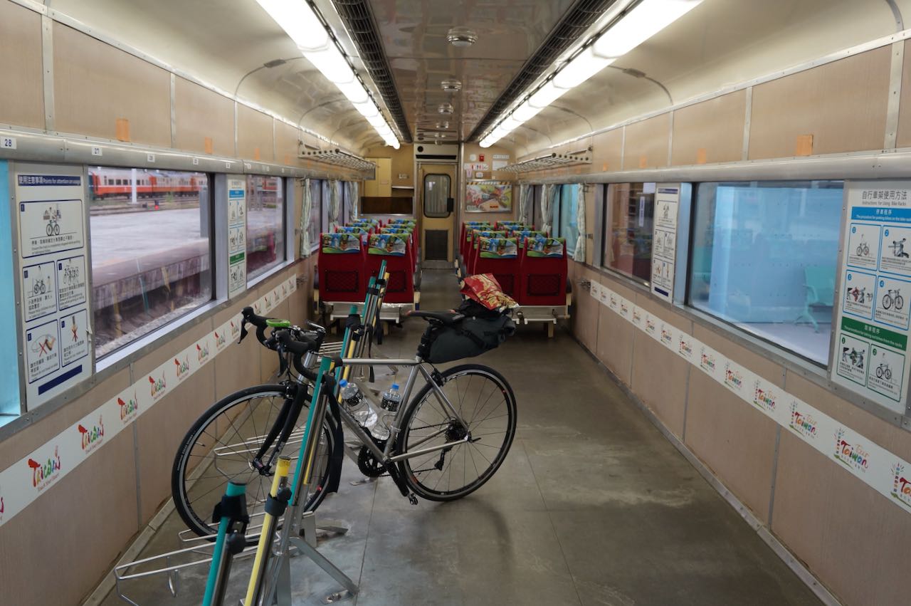
To avoid the heavy traffic on Provincial Highway 9 and cycle only on Provincial Highway 9D, you may take a train to Heping Station, cycle to Nan’ao Station, and then take a train to Dong’ao Station to resume cycling from there.
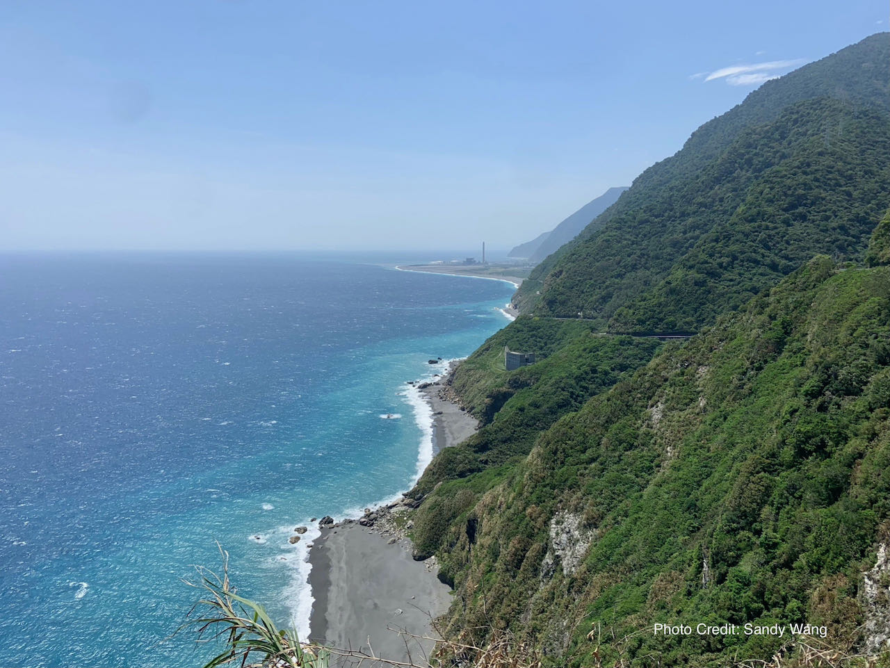
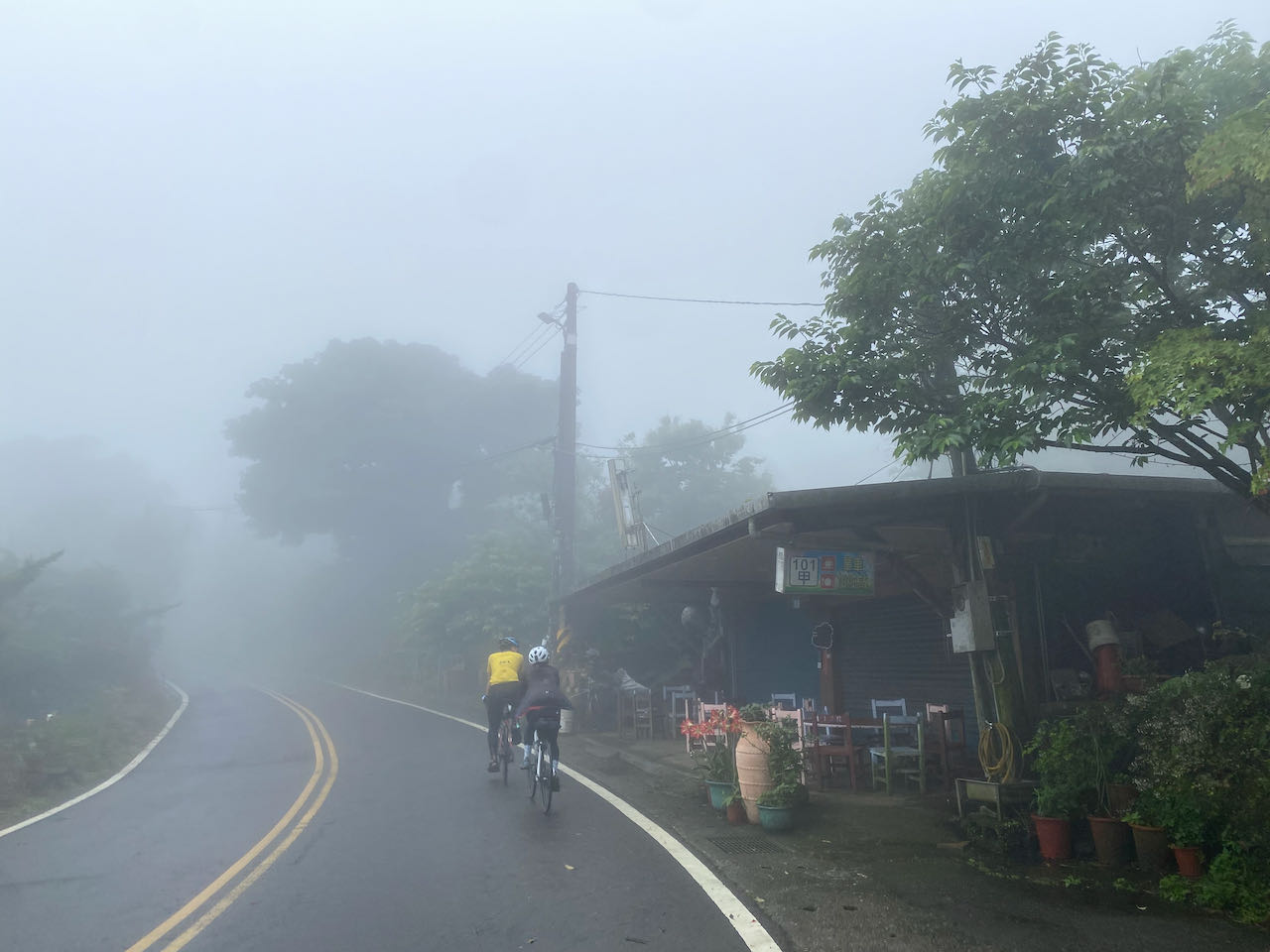
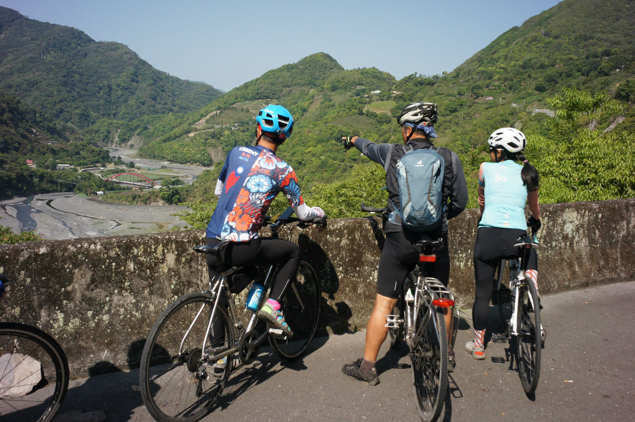
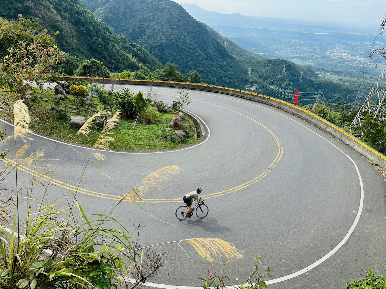
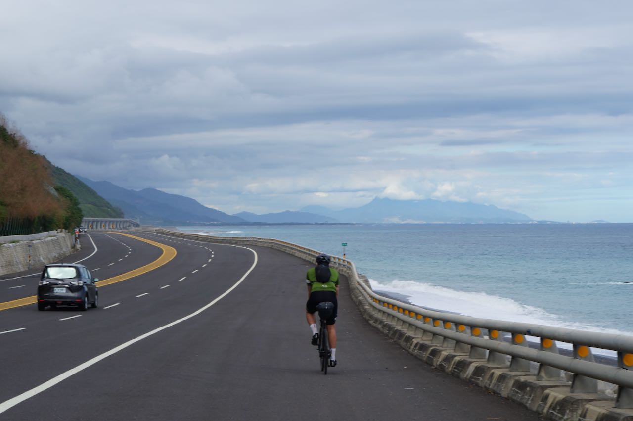
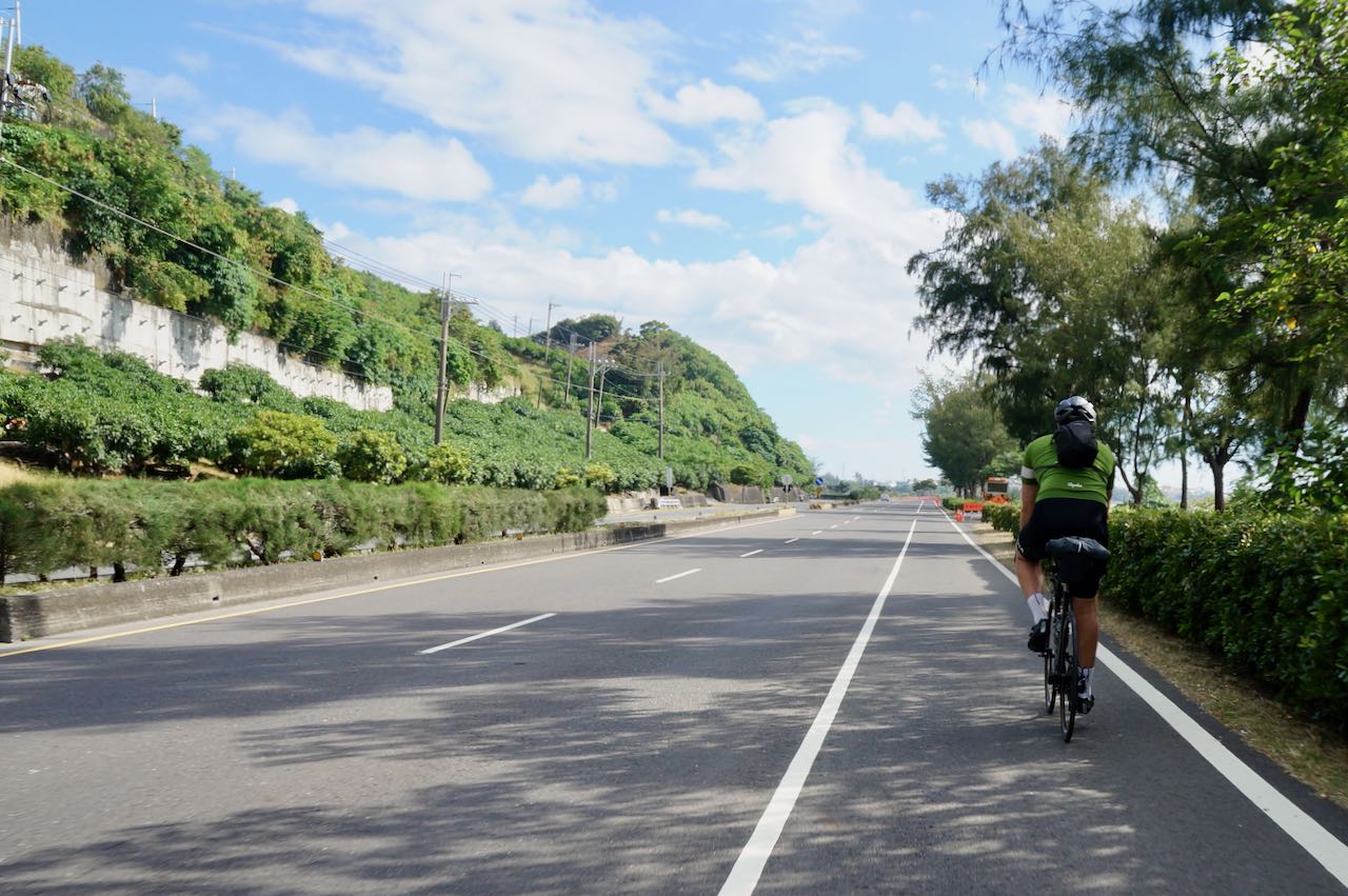
The Suhua Highway is a treacherous and narrow roadway that winds along the edge of a steep cliff, connecting Hualien to Yilan. It navigates through hilly terrain, featuring three major climbs and noisy tunnels. Cycling on this route is considerably more challenging compared to other sections of Cycle Route No. 1. As a result, it is often recommended to take the train with our bikes to bypass this segment.
However, cycling on Suhua Highway offers stunning coastal views, challenging terrain, a sense of adventure, and a refreshing experience in nature. Some cyclists embrace the opportunity for the breathtaking views and the exhilarating experience of tackling the challenging terrain.
We had customers wondering if they should do it. Here are my thoughts about whether to cycle on this part.
Challenging: long with lots of climbing
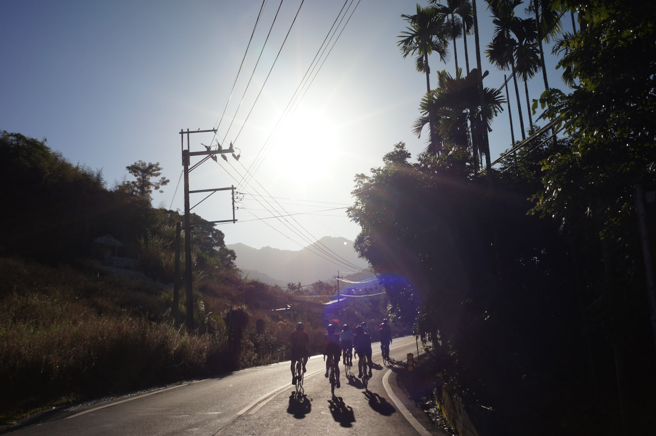
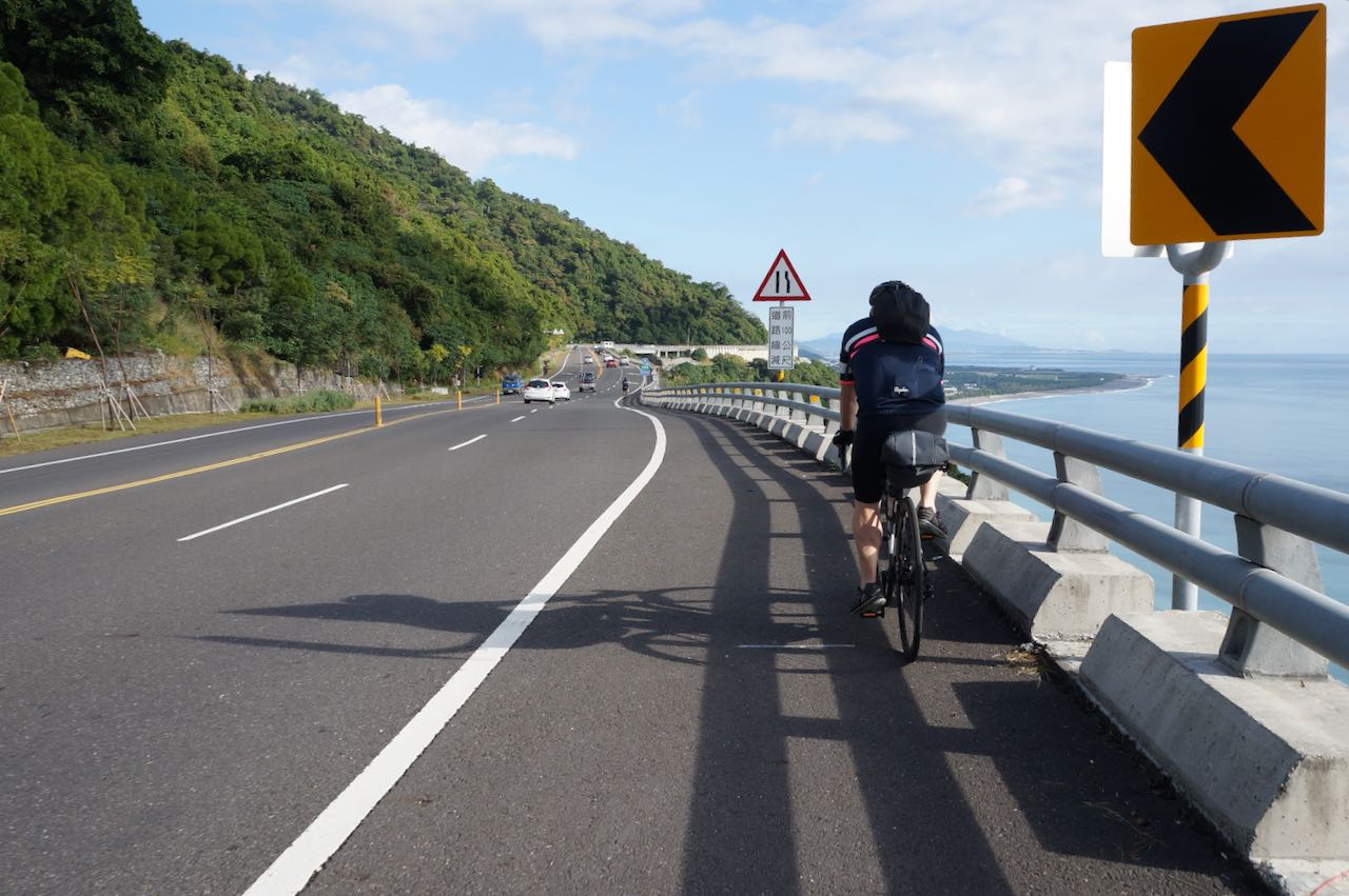
The Suhua Highway from Xincheng to Su’aoxin is not an easy one. We have 82 km to cover with several peaks to climb, resulting in a total ascent of 1,675m according to Garmin Connect. We need to estimate our strength and decide how challenging we want our day to be.
Risks posed by Mother Nature
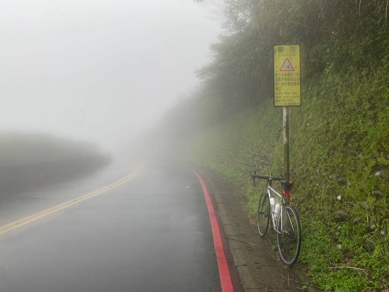
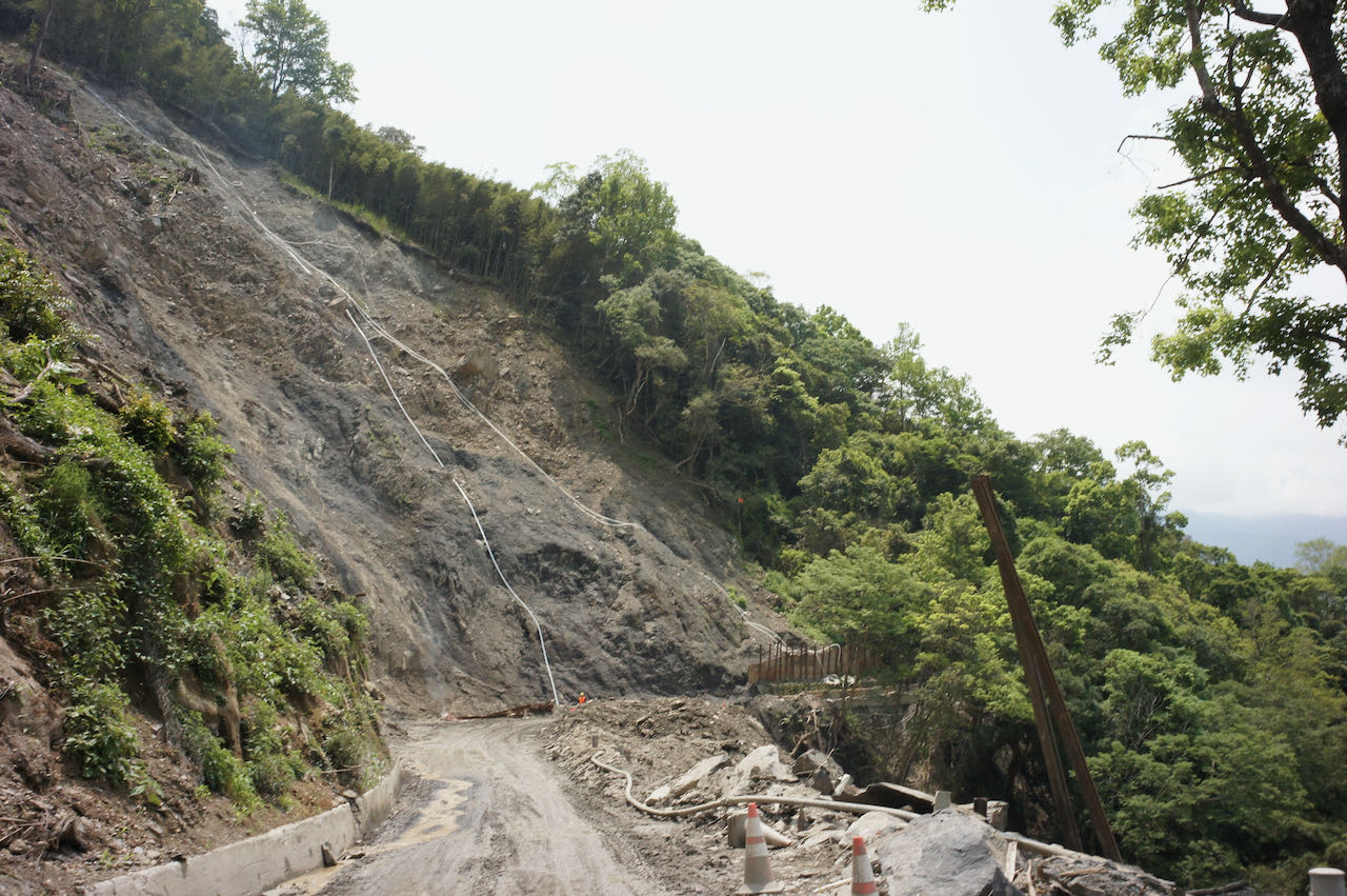
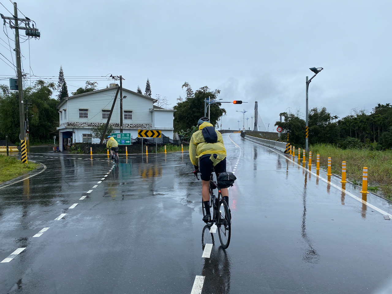
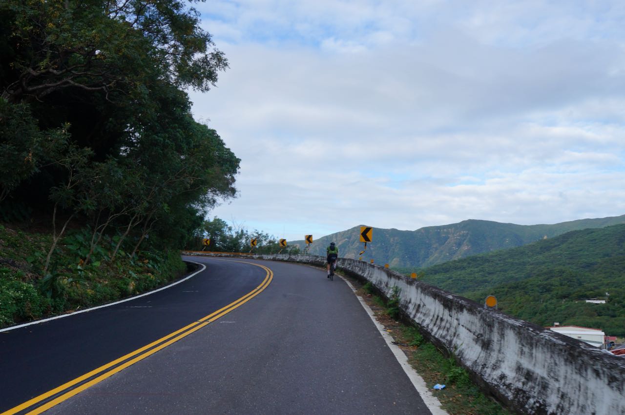
There are also some risks involved in cycling on this route. First, the risk posed by mother nature. Landslides and falling rocks on the road, though not common, can occur, particularly after earthquakes, heavy rains, and typhoons.
Risk posed by other vehicles
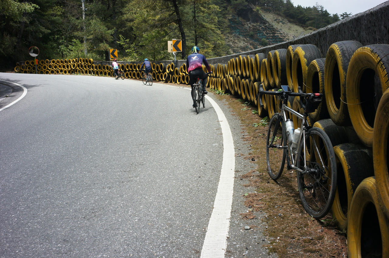
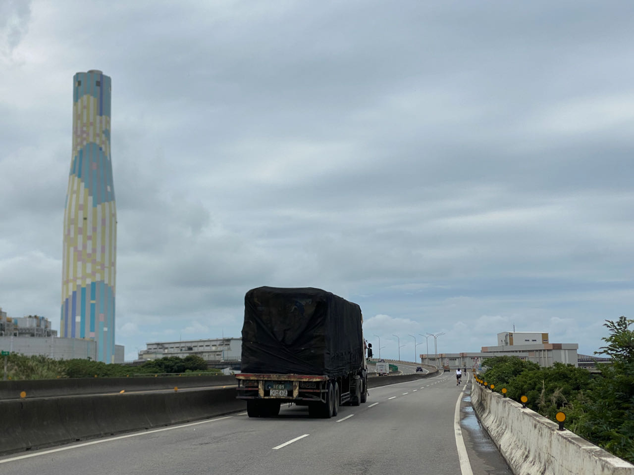
Secondly, there is a risk posed by other road users such as heavy trucks, coaches, and cars. The road is narrow, leaving less space for those vehicles to overtake bicycles.
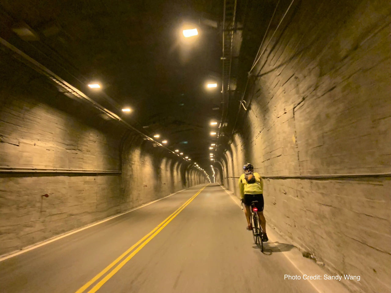
Another challenge is cycling through the tunnels with those vehicles. Along the route, there are several narrow tunnels where the noises produced by heavy vehicles can be trapped inside, making it unpleasant to the ears.
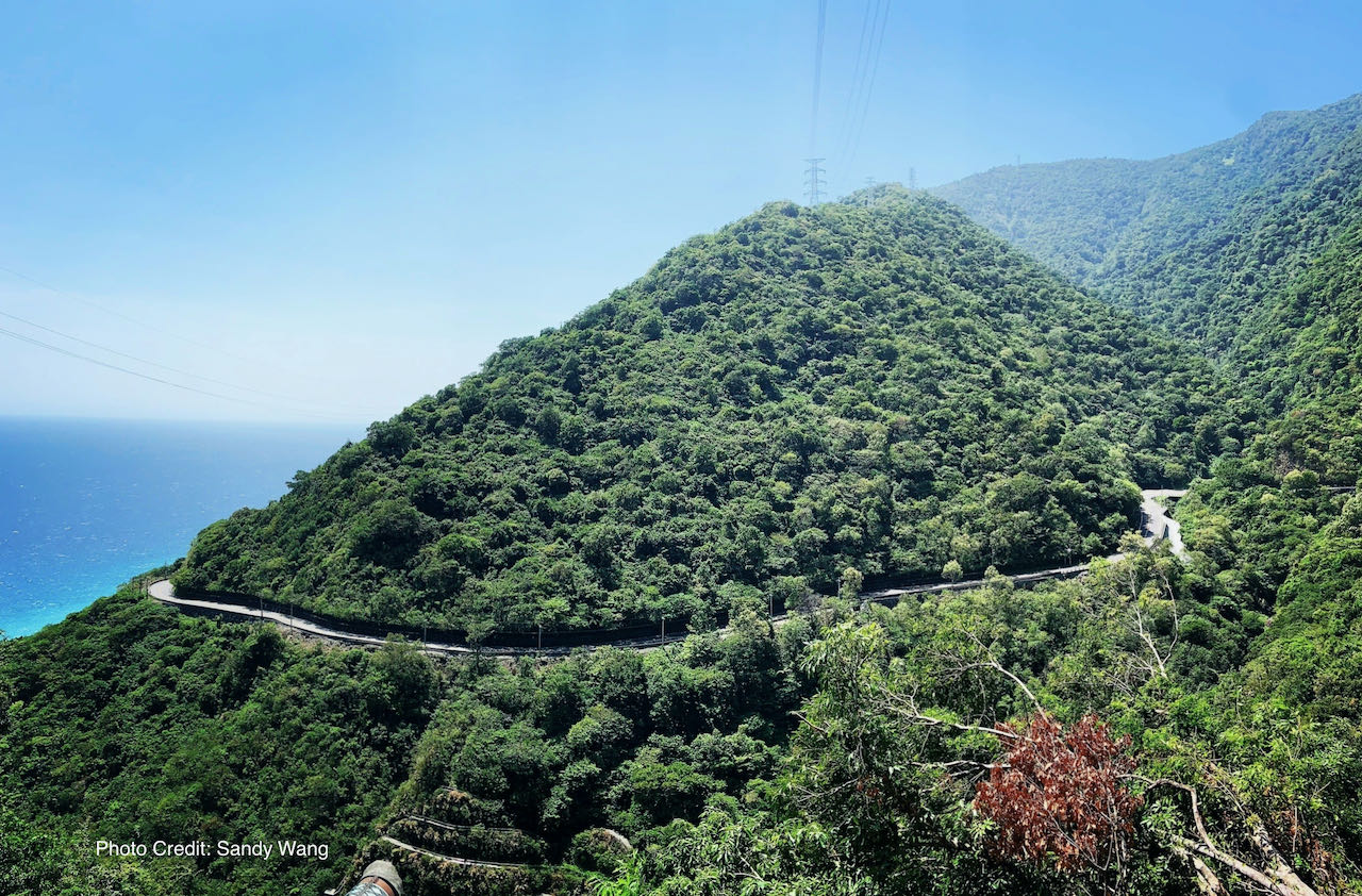
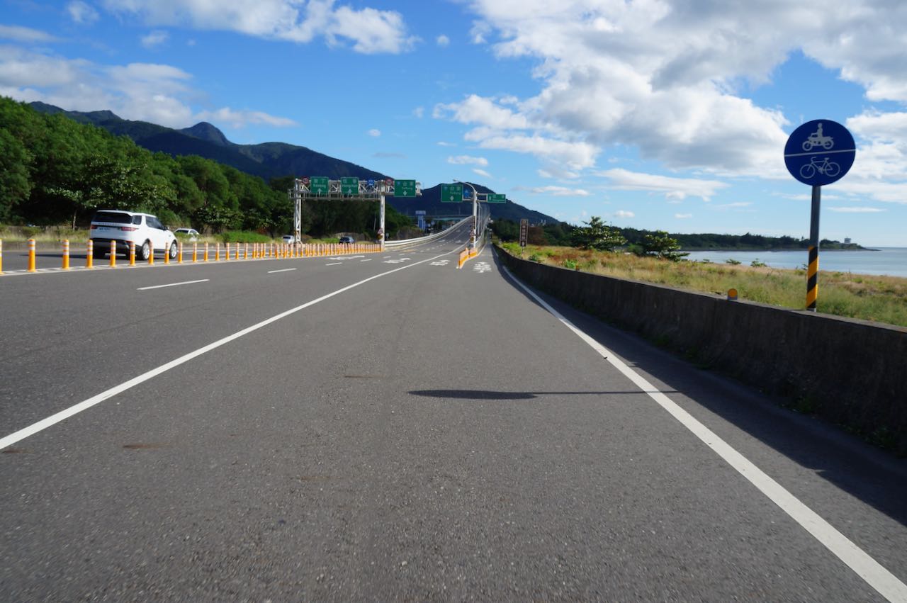
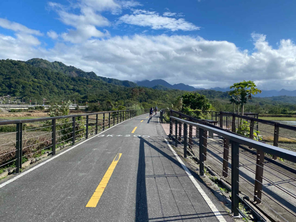
New Suhua Highway
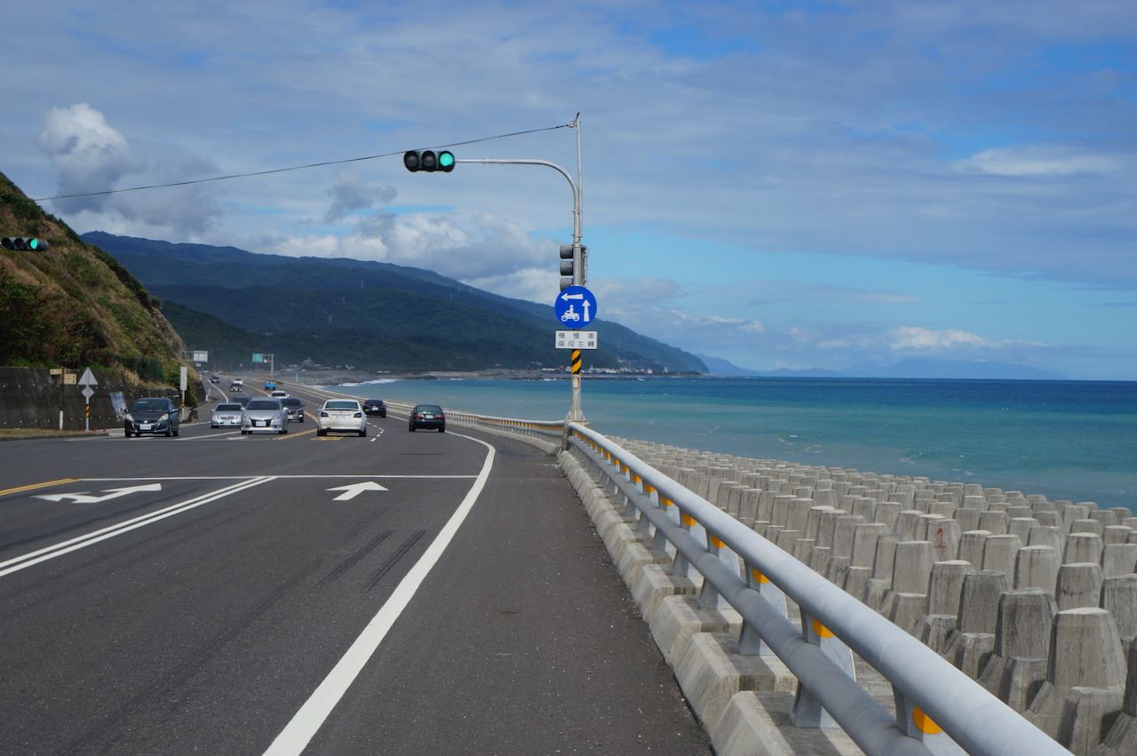
The situation has improved after the Directorate General of Highways finished building the new Suhua Highway (Provincial Highway 9) in 2021. The new highway has diverted more traffic from the old one (Provincial Highway 9丁), making some of the sections more like a road exclusively for bikes. Which are shown on the map below in blue:
Daqingshui to Hezhong: 10.7km, Total Ascent 252m
Heping to Nanao: 25.9km, Total Ascent 453m
Dongao to Suaoxing: 18.84km, Total Ascent 420m
Sections with Combined Traffics
However, there are still some sections where the two highways merge and the traffic combine (shown on the map above in red). These sections are:
Xincheng to Daqinshui: 12.66km, Total Ascent 323m with 4 tunnels
Nanao to Dongao: 10.94km, Total Ascent 275m with 1 tunnel
新澳隧道 (Xinao Tunnel): Length 1267m, Two pipes (northbound pipe has two lanes)
Update on January 2026: Since the Provincial Highway 9D between Daqinshui to Horen Station is severely damaged and there is no plan to repair it, the Overlapping Sections from Xincheng to Daqinshui is extended to Horen Station. The total distance from Xincheng to Horen Station is 15.6km, Total Ascent Estimated 300m (Data shown on Garmin route is exaggerated because the software failed to recognise the tunnel).
Strategies and Tips
If you are well-informed and decide to cycle on this part, here are some tips I would like to share with you:
Cycle Only in Favorable Weather
Riding in poor weather conditions is both risky and unpleasant. Always choose to cycle when the weather is clear and stable.
Be Mindful of Heavy Trucks
Although heavy trucks can be loud, their drivers are experienced and familiar with the route. They usually wait patiently for a safe opportunity to overtake cyclists. To make it easier for them, it’s best to ride in pairs rather than forming a long line, which can make overtaking more difficult.
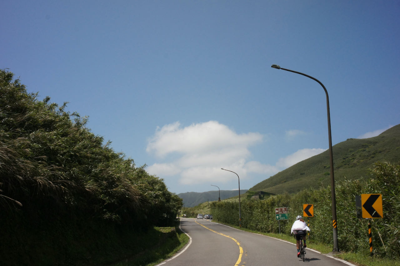
Cycling Northwards Is More Advantageous
Traveling northward (anti-clockwise around the island) offers several benefits. Most attractions are located on the sea side, and since Taiwan follows right-hand traffic, this direction allows for better coastal views without needing to cross the road. Additionally, it’s easier to spot falling rocks on this side.
Plan Your Ride Timing Carefully
For Northbound Riders: Start early to pass through the four tunnels between Chongde and Daqingshui before traffic builds up. Beyond Daqingshui, most tunnels are located along the Old Suhua Highway (9丁 or 9D), where traffic is lighter. The final shared section of the new and old routes, from Nanao to Dongao, spans 11 km with a total ascent of 275 m and a 1.2 km tunnel. Assess your stamina, traffic conditions, weather, and time of day. If needed, you can take a train without bagging your bike to Dongao or Suaoxin.
For Southbound Riders: Start early to get through the Nanao–Dongao section before traffic increases.
Use the Truck Drivers’ Lunch Break to Your Advantage
Between 12:00 and 1:00 pm, most truck drivers take their lunch break, leading to lighter traffic. Utilize this window to cycle through the busier sections more safely.
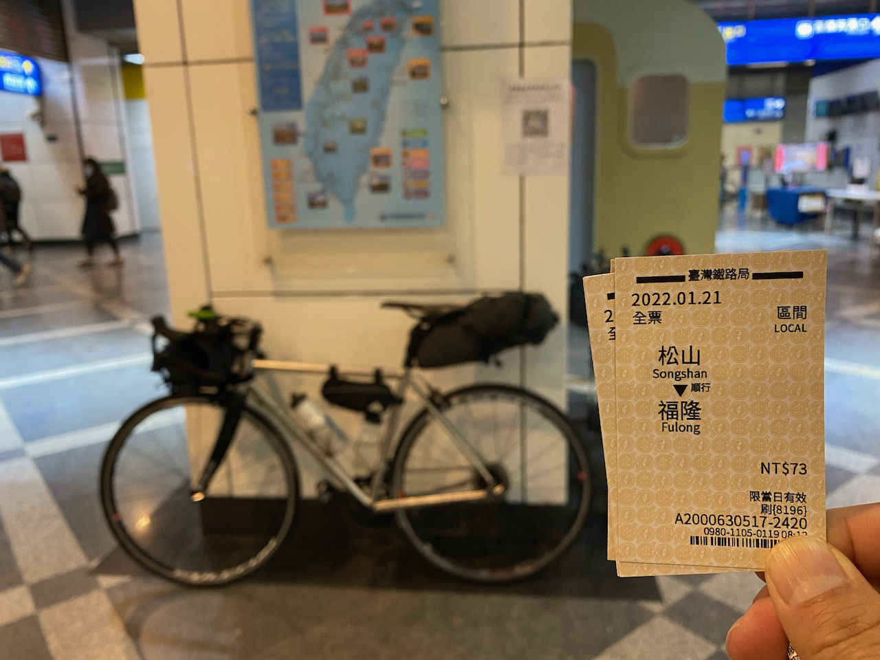
Take the Train to Skip the Busy Sections
If you only want to cycle on the best part of Suhua Highway (Provincial Highway 9D) and skip those sections with heavy traffics, you can take a train from Xincheng Taoroko Station to Heping Station and then enjoy the ride to Nan’ao Station on Provincial Highway 9D. Then take a train to Dong’ao Station and then ride all the way to Su’ao on Provincial Highway 9D. There are plenty of trains that allow you to push the bikes onboard after buying a ticket for your bike at half the adult fare. You can learn more about this from our blogpost on How to Ride with Your Bike on Public Transportation in Taiwan.
Experience sharing from our customer
Kevin, who did the around-the-island in September 2023, rode the Suhua Highway. He set off at 5:00 am from Xincheng and found the overlapping sections in Chongde very manageable in the early morning. When he reached Nan’ao around 10:00 am, there were heavy trucks. He said the heavy trucks usually came in waves. His strategy was to stop at the roadside to give way to the trucks first. Then he would have a window of about 10 minutes or so without the trucks. It would be long enough to cover a tunnel.
During the Lunar New Year in 2026, JM and co. cycled north from Nan’ao and enjoyed favourable weather. They reported that the section from Nan’ao to Dong’ao was safe and wide enough for cycling, likely due to a reduced number of heavy trucks during the holiday. Furthermore, the route from Dong’ao to Su’ao was described as an “absolute dream for a cycler,” potentially ranking among the top ten cycling roads globally.
Route – Xincheng (Taroko) Station to Su’aoxin Station
Yangmingshan National Park is one of Taiwan’s nine national parks, renowned for its volcanic terrain, breathtaking peaks, and tranquil lakes. The park offers a variety of hiking trails that allow visitors to explore and savour panoramic vistas, including the renowned Seven Star Mountain and the picturesque beauty of Xiaoyoukeng. Due to its elevation of over 800 metres, well-maintained roads, and convenient accessibility from Taipei, it has become a favoured destination for cycling enthusiasts.
The nearest starting points to climb the mountain from Taipei are accessible via the Riverside Bikeways, which are Yangde Boulevard (Provincial Highway 2A or 2甲) and Zhishan Road, followed by Pingjing Street. Yangde Boulevard is a less steep and more easily navigable option, but it often experiences heavier traffic. To avoid inhaling exhaust fumes while pushing my lungs to their limits, I generally prefer not to choose this route for climbing, unless it’s early in the morning. Descending on Yangde Boulevard, however, is less physically demanding and can be completed relatively quickly. On the other hand, despite its steeper incline, I personally enjoy taking the Zhishan Road and Pingjing Street route the most, as encounters with cars are infrequent.
Balaka Highway
If steepness is not your preference, County Highway 101 followed by County Highway 101A or 101甲 provides a more gentle approach. However, you need to get to Hongshulin to begin the climb. If you prefer not to ride there, you may take an MRT (Mass Rapid Transit) instead. The other two starting points, Jinshan District and Sanzhi District, are quite remote from the city centre.
Here, I have plotted different routes with varying lengths and difficulties for you to choose from.
It’s a 17 km climb that takes you to Lengshuikeng Visitor Centre at 746 m where you can see the vegetation changes. Then the final kilometres on the Zhonghu Road of Armaments (中湖戰備道路) offer a captivating panoramic view with stunning vistas of the surrounding mountains. Upon reaching Xiaoyoukeng Visitor Center, you can take a short walk on a pleasant hiking trail to explore a volcanic steam vent area (fumaroles), provided you are comfortable leaving your bike unattended for an hour. If you have more time, you can take a detour to the Bamboo Lake where you can find many restaurants and flower farms. For the descent, you can take Yangde Boulevard to return to Taipei city. There is a smooth transition to get to the Riverside Bikeways that connect to the other area of the city.
This is a flexible route. If you wish to shorten your ride before completing the climb, there are several shortcuts available that can take you directly to Yangde Boulevard.
NOTE: To use the routes, please install the App on your smartphone. The App will launch and load the route automatically after you tap the above links on your smartphone’s browser. For Garmin Connect, you can then use the APP to send the route to your garmin device. If your Garmin device is not purchased in Taiwan, you will also need make sure you have the Taiwan map on your device. Here is our blog post on this topic.
Route 2: Ascend Pingjing Street, Descend Balaka Highway (County Highway 101A or 101甲) 48 km 1267 m Total Ascent
The climbing is the same as Route 1. However when you reach Erziping Visitor Center, you have the option to continue climbing towards the Mount Datun Air Navigation Station. This segment spans 2.36km with a total ascent of 247 m, resulting in an average gradient of over 11%. I recommend attempting this climb only under favourable weather conditions.
Descending on Balaka Highway (101A or 101甲) is a fun and thrilling experience due to ideal level of steepness. It’s a quiet road, but please remember not to assume sole ownership of it as occasional cars may pass by. On County Highway 101, you’ll come across Wuji Tianyuan Temple, distinguished by its building that resembles an umbrella. The temple boasts a beautiful cherry blossom garden, which is worth visiting during the appropriate season, typically around March and April.
At the end of the descent, you will find yourself in Tamsui, an area with numerous tourist attractions. Among my favourites are the Hobe Fort and Fort San Domingo.
From there, you have the option to cycle back to Taipei using the Riverside Bikeways or simply take the MRT from Hongshulin Station.
As I mentioned earlier, Balaka Highway (101A or 101甲) is less steep to climb. Therefore, this route is equally enjoyable when done in reservse.
Route 3: Ascend Pingjing Street, Descend Yangjin Road (Provincial Highway 2A or 2甲), Ascend again to Fenguizui 74km 1597 m Total ascent
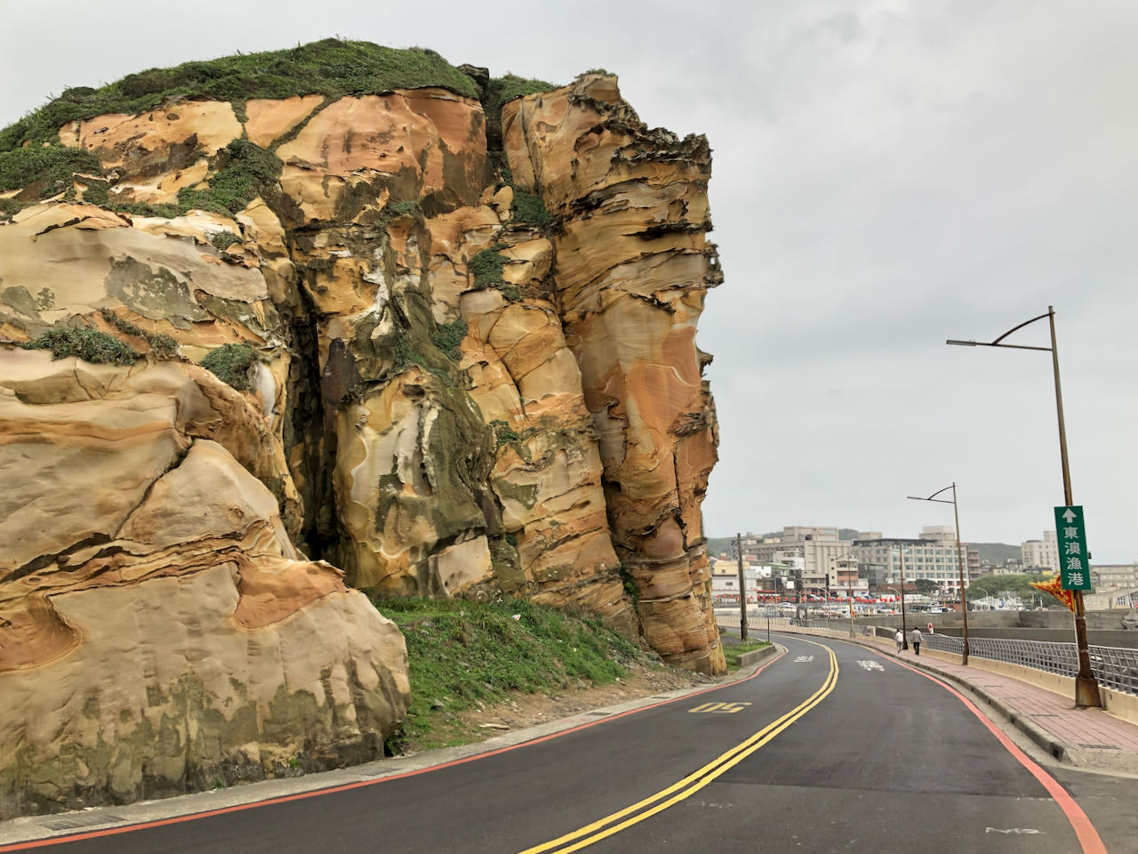
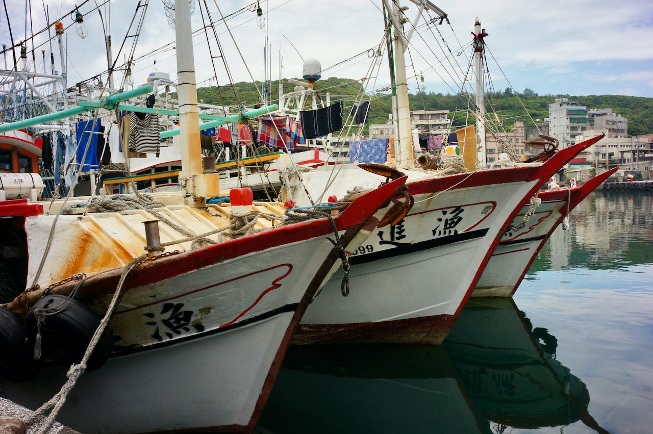
This route features two climbs. The first climb follows the same route as Route 1. By descending to Jinshan District, you will reach the picturesque north coast. The Yehliu Geopark offers a plethora of fascinating orange rock formations to explore. Afterward, you can resupply and embark on your climb back to Taipei via Fengguizui (600 m), following the suggested route.
Orange rock formationFishing Boats in Yehliu Fish Barbour
Alternatively, you may cycle to Keelung through the Waimushan Seaside Scenic Area followed by a comparably flat route on Provincial Highway 5 to get back to Taipei. Yehliu to Keelung is a refreshing route to cycle. The Keelung to Taipei leg has nothing to boast of. Sometimes, I prefer to take the train from Keelung back to Taipei, alighting at Nangan, Songshan or Wanhua station. Normally, before 15:30 each day, there are 1 to 2 trains every hour that accommodate unbagged bikes. After 15:30, you’ll need to wait until 18:16. For more details about taking trains with you bikes, refer to the provided link here.
Route 4: Ascend Pingjing Street, Descend to Jinshan, Ascend again on County Highway 101 and Balaka 96 km 1985 m Total Ascent
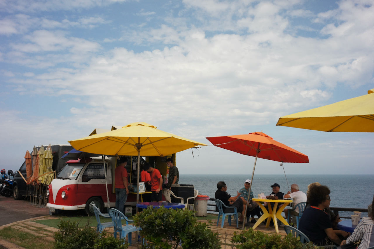
This route features two climbs on Yangmingshan. The first half of this route is the same as Route 3, but we would head west after descending to Jinshan District and cycle along the invigorating and magnificent north coast. On weekends, you can find cafe trucks near Jhungjiao Bay. The Fugui Cape Park, situated on the northern tip of Taiwan’s main island, presents a pristine lighthouse and is an idyllic place to visit. After a short ride from Fugui Cape, there is a popular sticky rice dumpling restaurant that provides a delicious calorie boost at a very reasonable price. The final climb begins at Sanzhi District, where you can restock your supplies. At the junction of County Highway 101 and 101A (or 101甲), there is a convenience store for further provisions before reaching the top. As you finish descending on Yangde Boulevard and check your Strava, you’ll notice you have traced a big fist on the map. Therefore, I suggest we name it the Budha’s Fist as the 5th Route is referred to as the Budhda’s Palm, a route that deserves a dedicated post.
If you don’t want to make the 2nd climb, you can simply cycle straight to Tamsui and return to Taipei. The route is a little hilly but the total ascent is smaller.
After cycling these 5 routes, there is still much more to explore within Yangmingshan National Park. The roads are well-maintained, offering numerous interesting stops along the way. Feel free to plan your own route and embark on further exploration, but it’s important to be prepared as weather conditions can change dramatically. We’ve had fellow cyclists who experienced difficulties descending from the top due to rain rapidly draining their body heat, which can lead to hypothermia. In such cases, they had to resort to hiring a van for transportation back. Stay cautious and enjoy your explorations!
The main island of Taiwan is shaped like a sweet potato, with a length of 394 km and width 144 km. On this small island, there are 274 peaks higher than 3000 metres above sea level. These peaks are located mainly on the centre and east side of the island, primarily in the Alishan Range 阿里山山脈, Central Mountain Range 中央山脈, Xueshan Range 雪山山脈 and Yushan Range 玉山山脈. Only 26% of the island is flat, mostly found on the west coast.
In the mountains, there are well maintained roads connecting the indigenous tribes and farms. Despite the frequent landslides triggered by typhoons, heavy rainfalls, and earthquakes resulting in the destruction and blockades of some of the roads, they are fixed quickly. If it takes longer, there will be traffic controls.
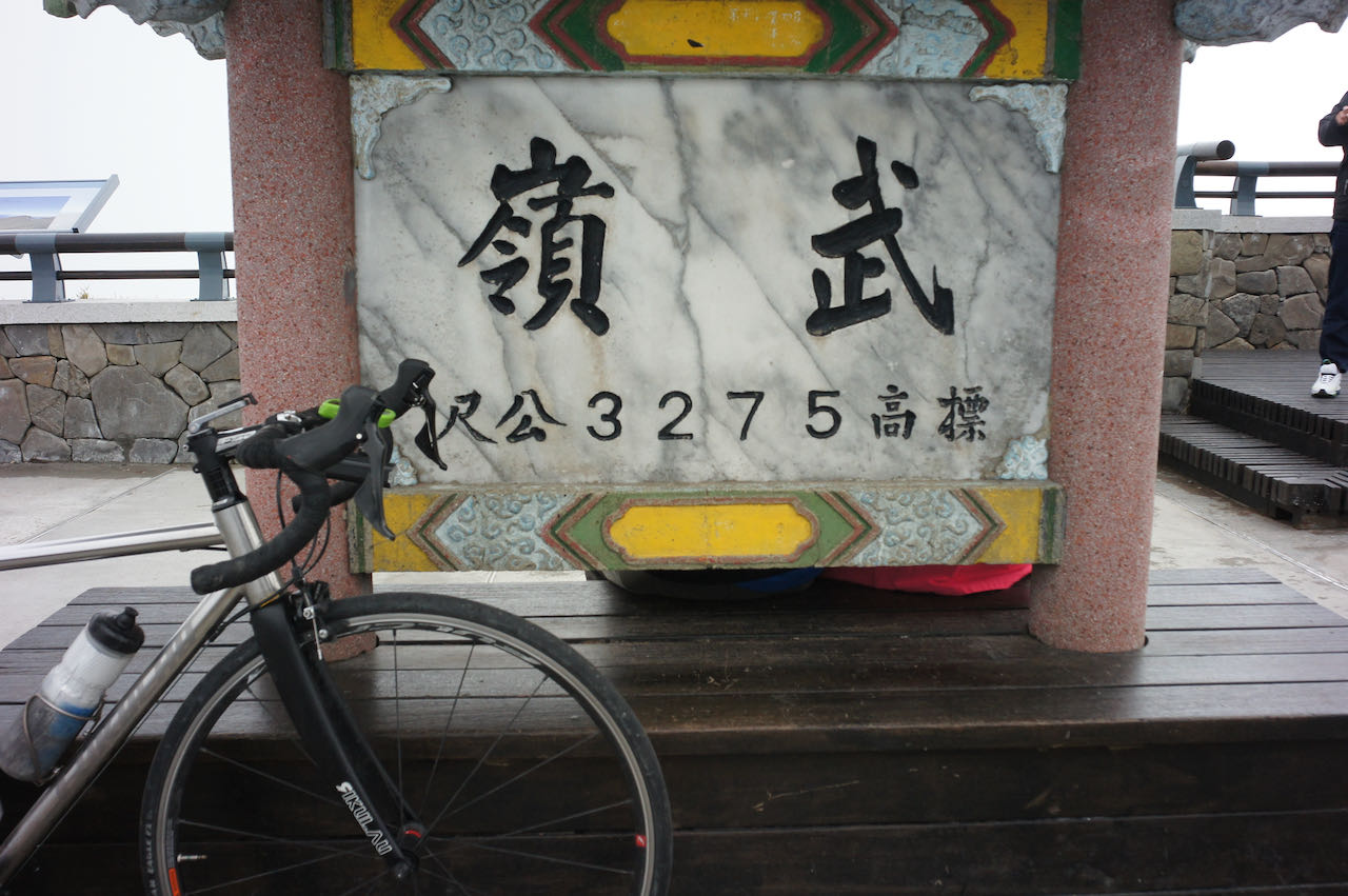
When I first learned that Eddie Chen, a famous cycling writer, Vlogger and the founder of Trekking Taiwan, started a project in 2019 to cycle and document his trips of “Wuling Pass from the North towards Eluanbi – a 500-mile cross-country ride in Taiwan” 北進武嶺南出鵝鑾鼻,縱斷台灣五百哩 – from Fuguijiao 富貴角, the northern tip of the island to Eluanbi 鵝鑾鼻, the southern tip via the mountain ranges, my mind was blown. It is so daring and so ambitious. Yet it is so enticing for all cycling enthusiasts. Altitude gains are not avoided. You just cycle through the mountains with brute force like slitting the sweet potato 剖地瓜. The total distance covered is 760 km, with a total ascent of 26,087 metres and the highest elevation at Wuling Pass 武嶺 at 3,275 m.
Eventually, in April 2023, I joined one of the 5-day cycling tours guided by Eddie to do the first half of this route, and here I share my experience. I hope it is going to help our fellow cyclists planning their routes.
Day 1 Fuguijiao Lighthouse to Jiaobanshan (Distance 109 km, Total Ascent 1,789 m)
We met up at Songshan Train Station at 6:00 am and hopped on our support car to get to Fuguijiao, the starting point. Those who want to do it by themselves without a support car can stay at the small hotels nearby in Baishawan 白沙灣 or Sanzhi District 三芝區 the night before.
The lighthouse was charming as usual but the weather was not particularly promising. It rained as we started our climb. The fog got thicker as we got closer to the top of Yangmingshan 陽明山. It was my first time on this volcano in such weather conditions. Dirt stuck on my bike’s rims and made some unpleasant grinding noise as I hit the brake, especially on the steep descending. I have a decent robust aluminium wheelset, but I was worrying about the pads. They might not make it if we were going to have five days of long, steep descents in wet conditions like this, even though they were thick. During the lunch break, one of our team members found her brake pads worn to the limit. As we cycled past Taipei city, we bought some more spares just in case.
We called it a day at Dadaocheng Pier Plaza 大稻埕碼頭廣場 at 4:00 pm by hopping on our support car to get to Jiaobanshan 角板山. Dinner was booked at 6:00 pm there. The restaurant opened that day just for us. Soon the traffic would get busy. We did not want to keep them waiting.
NOTE: To use the routes, please install the App on your smartphone. The App will launch and load the route automatically after you tap the above links on your smartphone’s browser. For Garmin Connect, you can then use the APP to send the route to your garmin device. If your Garmin device is not purchased in Taiwan, you will also need make sure you have the Taiwan map on your device. Here is our blog post on this topic.
Day 2 Jiaobanshan to Datong District of Yilan (Distance 86 km, Total Ascent 1,930 m)
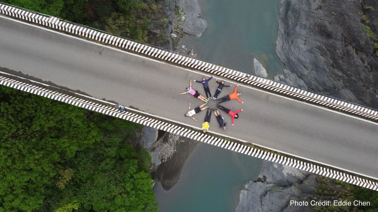
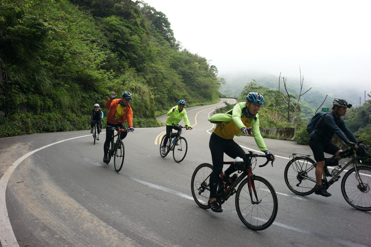
This was mainly my favourite Northern Cross-Island Highway 北橫公路. We have a traffic control beyond Baling 巴陵 on Provincial Highway 7 at 49.7k with only two windows to pass each day, ie., 11:00 – 12:00 and 16:00 – 17:00. Our support car brought us closer to make sure we could make it there before it was closed. Eddie made good use of the car and brought us to a bridge in a serene valley before we started cycling. Richard, an avid cyclist from Singapore who started the popular cycling group Cycling SG to Malaysia, suggested we all lay down in a circle for Eddie to take such a stunning picture.
Weather was so nice. Everyone enjoyed cycling on such a beautiful winding road. But there were some hazards that we should be aware of. I saw signs showing the sections where falling rocks are prone to happen. In fact, some stones were spotted on the road surface. Eddie said whenever we hear some falling rocks, we should run away immediately as it could be the prelude of some larger rocks coming.
I totally appreciated how vulnerable we could be in the mountains when I was passing the traffic control spot. A large area of green vegetation was peeled off in a landslide exposing an unstable muddy slope. Even after months of work by the road construction workers, the road was still not recognizable. I had to get off my bike and push it through the muddy surface. I raised my camera without slowing my pace to take some snapshots but immediately got yelled at by a worker. I was supposed to pass the section as quickly as I could without doing anything else. Rocks could fall anytime. No hard feelings. My bad.
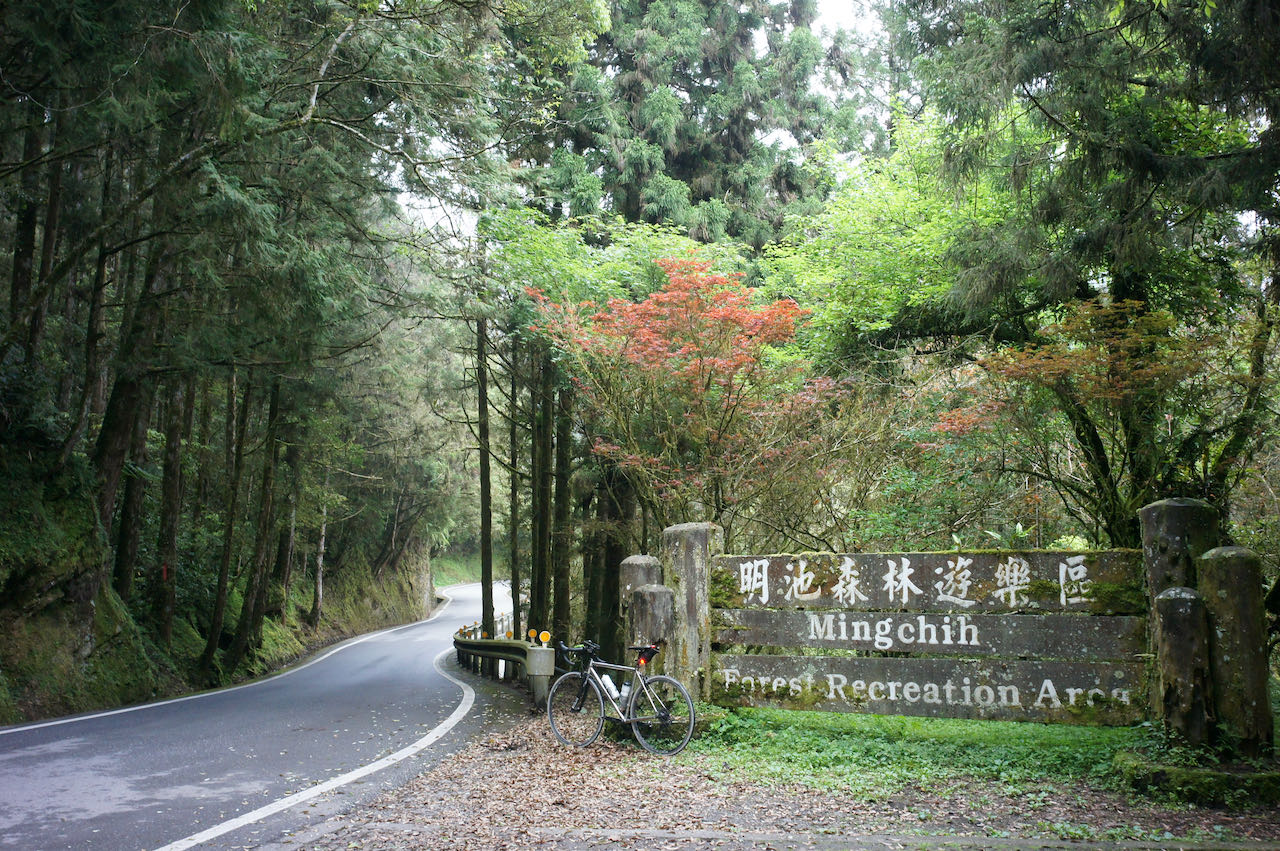
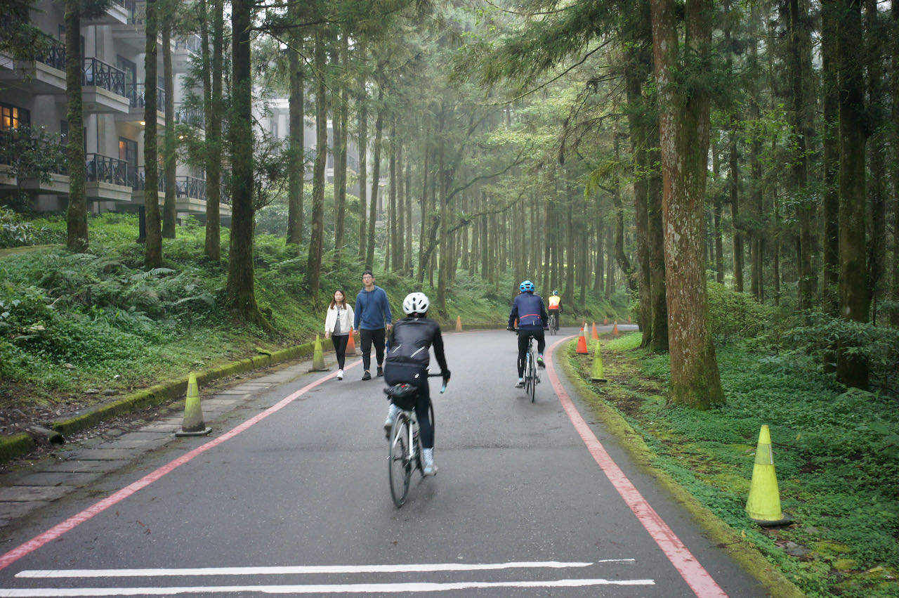
The Northern Cross-Island Highway beyond Baling after the traffic control was so comfortable to ride. The slope was mild, and there was hardly any traffic. It was magical that there were strange interesting plants along the way. We soon reached the last peak of the day at Mingchi National Forest Recreation Area 明池國家森林遊樂區 around 14:30, and the Northern Cross-Island Highway had led us into a deep, tranquil forest. The resort here makes a great place for a stay over or a long retreat.
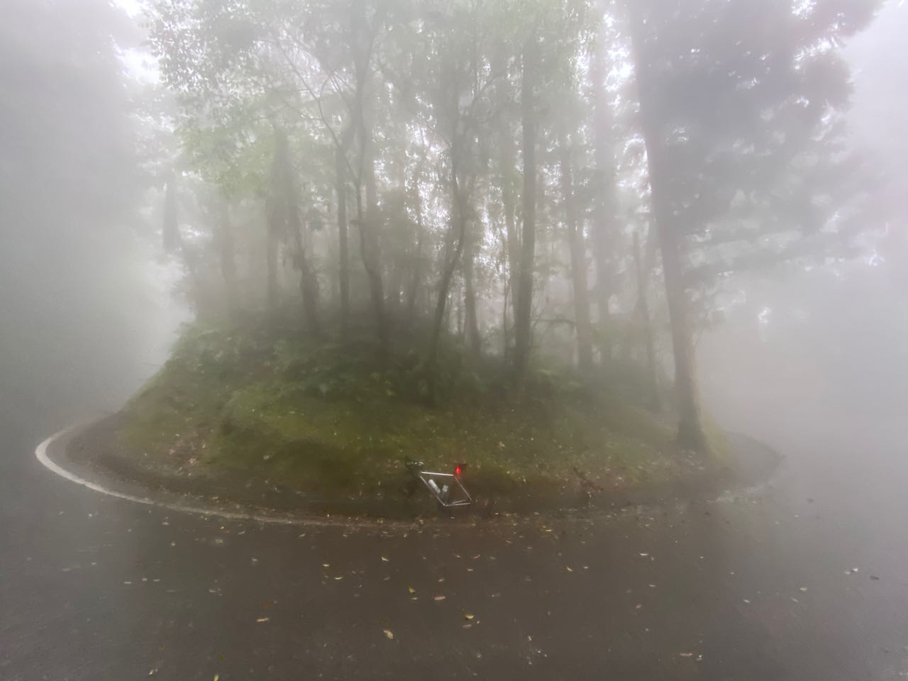
The fog got slowly thicker as we were descending into the east side of the mountain. The humidity from the Pacific Ocean, carried by the prevailing wind, was forced to creep up the slope and condensed to form mist at this altitude where temperature was cooler. At some point I could only follow the white paint on the road side in front of my wheel to proceed. The sight of my team was long gone. My wheels were gathering water and dirt from the road and grinding with the braking pads again. As more dirt accumulated on the braking area, the noise got creepily louder. I released the brake a bit to let go of the dirt and then hit the brake again. The noise would then slowly build up again. I was glad that I bought some spare braking pads.
I saw a red flag flying, which turned out to be a team of road maintenance workers. I was not sure what they were doing, but I really respect their hard work under such poor working conditions. With hindsight, the whole experience was so beautiful in a surreal way.
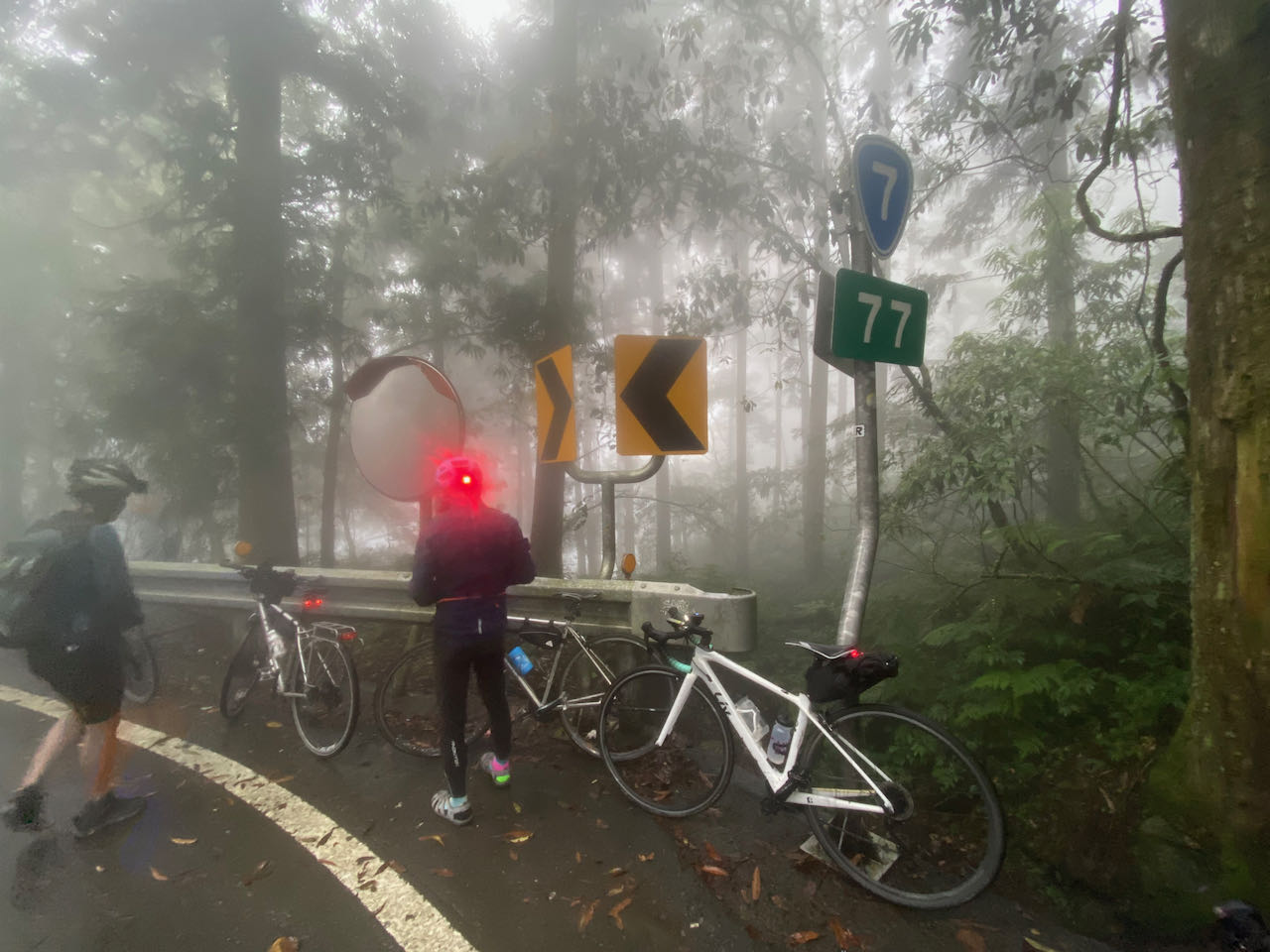
We gathered at the 77K of Provincial Highway 7 and got in the support car to get to a farm moonlighting as a B&B to stay over. Meeting my team and getting in the car was like waking up from a dream in a wonderland. It is said that there are steeper and wetter descents ahead before reaching the Baitao Bridge 百韜橋. Those who want to make the descent all by themselves should note that.
NOTE: To use the routes, please install the App on your smartphone. The App will launch and load the route automatically after you tap the above links on your smartphone’s browser. For Garmin Connect, you can then use the APP to send the route to your garmin device. If your Garmin device is not purchased in Taiwan, you will also need make sure you have the Taiwan map on your device. Here is our blog post on this topic.
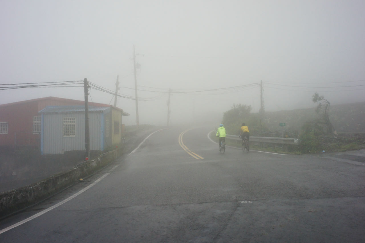
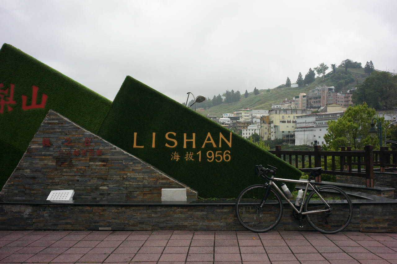
Day 3 Datong, Yilan to Lishan (Distance 61 km, Total Ascent 2,085 m)
It was a long, steady climb along the Provincial Highway 7A to Lishan. As we gained altitude, we were in the dreamy wonderland of fog once again. Today, I could relax mentally and enjoy the experience as climbing requires less focus than descending.
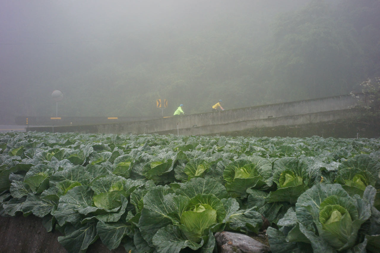
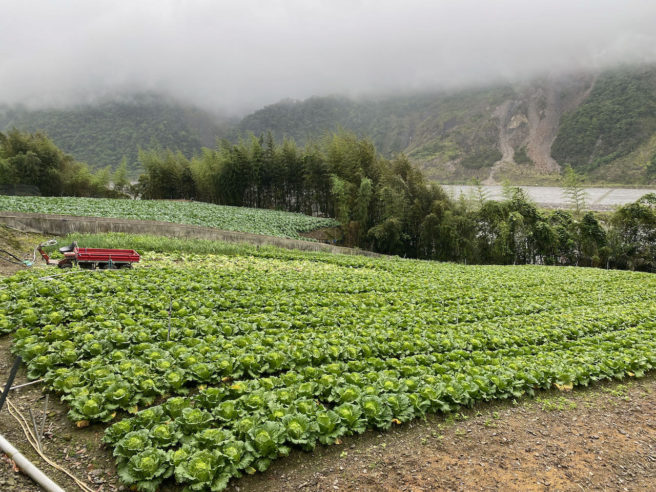
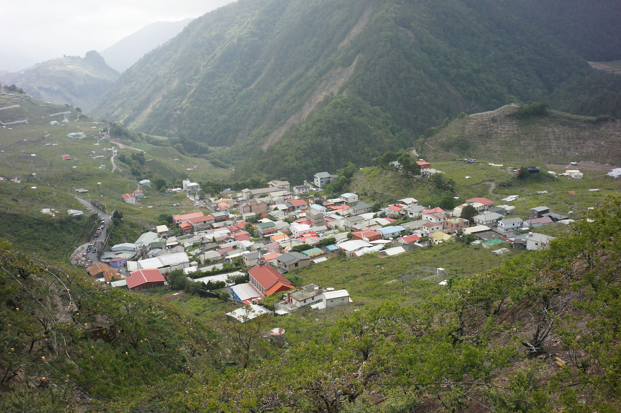
There were rows of cabbages growing on the fields on both sides. These white vegetables are ubiquitous in restaurants and on dinner tables in Taiwan, our daily staple. Among the several Atayal Tribes 泰雅族 along the main road, the Nanshan Settlement 南山部落 was the most important supply stop. There are two convenience stores and a gas station. Eddie and our driver loaded up lunches there for us to consume after some more climbing to the Siyuan Pass 思源埡口 (or formerly known as Piyanan Saddle 匹亞南鞍部), a mountain pass transferring from the Central Mountain Range to the Xueshan Range.
It was cold once we stopped at the Siyuan Pass for lunch. I had to put on all my clothes including a polar fleece sweater, a light down jacket and a wind-stopping jacket. Humidity and thin air have drained one of our members’ body heat, making him dizzy.
Then the mountain did its magic. We descended from Siyuan Pass for just a few minutes and found ourselves bathing in the sun with a blue sky. The temperature jumped by more than 10 degrees. We were all energised and continued our ride to Lishan 梨山. We made it there all by ourselves.
NOTE: To use the routes, please install the App on your smartphone. The App will launch and load the route automatically after you tap the above links on your smartphone’s browser. For Garmin Connect, you can then use the APP to send the route to your garmin device. If your Garmin device is not purchased in Taiwan, you will also need make sure you have the Taiwan map on your device. Here is our blog post on this topic.
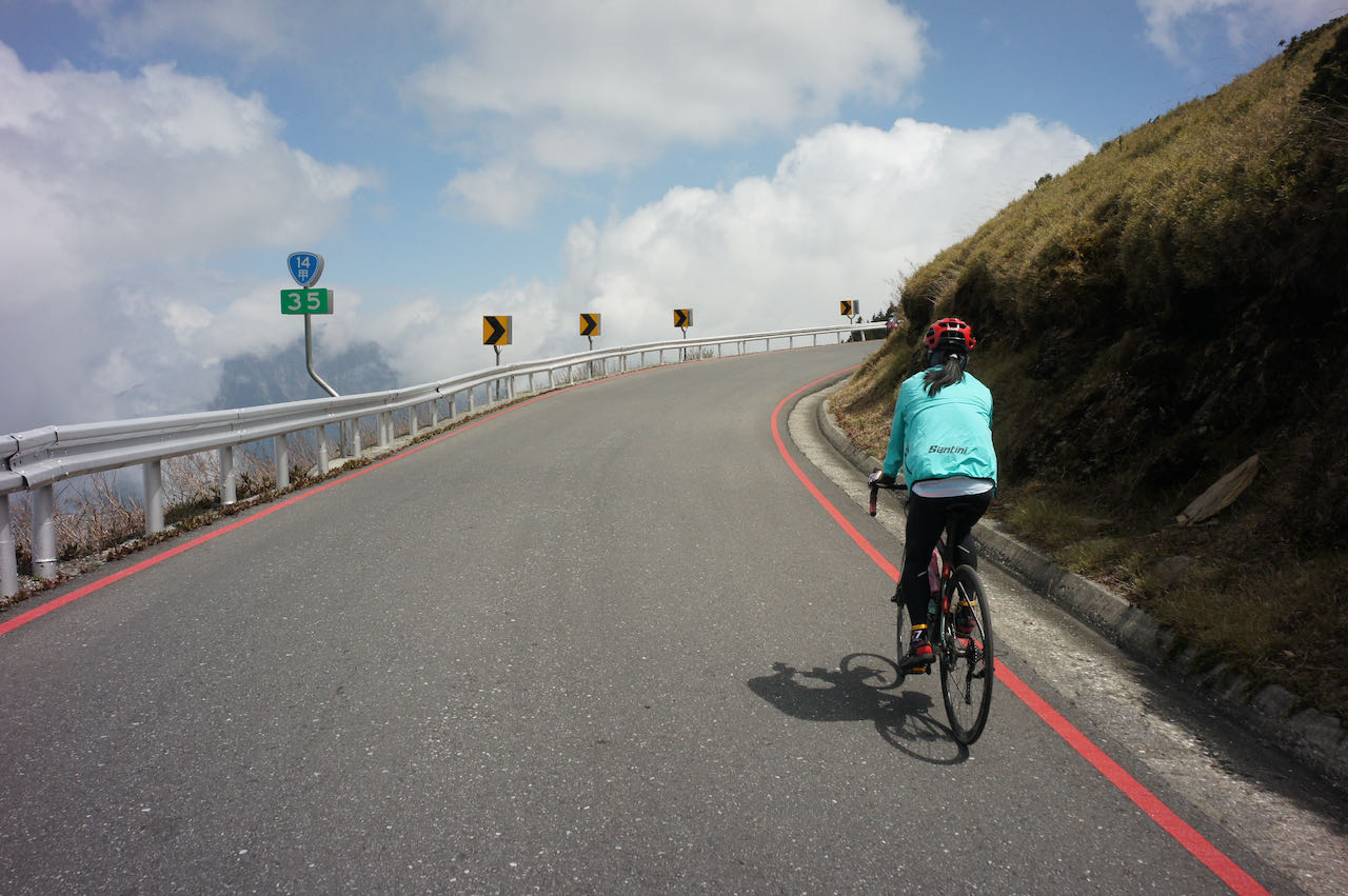
Day 4 Lishan to Wuling Pass and then Ch’un-yang Hot Spring (Distance 78.8 km, Total Ascent 1,655 m)
Today, we reached Wuling Pass, the highest paved road of Taiwan at an altitude of 3,275 metres. The total ascent was “only” 1,655 metres, which is a typical long day climb for me. But the thin air and the steepness made it extremely challenging.
We started from Lishan and continued the climb. The average gradient was 3.1%. It was not too bad until I reached Dayuling 大禹嶺 at 2,565 metres. Then the average gradient jumped to 8.3%. It made me feel weak especially inside the sharp hairpin turns where the steepness was way beyond the figure. It is said that the 5km between Dayuling and the Hehuanshan Service Station 合歡山服務站 is the steepest no matter if we are climbing from Hualien or Yilan.
When we stopped before a turn to take some pictures, we noticed motorbikes and cars coming down from the top. They had to brake so intensely that smells of burnt braking pads filled the air. There was a wall padded with old tires as a buffer, just in case someone failed to slow down on that turn and hit the wall.
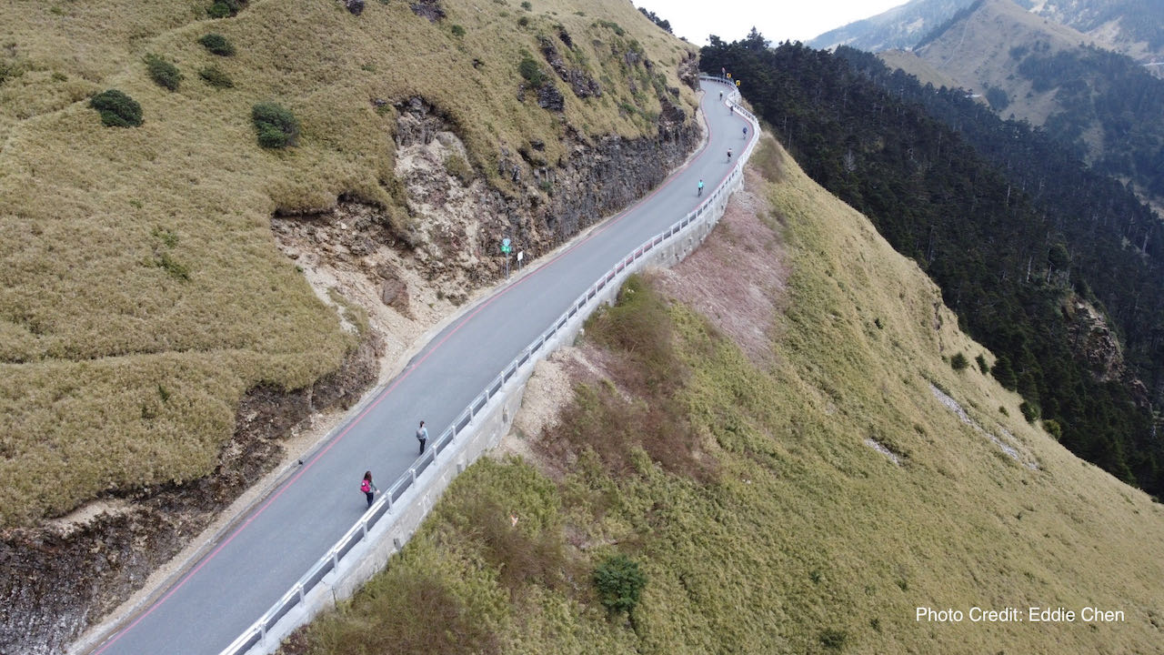
I was worrying that if I exert too vigorously, I might trigger altitude sickness. I knew how it felt when I was in Nepal hiking years ago. I failed to climb to Wuling Pass around 5 years ago when I was a novice on cycling. This was my second attempt. I did not want to ruin it. I regretted drinking a big can of beer the previous night, as it might have had an impact on my performance. I slowly made my way up, partly cycling and partly walking. I did not mind being slow. I stopped frequently to take pictures because the stunning views after each turn were hard to ignore.
The mountain offered a short respite by allowing me to descend 76m for around 1.2km, followed by the final 162 metres climb at an 11%+ gradient. We were lucky that the weather was so fine. I patiently climbed up the hill and made it there finally. It was magnificent up there! I lingered for a little more time to savour my accomplishment, looking at the surrounding peaks, while the rest of the team was sitting in the car ready to be taken to the hotel. I am sure I will do this again.
NOTE: To use the routes, please install the App on your smartphone. The App will launch and load the route automatically after you tap the above links on your smartphone’s browser. For Garmin Connect, you can then use the APP to send the route to your garmin device. If your Garmin device is not purchased in Taiwan, you will also need make sure you have the Taiwan map on your device. Here is our blog post on this topic.
Day 5 Ch’un-yang Hot Spring to Puli ( Distance 55km, Total Ascent 855m)
It was the last day of the trip. After climbing Wuling, most people would descend along the Provincial Highway 14甲 (or 14A ) to Puli 埔里 directly. However, Eddie led us to Wujie 武界, where the indigenous Bunun 布農族 people live. This route involved more climbing, but it was more enjoyable due to less traffic. We had a delicious lunch prepared by a chef from the Bunun Tribe. The final descent from Wujie to Puli was not to be taken lightly. It was a steep long descent with occasional metal drain grates laid across the road, which could become slippery when wet.
That’s it for my 5-day trip. Thanks to the good weather in the last 3 days, my braking pads survived. In fact, there were still some lives in them.
NOTE: To use the routes, please install the App on your smartphone. The App will launch and load the route automatically after you tap the above links on your smartphone’s browser. For Garmin Connect, you can then use the APP to send the route to your garmin device. If your Garmin device is not purchased in Taiwan, you will also need make sure you have the Taiwan map on your device. Here is our blog post on this topic.
Conclusion
I had a great time cycling with Eddie and the team members. Each one of them is an extraordinary and tenacious cyclist. Despite the limitations in the mountains, Eddie arranged clean and comfortable places for us to rest after our day-long workouts. We were well-fed with a variety of food. Our support car showed up at the best locations to provide us with supplies and access to our personal belongings. Although I did not cover the entire planned route on my bike, thanks to Eddie’s organised tour, I was able to get a glimpse of what it is like to cycle in the mountains, especially in high-altitude locations.
Eddie has been cycling in the mountains for years. And he is familiar with the indigenous people who live there. Every Christmas, he organises a ride in Baling to meet the Atayal people. However, on this trip, we had hardly any chance to interact with the indigenous people. Eddie explained that it was because we were accompanied by a support car. People knew that we would be well taken care of and didn’t require their help. When Eddit travelled with just his bicycle, the barrier between people were gone. He often encountered generous individuals who were ready to share the best food from their kitchen and hospitality with him.
As a free-spirited individual, I prefer embarking on cycling trips planned by myself. In an ideal world, I enjoy carrying my own luggages and roaming in the mountains at my own pace. However, as a father of two small kids and with a company to run, I am unable to do so at this stage. If you are an experienced cyclist who knows your abilities, you can do such trips independently. Just ensure to meticulously plan your route, including supply stops and accommodations.
Keep an eye on weather conditions and potential road blockages. Be aware that there are some areas without cell phone signals. Some of our customers had done their own research and plotted their route in the mountains like this. All they need is a brief comment from me regarding the latest condition and then a bike and some necessary accessories from our end.
If you wish to plan your own trip, there are several useful sources of information:
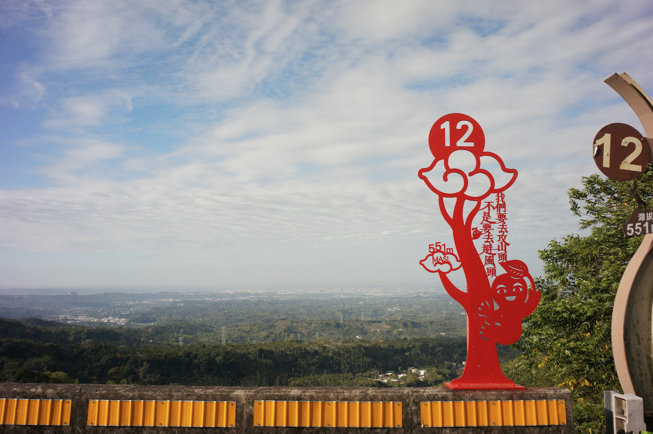
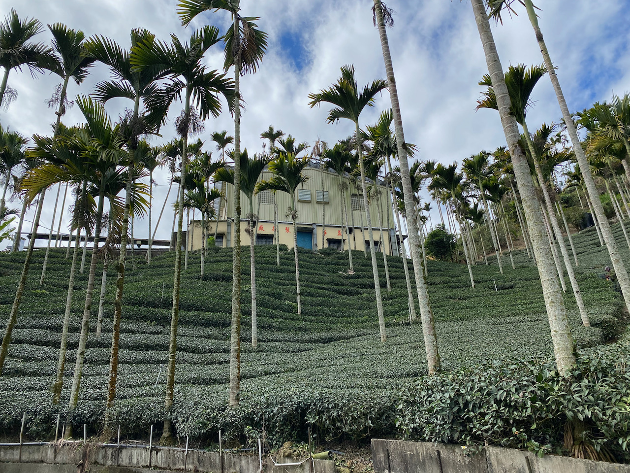
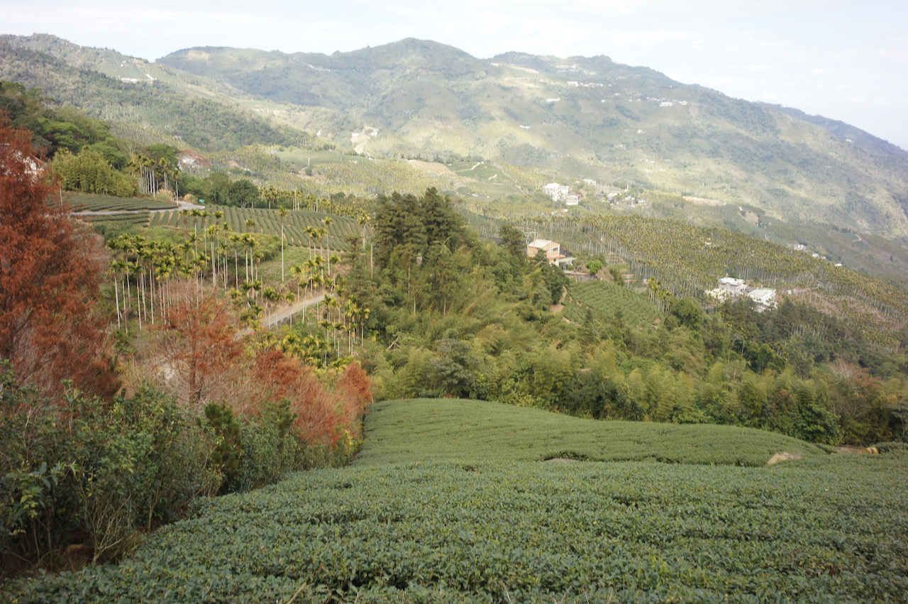
Taiping 36 Bends, or Meishan 36 Bends 梅山36彎 as known in Chinese, is a 15km route with 800m elevation gain in Meishan, Chiayi. It’s famous among local cyclists for its 36 hairpin turns and beautiful scenery along the way. It’s also the course of a popular cycling challenge. Even if you are not participating in the challenge, anytime when you have completed the course, you can get a certificate from the local government office by paying a nominal admin fee of NT$100.
I hadn’t had a chance to ride this route because it is more than 250 km away from Taipei, where I live. Invited by my cycling fellows, I finally decided to do it on a Saturday in January by joining a cycling group in Taiwan.
In the small hours of that Saturday, we boarded a coach bound for the starting point with our bikes. We were going to spend the morning cycling and then hop on the same coach to get back to Taipei later in the day.
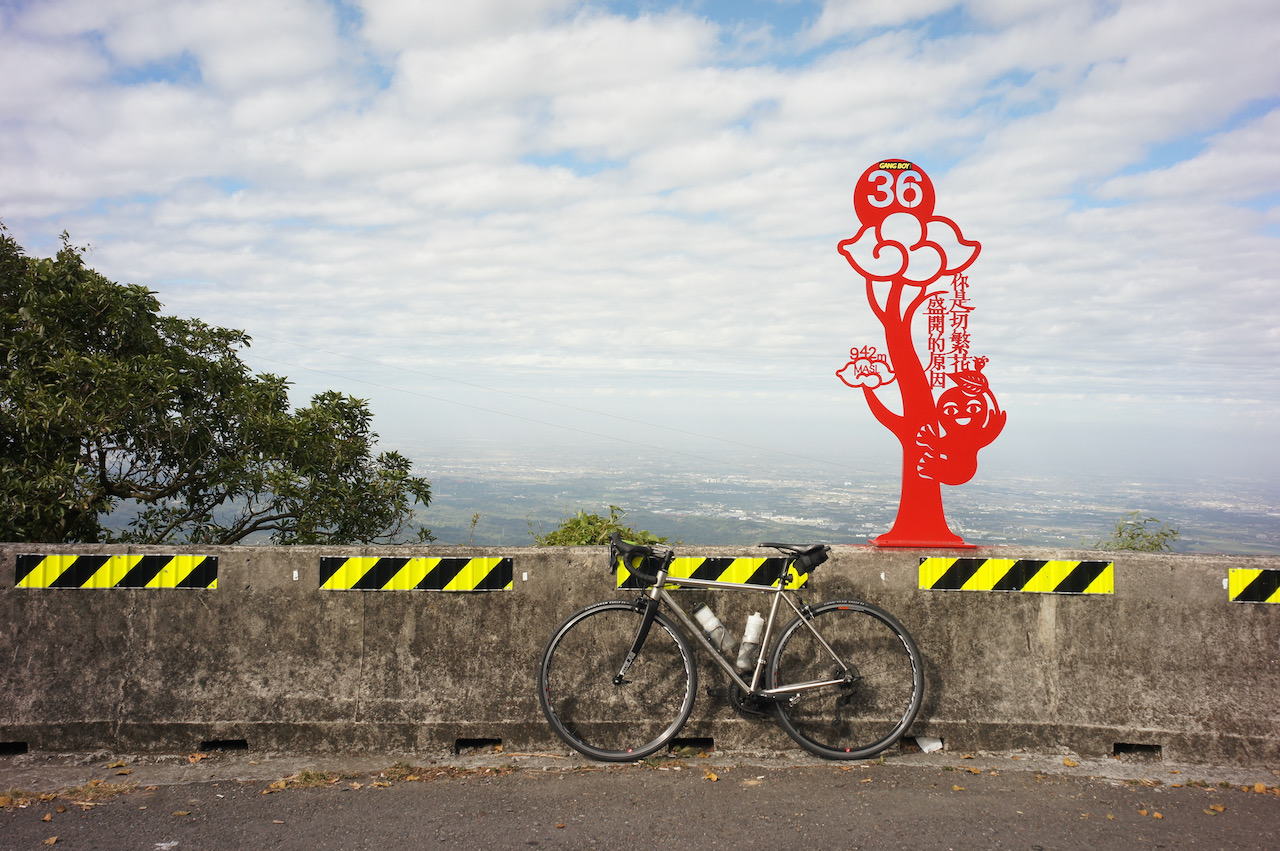
We arrived at Meishan Park, the starting point, around 8:00 a.m. and started our ride right away. The climb began immediately. I wasn’t quite ready for it after a sleepless night. But then there was the sign of the first bend which is stylised as Traditional Chinese paper cutting in bright red. It was encouraging to me. Some of our group members decided to take pictures with all the 36 signs.
As we slowly passed more bends and gained our elevation, we got better and better views of the Chiayi-Tainan Plain 嘉南平原. After spending 2 hours climbing and finishing all the 36 bends, we reached Taiping Old Street. Actually there is much much more to climb if you want to. You can reach Alishan National Forest Recreation Area ultimately at 2,200m of elevation. I would like to do a multi-day cycling trip with that as the destination.
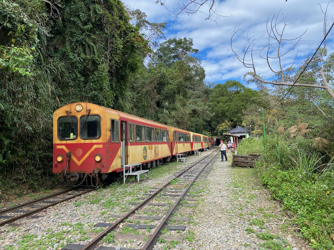
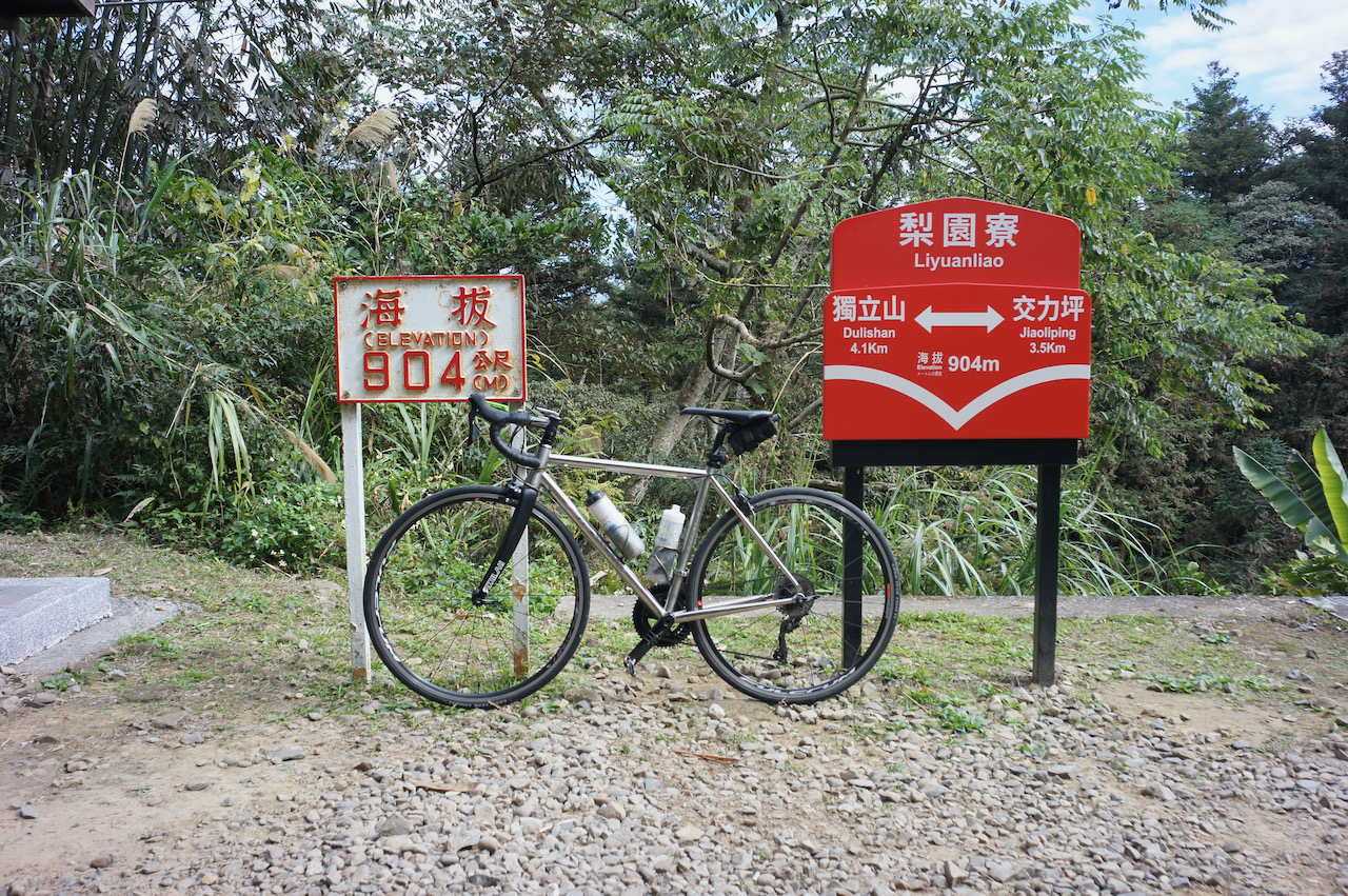
It would have been fun to descend back to Meishan Park via the 36 bends, but we had other plans. We continued on the Township Road 嘉154, saw lots of beautiful tea farms and reached Liyuanliao Station 梨園寮車站, one of the stations of the Alishan Forest Railway. The long descent back to Provincial Highway No. 3 was mild and long without many bends. It was a very pleasant ride but it could be dangerous as we accumulated more speed while comfortably going down hill with our alert level getting lower. Sandy said she could have fallen asleep.
We cycled back to Meishan Park for lunch along Provincial Highway No. 3 and then took the coach back to Taipei. It was totally dark when we were back home.
Doing It Yourself
To ride this route without joining an organised tour, you can take a train to Dalin Station, which is around 13 km from Meishan Park. It’ll take around 5 hours from Taipei to Dalin. The other option is HSR, which takes around 1.5 hours to get from Taipei to Yunlin Station, about 28 km away from the starting point. Here are some details on how to take public transportation with a bike. Please note that there is only one convenience store as a decent supply stop at Taiping Old Street. Some grocery stores can be found on GoogleMaps after passing Taiping Old Street, but I am not sure about the opening hours. So, plan your water consumption and supply carefully.
NOTE: To use the routes, please install the App on your smartphone. The App will launch and load the route automatically after you tap the above links on your smartphone’s browser. For Garmin Connect, you can then use the APP to send the route to your garmin device. If your Garmin device is not purchased in Taiwan, you will also need make sure you have the Taiwan map on your device. Here is our blog post on this topic.
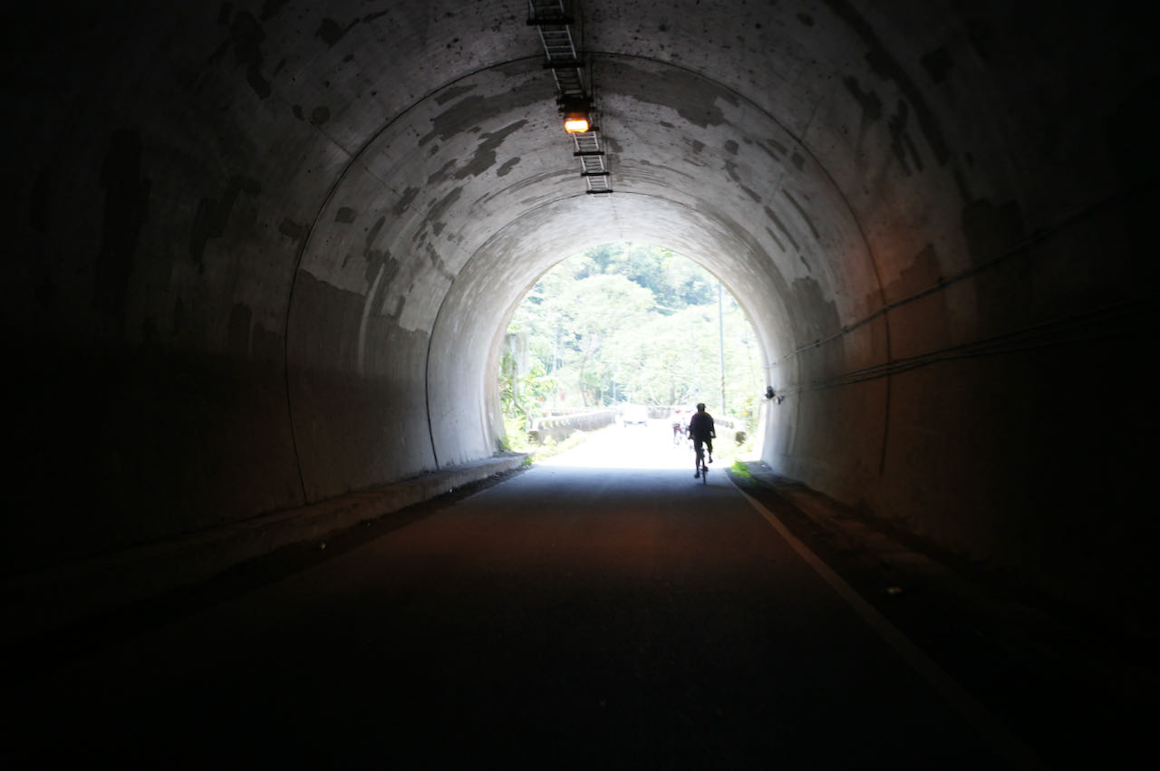
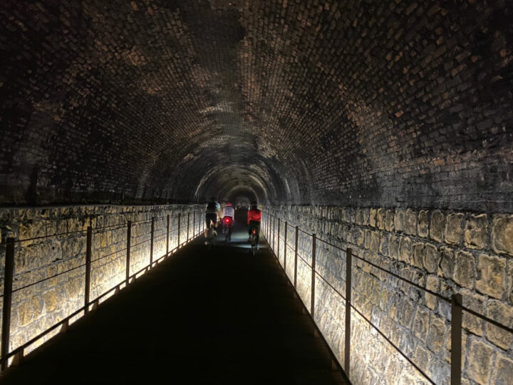
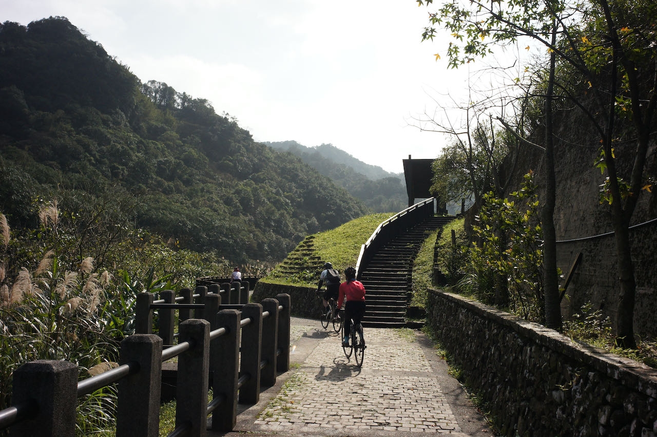
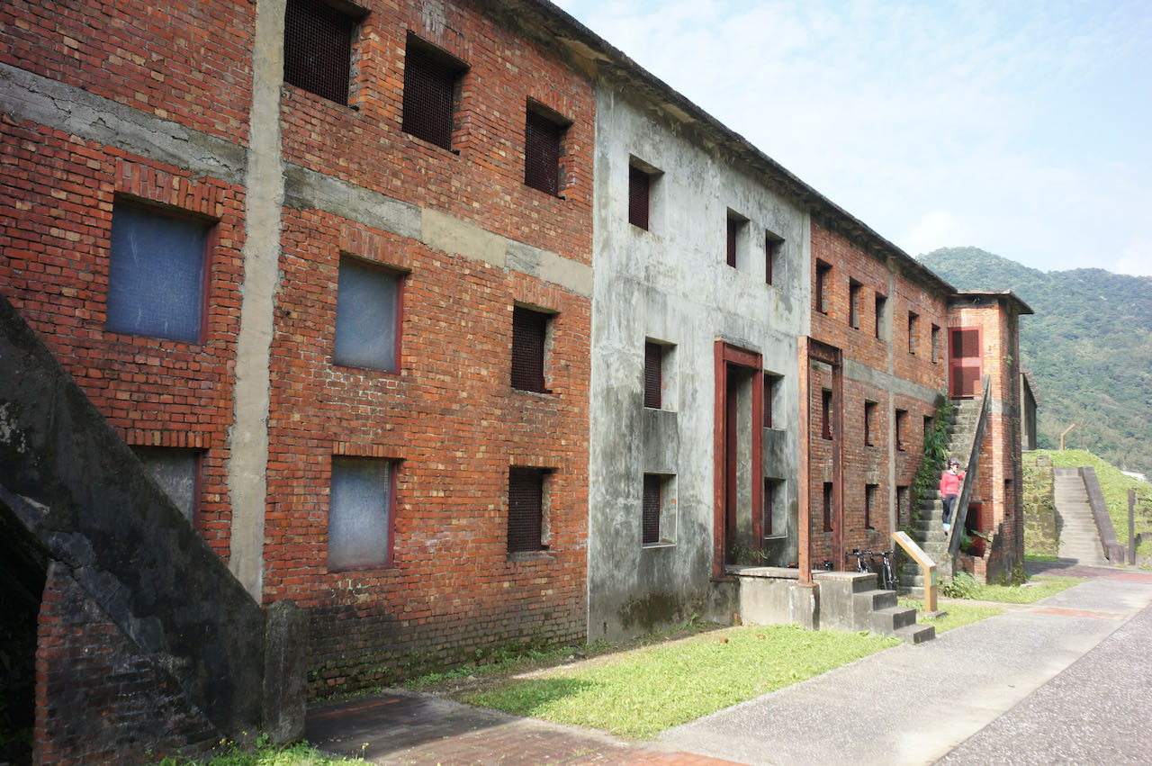
I went cycling with my friends on a Sunday in January to explore a route plotted by Sandy. We took a train from Taipei (you can board the train at Wanhua Station 萬華站, Songshan Station 松山站 or Nangang Station 南港站) to Ruifang Station 瑞芳站 and started our ride right away. We have visited the Houtong Cat Village 猴銅貓村, the Houtong Miner’s Culture & History Museum 猴銅礦工文史館 and the Sandiaoling Tunnel 三貂嶺隧道 – an old railroad tunnel that had been closed for 37 years and then was reopened in 2022 as a bike trail. On our way back to Taipei, we went to watch people flying their sky lanterns in Shifen Old Street 十分老街. This is a route with lots of interesting historical and cultural sites.
Opening hours: 8:30 ~ 16:30 everyday except Monday. If the Monday falls in a long consecutive holiday, it’ll still open. And in this case, the next working day is closed. Visitors need to to make a booking on the link above to secure a place.
Safety Precautions: The entrance of the tunnel is flooded. It’s a feature (not a bug) for people to take pictures of their reflection. But it could be slippery. The whole tunnel’s floor is laid with rows of steels with wide gaps. It can be a trap for those who wear SPD-SL or Look Keo cleats. Be careful not to stick the cleats into the gaps when you need to stop to walk. It’s dark inside and there are lots of pedestrians. Please limit your speed.
The most direct route to cycle back to Taipei is via Provincial Highway 2C (or 2丙) and County Highway 106. But it can be busy with traffic especially during weekends. Sandy had instead routed through some small roads to avoid the traffic. I have provided my GPS record below in Garmin, Velodash, and komoot. The GPX route on the entrance of Sandiaoling Tunnel is difficult to edit because the new bike path and the entrance are not yet recognised by the map. Please follow the sign on the road when you are in that area.
This is a perfect route for a 1 day cycling trip close to Taipei. If you find the route too long, you can hop on a train on Shuangxi Train Station 雙溪站 with your bike to get back to Taipei. You can also extend the route a little to make it part of your around the island trip.
NOTE: To use the routes, please install the App on your smartphone. The App will launch and load the route automatically after you tap the above links on your smartphone’s browser. For Garmin Connect, you can then use the APP to send the route to your garmin device. If your Garmin device is not purchased in Taiwan, you will also need make sure you have the Taiwan map on your device. Here is our blog post on this topic.
This post is on the branch routes and circular routes along Cycling Route No. 1. We have another post on doing the typical around-the-island ride in 9 days along Cycling Route No. 1.
Click on the circular markings on the map for detailed info and GPX files for each day, or
Details of each route are linked to the map so that you can have a better idea of the location of the routes.
The downloadable GPX files on the Taiwan Bike Single Portal cannot be imported to Garmin directly. We fixed them with GPSvisualiser and import them to connect.Garmin.com. You can use the links we provided to get the routes.
We shorten the name of the routes so that it can be displayed better on the small screen of the Garmin or other GPS devices. For example, Cycling Route No. 1-15 is shorten to CR1-15.
The website connect.Garmin.com and the App Connet by Garmin has Reverse Direction function in the route edit mode. If you need to travel in the opposite direction, you can reverse the direction of the course before loading it to your device.
If you don’t use a Garmin but would like to follow the routes, you can use Velodash on your smartphone for navigation. The direction reversal function is not available for an imported route. But it is not necessary as the Velodash does not provide turn by turn navigation hitherto. Just follow the line on the map when you are cycling.
The GPX routes and the routes shown on the maps are not exactly the same. In some cases, the staring point, ending point and some supply stops of a route on the map may deviate from the GPX route for 50 metres or more. Please fine tune the routes to suit your itinerary.
We also have a day-to-day plan with our suggestions and alternative routes for doing the around-the-island in 9 days along Cycling Route No. 1.
Disclaimer
We DO NOT own the graphic and information in this post – it all came from the Taiwan Cycling Single Portal built and maintained by the Ministry of Transportation and Communications of the Taiwan Government. This website is the authoritative source of information for all those who plan to do the around-the-island trip in Taiwan. It’s very useful, but unfortunately not very user-friendly in our opinion. Therefore, what we are trying to do here is to re-organize the information in a way that we find handy and mobile-friendly.
More on the around-the-island tour
My First Cycling Trip in Taiwan Day 7
Still in the Huadong Valley. We visited a tea shop in Wuhe Village and got treated with a special kind of tea and spent the night in Yuli.
We left Keelung and continued our trip on the north east coast. We had a short hike on the trails on Cape Bitoujiao. A beautiful primary school at the beginning.
I went cycling with my friends on a Sunday in November to explore a route plotted by Sandy. She was about to lead a local cycling group to do part of the around-the-island in the northern part of Taiwan. Since it’s already the 3rd time the group did the around-the-island, Sandy wanted to try something different. The route she plotted turned out to be a very nice one with beautiful views on the countryside. Most of the time you’ll be riding on the bikeways. It’s also quiet and without much climbs.
I have converted my GPS record that day to a Garmin Course for navigation, with the starting point set at Songshan Train Station, which is the official starting point of Taiwan Cycling Route No. 1. The GPX route is available for download at the end of this post.
If you are planning for an around-the-island trip, instead of following the official route, you may consider using this route for your day 1 itinerary. The route ends at an old town called Beipu 北埔 in Hsinchu 新竹, which is a small town with limited hotel choices. If you cannot book one, you may need to switch to Hsinchu City 新竹市 from Zhudong 竹東. There are more hotels to choose from.
Here are more details about the route.
Road Conditions
Starting from Songshan Train Station 松山火車站, you will head west and cut across Taipei on Nanjing East Road 南京東路. Nanjing East Road is very bike friendly because there are bike lanes on the wide sidewalks. It’s also fine if you want to cycle with the other vehicles on the road. The road is wide in general. For some parts, bus stops are built on the fast lanes so that bicycles and scooters won’t be fighting for roadside spaces with buses. Once you reach the Dadaocheng Pier Plaza 大稻埕碼頭廣場, you will begin a 55 km ride along the Riverside Bikeways with minimal motorised vehicles. If you want to avoid city traffic as much as possible, you can get into the Riverside Bikeways directly via the evacuation gate at Rainbow Bridge 彩虹橋 from Songshan. Besides the Riverside Bikeways, the rest of the route is mostly done on the well-maintained Provincial Highway No. 3. Sandy has plotted carefully to skip most of the climbs.
Places to Visit and Things to See
What you will see along this route are mostly rural landscapes and some old infrastructure like canals and bridges. There are also some old towns and old streets where you can stop by for supply and meals.
Comparison with Other Routes
So far I have tried 3 routes to cover the first day of the around-the-island, starting from Songshan and ending in Hsinchu.
The west coast route (green one on the map) is flat and wide so that we can cycle as fast as we can. It offers panoramic views of the sea while we are cycling. There are also sections of bikeways for us to get away from the traffic though it’s not too busy. There are less towns there but it’s not difficult to find supply. There are also not too many trees to provide shade. Therefore it can be very hot in the summer.
Day 1 of the official Taiwan Cycling Route No. 1 (blue one on the map) is mainly done along Provincial Highway No. 3. It’s well maintained but with lots of slopes. You will have to go up and down again and again. There are a couple interesting towns to stop by along the way. Provincial Highway No. 3 is also a popular route for motorbike riders to hone their cornering skills. So, it could get very noisy especially during weekends.
If you take the route plotted by Sandy (orange one on the map), you will spend much more time on dedicated bikeways and rural country roads. It is flat and quiet. You can cycle more leisurely and enjoy the views. But you may tend to spend more time pausing to take photos. If it gets dark, it will become very difficult to navigate. So, make sure you get back to the main roads before the sun sets. Also pay attention to the local weather before you set off. After heavy rain, those bikeways could be flooded.
NOTE: To use the routes, please install the App on your smartphone. The App will launch and load the route automatically after you tap the above links on your smartphone’s browser. For Garmin Connect, you can then use the APP to send the route to your garmin device. If your Garmin device is not purchased in Taiwan, you will also need make sure you have the Taiwan map on your device. Here is our blog post on this topic.
Here are some considerations when I was planning this part.
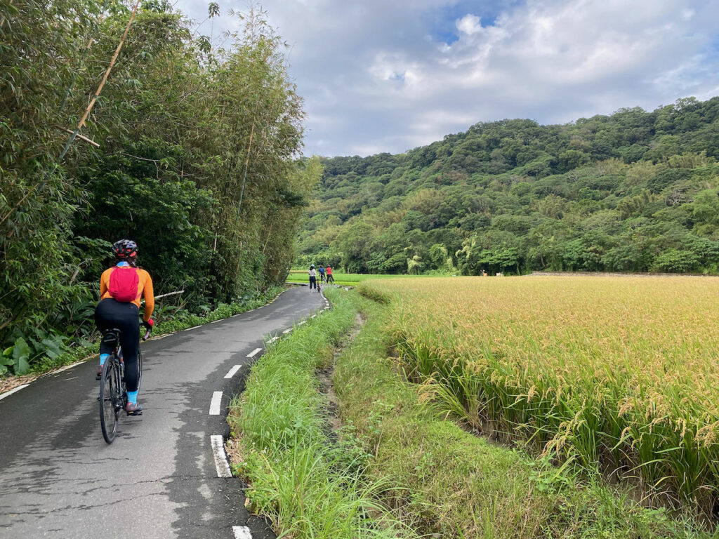
From Taitung to Hualien, there are two routes to choose from, the rift valley and the coastal route which sandwich the Coastal Mountain Range. The rift valley is more populous with vast paddy rice fields and many interesting places to visit. Supplies and places to stay over are easier to find. But the coastal route offers stupendous views of the Pacific Ocean which shouldn’t be missed. In a perfect world, I would plan the route to cover both the rift valley and the coast by starting from Taitung heading north to Ruisui in the rift valley and then switch to the coast using the Ruigang Industry Road (花 64 or HL64). By doing so, you will get the best part of the rift valley and the coastal route. The most famous part of the rift valley is found on the Southern half of the rift valley and the best views of the Pacific Ocean are found on the northern part. And the direction is important, too. By travelling northwards, you find yourself closest to the sea because we drive on the right side of the road. Most interesting stops are on this side making it safer to visit the places without having to cross the road.
Then after Hualien City, there is the Taraoko Gorge, the starting point of the Central Cross-Island Highway transversing the Central Mountain Range which brings you to the altitude of 3,275 metre at the Wuling Pass, the route for Taiwan Kom Challenge. I would plan a short detour climbing to Tian Xiang Recreational Area (Altitude 485m) to get a taste of the challenge before heading north to tackle the tricky Suhua Highway which brings you to Yilan.
The Suhua Highway
Why is the Suhua Highway so tricky? It’s a topic not to be taken lightly whether to cycle on this section or not. Not only does the route have a total ascent of 1,451m in 78km from Xincheng to Su’ao, many parts of the highway is built right next to a cliff with the width merely enough for two vehicles to pass. High steep slopes are found on your left to the peak of the mountain. Frequent earthquakes loosen the rocks on the slopes making them ready to fall onto the road. There could be landslides to block the whole road after heavy rains or typhoons. Besides, there are around 9 tunnels to cycle through which means poor air condition and visibility inside. And noises produced by the motorised vehicles are trapped inside to blast your eardrums non-stop.
Nonetheless, most people who have done it would say that it is worth the risk. I myself have not done it yet but I had goosebumps just by looking at the Street View on GoogleMaps when researching for this itinerary. And there has been a good development. The traffic condition has improved a lot after the Suhua Highway Improvement Project is completed in 2020. New wider segments are built to straighten the highway. Travelling time is reduced. Bikes are not allowed on these new segments but those heavy vehicles and cars would then be drawn to the new route (Provincial Highway 9), making the old one (Provincial Highway 9丁 or 9D) less busy, more enjoyable to cycle. In fact, big trucks are not allowed on the old route. But please note that there are still segments where the old Suhua Highway and the new one overlaps.
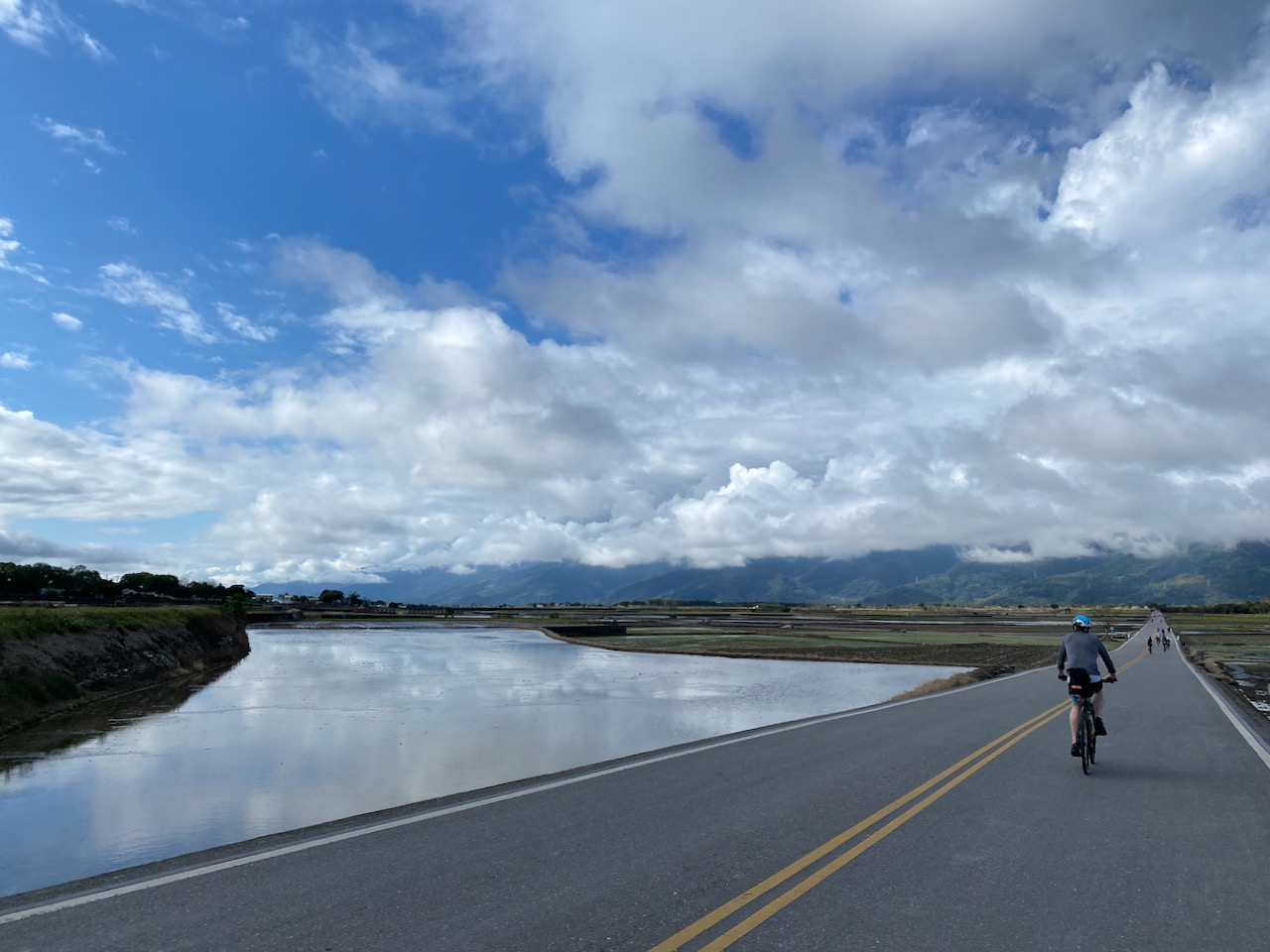
Heading north on the old Suhua Highway, after climbing the 5th peak of Suhua Highway, we would then descend to the plain of Yilan which is an alluvial fan formed by the Lanyang River. There are lots of hot spring hotels in Jiaoxi. It would be nice to plan a longer stay to chill out there by having a day with less distance to cover. Most people would then head north east and climb two peaks on the Beiyi Highway (北宜公路 Also a segment of Provincial Highway No. 9) to get back to Xindian in Taipei to finish the whole trip. But the coasts on the north and north east are too good to be skipped. I would just head north to Fulong and stick to the coasts.
Isn’t it a nice plan? But this is exactly what we did not do. This is only good for those who do it from May to September when the wind is not coming from the north. Or for those who don’t mind cycling against the wind.
We did this stage in January when there was the prevailing wind coming from the north. We needed to head south to make the wind work for us. We started from Fulong, the north east tip of the island, and spent the first day covering Yilan. Then, we skipped the Suhua highway by taking the train to Hualien from Suaoxin Station. Since we were heading south, there were not many benefits of cycling on the coast route. We stayed in the rift valley the whole time from Hualien to Taitung. Here are the details of the itinerary
Day 1 Fulong to Xincheng Taroko, Hualien (54km, Ascent 143m, Descent 128m with a train ride from Suaoxin to Hualien)
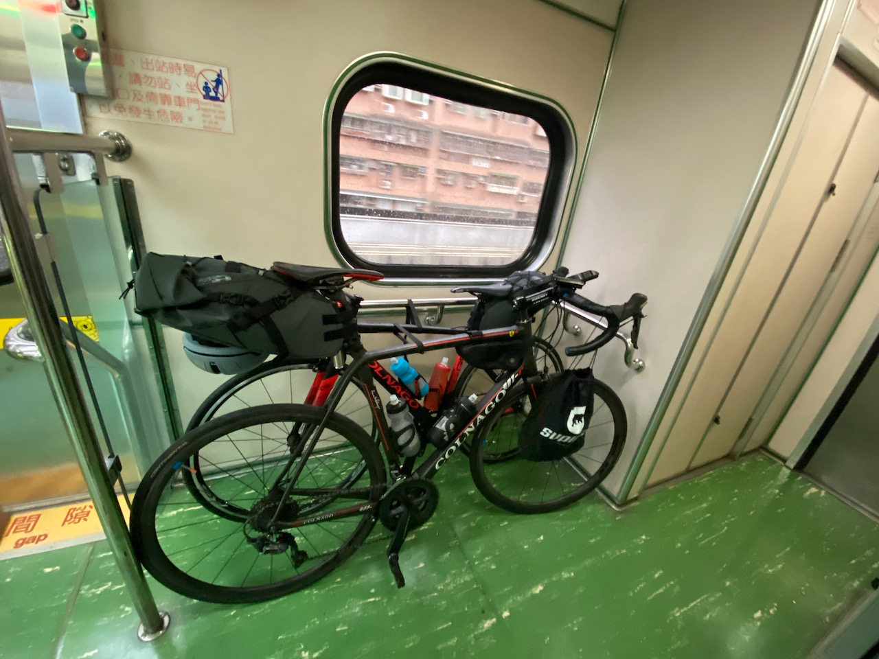
To get to Fulong from Taipei, we took a 1.5 hour early train (No. 4148), which allows whole bikes on board. Two of my friends boarded from Wanhua station first. On that weekday morning, it was so packed that it required some courage to force into the train with such big pieces of luggages. Then it got much better on the next station of Taipei Main Station where more passengers would get off. When it’s my turn to board at Songshan station, we have even much more space. There are 900,000 commuters to Taipei each day. When the train is leaving the city, it gets empty. It may be a good idea to use Songshan Station or Nangan Station for trains heading north. Please refer to this post for more info about taking bikes on public transportation in Taiwan.
Everything went perfectly well except the rain. Not pouring down but enough to wet everything and flood all the potholes. We decided to complete the trip as soon as possible. I tried to lead the group to some dedicated bikeways but they seemed muddy. It’s better sticking to the main road. Water was sloshing in my friend’s shoes (I wore slippers). Each time we stopped for a break, they had to take off their shoes and shocks and pour the water. They have waterproof jackets but once water got hold of the internal layers sticking outside on the sleeves or waist, it seeped inside and drenched everything. All the clothes in the bags were drenched too. A disposable raincoat sold in the convenience stores would solve the problem, though it is thin and torn easily.
We made it to the Suaoxin Station early. There weren’t any shops inside the station. Neither there were any shops around the area except for a 7-Eleven and several food stalls we missed 1 km away. We swapped the tickets for an earlier train and got back to the 7-eleven for lunch.
This train ride was nice. We had the whole car to ourselves. We did not stay in Xincheng because we did not plan to have a detour to climb to Tianxiang and the hotels around Xincheng Taroko Station are a little pricier. I planned our stay further south, the Beipu Station. My friend realised their clothes in the bags were drenched too after checking into the B&B and getting ready for showers. Those bags claim to be water resistant or waterproof are destined to leak after a couple uses. So, I always pack my clothes in zip lock bags. I don’t mean to be gleeful but just to let my readers know the differences. We then ended up spending the afternoon in a coin operated laundry to wash and tumble dry the clothes (and ahem… shoes).
NOTE: To use the routes, please install the App on your smartphone. The App will launch and load the route automatically after you tap the above links on your smartphone’s browser. For Garmin Connect, you can then use the APP to send the route to your garmin device. If your Garmin device is not purchased in Taiwan, you will also need make sure you have the Taiwan map on your device. Here is our blog post on this topic.
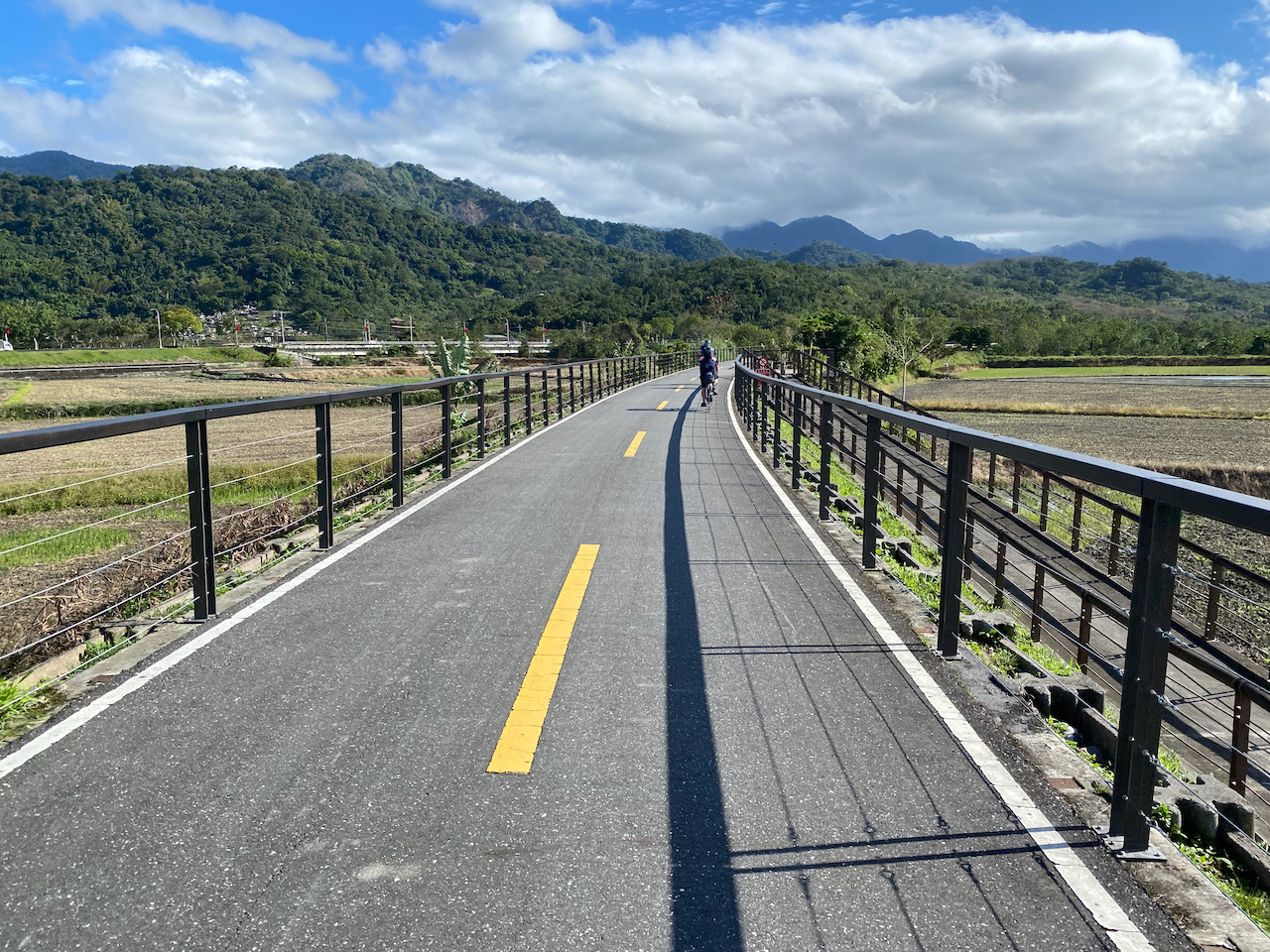
Day 2 Xincheng Taroko to Guangfu (72km Ascent 530m, Descent 435m)
We were sticking to the rift valley route instead of the coastal route in Hualien. But there are two routes in the rift valley to choose, the Provincial Highway No. 9 and the County Highway 193. The former one is wider, flatter but with more traffic. There are more supply stops. The latter one is smaller, some short climbs but quieter with less traffic. We voted unanimously to cycle on County Highway 193, which turned out to be a great choice. Once we left Hualien and turned into County Highway 193, we had the whole road to ourselves. It was so quiet and we could chat relaxly while cycling. It’s still raining on the 2nd day. The surface is totally wet but there were no other vehicles to splash muddy waters on us. The only inconvenience was that there were only some small grocery stores along the route. Not quite probable to get a decent meal and choices of snacks are very limited if you find one that’s open.
We reached the B&B late after lunch with empty stomachs but we needed to clean our bikes first. Lucky that the B&B has a big yard with a hose for us to rinse the dirt from our bikes. Then everyone rushed to their rooms for shower and I went for a quick lunch with another member who had the same priority as mine: food.
That evening, we managed to find a fancy restaurant serving really nice meals.
NOTE: To use the routes, please install the App on your smartphone. The App will launch and load the route automatically after you tap the above links on your smartphone’s browser. For Garmin Connect, you can then use the APP to send the route to your garmin device. If your Garmin device is not purchased in Taiwan, you will also need make sure you have the Taiwan map on your device. Here is our blog post on this topic.
Day 3 Guangfu to Fuli (65km Accent 424, Descent 310m)
Sun finally came out. We stayed on Provincial Highway No. 9, which is flat and wide, except there is a short climb of 150 metres to the Wuhe Terrace where you can find some tea shops and a Tropic of Cancer Marker. After descending from this terrace, there were two bikeways running parallel to our route. The first one, Fuyuen old railway bikeway 富源舊鐵路自行車道, started from the Fuyuan Station running southwards. It is converted from the old railways after a new one was built elevated. Then there was this Yufu bikeway (玉富自行車道) brought us from Yuli to Old Dongli Train Station, a place for chill out and taking pictures. Apart from the two bikeways, we cycled on Provincial Highway No. 9. It’s a wide flat road with a shoulder dedicated for scooters and bicycles. After leaving the 2nd bikeway, there is a farmer’s association outlet selling local products on the Provincial Highway No. 9. Sometimes you would find some sculptures made of the hays after the rice is harvested here. This was an easy day. We checked into the B&B early and drank some beer before sunset. Fuli is a very small town. There was only one restaurant with dine in option.
NOTE: To use the routes, please install the App on your smartphone. The App will launch and load the route automatically after you tap the above links on your smartphone’s browser. For Garmin Connect, you can then use the APP to send the route to your garmin device. If your Garmin device is not purchased in Taiwan, you will also need make sure you have the Taiwan map on your device. Here is our blog post on this topic.
Day 4 Fuli to Taitung (60km Ascent 324m, Descend 517m)
This is the last day of our trip. Only 60km left to cover. There was this famous Brown Boulevard laid ahead of us in Chishang where the finest rice of Taiwan is cultivated. The part of Provincial Highway No. 9 was equally great. After a little climb of around 100m, we descended to the Taitung Train Station to have our bikes shipped back to Taipei. We managed to find a SPA that lets us use their staff’s shower room if we spend some money for their services. It was so nice to get refreshed before boarding a plane there to get to Taipei.
NOTE: To use the routes, please install the App on your smartphone. The App will launch and load the route automatically after you tap the above links on your smartphone’s browser. For Garmin Connect, you can then use the APP to send the route to your garmin device. If your Garmin device is not purchased in Taiwan, you will also need make sure you have the Taiwan map on your device. Here is our blog post on this topic.
Conclusion:
After completing this stage, we’d still need to cycle from Taipei to Fulong to complete the loop of around the island but my friends were already claiming that they had accomplished the challenge because they had cycled to Fulong by themselves for some weekends. So, that’s it for the around Taiwan trips. But there is still more to explore on the island, especially in the mountains.
We did multiple trips to cycle around Taiwan because we did not have time to do it in one go. The downloadable GPX file of the cycling route is at the end of each section.
This is the 2nd stage of our Around Taiwan in Multiple Stages trip. We were to cover Kaohsiung to Taitung in this stage. We would go from the west coast to the east coast by climbing over the 460m Shouka mountain pass or Shouka Biker Rest Stop. We started off from Kaohsiung 高雄 cycled to Checheng 車城. There are two routes to climb to the Shouka Biker Rest Stop, the Provincial Highway No. 9 or County Highway 199. Provincial Highway No. 9 has lots of traffic making it less enjoyable. So County Highway 199 is a better choice. We spent the 3rd night in Jinlun 金崙 where quite a number of small hotels to choose. Some even offer hotsprings. The last day was quite easy. It’s just 41 km to Taitung Train Station where you can have your bike sent back to Taipei (Wanhua Station or Songshan Station). Then you can either take a domestic flight back to Songshan Airport in Taipei or take a train home. For me, I have taken a special train with 40 bike racks in carriages for bikers. I can push my whole bike onto the train, the C.K. EXP No. 81 (Departs at 16:02) and had 5 hours to spare until I arrived at Songshan Station. C.K. EXP No. 81 is only available every Friday, Saturday, Sunday and Monday.
If this stage seems too short for you, I have plotted an extra route by heading further south to the Eluanbi Lighthouse.
Day 1: Kaohsiung to Checheng (99km, Ascent 310m, Descent 323m) 高雄至車城
We only had 3 days to spare when we were having this stage. So, we started from Kaohsiung instead of Tainan where we left off to make it easier. We sent our bikes to Fengshan on Wednesday and collected them on Friday before 8:00 p.m. Then we spent the night in Kaohsiung and started as early as possible the next day. With hindsight, Nanzi is a better location to collect the bike as it’s closer to HSR and the luggage room is easier to locate. The other option is taking the earliest HSR with the bikes bagged on Saturday morning and start cycling right from Kaohsiung Zuoying HSR station. The earliest HSR to arrive at Zuoying, Kaohsiung is 8:40 am which makes you start late, though.
Kaohsiung is the 3rd biggest city in Taiwan. When we started cycling from the city centre, it was a 4-lane main road. As we headed south further, a bikeway emerged making cycling more relaxing. Then the road got less busier when we reached the countryside. We had a broken spoke and were lucky to have a very helpful bike shop nearby in front of Fang-Liao station. While waiting, we had a 3-hour lunch break. Can’t complain. Carbon wheels are tricky to fix. But we still can make it to Checheng before 3:30. It’s quite an easy route and the wind at our back did make it much easier.
If you have plenty of time, you may take a detour to the Pier 2 Art Center and then take a ferry to Qijin District, cycle south east along the narrow isle and get back to the main route by ferry at the Zhong Zhou Ferry Station.
NOTE: To use the routes, please install the App on your smartphone. The App will launch and load the route automatically after you tap the above links on your smartphone’s browser. For Garmin Connect, you can then use the APP to send the route to your garmin device. If your Garmin device is not purchased in Taiwan, you will also need make sure you have the Taiwan map on your device. Here is our blog post on this topic.
Day 2: Checheng to Jinlun (78km, Ascent 650m, Descent 629m)車城至金崙
The first 37km in Day 2 is harder as it involved accumulated climbing of 530m. But once we reached Shouka pass, there would be a long thrilling descent to the east coast. The detour to Duoliang Railway Station, which is marketed as the most beautiful train station of Taiwan is to be found along Provincial Highway No. 9 right before reaching Jinlun.
NOTE: To use the routes, please install the App on your smartphone. The App will launch and load the route automatically after you tap the above links on your smartphone’s browser. For Garmin Connect, you can then use the APP to send the route to your garmin device. If your Garmin device is not purchased in Taiwan, you will also need make sure you have the Taiwan map on your device. Here is our blog post on this topic.
Day 2: Extra Checheng to Jinlun via Eluanbi Lighthouse (136km, Ascent 1170m, Descent 1148m) 車城至鵝鑾鼻至金崙
Instead of heading east on County Highway No. 199, you can head south all the way to Eluanbi Lighthouse before switching northwards, enjoy the view on the east side and then do the unavoidable climb to Shouka Pass. It would be a long long day of 136km distance with 1093m of Ascent, 1070m of Descent. Given that it’s also hard to get supply or stay over after turning north from Eluanbi Lighthouse, I would suggest inserting one extra night by staying over on Manzhou Township if you plan to use this route. You would have covered 45km there only but it’s better there for more choices of homestays with food stalls and convenience stores for meals and supplies. Or you may cover more distance on Day 1 and stay over in Kenting to make this day a little bit shorter. There are plenty of small hotels in the vicinity of Kenting Night Market. Whatever the plan is, Just don’t end up having to descend in the dark from Shouka Pass.
NOTE: To use the routes, please install the App on your smartphone. The App will launch and load the route automatically after you tap the above links on your smartphone’s browser. For Garmin Connect, you can then use the APP to send the route to your garmin device. If your Garmin device is not purchased in Taiwan, you will also need make sure you have the Taiwan map on your device. Here is our blog post on this topic.
Day 3: Jinlun to Taitung (41km, Ascent 263m, Descent 256m) 金崙至台東
This is the last day of our stage 2. I make it much shorter for more slacks to ourselves. I don’t want to miss the train home in case we have any delays due to any issues. Taitung is one of the most remote cities on the Taiwan main island. Tickets for direct trains to Taipei are snapped up within hours when they are available for purchase. There are flights to Taipei Songshan Airport but seats are limited. If missed, we would have to take the train or coach back to Kaohsiung for HSR or coaches to get back to Taipei.
We cycled directly to Taitung Train Station. My friends drop their bikes at the luggage room and have them sent back to Taipei. We had a relaxing lunch at the city centre which is 5km from the train station. While they took a flight back to Taipei, I took a 5 hour train ride back to Songshan Train Station with my bikes on board. (Edit: this train is no longer in services. Now, the only train that takes naked bikes from Taitung to Taipei is Chu-Kuang Express 667 which departs at 22:45 every Sunday and arrives at 04:31 the next day.)
Please note that there is not much public transportation in Taitung City. No Ubers either. There are plenty of taxis but most of them are queuing at the train station. So, it would be easier to have the restaurant booking a taxi for you while you are having a meal.
NOTE: To use the routes, please install the App on your smartphone. The App will launch and load the route automatically after you tap the above links on your smartphone’s browser. For Garmin Connect, you can then use the APP to send the route to your garmin device. If your Garmin device is not purchased in Taiwan, you will also need make sure you have the Taiwan map on your device. Here is our blog post on this topic.
Cycling around Taiwan in multiple stages is an itinerary I planned for my expat friends in Taipei who don’t have the luxury of taking 9 – 10 days off from work to do it in one go. For each stage, one can use a weekend plus 1 – 2 day(s) off before or after to make it a 3 – 4 days cycling holiday. The downloadable GPX file of the cycling route is at the end of each section.
By dividing the route into multiple stages, we will get some extra bonus such as being able to visit different parts of the island in their best seasons. We can also incorporate some detours to visit more interesting places as we are more relaxed about time. For those who do it in one go, they are bound to cycle against the prevailing wind (North-East for winters and South-West for summers) on one side of the island. When doing it in multiple stages, we can change our direction for different stages so that we will always have the wind at our back.
In the detailed itinerary, I have provided an alternate GPS route plotted to maximise the use of the dedicated bikeways, which my friends found more enjoyable. These bikeways provide a break from the noisy traffic, well paved road surface and sometimes shades by trees. Some even offer us very pleasant views and lead us to interesting places.
However, these bikeways are usually narrower than regular roads, which means you could be slowed down by other users. Your rhythm could be hampered by those roadblocks built to stop other vehicles from entering. Please also note that the conditions on those bikeways could change drastically during unfavourable weather. Some can be flooded, populated by slippery mosses, blocked by sands or even completely destroyed by the natural forces. So, please observe and proceed with caution. When in doubt, switch to the main roads for your own safety.
I have marked some convenience stores on GoogleMaps for your reference. They are reliable supply stops as they mostly open 24 hours a day. But I‘d also like to support small businesses such as local grocery stores and betel nut stalls. They sell water at half the price we pay in the convenience stores.
For my said trips with friends, we took public transportations to get to the starting point and return from the end of each stage outside of Taipei. Please refer to this post for details on how to travel with your bikes on public transportation. As lots if people in Taipei would spend their weekends away from the city, I highly recommend you avoid ending your trips on Sundays so as not to compete for tickets with the crowd, especially when you plan to carry your bike onto a train carriage/coach.
Here are the details of what we did for your reference.
For Stage One, there are 3 routes to go on the west part of the island: the coastal route, a route close to the mountains and a route in the middle. I picked the coastal route as it is wide and flat with sparse traffic lights. There are heavy vehicles occasionally passing by but most of the traffic is on the elevated highways, leaving us plenty of space on the ground level. There are less supply stops and not many choices of hotels, so we needed to commit to a longer day of cycling than wanted.
Day 1: Taipei to Hsinchu City (89km, Ascent 165m, Descent 160m) 台北至新竹
NOTE: To use the routes, please install the App on your smartphone. The App will launch and load the route automatically after you tap the above links on your smartphone’s browser. For Garmin Connect, you can then use the APP to send the route to your garmin device. If your Garmin device is not purchased in Taiwan, you will also need make sure you have the Taiwan map on your device. Here is our blog post on this topic.
Day 2: Hsinchu City to Lukang (110km, Ascent 205m, Descent 206m) 新竹至鹿港
Suggested Lunch Break: Baishatun or Tongxiao 白沙屯或通宵
If 110km a day is too ambitious, you can plan your stay in Wuqi District, Taichung 台中梧棲區 instead of Lukang, leaving the remaining 20km for Day 3. But I believe that extra 20 km should not impose much impact as the route for Day 3 is direct and flat. Gaomei Wetlands 高美濕地 is a nice place to visit. I have even pondered staying over in the small hotel there. But the dinner plan could be tricky. Wuqi District may be a better choice as it’s only 7km from Gaomei.
Lukang is a popular tourist destination. There are plenty of hotels to choose from but they can be fully booked during weekends.
NOTE: To use the routes, please install the App on your smartphone. The App will launch and load the route automatically after you tap the above links on your smartphone’s browser. For Garmin Connect, you can then use the APP to send the route to your garmin device. If your Garmin device is not purchased in Taiwan, you will also need make sure you have the Taiwan map on your device. Here is our blog post on this topic.
Day 3: Lukang to Budai (91km, Ascent 80m, Descent 83m) 鹿港至布袋
Suggested Lunch Break: Mailiao 麥寮
For day 3, if you want to cover less distance, you may stay over in Dongshi 東石 which is 10km less. But choices of hotels are very limited.
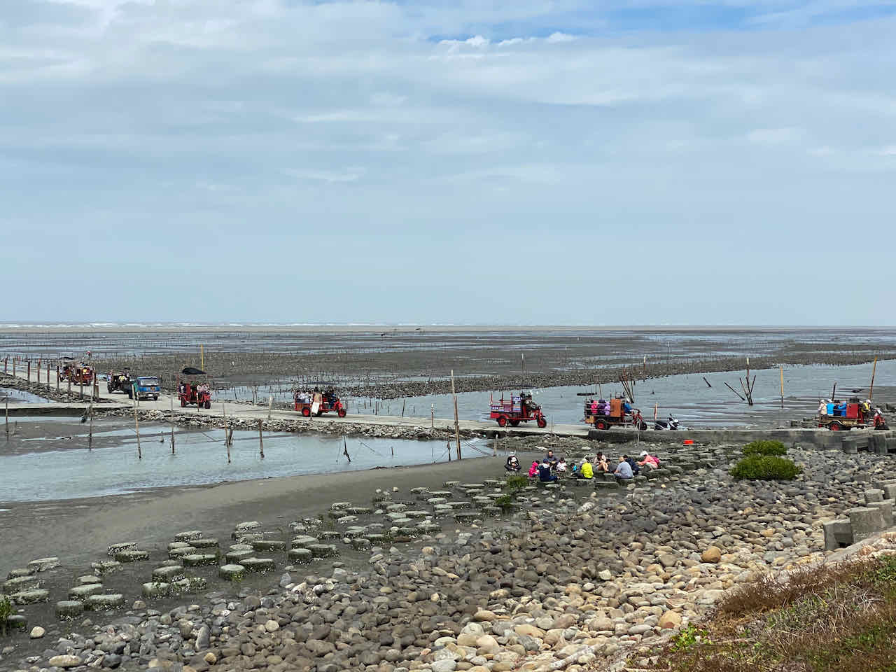
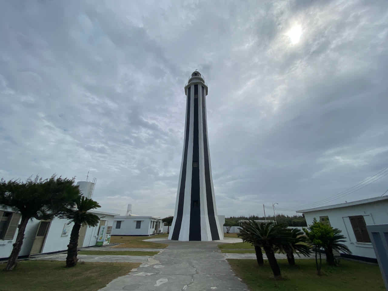
A detour to Fangyuan Lighthouse 芳苑燈塔 is around 3km from the main route. The oyster farm nearby has become a tourist attraction where people can ride a cart out to the oyster field and dig some oysters.
We stayed on the isle of Budai. There are plenty of hotels to choose from. The Budai Harbour Fish Market offers seafood with great atmosphere like in the night markets. If you have more days to spare, there is ferry service to bring you to Penghu County 澎湖 with your bike.
NOTE: To use the routes, please install the App on your smartphone. The App will launch and load the route automatically after you tap the above links on your smartphone’s browser. For Garmin Connect, you can then use the APP to send the route to your garmin device. If your Garmin device is not purchased in Taiwan, you will also need make sure you have the Taiwan map on your device. Here is our blog post on this topic.
Day 4a: Budai to Tainan Train Station (50km, Ascent 153m, Descent 142m) 布袋至台南火車站
Suggested Lunch Break: Tainan
This is the last day of our Stage 1. We dropped our bikes at Tainan Train Station Luggage Room to be sent back to Wanhua 萬華 or Songshan Station 松山車站 in Taipei. They were available for pick up the next day. The Tainan Station Luggage Room is hidden behind a private scooter parking. You need to get into the gate to find it. Then we took the train to Shalun Station 沙崙車站 for the High Speed Railway. You can also take the train or inter-city buses to get back to Taipei.
I prefer having my bike shipped for less hassle. And we have an e-bike in the group which would be too heavy to carry. Another option is bagging your bike and carrying them onto the train or HSR but the carriage can be too crowded to take in such a big piece of luggage during peak hours.
NOTE: To use the routes, please install the App on your smartphone. The App will launch and load the route automatically after you tap the above links on your smartphone’s browser. For Garmin Connect, you can then use the APP to send the route to your garmin device. If your Garmin device is not purchased in Taiwan, you will also need make sure you have the Taiwan map on your device. Here is our blog post on this topic.
If you want to cycle more on day 4, you can cycle to Kaoshsiung as shown in this Day 4b plan.
Day 4b: Budai to Kaohsiung (89km, Ascent 135m, Descent 112m) 布袋至高雄
There are two train stations in Kaohsiung that provide bike shipping services, Nanzi Station 楠梓車站 and Fengshan Station 鳳山車站. Nanzi Station is more preferable as it is much closer to the High Speed Railway Station in Kaohsiung. I have used Fengshan Station before. The luggage room was very difficult to locate and it is hidden behind a construction site, the work of which seems to be unlikely to finish soon.
NOTE: To use the routes, please install the App on your smartphone. The App will launch and load the route automatically after you tap the above links on your smartphone’s browser. For Garmin Connect, you can then use the APP to send the route to your garmin device. If your Garmin device is not purchased in Taiwan, you will also need make sure you have the Taiwan map on your device. Here is our blog post on this topic.