Category: Climbing routes

  • Cycling Route: Wufenshan and Buyan Pavilion – Climb Training

    Cycling Route: Wufenshan and Buyan Pavilion – Climb Training

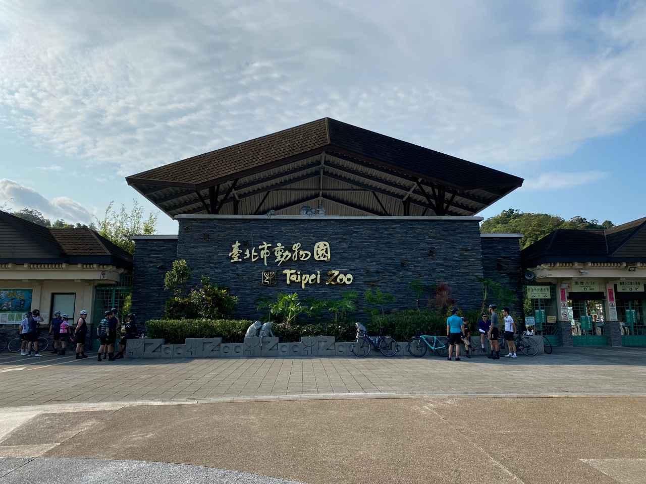
    I went for a cycling trip with a group of cyclists in the outskirts of Taipei on a Saturday in mid June. It is a 67km loop with two climbs to Wufenshan Meteorological Radar  Observatory 五分山氣象雷達站 (757m) and Buyan Pavilion 不厭亭 (530m). The route is designed by Sandy, my cycling enthusiast friend who wanted to offer a group of cyclists from the southern part of Taiwan an unique cycling experience here in the northern part of the island. The downloadable GPX file of this cycling route is at the end of this post. 

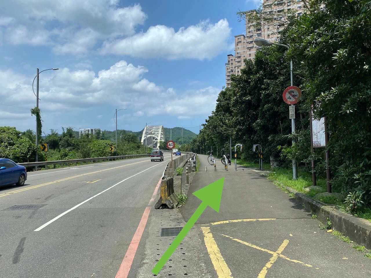
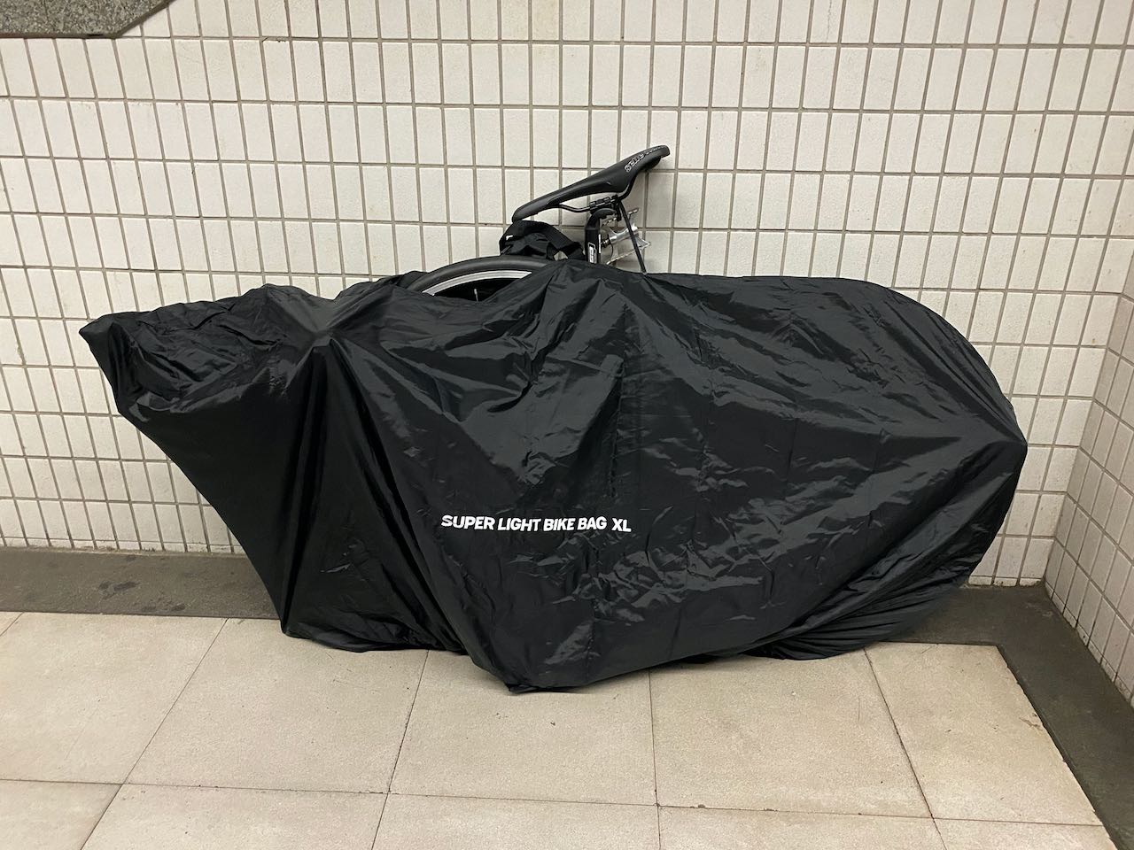
    For people living in Taipei city, we can just hop on our bike, head towards a random direction, and there will be a cycling route waiting for us. We can reach those small quiet towns in the outskirts of the city in 1-2 hours. However, in order to get away from the city traffic as soon as possible and spend more time in the countryside, we sometimes take the train with our bikes to get away from Taipei first and begin our ride somewhere else. That day I was to meet my friends in Ruifang Station 瑞芳站 at 6:30 am. I bagged my bike, boarded the earliest north-bound train at Nangang Station 南港站, and arrived at Ruifang Station in 40 minutes. Please refer to this post for more information about traveling with your bikes on public Transportation in Taiwan

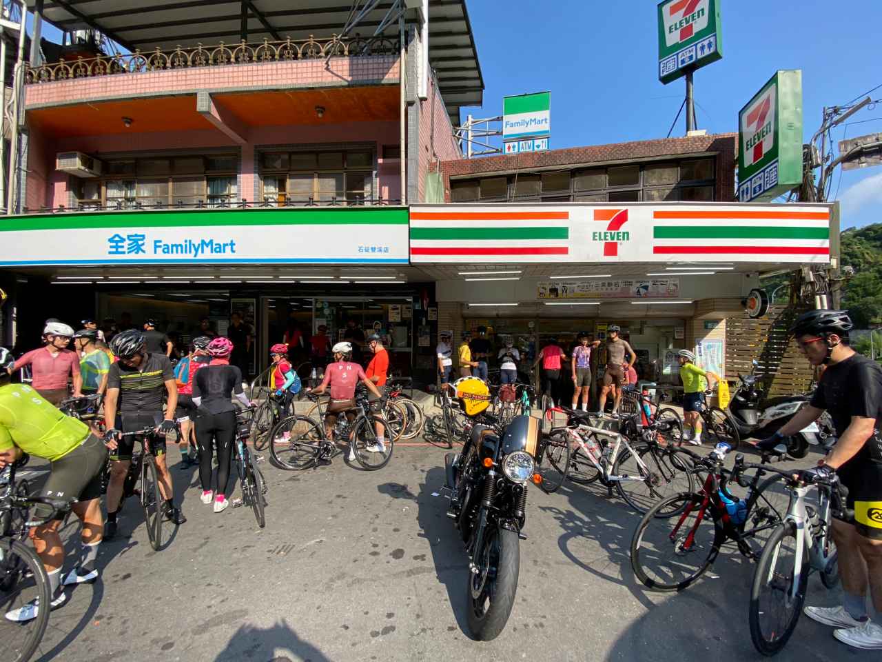
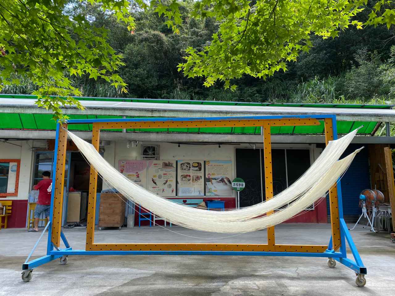
    I found a breakfast shop next to two convenience stores (7-Eleven and OK mart) outside Ruifang Station. It offers a wide range of traditional picks that turn plain flour into different kinds of products like deep fried bread sticks, clay oven rolls, and steamed buns of sweet or savory favors. The soybean milk had a slightly burnt taste, which I found really good to go with a clay oven roll. I usually prefer not to eat too much carbohydrate but I needed to load up some energy for the climbs that day. 

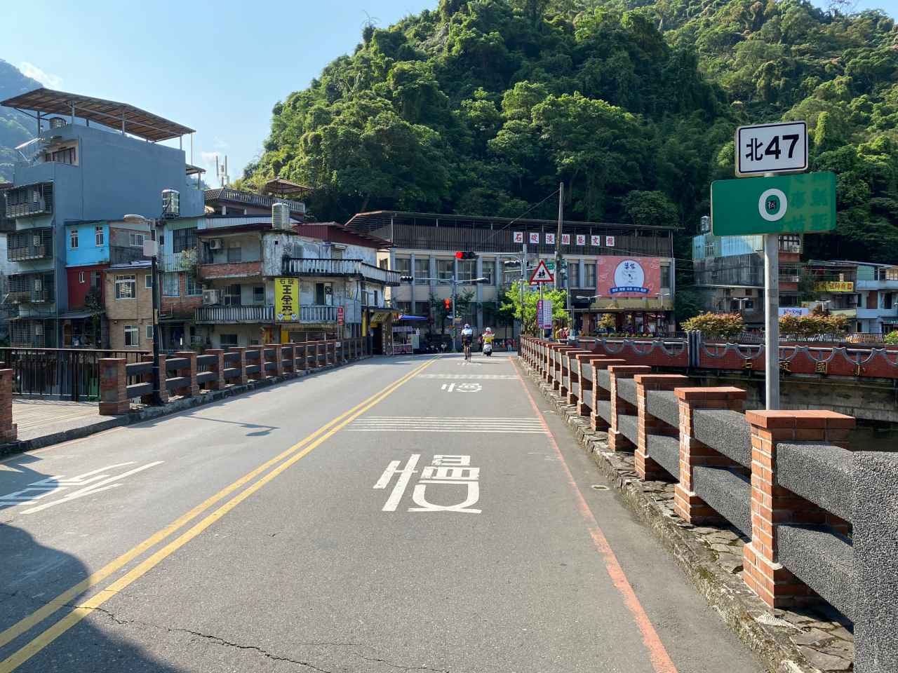
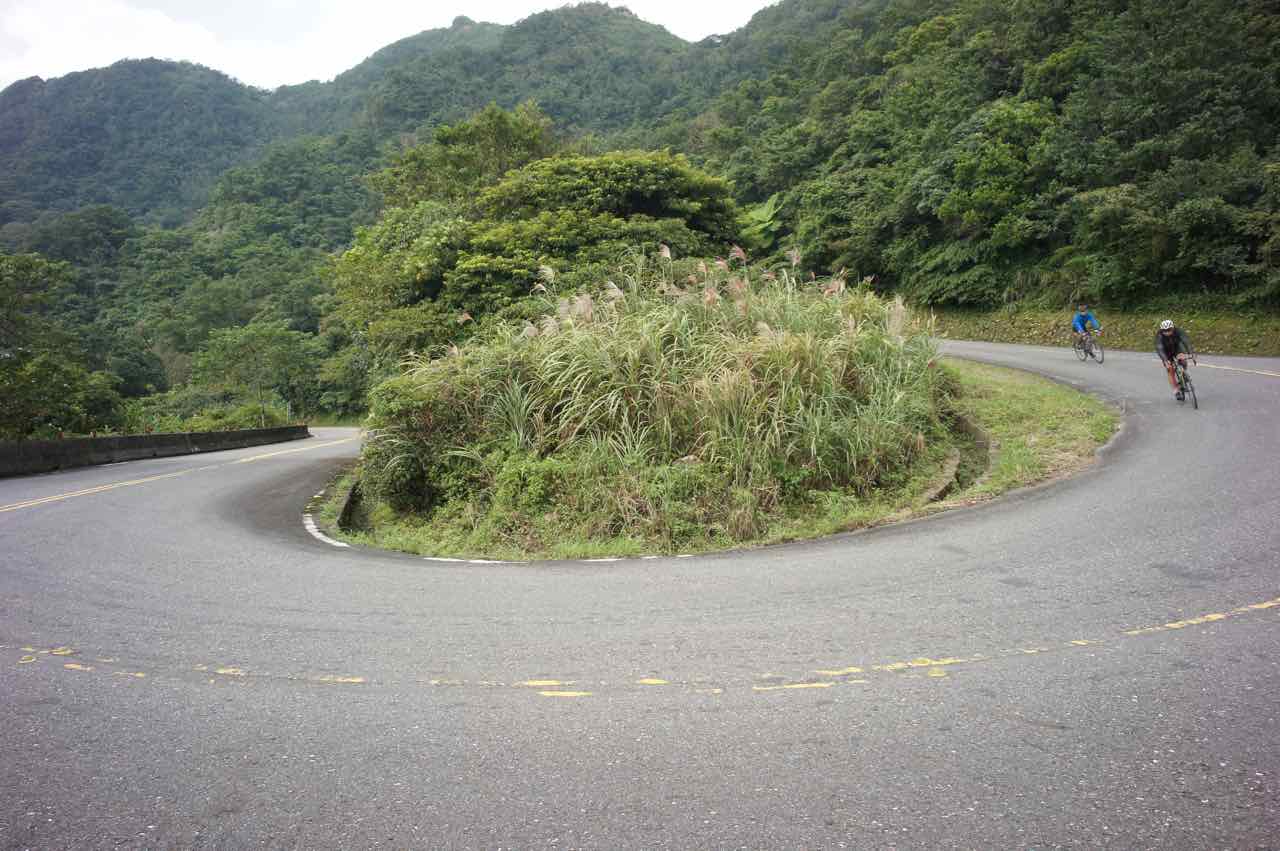
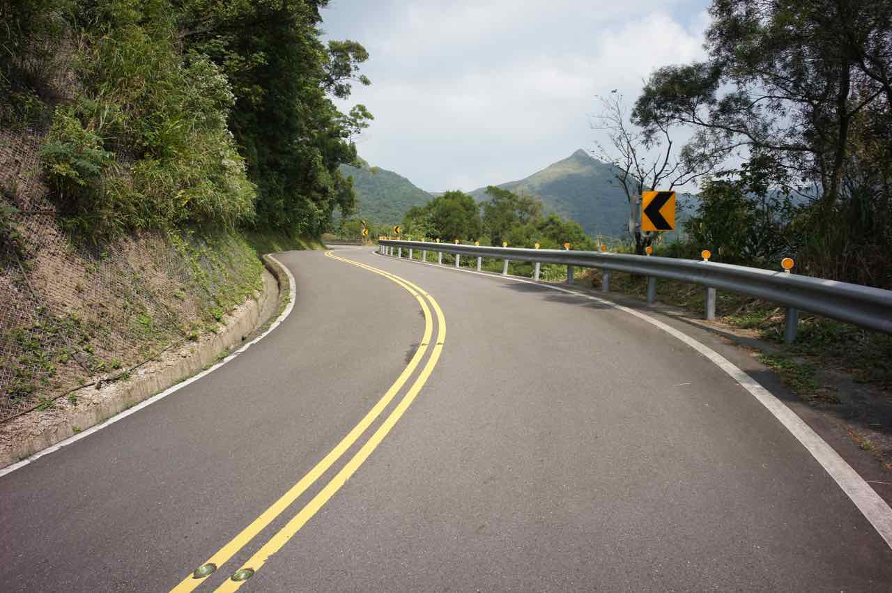
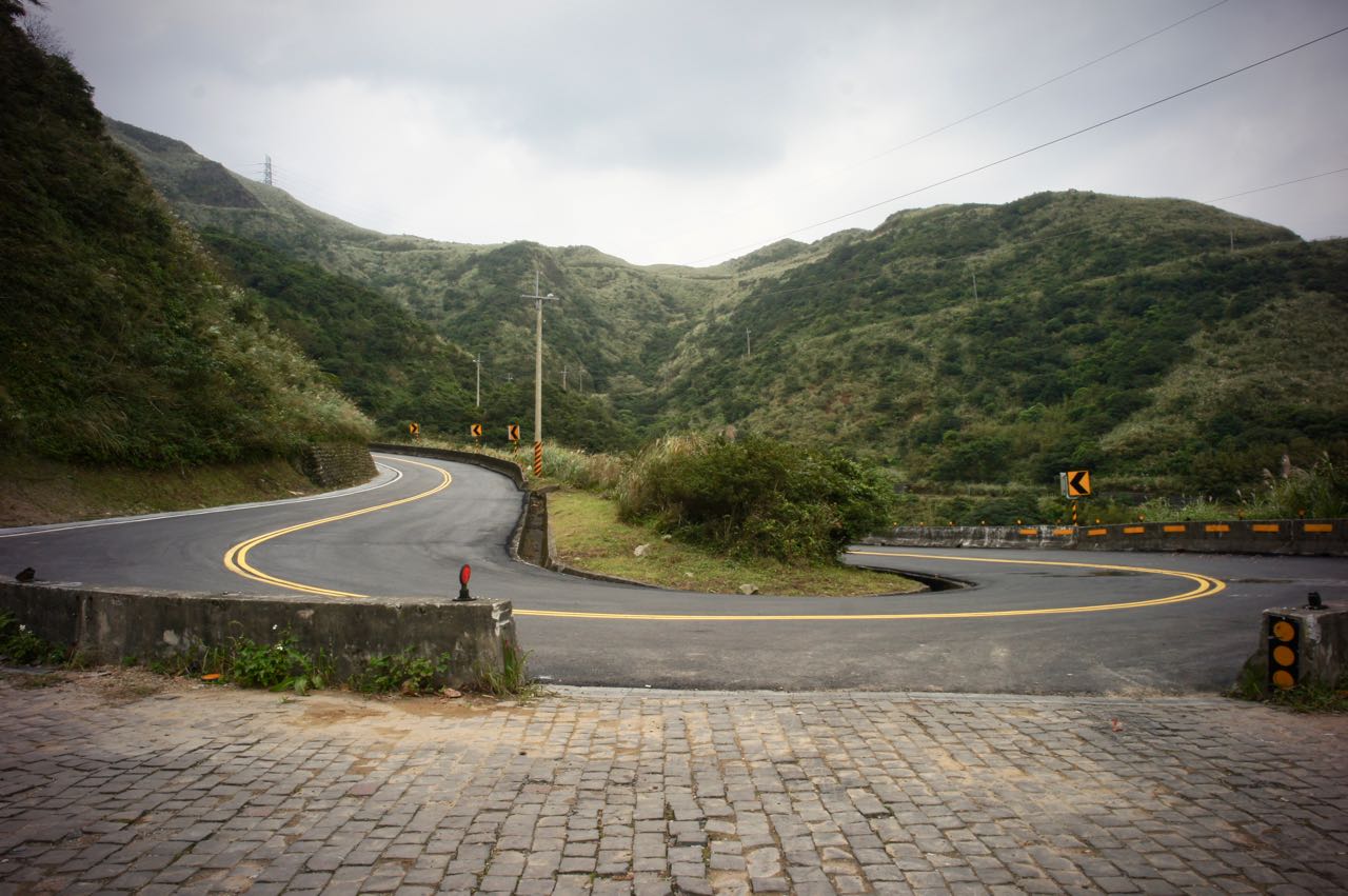
    After meeting up and exchanging some greetings, we headed off to County Highway 106 via Provincial Highway 2D (Shown on Google Maps as 2丁) for the first climb. I had cycled on County Highway 106 a couple times before, but all in the opposite direction, starting off from Nangang, and for a descent. I always found the road rather steep. However, when doing the climb, it wasn’t as bad as I had expected. The first part of the first climb, which is around 7.63km, with an elevation of 476m (average gradient around 6.2%) was completed in an hour. It was probably the 14 sharp turns on this route, rather than the gradient, that made me nervous when I was descending.

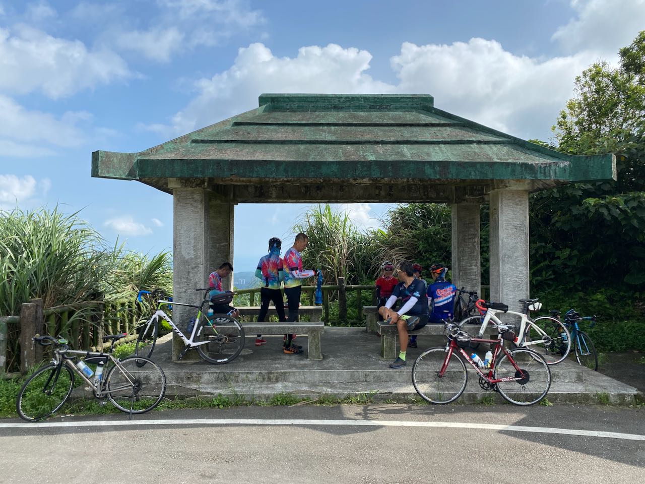
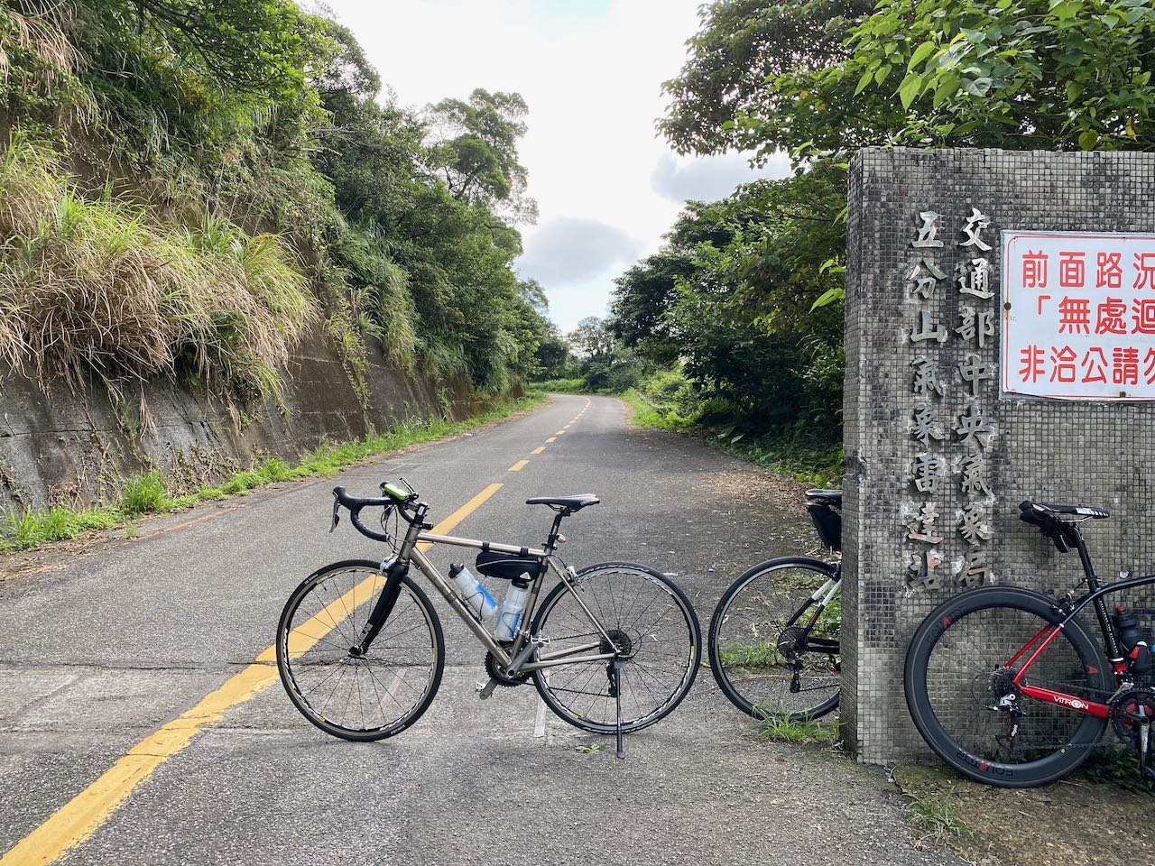
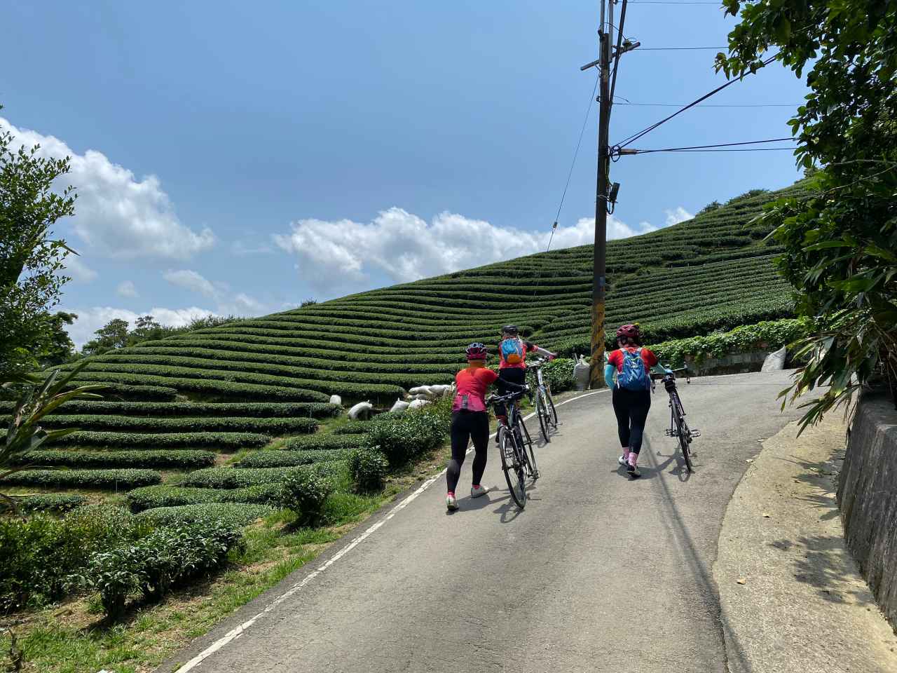
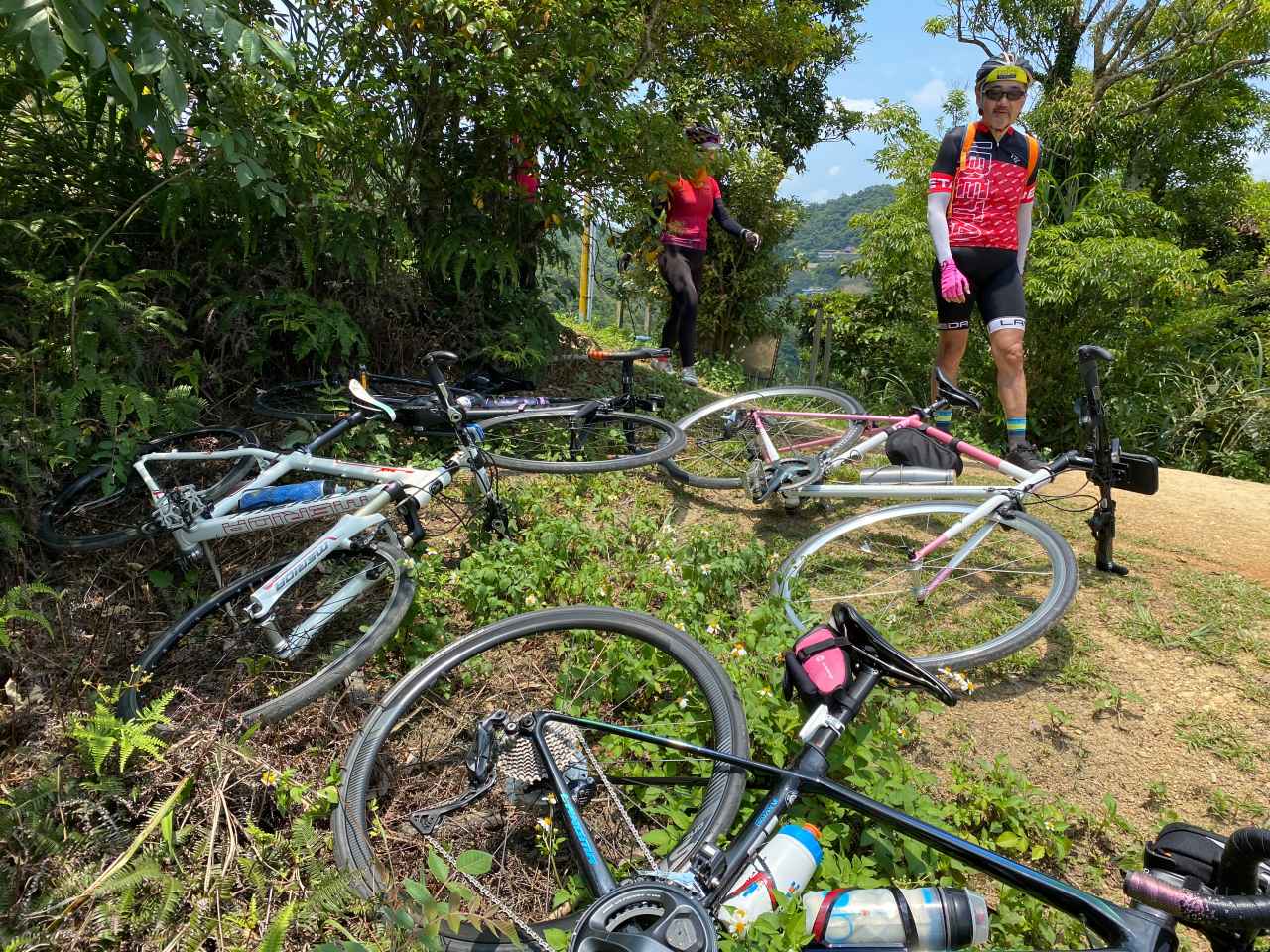
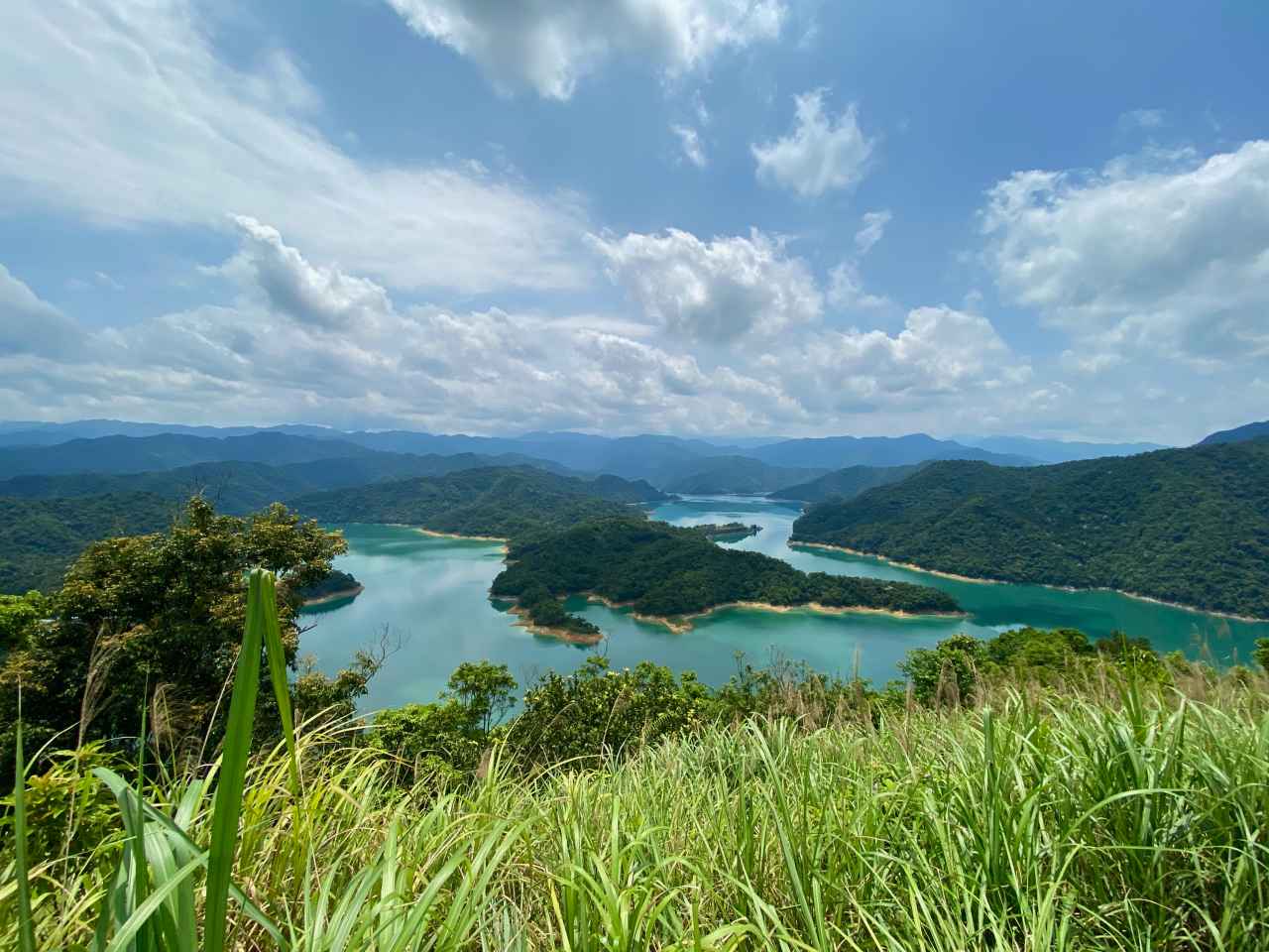
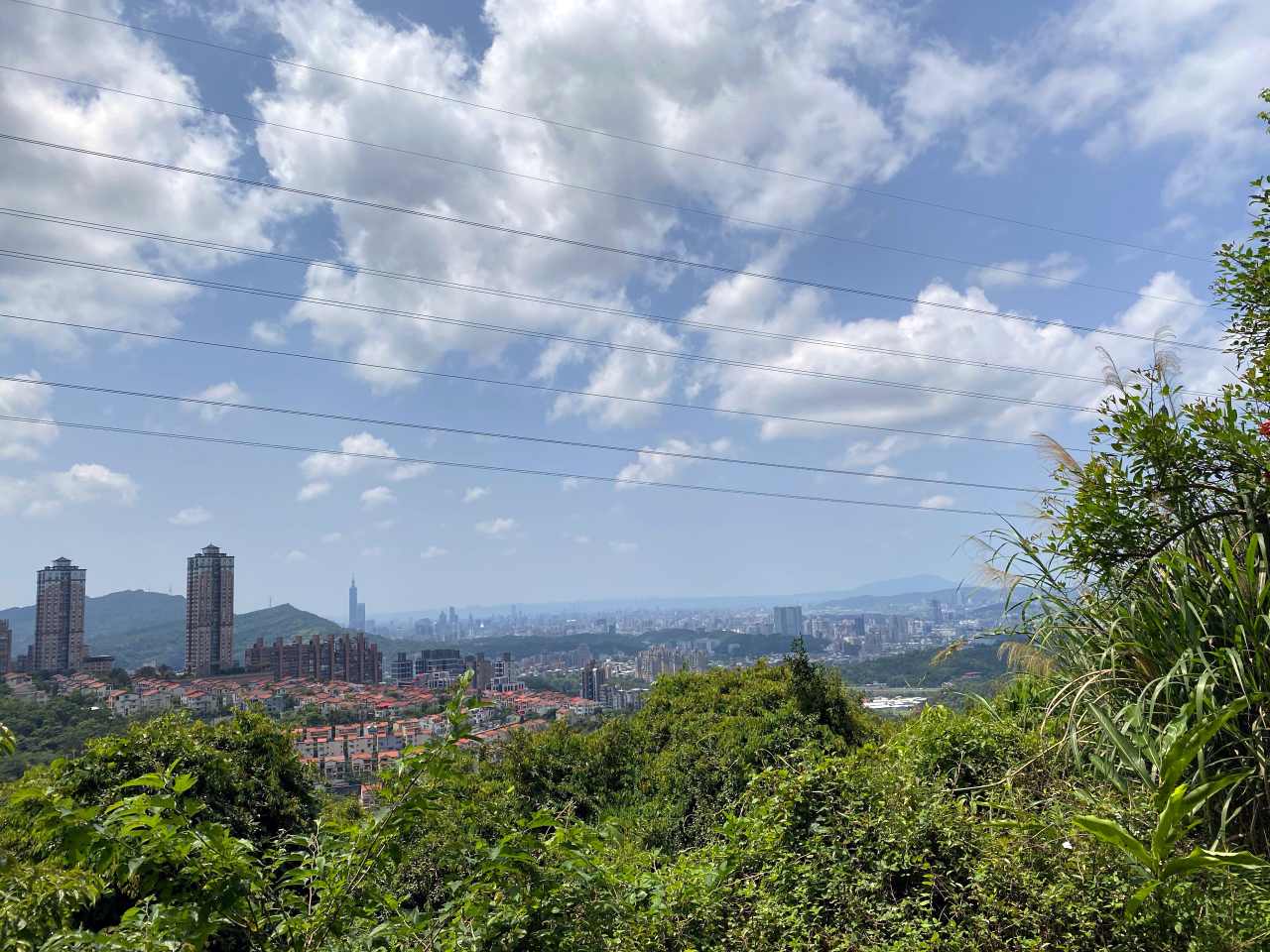
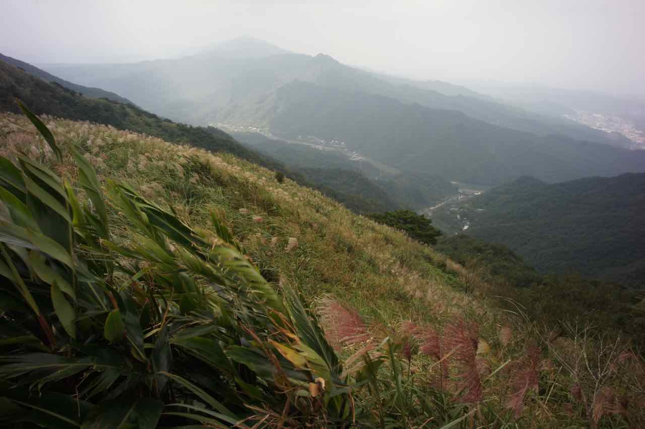
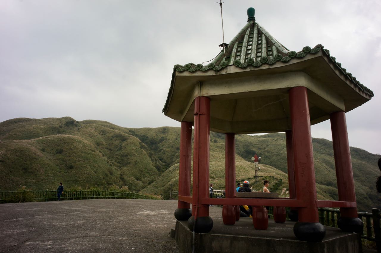
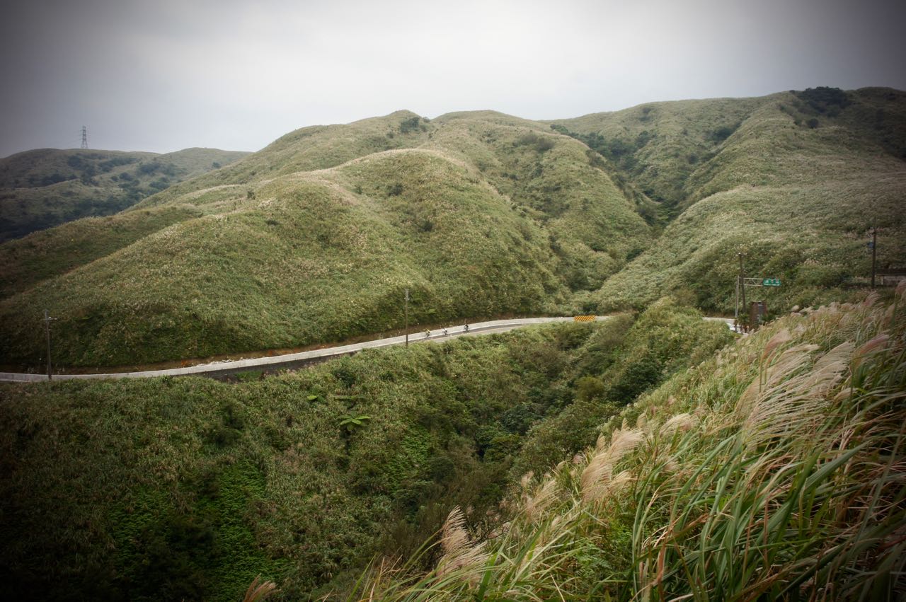
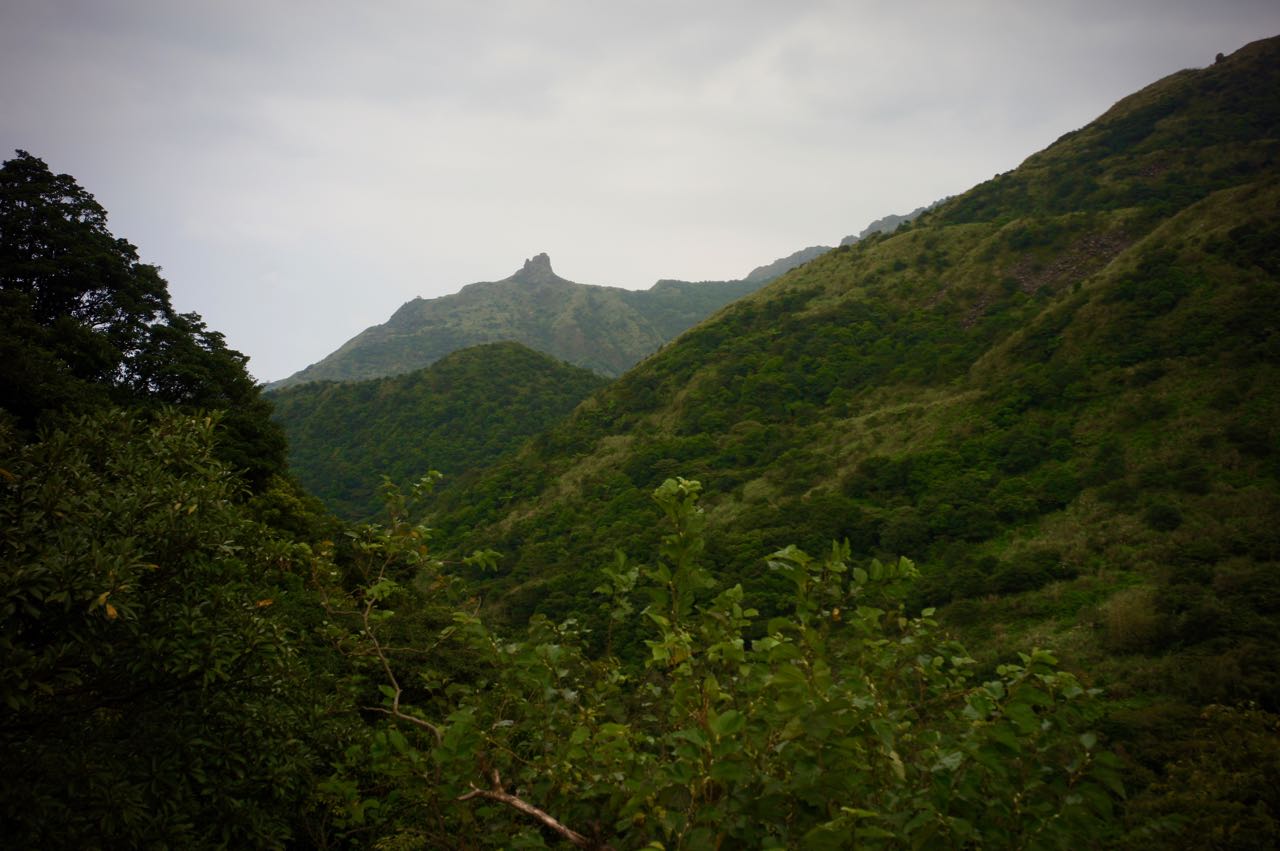
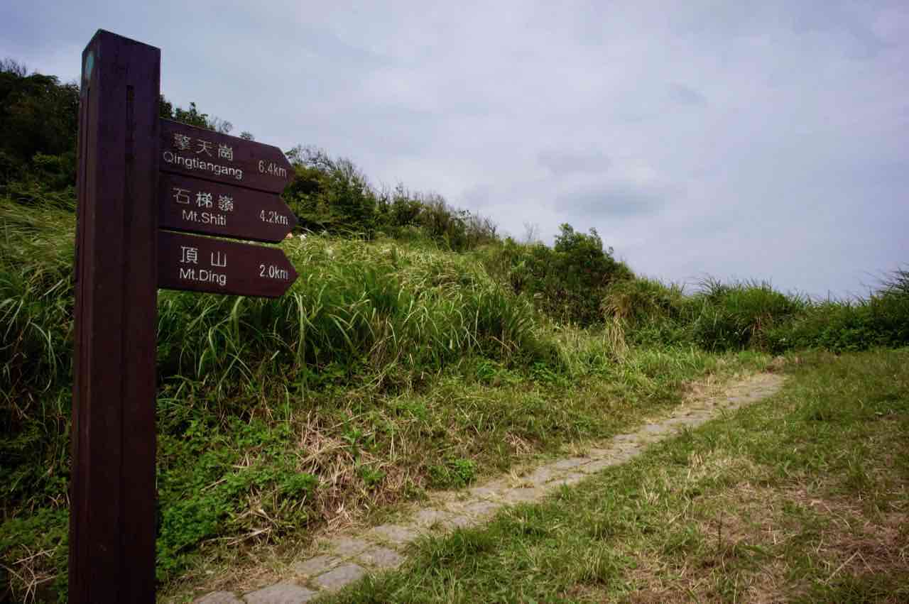
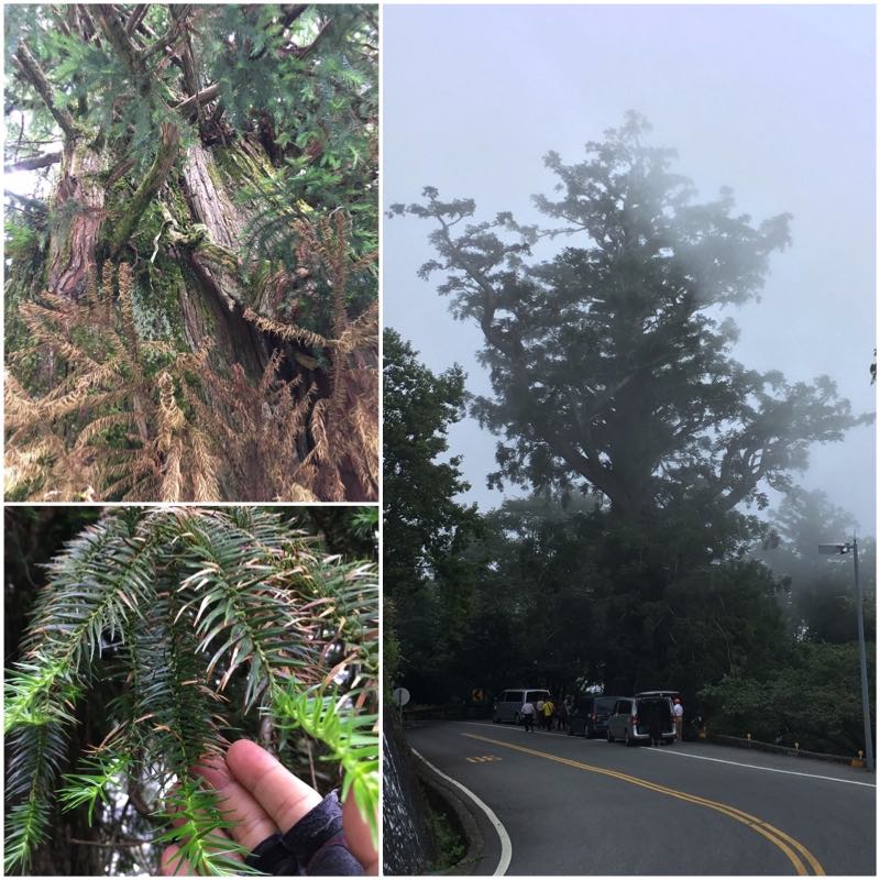
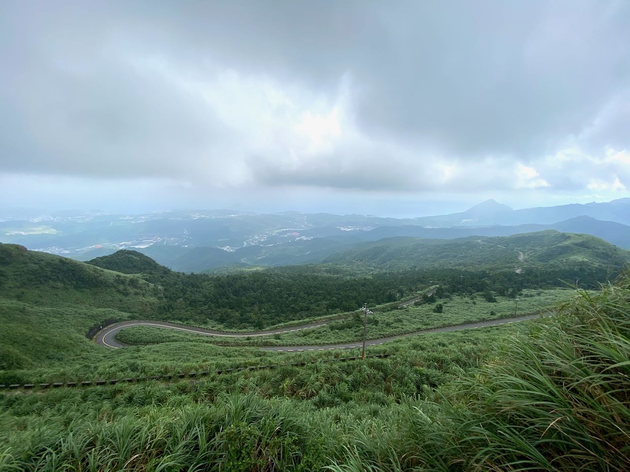
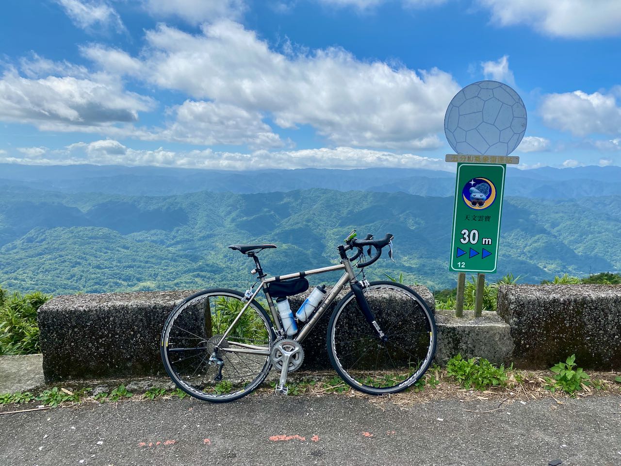
    After taking a short break chatting with the teammates underneath a small pavilion, where we enjoyed some breeze and the sea view, I reached a familiar junction with a U-turn that leads to a small path for more climbing. I had passed this junction in my previous rides and had always felt relieved for the fact that I didn’t have to take this route after cycling for around 40km from Nangang. But this time, we were going this way because it was the detour mapped out by Sandy that would bring us to the Wufenshan Meteorological Radar Observatory. It turned out to be one of the most enjoyable climbs I have ever done. I reached a state of euphoria in a split second as soon as I arrived at the first turn, which rewarded us with a panoramic view of the peaks sitting on multiple layers of ridges and the sea afar. It was another climb of 281m in 4.55km but I did not notice making any effort reaching the top. There were fellow cyclists doing climb sprinting along the route. If you stop to take pictures, please watch out for speedy bikes coming both ways. 

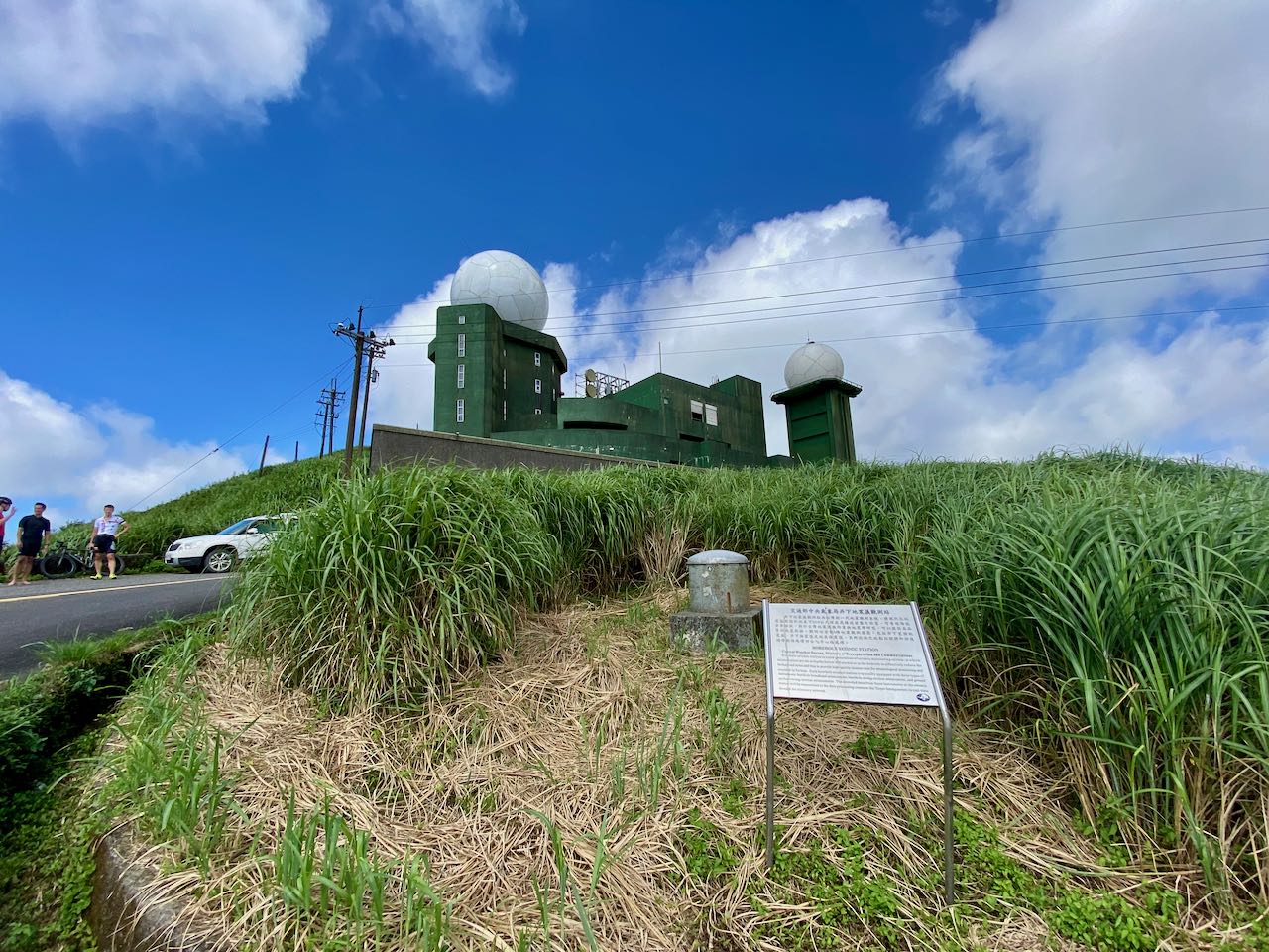
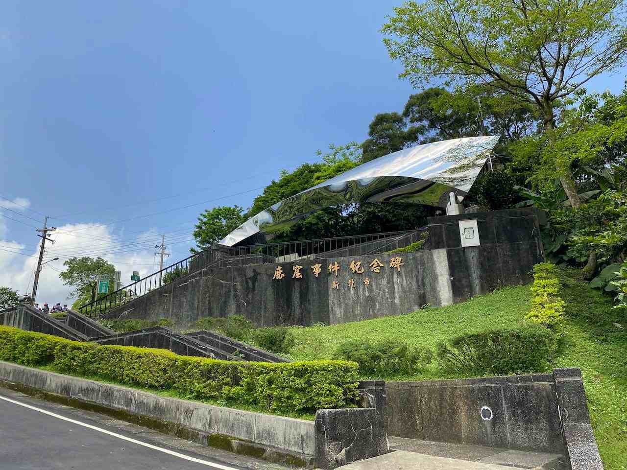
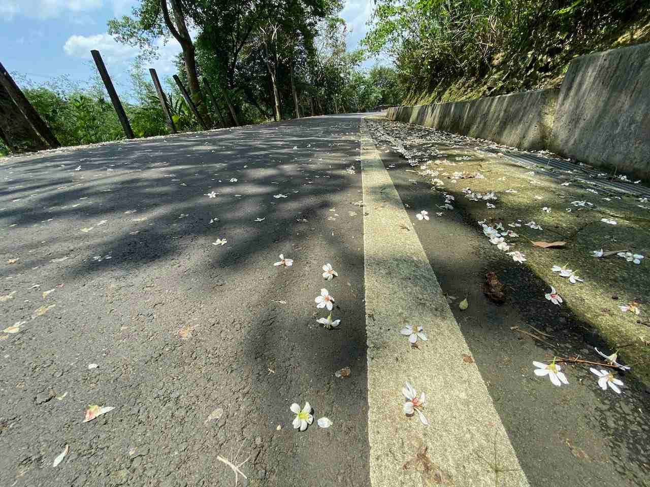
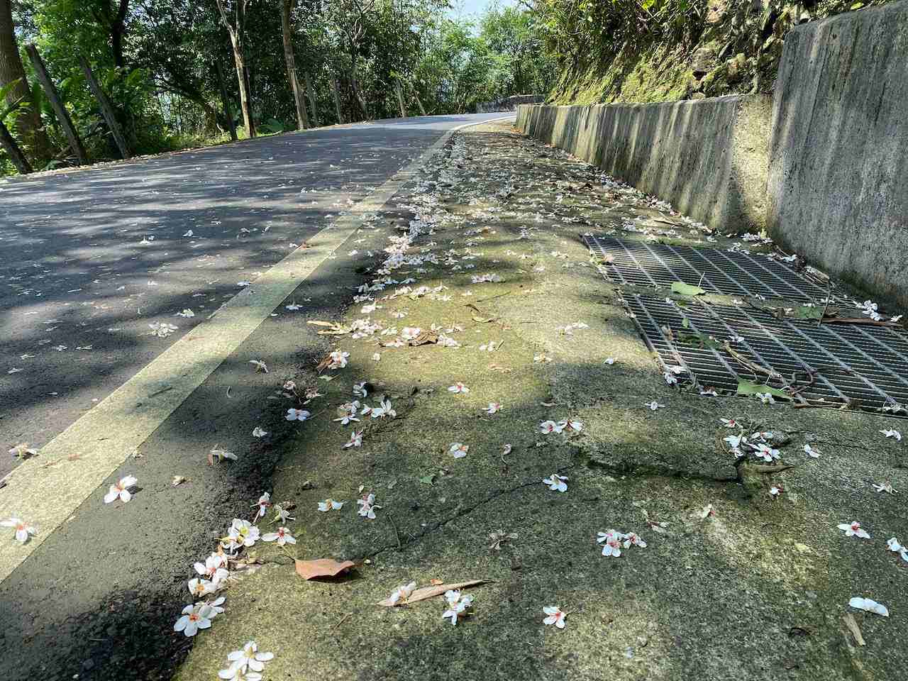
    We took a dive from the top (757m) all the way to Shifen 十分 (elevation 175m), a small town in a valley, for a short break and some supplies. Shifen had been attracting hordes of tourists for its signature activity of sky lantern launching. Before sending your sky lantern up into the air, you can make wishes by writing them down on the lantern. It must be fun to do that. However, the industry is under the accusation of causing environmental issues and wildfire risks. I surely don’t want the lantern with my wishes on it dangling on a tree and becoming an eyesore of an otherwise beautiful valley, nor do I want it setting fire to someone’s home. To address these issues, the industry and the Tourism Bureau have formulated some countermeasures, including restricting the launch to certain areas, limiting the amount of fuel in the lanterns so as to prevent them from traveling afar. There are also schemes implemented to retrieve and recycle the used lanterns. A local cultural preservation group even developed a new kind of lantern that will self-incinerate in the air after launching, which I find a very good idea. Now I’m more willing to have a try. 

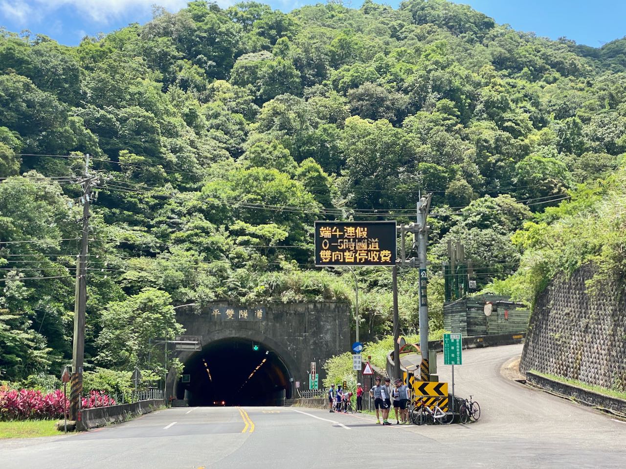
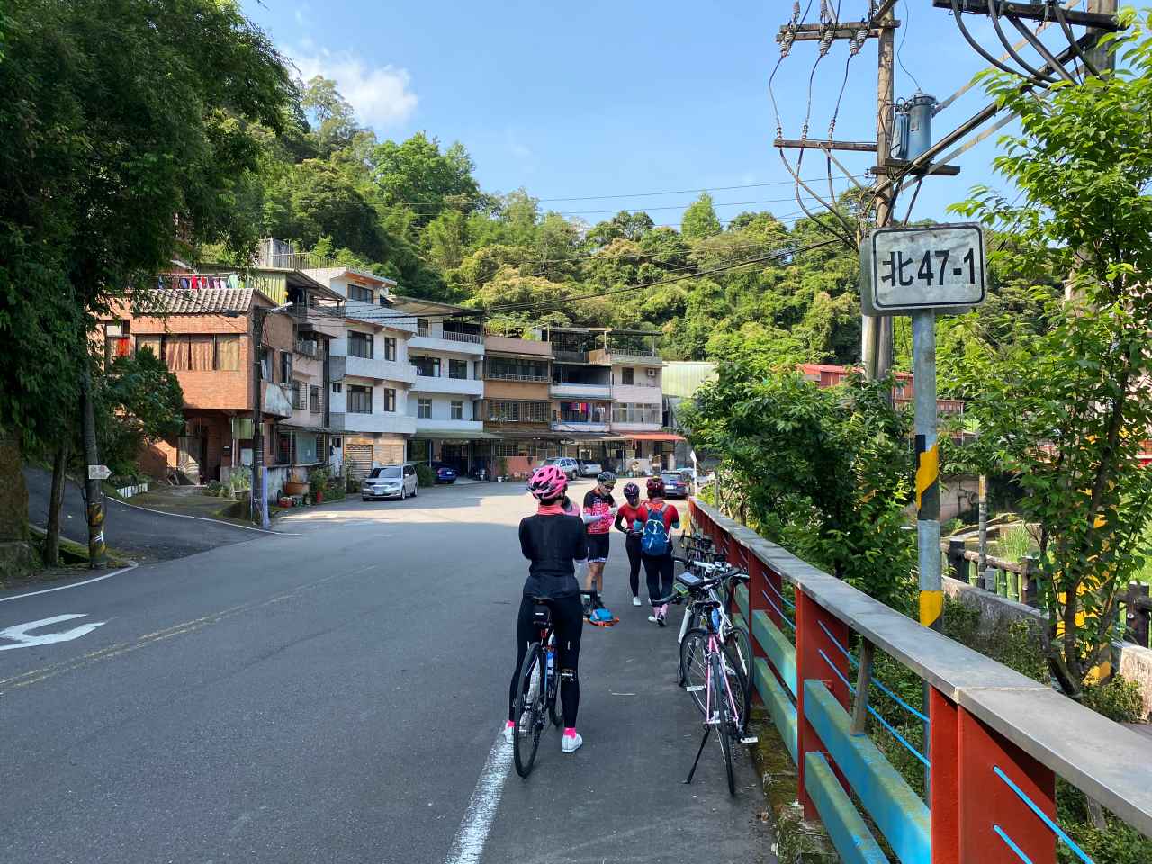
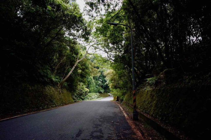
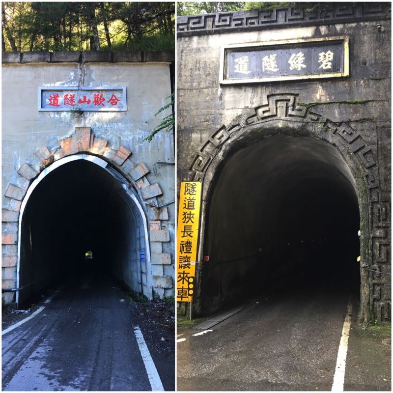
    We took the Provincial Highway 2C (shown on Google Maps as 2丙) to the next town, Shuangxi 雙溪, for lunch. It was another thrilling speedy glide on the wide and straight highway, after climbing a short slope to the tunnel. If you see a spike on the elevation profile on your GPS route, it’s probably because your GPS App fails to recognise the tunnel and tracks it as if you have climbed over the hill. Before we reached Shuangxi, we switched to a small road along a stream for less traffic and more shade. GPS route is available at the end of this post.

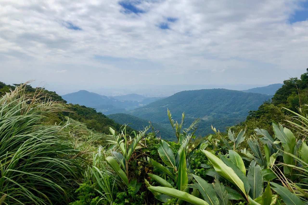
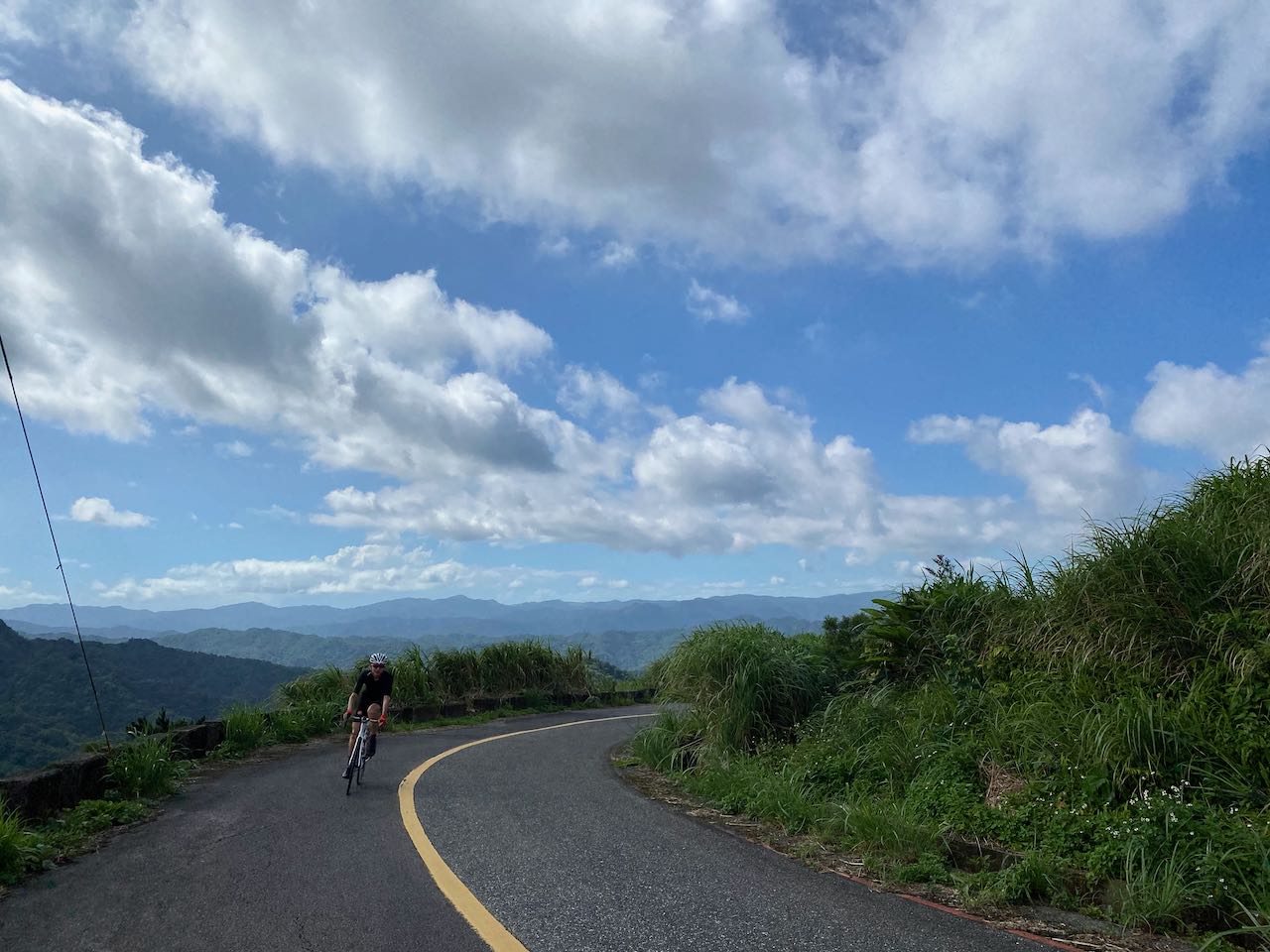
    We set off to Buyan Pavilion refreshed. It’s harder for this climb because of the heat in the afternoon. On the other side of the hill sits an interesting town, Jiufen 九份, where Sandy had plotted an eventful route full of interesting spots for the group to visit. But I realized mid-way through the climb that I probably shouldn’t stick with the plan. As I had another cycling trip with a new friend early next morning and I had no idea what his average speed would be, I did not want to exhaust all my strength, risking not being able to keep up with him. So, not without regret, I returned to Shuangxi, packed my bike and took the next train home. 

    That was a wonderful trip. I will surely do it more in the future. As shown on the GPX route at the end of this post, after descending from Buyan Pavilion, there are two branches before reaching the coastal line. The first one to Jioufen Elementary School is for a dessert shop that serves shredded ice topped with taro balls. Located on the edge of the hillside, the shop offers a nice sea view to customers along with delicious desserts. It’s very popular amonglocal cyclists. The other branch leads to an old small canal bridge, which is very photogenic. And there are yet more to be visited. 

    Thank you Sandy for designing such a wonderful route. 

    For more information about Buyan Pavilion, here is another post. https://www.bikeexpress.com.tw/2019/cycling-route-buyan-pavilion-climb-training/

    Routes:

    NOTE: To use the routes, please install the App on your smartphone. The App will launch and load the route automatically after you tap the above links on your smartphone’s browser. For Garmin Connect, you can then use the APP to send the route to your garmin device. If your Garmin device is not purchased in Taiwan, you will also need make sure you have the Taiwan map on your device. Here is our blog post on this topic.

  • Cycling Route: Crocodile Island – Climb Training

    Cycling Route: Crocodile Island – Climb Training

    I went for a cycling trip with a small group of local cyclists on a Saturday in May, to get a good look at the Crocodile Island 鱷魚島, which can be found in the Fei-ts’ui Reservoir 翡翠水庫 in Shiding District 石碇區 of New Taipei City. It is a 41km route with a maximum altitude of 583m and an elevation gain 1871m. The cycling route is designed by the group leader Sean Fang. The GPX file is downloadable at the end of this post. 

    We met at 7:30 am outside Taipei Zoo, and then took County Highway 106B (shown on Google Maps as 106乙) to a junction where 106B meets 106. With two big convenience stores (7-Eleven and Family Mart) and some parking space available, this junction has become a popular stop among cyclists and motorcyclists for toilet breaks and supply. It’s particularly crowded during weekends, so you better park your bike securely before getting into the stores, lest some careless souls may hurt your beloved one by accident.

    After getting what I needed in one of the convenience stores, I was called by my friends to help a young lady cyclist who can’t speak mandarin. Turned out she was looking for the toilet, which was apparently in short supply in this area. The shopkeeper was so kind that he let her use the one reserved for staff. 

    Let me sidetrack a bit to talk about toilets in Taiwan. Only a special kind of toilet paper, which is specifically designed to be dissolvable in water, can be flushed down the toilets in Taiwan. But in old buildings or many rural areas where the draining pipes are old and narrow, toilets get clogged very easily, especially when they are in heavy use. That’s why you can always find a garbage bin inside the compartment of those toilets, which is where the used toilet paper is meant to go. Please do not hesitate to use it. Otherwise you may be left in a very embarrassing situation. And when enough toilets are clogged, shopkeepers may stop letting us use their toilets. 

    So, we continued on the County Highway 106B and then made a right turn onto the Township Road TP47 (Shown on Google Maps as 北47) after passing the small town called Shiding.

    TP47 splitted into TP47 and TP47-1. We were supposed to take TP47-1 and start the climbing. But this turn is a bit tricky – Sean had led us to a wrong path even though he was the one who plotted the route and it was not his first time here. Anyway, we realized our mistake soon enough as the road became impossible for cycling.

    TP47-1 is good for cycling in late spring and summer as the trees along the route will protect us from the sun. That day there were practically zero motor vehicles but we had several cycling groups doing the climb with us. Around midway of the route, there was a handmade noodle workshop, HSU’s Noodle, where visitors could try making their own. For us, it was a nice location for taking a break and getting some supplies. It’s also interesting to see how noodles are made in the traditional way. 

    We reached the top and met Beiyi Road (Provincial Highway No. 9). It was a good climb, but I don’t think it’s a good idea to descend on this route because the shade beneath the trees keeps the surface wet and thus makes it a hotbed for slippery mosses. We actually saw an ambulance rushing past us that day, possible for a bike accident. A member of our group told me that they would have cancelled this trip if it had rained heavily the previous day because the road surface might not have enough time to dry. And if it’s summer, you’d better end the trip around noon because there usually are thunderstorms in the afternoon. 

    So, we were on one of the twin peaks on Beiyi Road, which connects Taipei and Yilan County. Some cyclists who do the around-the-island anti-clockwisely would take this route to get back to Taipei. It is the final leg and the end of the final climb. After that, all they need to do is a long descent all the way to Taipei to complete the loop. A coffee shop and some traditional food stalls are here to help make an early celebration. 

    We were also heading to Taipei from here but would make a detour first to take a look at the Crocodile Island. We needed to switch to a small road right next to a small police station after a short descend. So, take it easy and don’t go too fast or you will miss the turn. 

    The detour was around 2.5 km on a small road with an elevation profile shaped like a “V”. It was so steep that, when descending, some in our group found themselves not able to keep their grips firm on the brakes. And when ascending, we all gave up riding and pushed our bikes to the first viewing platform after passing by a beautiful tea farm. Those on motor vehicles were so impressed that we could make it there on bikes. 

    In order to get to a better viewing spot, we left our bikes and hiked a short trial. It may be a good idea to bring a bike lock if you want to have greater peace of mind. 

    The return leg was simple. We headed back to Beiyi Road and took a long thrilling descent to Xindian MRT station. 

    That was a wonderful route. Thank you, Sean.

    Routes

    NOTE: To use the routes, please install the App on your smartphone. The App will launch and load the route automatically after you tap the above links on your smartphone’s browser. For Garmin Connect, you can then use the APP to send the route to your garmin device. If your Garmin device is not purchased in Taiwan, you will also need make sure you have the Taiwan map on your device. Here is our blog post on this topic.

  • Cycling Route: Xiong Kong Tea Plantation – Climb Training

    Cycling Route: Xiong Kong Tea Plantation – Climb Training

    I went for a cycling trip from Xindian 新店 to Xiong Kong Tea Plantation 熊空茶園 with a group of local cyclists on a weekend in May. It was a 60km route with two climbs (338m, 728m), planned by one of our fellow cyclists Martin. The tea plantation is operated by Taiwan Tea Corporation 台灣農林 (TPE: 2913), formerly known as Mitsui & Co., Ltd., which was founded in 1899 during the Japanese rule. The downloadable GPX file of this cycling route is at the end of this post. 

    We met at 7:20 am in the convenience store near Xindian MRT station. It had been transformed, by different cycling groups meeting up there, into an outdoor showroom of advanced bikes, cycling outfits, and various cycling accessories. With two convenience stores located conveniently near the MRT station, and a well-maintained toilet inside the MRT station, this spot serves as the default starting point for a number of popular cycling routes, including the section of Provincial Highway No. 9 connecting Taipei and Yilan (Beiyi Road 北宜公路), and the No. 9A (9甲) which brings you to the Wulai District 烏來區 (Xinwu Road 新屋路). 

    After socialising with others and filling up my bottles, I set off with the group to cycle along County Highway No. 110. The first climb soon appeared on our left-hand side on Chezi Road 車子路, leading to Daguan Road 達觀路. Motor traffic was practically zero as it is a cul-de-sac at the top with only a handful of residential buildings sitting along the road. We took a long break at a small pavilion just before we reached the top of the climb. It was a good warm-up to climb 305m.

    Then, Martin showed us a shortcut right next to the pavilion, which leads to the Erbazi Botanical Garden (二叭子植物園) via a series of short stairways. You will have to carry your bikes if you want to take this shortcut, but we all found it worth the effort as it was a beautiful garden. Also, by taking this shortcut, you can avoid descending on the same route.

    Where the botanical garden is located is a humid valley. Plants love humidity. Mosses are growing on the cement surface of the paths in this area, which make them slippery all the time except for a bright sunny day. It’s especially dangerous on the steeper parts, so walking with your bike is mandatory in this case. Go with your walkable pedal shoes if you plan to take this route. We were lucky to have the sun high up and dry the mosses, so that we could ride on our bikes slowly back to the main road.

    When we were back on County Highway No. 110, we started heading to the Sanxia District 三峽. Traffic was not busy and we could set our own pace without pressure. We reached a small town called Jiou Jiou 九鬮 with several stalls selling very juicy roasted pork sausages. Make sure you have more of those before the real climb to Xiong Kong because, at the top, there is only one small restaurant with very limited capacity. On that day it took them 45 minutes to prepare some very standard meal sets for us. 

    After the feast of pork sausages, we went to the 7-Eleven (address: No. 241, Chengfu Road, Sanxia District, New Taipei City, 237) around 300m ahead along County Highway No. 110 for water supply. It’s also good for some more snacks. I would have done that if I had known I would need to wait that long for my meal. The 7-Eleven also comes with a toilet. If you miss this chance, there is another toilet stop 2.3km away at the Daliao Tea House. The tea house is an old Japanese building built in 1944 as the residence of the chairman of the Taiwan Tea Plantation Corporation. We visited it only on the return leg because we did not want to start our climbing late. It’s better time management, I think.

    The climbing starts on the quiet Zhulun Road 竹崙路 (Township Road 北109). Road signs for the tea plantation were clearly displayed along the road. First half of the path was wide. Road surface was well maintained and smooth. The slope was moderate. There were cars and motorbikes passing by sporadically. We all shared the same destination as this road is also a dead end. After the first half, cracked surfaces and small pieces of broken concrete appeared. Roads got narrower, cracks deeper, slopes steeper, and turns sharper as we were approaching the top. I was told that a cyclist friend once had a minor accident on the descending leg when a trailing car imposed pressure on her. Her wheels slipped sideways on the edge of the cracks. She lost balance and fell. Fortunately, her bike was fine and she had minor injuries only. Anyway, this must be an enjoyable route for her, or she wouldn’t have joined us this time. 

    I made it to the top sooner than I had expected. A short, mild downward slope brought me to the entrance of the tea plantation. A wide planform with tables for people to enjoy the vast view of the hills caught my eyes. On my right-hand side, there was a trail leading into a small forest of tall straight pine trees (Japanese Cedar). A billboard showing the elevation of 700 metre was set up right next to the gate of the tea plantation on the other side. They charge NTD100 per head for each visit, which will be rebated when you shop in the souvenir shop. Fair deal. But for us, it’s enough just to stay outside for the views and some food. 

    The descent from the top was tricky because of the condition of the road. When my bike rolled over the cracked surface, my hands were almost shaked off the handlebar. I was lucky to do the ride with a Rikulau Audax Hercules, a flat-bar road bike. I could hold the grip and the brakes securely without making my hands numb. If I had been on a drop-bar, I might have had to stop and let my hands take a break. 

    The return trip to Xindian was very straight forward. That was enough for the day. It was a weekend and I took MRT home with my bike.

    For those who want more, the New Taipei City Yingge Ceramics Museum is 10km away from Jiou Jiou 九鬮. The building itself is nice and worth a visit even if you are not interested in ceramics. There is an outdoor water plaza for some water fun in the summer. Kids love it. Then you may either take a train back to Taipei or cycling back along the Dahan River Bikeway. 

    Routes

    NOTE: To use the routes, please install the App on your smartphone. The App will launch and load the route automatically after you tap the above links on your smartphone’s browser. For Garmin Connect, you can then use the APP to send the route to your garmin device. If your Garmin device is not purchased in Taiwan, you will also need make sure you have the Taiwan map on your device. Here is our blog post on this topic.

  • Cycling Route: Maokong Loop – Climb Training

    Cycling Route: Maokong Loop – Climb Training

    Maokong Loop is a 13km long, single-peak (326m) cycling route in Wenshan District, South East of Taipei City. We went there on a public holiday in May, me on a Rikulau Audax Hercules and Lois on a Klever Q Comfort. The downloadable GPX file of this cycling route is at the end of this post. 

    Maokong is a popular tourist area where people can take the Maokong Gondola at the Taipei Zoo Station (next to the Taipei Zoo MRT Station of the Brown Line) to the top of the hill, take a leisure walk along the route on the peak, and enjoy the panoramic view of Taipei City with a cup of tea grown locally in one of the many tea cafes scattered around. This area used to be the biggest tea plantation in Taipei. As for kids, there is of course the amazing Taipei Zoo at the foot of the hill that never fails to offer joy and wonder. 

    To get to the starting point of this route, simply set your GPS navigation to this address: “No. 12, Section 1, Xinguang Road, Wenshan District”. It’s a 7-Eleven with a spacious area outside where you can park your bikes. If you start your ride early enough in the morning, say around 6:00, road traffic should be quite sparse and you will take less than an hour to get there from the centre of Taipei. 

    Strava (anti-clockwise): https://www.strava.com/routes/26747667

    If you start late and want to avoid the traffic, you may take the MRT Green Line to Jingmei Station, as the Brown Line does not take bicycles, and then use the following route to get to the starting point:

    Strava: https://www.strava.com/routes/26748715

    Taipei MRT takes bikes during weekends and between 10:00-16:00 on weekdays, except the Brown Line and a few busy stations. 

    If you are in the west side of the city like Datong District, Zhongzheng District, or Wanhua District, you may take a pleasant detour along the Riverside Bikeways to get to Maokong. We have compiled a list of the access points to the Riverside Bikeways in this post.

    As to us, we live on the east end of Taipei. There is a popular and well shaded cycling route linking up that part of the city and the area around Taipei Zoo, by going along Section 1, 2, 3, and 4 of the Academia Road (also known as Yanjiuyuan Road), followed by Lane 43, Section 5 of Muzha Road. It’s a 15.5km ride with 177m of elevation gain and very sparse motorized traffic:

    Strava: https://www.strava.com/routes/26403740

    We took a brief break and fueled up at the 7-Eleven before heading for the real climb. Traffic was busier than usual because it’s a holiday but still not too bad for cycling. I had done the loop anti-clockwise before, so this time we opted for a clockwise ride by taking the left branch at the Y junction on Section 3 of Zhinan Road.

    It was a straight, continuous climb all the way up to the top without much shade at noon time. The climbing ended shortly after we took a right turn and cross a short bridge called Caonan Bridge 草湳橋. There was then a mild downward road winding around the peak, lined with tea houses and cafes. Once you reach the busy Gondola Terminal, the descent back to the ground level starts. It may be a good idea to bring along a book if you have the whole day. It is said that the sunset and night views there are really great, so night rides along this route are popular among local cyclists. If you googled 夜騎貓空, which means night rides in Maokong, you will find lots of blog posts in Chinese. But for first-timers, it may be better to do it during daytime for safety consideration.

    Now I have done it both clockwise and anti-clockwise. Which way is better? My vote goes to the anti-clockwise one. It’s because the climbing is less steep and there seems to be more shading. The Gondola Terminal will again greet you at the end of the climb. 

    Strava (clockwise): https://www.strava.com/routes/21611174

    We had a late lunch after the ride, which wasn’t worth mentioning, and then headed back home following the same route.

    There is another route to climb Maokong, via the Hengguang Bridge. It is said that the traffic is sparser. I will have a try later.

    Routes

    NOTE: To use the routes, please install the App on your smartphone. The App will launch and load the route automatically after you tap the above links on your smartphone’s browser. For Garmin Connect, you can then use the APP to send the route to your garmin device. If your Garmin device is not purchased in Taiwan, you will also need make sure you have the Taiwan map on your device. Here is our blog post on this topic.

  • Cycling Route: Xizhi Pigeon – Climb Training

    Cycling Route: Xizhi Pigeon – Climb Training

    I had been seeing fellow local cyclists posting accounts and photos of their rides along the route named Xizhi Pigeon 汐鴿展翅, which seems to be lots of fun. I wanted to do it, too. I found the route’s gpx on xplova and invited Lois to join me. The downloadable GPX file of this cycling route is at the end of this post. 

    Xizhi Pigeon 汐鴿展翅 is a 28km cycling route with its starting point at the Nangang Exhibition Center 南港展覽中心 on the east fringe of Taipei City. The maximum elevation of 394.29m at the top makes it a good route for climb training. The route mainly consists of Section 1 and Section 2 of Jiuzhuang Street 舊莊街, Xiding Road 汐碇路 and Xizhi Keelung Riverside Bikeway 汐止基隆自行車道. Upon completion of the route, you will draw a pigeon with spreading wings on the map of your GPS tracking app. 

    To get to the starting point with your bike, you can either take MRT to the Nangang Exhibition Center Station on the blue line (ref: Taking Bicycles on the Metro) or simply cycle there via the Riverside Bikeways along the Keelung river, setting your destination as the Nanhu bridge. It is along the route, so you may as well just start there. If you live outside Taipei, you can also get there by taking a train / HSR to the Nangang Station, followed by a short ride.

    I took the trip on a Friday morning in April, with me on a Rikulau Audax Hercules and Lois on a Klever Q-Comfort. The traffic soon got much quieter after about 5 minutes’ ride from the busy MRT station (Nangang Exhibition Center Station). We could enjoy our ride at our own pace with almost no cars and scooters on Jiuzhuang Street. Some of the slopes were rather steep for me that my heart rate raced up to over 170 bpm. There were tea shops and a tea workshop along the way but I had no mood to stop to explore. It took me about 1.5 hour to reach the top, where a shiny silver sculpture sits. This is the Luku Incident Memorial park and you can find out more about the incident in this blog post.

    With Velodash turned on to share our locations real time, I left Lois behind briefly to enjoy my speedy descent on Xiding Road. It was less steep and I could enjoy it without having to hit the brake much. I saw carpets of little white flowers spreading along the way. It was so beautiful that I had to stop to take a good look and take some pictures. It occurred to me later that those are the flowers of Tung Trees, which were introduced to the island during the Japanese rule (1895 -1945) for their economical values. The oil from their seeds makes good waterproofing material and paints. The trunks were used for furniture, clogs, toothpicks and matches. They were popular and planted extensively by poor families to supplement their income. Nowadays, local people love the trees for their dense blossoms during April and May. It’s dubbed as the May Snow. As beautiful as they are, you’d better not touch them as the whole plant is poisonous.

    At the bottom end of Xiding Road, we passed a busy juncture and entered the quiet Riverside Bikeways of Xizhi. It’s easy to miss the entrance, which is shown on the picture below. Then you will complete the route after riding for around 15 more minutes.

    I love this route because its elevation gives me enough training and it offers the reward of a mild downward slope which is perfect for speedy yet unthreatening descent. Traffic on the route is really low and therefore makes it very bike friendly. No wonder we ran into several groups of cyclists even on a weekday. 

    If you want more climbing after doing Xizhi Pigeon, Fengguizui lookout is just about 13km away via Dahu Street, which offers a 636m climb. GPS route available at the end of this post.

    If you want a low-carb meal, an authentic American smokehouse serving juicy brisket, Bogart’s Smokehouse, is about 1km away. 

    For me and Lois, our pick is this local hotpot restaurant that offers all-you-can-eat duck-blood curds 鴨血,  braised pork rice 魯肉飯, and free drinks and ice cream along with a very generous portion of meat and veggies in a standard lunch set. That’s a very satisfying conclusion for a great ride.

    Routes

    Xizhi Pigeon

    Fengguizui Lookout from Nanhu Bridge

    NOTE: To use the routes, please install the App on your smartphone. The App will launch and load the route automatically after you tap the above links on your smartphone’s browser. For Garmin Connect, you can then use the APP to send the route to your garmin device. If your Garmin device is not purchased in Taiwan, you will also need make sure you have the Taiwan map on your device. Here is our blog post on this topic.

  • Cycling Route: Buyan Pavilion – Climb Training

    Cycling Route: Buyan Pavilion – Climb Training

    Buyan Pavilion (不厭亭), apart from Fengguizui (風櫃嘴), is another popular climb training route in the Greater Taipei Area. The pavilion can be found at the highest point (530m above sea level) of Ruifang – Shuangxi Highway, a segment of County Highway 102, which is about 11 km away from either Ruifan Station or Shuangxi Station. However, Jiufen Old Street, the busy tourist spot, lays somewhere en route Ruifan Station to Buyan Pavilion. If you don’t want to get stuck in the heavy traffic, breathing in car emissions while you are doing the climb, starting from Shuangxi Station is definitely a better idea. But if you have to approach Buyan Pavilion from the Ruifan side for some reason, you may take a detour to Ruibin Beach via the Provincial Highway 2D (shown on Google Maps as 2丁) and then start climbing from Bin’er Road (also shown on Google Maps as 北35) or Jinshui Highway (北34) to avoid the heavy traffic in Jiufen. The downloadable GPX file of this cycling route is at the end of this post. 

    Some experienced cyclists may find this route too short for a one-day workout. In that case, County Highway 106 is a great route to bring you to Ruifan (44km, elevation gain 861m) or Shuangxi (40km, elevation gain 675m) from Taipei Zoo. Note that the county highways may be swamped with roaring motorbikes during weekends. If you happen to live around Nangang area, County Highway 109 could bring you to Shenkeng, where it meets County Highway 106.

    For my trip this time, I would just take the train to Shuangxi from Nangang Station. Otherwise I would have exhausted all my strength and time before even reaching the starting point. 

    It was a Saturday in October 2018. I had planned to board the train no. 4148 at 07:44 because it would take a naked bike, but unfortunately the tickets for bikes were sold out when I got to Nangang Station. See? It’s indeed a popular cycling destination. The next train that carries naked bikes was not leaving until 12:47! My contingency plan: bag it. You just need to make sure the bagged bike is not over 150 cm on any side and the total measurement is under 220 cm.  

    I took the train no. 4152 that leaves Nangang at 08:05. Still early. Not many passengers. I could keep my bike comfortably with me in front of my seat. Then, around an hour later, I arrived at Shuangxi, a quiet, relaxing small town with enough breakfast kiosks and convenience stores for cyclists to stock up. For me, I tend to have my first meal only after cycling. 

    Navigation was straightforward. Just find County Highway 102 and go towards Ruifang and the climbing would soon begin. Vegetation is not as tall as what I saw on the route to Fengguizui. Not much shade. Anyway, it was a cloudy day. I found the weather quite comfortable and reached Buyan Pavilion without much struggles, though I’m sure most cyclists would find my speed pretty slow.

    The view from the top was much better than that of Fengguizui. There was silvergrass all over the place. There was a truck selling roasted sweet potato and water, which I think would only be there during weekends and holidays. 

    Cyclists on a hilly road
    Three Cyclists Descending from Buyan Pavilion

    Then, I enjoyed my descend to Jiufen and met the busy traffic there. Going downhill with all the cars, buses and coaches requires extra caution. I had my lunch near Ruifang Station and took a detour via Provincial Highway 2D to visit Fanzi’ao Park (番仔澳酋長岩公園), Shen’ao Elephant Trunk Rock, and then Shen’ao Fishing Harbour. I should have left County Highway 102 at Jiufen and switched to Bin’er Road (北35), which would allow me to avoid the busy traffic and bring me to the coast directly. I should have had my lunch at the seafood restaurants there. Calling it a day, I completed my trip with the last leg to Keelung station and took a train home with my bike in the bag.

    If you still have time and strength to spare, switching to Jinshui Road (北34) from Jiufen will bring you to some less popular yet also interesting spots like Golden Waterfall and Gold Museum. You can even try climbing the Teapot Mountain (無耳茶壺山). It is also a less popular route as you have to come down on the same route and people find it boring. But it also makes it a less busy and perhaps more pleasant route.

    Routes

    NOTE: To use the routes, please install the App on your smartphone. The App will launch and load the route automatically after you tap the above links on your smartphone’s browser. For Garmin Connect, you can then use the APP to send the route to your garmin device. If your Garmin device is not purchased in Taiwan, you will also need make sure you have the Taiwan map on your device. Here is our blog post on this topic.

  • Cycling Route: Fengguizui Lookout – Climb Training

    Cycling Route: Fengguizui Lookout – Climb Training

    Fengguizui Lookout (風櫃嘴) is a very popular destination for those Taipei cyclists who want to get some quick training on climbing. Today, I tested myself to see if I can make it to the Lookout at 598m above sea level. I took the 6.5km Wanxi Industry Road (萬溪產業道路) and start climbing. It is a well shaded road with lots of fellow cyclists who would give you words of encouragement generously. And most importantly, there are not much other vehicles to share the road. The downloadable GPX file of this cycling route is at the end of this post. 

    The view from the Lookout is not particularly impressive. It is a pass connecting Shilin District (士林區) and Wanli District(萬里區). If you are looking for a better view, you may join the hikers and take the trail to the Mt. Ding (頂山, 768m) and Mt. Shiti (石梯嶺, 886m) on foot. Or, let’s don’t leave our bicycles and take the “北 28” and descend to Wanli Fishing Harbour (萬里漁港) and then take the dedicated bikeway along the coast to Keelung (基隆).

    If you have enough of cycling, try your luck to find a train to take you and your bicycle back to Taipei (e.g. Nangang station (南港車站), Songshan Station (松山車站) or Wanhua Station (萬華車站). But not for Taipei Station (台北車站)) . Some particular trains accept naked bicycles for half the fare. Otherwise, keep cycling and take Provincial Highway No. 5A (Shown on Google Maps as 5甲) to get back to Taipei (around 25km)


    Route:

    • Garmin: https://connect.garmin.com/modern/course/43115208
    • Velodash: https://cx6sm.app.goo.gl/3sfZ
    • komoot: https://www.komoot.com/tour/1032787650
    • Most navigation apps will not route us to the dedicated bikeways along the costal line. Find this Bikeway Entrance right next to the Wanli Fishing Harbour (shown below) and stick to it, you would reach Dawulun Fishing Harbour (大武崙漁港) and then Waimushan Fishing Harbour (外木山漁港) and then Keelung city without much climbing. If you take the Provincial Highway No. 2, expect lots of climbing and traffics without much benefit of seaview.
    Bikeway entrance next to a fishing port
    • When you reach Dawulun Fishing Harbour, Set Google Map Navigation: Keelung Station (基隆車站).

    My Strava link here

  • Taiwan KOM Challenge in 3 Days (2)

    Taiwan KOM Challenge in 3 Days (2)

    • Where: Luodong, Taroko, Wuling, Qingjing, Puli Township
    • When: 30 June – 3 July 2017
    • Who: Peter and fellow cyclists who joined the group tour organized by Bike Explorer Club 山海戀單車俱樂部
    • This fir (巒大杉 Cunninghamia lanceolata var. konishii) can be found at around 127.6 km of Provincial Highway No. 8. It is more than 3000 years old and around 50 metres tall.
    • It must have been hard to build these roads, especially the numerous small tunnels, yet the designers did not make compromises on aesthetics. The entrances are decorated with beautiful patterns.
    • The Acacia Hill Station (合歡山管理站 elevation 3002 metres above sea level ) was the last stop before the team reached Wuling. We were at the same level of the clouds. The air was cool and had a unique taste of freshness. It’s a busy spot where campers, hikers and cyclists gather. Our coaches had to give us a push to help us balance upon starting – it’s easy to lose balance when the roads are so steep, and if you do, you will likely force your muscles a bit too much, which may trigger spasm.
    Cyclist on Wuling Pass, supporting vans and mountain ridge
    • Made it to Wuling (elevation 3275 metres above sea level), finally! It’s a great achievement! We were so lucky that the weather was so fine. The downhill ride was more dangerous and tricky. For some cyclists, it is good enough to do the climb on bike and go home by car. But for some, it is not even enough to do the whole trip once. There is the so-called “Wuling Double” (雙進武嶺) challenge, in which people head up to Wuling from Tianxiang (66km, ascending 2825 metre) and then down to Puli (55 km, descending 2826 metres) on the first day, and return to Tianxiang via the same route on the second day! To me, bicycle is a means to explore the world. I always plan my routes to minimise changes of elevation in order to make the ride easier. The thought of maximising its difficulty had surely not crossed my mind before.
    Cyclist, lake, valley
    • We descended to a nice Japanese style resort in Qingjing (清境, elevation 1607 metres). Everyone was so thrilled about what they had achieved. We had a sharing on the roof about our own story with cycling. The team included some local Taiwanese, a Singaporean, and some marathon runners and one cyclist from Hong Kong. I was so surprised to learn that most of my team mates had only been cycling for around 5 years. A couple retired locals told us that cycling had healed their ageing bodies. It made them young. No doubt it is! They did much better than me in the trip. I seized the last chance to ride on the final day after making sure my hip joint was fine. Yeah, it’s much more fun to cycle than just sitting in a van.

    Conclusion:

    Lois and I love travelling on bicycles, but we had never joined a cycling tour before. We used to just roam along the routes at our own pace, and we would change our plan anytime. Must say we are both free spirits. What we need is someone to provide us the bicycles and take them back at the end of our trip, at the time and place that is most convenient for us. And this is the key service we provide at Bike Express Taiwan.

    Freedom comes at a price, of course. Without an organiser, we need to do all the planning and booking ourselves, probably paying more. Without a support car, we need to carry all our luggages by ourselves and have to plan more conservatively to avoid exhausting or even injuring ourselves. So, if all you want is cycling and sightseeing, you’d better join a cycling tour and let someone else worry about the rest.

  • Taiwan KOM Challenge in 3 Days (1)

    Taiwan KOM Challenge in 3 Days (1)

    • Where: Luodong, Taroko, Wuling, Qingjing, Puli Township. The route of KOM challenge in Taiwan. 
    • When: 30 June – 3 July 2017
    • Who: Peter and fellow cyclists who joined the group tour organized by Bike Explorer Club (山海戀單車俱樂部)
    • Goal: To get to Wuling Pass (elevation 3275 metres above sea level, Taiwan’s highest road) from Xincheng Taroko Station (elevation 36 metres) on bicycles in 3 days. This 106km route is usually done in several hours by participants during the KOM challenge.
    Cyclist and Support Truck with Bananas
    • No luggage on the bicycle for this 4-day trip. All were taken care of by the support vehicles. They were also loaded with beverages and energy food to be served at every rest stops.
    Scarecrow, rice paddy field, bicycle and train platform
    • The first half-day we cycled on the flat scenic country roads to warm up before embarking on the challenging climb. The Dongshan Township has quite a number of tourist attractions to offer. We cycled along the Dongshan River Bikeway to the Dongshan Train Station, which has a cover like a melon trellis. Then The Sanqi Village offered a vast view of paddy rice fields. They even built a viewing platform for visitors. 
    Train Tickets, a cargo car, passengers car and Xincheng Taroko Station
    • We were supposed to approach Wuling Pass from the north (北進武嶺). At least this was what I had signed up for. It’s the least steep one, I supposed. Unfortunately, right before our trip started, part of that route were ruined by typhoon, and we had to take the east route instead. We took the train from Su’aoxin Station (蘇澳新站) to Xincheng Taroko Station (新城太魯閣車站). It is a 80km trip covered by train without any climbing. Looked like it’s going to be very steep ahead. Some cyclists I met said that approaching Wuling Pass from the west has endless ramps to climb, while doing it from the east is like climb walls.
    Cyclists on Road of Taroko Gorge
    • We spent the afternoon climbing on the Provincial Highway No. 8 from Xincheng Taroko Station to Tianxiang (天祥, elevation 476 metres ), a 22km ride with a total climbing of 1,370 metres. It’s a road/semi-tunnel carved out of the rocks of the Taroko gorge. Very impressive! Therefore the saying goes, “If you have not been to Taroko, you have not been to Taiwan”. I hired a car and drove on this road years ago. It was a different experience. I did not know that I can climb the road with a bicycle there.
    Van with open door, exhausted cyclist and Sihbaiyang rest stop
    • Endless climbs for the next day. The moment I stopped pedalling, my bicycle started retreating. It was hard to tell by sight how steep the road actually is as it goes zig-zag all the way up. But you could use a cup of water to show the tilt. Though I managed to ride using the lowest gear, I was moving no quicker than on foot. My plan was to stay on the bicycle as long as possible (because it’s a cycling tour after all), but unfortunately I was told to hop on the support van or I wouldn’t have time for lunch. So, that was me looking completely exhausted in the van. While I was trying to help myself to food with shaking hands at Sinbaiyang (新白揚, elevation 1644 metres above sea level), the other guys were already done with lunch and taking a nap. And that’s it for me. After cooling down, I found myself unable to walk properly because of an aching hip joint. To avoid leaving permanent damage, I decided there would be no more cycling for the afternoon and the next day. I would get to Wuling sitting comfortably on the van. Anyway, I had already climbed around 3400 meters. My personal best.